
Fort Lennox on Île aux Noix
Fort Lennox is closed to visitors for the 2026 season; Parks Canada has not announced a reopening date. Check before you go. Its history and nearby forts.
Fort Lennox National Historic Site is closed to visitors for the 2026 season, and Parks Canada has not announced a reopening date; check its Fort Lennox page before you go. The fort is a British stone-and-earth work from the 1820s on Île aux Noix, an island in the Richelieu River a few kilometres north of the border, about 73 road miles from the cabins. This page has its history, how a visit worked, the route via Lacolle, and the Richelieu sights you can visit while it is closed: the Lacolle blockhouse, Saint-Jean-sur-Richelieu and Fort Chambly.
The 2026 closure
Parks Canada stopped all activities at Fort Lennox for the 2026 season. The reason it gives is humidity and air quality problems in some of the historic buildings, along with operational constraints. The closure gives the agency time for assessment and repair work, and for a review of how the site will operate in the future. Parks Canada has not announced a reopening date or a 2027 season. Check its Fort Lennox page before you go.
This is the second long closure in a decade. The site closed in 2018 for a conservation project centered on the soldiers' barracks, ran into structural problems in 2021, and reopened on June 17, 2023, after five years and more than $14 million of federal work. If the closure notice is still on the Parks Canada page when you plan your trip, the rest of the Richelieu still makes a good day, and the last two sections of this page cover it.
To make up for the closure, Parks Canada offered free admission to its other national parks and historic sites from June 19 to September 7, 2026, with its Canada Strong pass. That offer has ended.
Where the island is
Île aux Noix sits in the middle of the Richelieu, the river that drains Lake Champlain north toward the St. Lawrence. The town on the west bank is Saint-Paul-de-l'Île-aux-Noix, on Route 223, with several marinas along the river. Parks Canada describes the fort as a few kilometres from the Canada-U.S. border, and its visitor centre is on the mainland at 1, 61e Avenue, where Parks Canada lists free parking for cars, buses and RVs. There is no bridge and no road to the island. Visitors reach it by boat only.
From the cabins, the island is the far end of Lake Champlain's story. The water that passes Plattsburgh leaves the lake near Rouses Point and flows on past the fort, and the armies of 1760, 1775 and 1812 all moved along this line of lake and river. The Plattsburgh guide covers the American end of it.
The first people on the island
People were on Île aux Noix long before any fort. Parks Canada counts nearly 6,000 years of human occupation. Indigenous groups who traveled the country between Missisquoi Bay, Saint-Bernard-de-Lacolle and the mouth of the Rivière du Sud came back to the island season after season. It sits where several rivers and brooks meet, which made it a good place to hunt and fish, and the bluff at its southern tip gave some protection. The exhibition that opened in the barracks in 2023 starts with this period and uses objects from Parks Canada's archaeological collection.
The French fort of 1759 and the siege of 1760
The French began fortifying the island in the spring of 1759, to stop a British invasion coming north from Lake Champlain. The plan was for a fort holding 3,000 men, with batteries covering the river. There was not enough time or labor to finish it. Bourlamaque prepared the defence, and Bougainville took over command later.
The British came in August 1760. On August 16 they began the siege of the French entrenchments: General Haviland landed about 3,400 men less than three kilometres downriver, on the east bank, and set up batteries. Bougainville had about 1,400 soldiers, many of them poorly trained, and he was short of ammunition and supplies. On August 25 the British captured the small French fleet, which cut the island off from the other French posts. On August 27 Bougainville ordered the island evacuated, first to Saint-Jean and then to Montreal, and left a detachment of 60 men to cover the retreat. They surrendered the next day.
Haviland went on north to join the armies of Amherst and Murray closing in on Montreal. After Montreal surrendered, Amherst visited the island in October 1760 and ordered both the French works and the British siege batteries pulled down.
The American invasion of 1775 and 1776
The island's next army came from the south. When the War of Independence broke out in 1775, American troops occupied Île aux Noix within a few months, and General Schuyler used it as the base for the attack on Montreal. A year later, after the resistance they met at Quebec City and a British counter-attack, the Americans fell back to the island again, and it served as a refuge for the retreating troops.
Once the Americans had gone, the island became the southernmost British defensive position on the Richelieu. The British built blockhouses there in 1776, began fortifying part of the old French ramparts in 1778 to a plan by the engineer Twiss, finished the work in 1779 and added three redoubts in 1782.
The War of 1812 and the shipyard
The border stayed tense after the Revolution, and in 1812 the two countries were at war again. With most of its army fighting Napoleon in Europe, Britain stayed on the defensive in North America for the first year. The answer to the American fleet on Lake Champlain was a naval base and shipyard at Île aux Noix, where several warships were built, among them the Confiance.
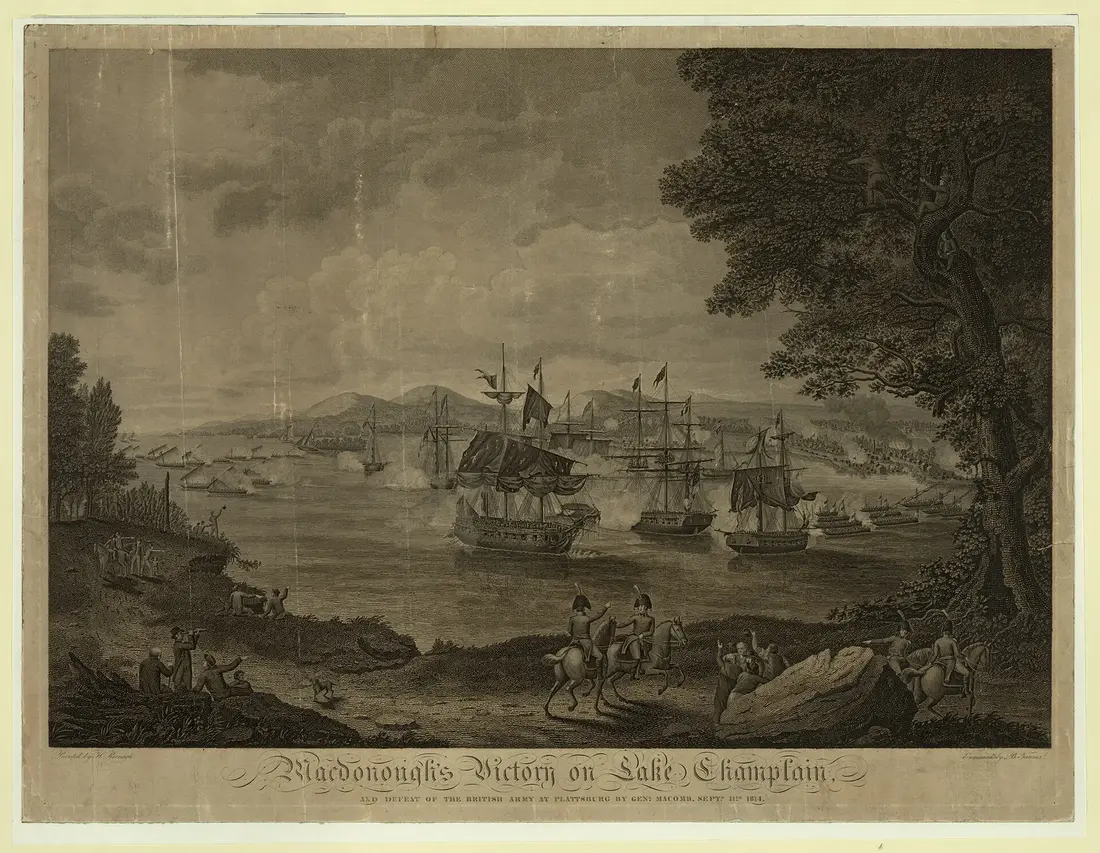
The Confiance led the British squadron at the Battle of Plattsburgh in the fall of 1814. The American fleet won, and Parks Canada calls it the last battle on Lake Champlain. The battle was fought on September 11, 1814, and Plattsburgh still marks it with a commemoration weekend each September; the Plattsburgh guide has the museum and the battle sites. Shipbuilding on the island went on for about a year after the war, the naval garrison was cut back through the 1820s, and the shipyard closed for good in 1834.
Building Fort Lennox
The fort that stands today is the third fortification on the island. After the War of 1812 the colonial government looked again at the island's role, and what pushed it to build was an American fort going up at Rouses Point, less than 15 kilometres to the south. Fort Lennox was built from 1819 to 1829 to plans by the engineer Nicolls, to protect the colony from an American invasion down the Richelieu.
It is named for Charles Lennox, Duke of Richmond, who died in 1819 while serving as Governor-in-Chief of British North America. The design is a classic bastioned fort: a rectangular earth enceinte with a bastion at each corner, a moat (the fosse) around it, and two outworks, a redan and a ravelin. Inside stand neoclassical stone buildings: the barracks, the officers' quarters, the guardhouse, a powder magazine, an ordnance storehouse and an artillery storehouse, along with 17 casemates built into the ramparts.
After the soldiers left
Two new routes made the island less important within a generation. The Saint-Jean to La Prairie railway opened in 1836 and the Chambly Canal in 1843, and together they made Saint-Jean the military and economic center of the valley. The Patriote rebellions of 1837 and 1838 brought the soldiers back for a while, as the island became a base for putting down the insurgents, and after that the fort was a secondary post.
Its later uses were varied. In 1858 it held young offenders as a reform prison. Military activity picked up again during the American Civil War and the years after it, a decade when Malone itself was a staging point for one arm of the Fenian raids into Canada in 1866 and 1870; the Malone history museum guide has that side of the story. British troops left the island for good in 1870, and the Canadian government chose not to reoccupy it, since the Treaty of Washington took the edge off the American threat.
Farmers rented the island for pasture, and in 1899 a Mr. Naylor rented the fort itself as a summer resort. In 1921 the Department of Militia and Defence transferred the island to the Department of the Interior. From 1940 to 1943 the fort was an internment camp for about 300 men, Jewish refugees from Germany held first as prisoners of war and then recognized as refugees from Nazi persecution.
The Historic Sites and Monuments Board of Canada recognized the fort as a site of national historic interest shortly after the board was founded in 1920. The island was declared a national historic park in 1940, and conservation and restoration began in earnest in 1970.
The fort and its buildings
These are the buildings a visit covered before the closure. The earth ramparts, with a bastion at each corner, enclose the stone buildings, and the moat wraps the whole works.
The barracks
The soldiers' barracks is the centerpiece and the building most of the 2018 to 2023 money went into. It stands on clay with the water table about three feet below the surface, and over time its foundation stones shifted and its corners sank. Crews consolidated the foundations, numbered, dismantled and reset the cut stone of the pediment, the large rear staircase and the corners, repaired 495 masonry stones, some with new limestone of the same type, and repainted every window.
When the site reopened in 2023, the ground floor held a new exhibition, Passages, une île aux mille visages, on the island's 6,000 years of occupation, with artifacts from the archaeological collection. It covered daily life for the military families, the women of the garrison and the soldiers. The upstairs soldiers' room was redesigned too, and the new displays include twelve alcoves showing how people and families lived in the barracks from 1825 to the present. The Quebec museums society's listing for the site adds that 30 women and 60 children lived among the British garrison, and describes an interpreter in a redcoat and black-powder musket demonstrations.
The other buildings
The officers' quarters, the guardhouse and two of the magazines were part of the same conservation program. The north gate, the fort's main entrance, and its bridge over the moat had major work too. When the site reopens, its visit page is the place to see which buildings are open.
The moat and the river
The moat was dug for defence and has turned into wetland. Parks Canada lists frogs, turtles, birds and aquatic plants there. It also lists a set of its red chairs among the site's facilities.
The boat across
When the site was open, a visit started at the visitor centre on the mainland at 1, 61e Avenue in Saint-Paul-de-l'Île-aux-Noix. From there a shuttle boat took visitors across to the island, and Parks Canada's visit page still says the shuttle boat is the only way over. The docks on the island were upgraded in the 2018 to 2023 work to make the boat crossing safer and easier.
No shuttle runs in 2026. Parks Canada has not said how the boat will run after a reopening; its hours page is where a schedule would appear. Private boats are no help either. Parks Canada forbids landing at the island's docks and launching watercraft there, and it advises boaters not to land on the shoreline.
Seasons and prices before the closure
A summer site
Fort Lennox was a summer and early fall site. In 2023, the reopening year, it opened on the weekend of June 17 and 18, then every day from June 23 to September 4, then Friday to Sunday and holidays from September 8 to October 9, from 10 a.m. to 5 p.m. Parks Canada suggested allowing half a day or more for the visit. Treat any season dates you find elsewhere online as out of date until Parks Canada posts new ones.
What it cost
Parks Canada prices are in Canadian dollars. Since January 1, 2018, admission to Parks Canada places has been free for youth 17 and under. Parks Canada lists no daily admission or ferry price for Fort Lennox while it is closed, and any price after a reopening will be on its fees page. The one place where the Discovery Pass helps on this river now is Fort Chambly: Parks Canada lists it at $83.50 for an adult, $71.50 for a senior and $167.50 for a family or group of up to seven in one vehicle.
Food, picnics, dogs and access
Fort Lennox has no food service, and Parks Canada asks visitors to bring their own lunch, snacks and water; the site lists an outdoor picnic area. While the fort is closed, the Lacolle blockhouse and Fort Chambly both list picnic areas, so a packed lunch still works on a Richelieu day. Pack it in Malone before you leave: the groceries and supplies page has the stores, and the Malone town guide has the rest of the town. Keep the cooler simple, because the food you carry has to clear both borders; see below.
Parks Canada's facility list for Fort Lennox shows service dogs; ask the site about pet dogs once it reopens. The cabins allow pets for a fee, and the dog guide covers the rules and the paperwork for a dog that crosses the border.
Parks Canada lists accessible parking, restrooms, first aid and information at the site, and the 2023 work added family areas and inclusive washrooms in the barracks. Its page gives no detail on access around the island and inside the old buildings, so call the site at 450-291-5700 before a visit with a wheelchair once it reopens. Cyclists will find bike racks at the visitor centre.
The drive from the cabins
The fort is about 73 road miles from the cabins. Allow about an hour and three quarters of driving each way, plus the border going north and coming back. Every route starts the same way: County Route 25 north into Malone, then US 11 east through Chateaugay and Mooers toward Lake Champlain. Fill the tank in Malone; Stewart's has shops on both East Main and West Main streets.
| Crossing (U.S. and Canada) | Hours, both sides | Cabins to the fort | The Quebec side |
|---|---|---|---|
| Rouses Point and Lacolle (Route 223) | 8 a.m. to 8 p.m. | About 73 miles | Route 223 north along the river |
| Champlain and Saint-Bernard-de-Lacolle (I-87 and A-15) | 24 hours | About 74 miles | A-15 north, Route 202 into Lacolle, Route 223 north |
| Mooers and Hemmingford | 24 hours | About 75 miles | Route 202 east through Hemmingford to Lacolle |
| Trout River (NY 30) | Closed to U.S.-bound traffic | Not on the way | None |
Through Champlain and Lacolle
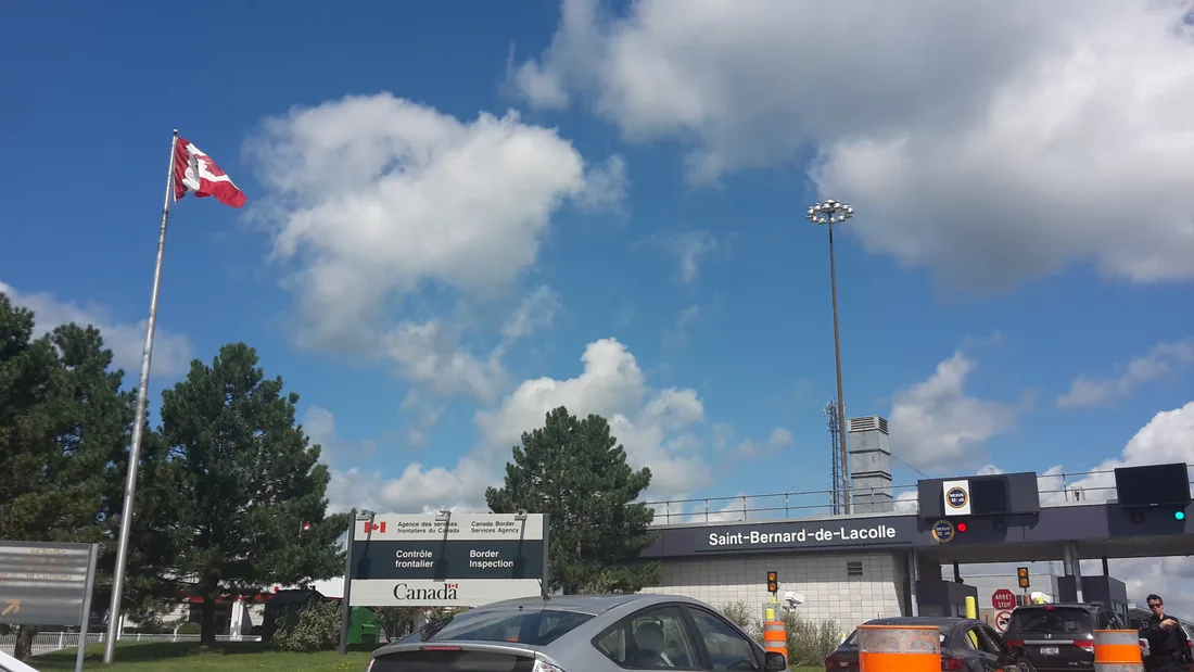
The Interstate crossing is the one to plan around, because it is open around the clock on both sides and the trip home never depends on the clock. Follow US 11 to Champlain and join I-87 for the last stretch to the border, where it becomes Quebec's Autoroute 15. From the booth it is about 16 miles to the fort: about four miles north on A-15, then off at the Route 202 exit and east into the village of Lacolle, then north on Route 223, which follows the west bank of the Richelieu for about five miles to Saint-Paul-de-l'Île-aux-Noix and the turn onto 61e Avenue. The cabins to the Champlain booth is about 58 miles.
In 2026 the Canada Border Services Agency is rebuilding the primary inspection line at Saint-Bernard-de-Lacolle, with work expected to end in winter 2027 and waits that may run longer than usual until then. The agency posts the current wait for this crossing, so check it before you leave the cabins. Its dedicated NEXUS lane toward Canada is listed as unavailable until further notice.
Through Rouses Point
The shortest route by a mile or so stays on US 11 all the way to Rouses Point and crosses where US 11 meets Quebec Route 223. Both border offices there keep the same hours, 8 a.m. to 8 p.m. every day, and from the line Route 223 runs straight north along the river, past the Lacolle blockhouse, to the fort. Come home through Champlain if there is any chance you will reach the border after 8 p.m.
Trout River
The Trout River crossing on NY 30, the closest to the cabins, has been closed to traffic heading into the United States since June 1, 2026, while the U.S. port is rebuilt, and is expected to reopen about May 2028. It is far to the west in any case. The border crossing guide has every crossing, the wait-time apps and NEXUS, and the Trout River post explains the closure.
Documents, money and what comes home
Everyone in the car needs a document for each booth. Going into Canada, the Canada Border Services Agency recommends that U.S. citizens carry a valid passport; it also accepts other documents that show name, date of birth and citizenship, with photo ID if they have no photo. U.S. permanent residents arriving by land show their green card. Coming back, CBP accepts a U.S. passport, a passport card, an enhanced driver's license or a trusted traveler card such as NEXUS from U.S. citizens, and a passport, enhanced license or trusted traveler card from Canadian citizens. Children under 16 who are U.S. or Canadian citizens need only proof of citizenship, such as a birth certificate. Canada asks that adults arrive in the same vehicle as the child, and that a parent traveling without the other parent carry a consent letter, preferably notarized.
Bring Canadian dollars or a card without foreign transaction fees for admission, the pay parking at Fort Chambly and lunch in town. Coming back from a day trip, each U.S. resident has a $200 duty-free allowance, which family members cannot pool.
One line about bottles: a U.S. proclamation bars packaged Canadian-made alcohol, in bottles, cans, boxes or kegs, from import from September 29, 2026, and CBP's notice on it mentions no exception for travelers. Check CBP's current guidance before you bring a bottle of Quebec cider or wine home, and see the border guide for the food rules and the allowances.
Nearby on the Richelieu
The Lacolle blockhouse
The Blockhaus de la Rivière-Lacolle stands on the Lacolle River beside Route 223 in Saint-Paul-de-l'Île-aux-Noix, right on the Rouses Point route and about 67 road miles from the cabins. It is a British blockhouse built about 1781 and in service through the War of 1812, part of the colony's defence network: it guarded a sawmill and a lighthouse on the river and served as an outpost for the garrisons of the upper Richelieu and Lake Champlain. Musket-ball holes are still in its walls. Two annexes were added in 1858 to give more living space, and families who worked for the Bowman and Bullock families lived in it until 1935.
Quebec's culture ministry renovated it from 1975, and in 1996 the province handed it to the municipality of Saint-Paul-de-l'Île-aux-Noix, which has run it since 1998. Its tourism listing shows restrooms, outdoor parking and a picnic area, and offers a 360-degree historical re-enactment you watch on your own phone. Its listings post no hours, so call the municipality at 450-291-3166 before you count on going inside; the outside of the building, with its musket-ball holes, is worth the stop either way.
Saint-Jean-sur-Richelieu
Saint-Jean-sur-Richelieu, about 85 road miles from the cabins, is the city that took over the island's military role in the 1830s. Its old quarter is the Vieux-Saint-Jean, and the city is the southern end of the Chambly Canal path, a flat walking and cycling route of more than 20 kilometres along the canal to Chambly, part of Quebec's Route Verte no. 1. In August the city hosts the International de montgolfières, a hot-air balloon festival with morning flights and evening shows; it ran August 7 to 9 and 13 to 16 in 2026, and its 2027 listing gives August 6 to 15.
Fort Chambly
Fort Chambly National Historic Site, another Parks Canada fort, stands on the Richelieu at 2 De Richelieu Street in Chambly, about 91 road miles from the cabins and 35 kilometres south of Montreal. Its 2026 season ran Wednesday to Sunday from May 16 to June 14, every day from June 15 to September 7, and Wednesday to Sunday from September 8 to October 12, from 10 a.m. to 5 p.m., with last admission at 4:30. Adult admission in 2026 is $10.00 and seniors $8.50, and youth get in free. The park around the fort is open year-round, with a picnic area and pay parking. While Fort Lennox is closed, Fort Chambly is the Parks Canada fort to see on this river; check its hours page for next season's dates.
A day on the Richelieu
This plan works while Fort Lennox is closed, on a day when Fort Chambly is in its season (in 2026, mid-May to mid-October, Wednesday to Sunday outside summer). Check both sites' hours before you go and adjust.
- 7:45 a.m. Leave the cabins with the picnic packed, fuel in Malone, and take US 11 east.
- About 9:15 a.m. Cross at Rouses Point, which opens at 8 a.m., or at Champlain. Have every passport out before the booth.
- About 9:30 a.m. Stop at the Lacolle blockhouse on Route 223 and walk around it.
- About 10 a.m. Drive north on Route 223 through Saint-Paul-de-l'Île-aux-Noix and on to Saint-Jean-sur-Richelieu.
- Late morning. Walk the old quarter, or a stretch of the Chambly Canal path, and have lunch in town.
- Early afternoon. Drive on to Fort Chambly for the fort and the park on the river; last admission is 4:30.
- About 4 p.m. Head back south. Fort Chambly is about 91 road miles from the cabins, a good two and a quarter hours of driving plus the border. Cross at Champlain, which is open all night, and you are home through Malone by early evening.
Once Fort Lennox reopens, put it in place of Saint-Jean: park at the visitor centre for the first boat and give the island the half day or more Parks Canada suggested in 2023. From Montreal or Hemmingford, the Montreal day trip and Parc Safari pages cover the other big days across the line. Back at the cabins, the hot tub is ready after the drive; the cabins page has all three.
Questions
Is Fort Lennox open?
Not in 2026. Fort Lennox is closed to visitors for the 2026 season, and Parks Canada has not announced a reopening date; check its Fort Lennox page before you go. The reason it gives is humidity and air quality problems in some historic buildings. Fort Chambly, farther down the Richelieu, is the Parks Canada fort to see instead.
How far is Fort Lennox from the cabins?
About 73 road miles, an hour and three quarters of driving each way plus the border. Take County Route 25 into Malone and US 11 east, then cross at Rouses Point (8 a.m. to 8 p.m.) or at Champlain and Lacolle on I-87, which is open 24 hours, and follow Route 223 north along the river. The border guide has every crossing.
How do you get onto the island?
When the site is open, only by its shuttle boat from the visitor centre at 1, 61e Avenue in Saint-Paul-de-l'Île-aux-Noix. There is no bridge or road, and Parks Canada does not allow private boats to land at the island's docks. No shuttle runs in 2026 while the site is closed.
What does a visit cost?
Parks Canada lists no daily admission or ferry price for Fort Lennox while it is closed. Prices are in Canadian dollars, and youth 17 and under get in free at every Parks Canada place. At Fort Chambly, adult admission in 2026 is $10.00 and seniors $8.50.
Is there food at Fort Lennox?
No. There is no food service on the island, and Parks Canada asks visitors to bring lunch, snacks and water. There is an outdoor picnic area. Shop in Malone on the way; the groceries page lists the stores, and keep the cooler simple for the border.
What documents do we need?
Coming back into the United States, each U.S. citizen needs a passport, passport card, enhanced driver's license or NEXUS card; children under 16 can show a birth certificate. Canada recommends a passport for U.S. citizens and a consent letter when one parent is not along. Check CBP's guidance before bringing Canadian alcohol home, since a ban on packaged Canadian alcohol took effect September 29, 2026.
What else is there to see nearby?
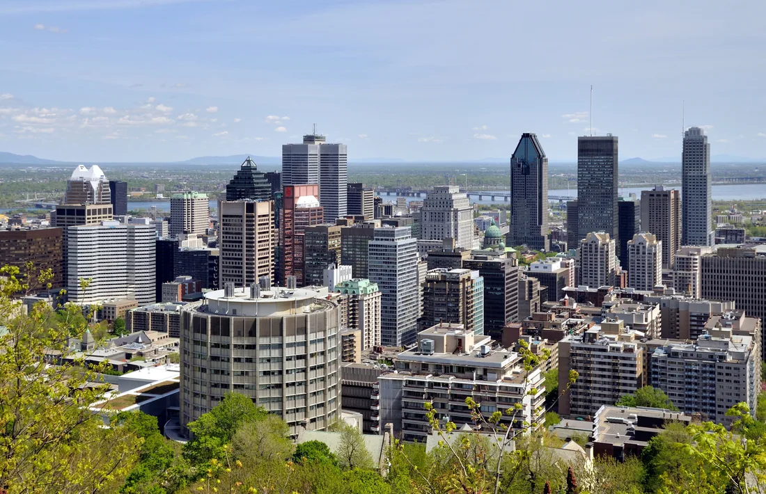
The Lacolle River blockhouse stands beside Route 223 in Saint-Paul-de-l'Île-aux-Noix. Saint-Jean-sur-Richelieu has its old quarter and the Chambly Canal path, and Fort Chambly is another Parks Canada fort on the same river. The Montreal day trip is the other big day across the line.
Sources
Facts on this page were checked against these sources in October 2026. Hours, fees and schedules change; confirm before you go.
- parks.canada.ca parks.canada.ca/lhn-nhs/qc/lennox/visit
- parcs.canada.ca parcs.canada.ca/lhn-nhs/qc/lennox/visit/heures-hours
- parks.canada.ca parks.canada.ca/lhn-nhs/qc/lennox/visit/directions
- parks.canada.ca parks.canada.ca/lhn-nhs/qc/lennox/culture
- parcs.canada.ca parcs.canada.ca/lhn-nhs/qc/lennox/securite-safety
- parcs.canada.ca parcs.canada.ca/lhn-nhs/qc/lennox/nature
- parks.canada.ca parks.canada.ca/lhn-nhs/qc/lennox/visit/tarifs-fees
- canada.ca canada.ca/fr/parcs-canada/nouvelles/2023/06/projets-dinvestissements-d
- canada.ca canada.ca/fr/parcs-canada/nouvelles/2023/06/parcs-canada-et-tourisme-h
- parks.canada.ca parks.canada.ca/lhn-nhs/qc/lennox/visit/infrastructure
- musees.qc.ca musees.qc.ca/en/museums/guide/fort-lennox-national-historic-site.html
- parks.canada.ca parks.canada.ca/lhn-nhs/qc/lennox/culture/site/nomades-nomads
- parks.canada.ca parks.canada.ca/lhn-nhs/qc/lennox/culture/site
- parks.canada.ca parks.canada.ca/lhn-nhs/qc/lennox/culture/site/campagne-1760-campaign
- parks.canada.ca parks.canada.ca/lhn-nhs/qc/lennox/culture/site/1775
- parks.canada.ca parks.canada.ca/lhn-nhs/qc/lennox/culture/site/1812
- parks.canada.ca parks.canada.ca/lhn-nhs/qc/lennox/culture/site/fortification
- parks.canada.ca parks.canada.ca/lhn-nhs/qc/lennox/culture/designation/transition
- parks.canada.ca parks.canada.ca/lhn-nhs/qc/lennox/culture/designation
- ileauxnoix.qc.ca ileauxnoix.qc.ca/tourisme/repertoire-des-attraits/
- U.S. Customs and Border Protection cbp.gov/about/contact/ports/champlain-new-york-0712
- cbsa-asfc.gc.ca cbsa-asfc.gc.ca/data/cbsa-offices-services-bureaux-asfc-en.json
- canada.ca canada.ca/en/border-services-agency/news/2024/11/the-cbsa-is-adjusting
- cbsa-asfc.gc.ca cbsa-asfc.gc.ca/bwt-taf/menu-eng.html
- cbsa-asfc.gc.ca cbsa-asfc.gc.ca/travel-voyage/td-dv-eng.html
- U.S. Customs and Border Protection cbp.gov/travel/us-citizens/western-hemisphere-travel-initiative
- U.S. Customs and Border Protection cbp.gov/travel/international-visitors/kbyg/types-exemptions
- content.govdelivery.com content.govdelivery.com/bulletins/gd/USDHSCBP-42ce49a
- passageport.org passageport.org/places-to-go/blockhaus-de-la-riviere-lacolle/
- quebecvacances.com quebecvacances.com/en/attractions/blockhaus-de-la-riviere-lacolle
- parks.canada.ca parks.canada.ca/lhn-nhs/qc/fortchambly/visit
- parks.canada.ca parks.canada.ca/lhn-nhs/qc/fortchambly/visit/heures-hours
- parks.canada.ca parks.canada.ca/lhn-nhs/qc/fortchambly/visit/tarifs-fees
- parcs.canada.ca parcs.canada.ca/lhn-nhs/qc/chambly/activ/piste-path
- quebecvacances.com quebecvacances.com/fr/explorer/au-bord-du-richelieu-des-montgolfieres-
In this guide
Stay nearby
The aviation cabin: flight-themed décor, a Jøtul gas stove, a large open deck with its own hot tub, and a smokeless fire pit on the lawn.
 The AviatorCabin 3 · 2 bd · 1 ba · sleeps 4
More in Day Trips
Sources
35 references, listed in full at the end of this guide: official park, state, tourism-office and business sources, checked October 2026.
Related guides


Photos on this page: 20170809-Saint-Bernard-de-Lacolle US-Canada (NY-Quebec) border crossing by Aude, CC BY-SA 4.0; Montreal - QC - Skyline by Taxiarchos228, CC BY 3.0. Resized and cropped for this site. All photo credits