
Hurricane Mountain Fire Tower
Hurricane Mountain near Keene: three trails to a bare summit and a restored 1919 fire tower, its history, parking, winter tips and the drive from the cabins.
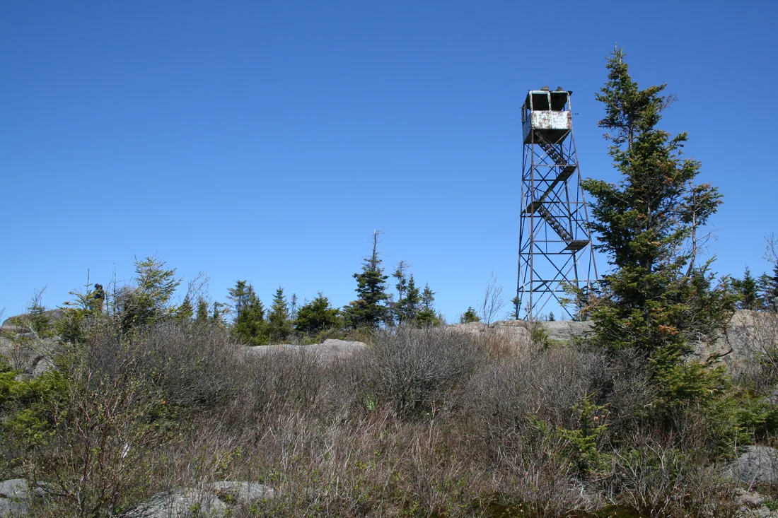
Hurricane Mountain is a 3,694-foot peak between Keene and Elizabethtown, on the eastern edge of the High Peaks, with a bare rock summit and a 35-foot steel fire tower that has stood on top since 1919 and reopened to climbers in 2015. Three trails reach the top, and the busiest leaves NY 9N and gains about 2,000 feet in 3.4 miles. That trailhead is about 71 road miles from the cabins, about an hour and three quarters by car, so plan a full day, with pie in Keene Valley or dinner in Lake Placid on the way home.
Hurricane Mountain at a glance
| Item | Details |
|---|---|
| Summit | 3,694 feet, a bare rock top in the Town of Keene, Essex County |
| Land | The 13,784-acre Hurricane Mountain Wilderness, part of the Forest Preserve; the half acre around the tower is the Hurricane Mountain Fire Tower Historic Area |
| Fire tower | A 35-foot Aermotor LS-40 steel tower from 1919, formally closed for fire watching in 1979, reopened to the public in 2015 |
| Trail from NY 9N | 3.4 miles each way, about 2,000 feet of climbing, the most used route |
| North Trail from Crow Clearing | About 2.7 to 3 miles each way, about 1,600 feet of climbing |
| East Trail from Hurricane Mountain Lane | About 2.2 miles each way, about 1,800 feet of climbing, the least used |
| Fees, permits, reservations | None; the wilderness is open all year |
| From the cabins | About 71 road miles to the NY 9N trailhead, about an hour and three quarters |
| Counts toward | ADK's Fire Tower Challenge and the Lake Placid 9er |
The trail from NY 9N
Most hikers start from NY 9N, the highway between Keene and Elizabethtown. Over twelve years of trail register counts, from 2000 to 2011, this trailhead logged between 3,180 and 4,338 sign-ins a year, the most of the three every year. The parking area is on the south side of the highway and the trail starts on the north side, so you walk across 9N to the register. Watch for traffic as you cross.
Mile by mile
- The first half mile. Switchbacks climb to the first ledges, with blueberry bushes on the rock. The ridge of Tripod and Knob Lock mountains blocks the view straight south across the road, and Big Slide shows to the southwest.
- The wetlands. The trail levels off, crosses a stream on a log bridge and runs on bog bridges through a broad marsh and beaver-flooded wetland.
- The climb. Past the wet ground the trail climbs steadily on switchbacks. Around 1.6 miles it turns rougher and steeper over a washed-out stretch of rock slab, then crosses a small shoulder of striped maple and a fern-covered slope. A lookout higher up shows the pointed top of Nippletop and other eastern High Peaks.
- The ledges. At about 2.8 miles the trail comes out on a cliff top with the High Peaks to the south, Lake Champlain and Vermont's Green Mountains to the east, and the tower ahead on one more rocky hump. A second ledge follows at about 2.9 miles.
- The junction. At about 3.2 miles the North Trail from Crow Clearing comes in from the left. On the way down, make sure everyone in your group takes the left turn here to stay on the 9N trail. The other branch ends at Crow Clearing, about 9 road miles from the 9N lot.
- The summit. A short level stretch and a rocky scramble bring you onto the open top at about 3.4 miles.
The 2014 rebuild
The trail you walk today is partly new. DEC's 2010 plan for the area described the upper part of the old route from 9N with grades steeper than 45 percent, gullies cut by running water and, in winter, ice flows where that water froze, which pushed hikers off to the sides and widened the trail. DEC forester Rob Daley scouted a new line, and forester Tate Connor finalized it and managed the job. Over twelve weeks in 2014, state-funded crews built it. The ADK professional trail crew spent three weeks on the upper section and two more setting steps and water bars, a volunteer ADK crew of seven worked on the lower sections over parts of 2013 and 2014, a Student Conservation Association crew of seven spent a week building bog bridges, and inmates from the state Department of Corrections carried lumber to the work sites for six weeks. The switchbacks added 0.8 mile, so the climb grew from 2.6 to 3.4 miles, with a gentler grade, fewer wet spots and several lookouts that make good places to rest.
The North Trail from Crow Clearing
The North Trail starts higher up. Crow Clearing, at the end of O'Toole Road above Keene, sits at about 2,230 feet, so the climb is about 1,600 feet over 2.7 to 3 miles. From the cabins it is about 69 road miles: in Keene, turn off NY 9N onto Hurricane Road at the town hall, then bear left onto O'Toole Road, which is dirt, for the last 1.2 miles to the lot.
The first part follows the Gulf Brook Trail, an old forest road with a firm, fairly level surface that starts with a narrow plank bridge. At about 1.1 miles a side trail leads to the Gulf Brook lean-to. The North Trail goes on to meet the 9N trail at about 2.8 miles and reaches the summit at about 3.0. It turns very muddy after rain, so wear waterproof boots. From 2000 to 2011 this trailhead logged 2,400 to 3,368 sign-ins a year.
Big Crow and the Nun-da-ga-o Ridge
Crow Clearing is also the start of a shorter walk and a longer loop. Big Crow Mountain is 0.6 mile from the lot, with about 600 feet of climbing that turns steep and rocky after the first fifth of a mile. The Nun-da-ga-o Ridge, which maps label the Soda Range, makes a loop of about 6 to 7 miles from the clearing over Weston Mountain and past Lost Pond, with about 1,800 feet of climbing; long stretches of the ridge path are unmarked, so carry a map. For a group where some want the tower and some want a short outing, Big Crow is the easy half of the day.
The clearing sits on East Hill, which had a resort long before it had a trailhead. Harvey Wiley opened a nine-room guest house there, the Wiley House, and in 1891 it grew into a 30-room hotel. In 1904 the Hurricane Hotel Company bought it and added cottages, a golf course and a tennis court, and Hurricane Lodge had its own post office. Once the automobile made vacationers less inclined to spend a whole summer in one place, the lodge faded.
The East Trail, the observers' route
The East Trail is the old way up. It starts at the end of Hurricane Mountain Lane on the Elizabethtown side, 2.7 miles in from NY 9N, where a gate stops cars; park in the small lot on the right before the gate, since parking on the lane is not allowed. From the cabins you drive past the 9N trailhead and about 4.6 miles farther east on 9N to reach the lane.
The first 1.2 miles follow the old road the fire observers used. The state built their cabin about 1.2 miles from this trailhead in 1928 and took it down in 1982. The road is fairly level and moderate for the first half mile and steeper after that. Past the cabin site the trail dips to a stream, climbs to a second stream at about 1.4 miles and then climbs hard to the summit with only a few breathers. In all it gains about 1,800 feet in about 2.2 miles.
This is the quietest way up. In the full years counted from 2005 to 2010, its register logged 334 to 556 sign-ins a year, against more than 3,000 a year at the 9N trailhead, which makes it a good choice for a second visit.
Parking, fees and reservations
No permit, fee or parking reservation is needed at any Hurricane trailhead, and the wilderness is open all year. The parking reservation system in Keene covers the Adirondack Mountain Reserve's trails to Indian Head and other summits, and it does not apply to Hurricane.
- NY 9N. A small lot on the south side of the highway, about 6.5 miles west of Elizabethtown and 3.5 miles east of the NY 73 fork. DEC's 2010 plan counted room for about five cars, noted that summer weekends overflowed onto the shoulder and called for six more spaces. Arrive early on weekends; around Keene, the town's advice for popular trailheads is to be there by 6:30 a.m. in summer, since lots often fill before 7.
- Crow Clearing. A lot at the end of O'Toole Road. Winter plowing stops about 0.3 mile short of the clearing, and that last stretch is usually closed in the spring mud season as well.
- Hurricane Mountain Lane. A small lot at the gate, with no parking along the lane.
Sign the register at whichever trailhead you use. DEC posts trail closures and notices for the whole park on its Adirondack backcountry information page, which is worth a look the night before.
The summit and the view
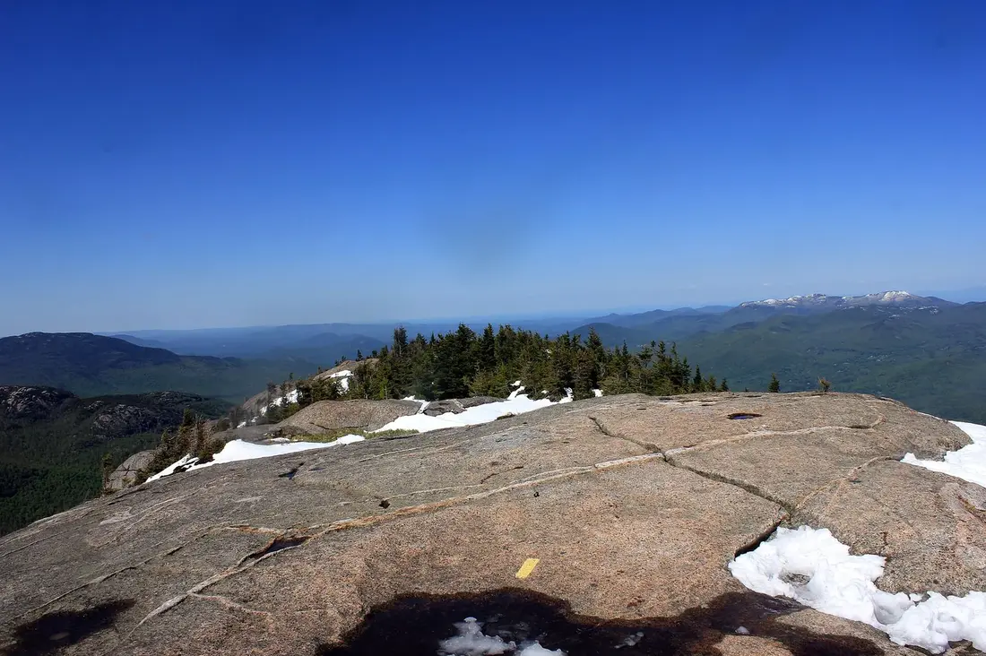
The top of Hurricane is nearly bare rock. The half-acre square around the tower has almost no vegetation, apart from a band of spruce and fir along its north edge, so you can walk around the open stone and look out in every direction. The summit and its tower can be seen from the hamlets of Keene and Elizabethtown, and from many of the eastern High Peaks the tower is how you pick Hurricane out.
What you see
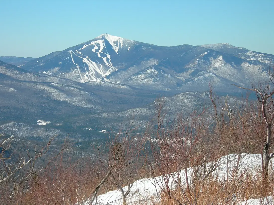
The view goes all the way around: the High Peaks to the south and west, Lake Champlain to the east with Vermont's Green Mountains rising behind it, and Whiteface to the northwest. From the cab, 35 feet up, you can find Mount Mansfield, Vermont's highest summit, on the Green Mountain ridge. On the 9N trail, the ledges show Big Slide and Nippletop well before the top.
The view made the mountain useful long before the tower. In his report for 1873, the surveyor Verplanck Colvin told how he climbed Hurricane on a bright July 21, looking for a summit that could see both ends of a measured line on Lake Champlain. His telescope found the lighthouse on Juniper Island and then, just clear of the hills, the Split Rock lighthouse, two points whose positions the United States Coast Survey had already fixed. He set copper bolt number 8 at his instrument station, and Hurricane became the inland corner that carried his survey from the lake to the High Peaks.
Plants and birds
Hurricane is on the Lake Champlain Birding Trail, and 153 bird species have been recorded in the area. The high spruce and fir are home to boreal birds such as the boreal chickadee and Bicknell's thrush, which has nested on the mountain, and peregrine falcons nest nearby. Stewards have documented rare plants on Hurricane, among them purple crowberry, mountain firmoss and Rand's goldenrod, so keep your boots on bare rock. Leave the cairns as you find them: the Friends of Hurricane Mountain ask hikers not to build, add to or take apart cairns, since stray ones can send people the wrong way.
The fire tower years
Fire made the tower. In the early 1900s wildfires burned nearly a million acres of Adirondack forest, and in 1908 a fire that started on East Hill in Keene burned most of the land around Hurricane. The state set up a fire detection system in 1909, and in 1910 Hurricane was one of the first eight Adirondack peaks to get a fire observation station.
For nine years the station had no tower at all. The summit was already bare, so the observer could see in every direction from the rock. Setting up the station cost $216.64, and the state strung 2.5 miles of telephone wire to the summit so the observer could reach the rangers quickly. Joseph Denton, the first observer, reported three fires in 1910, and Matthew Ryan reported 22 the next year.
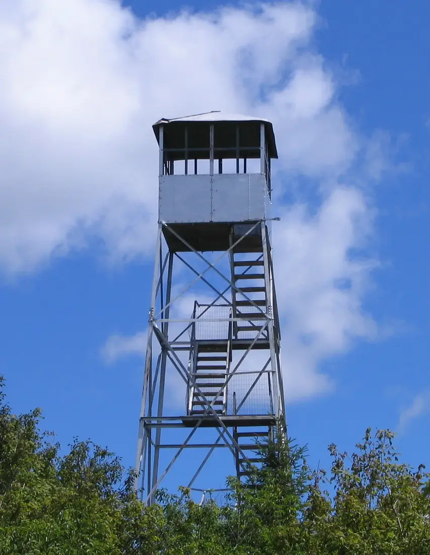
The steel tower went up in 1919, a 35-foot Aermotor LS-40, the model the state used more than any other. An Osborne Fire Finder, a map table with sighting apertures for fixing the bearing of a smoke, was installed in the cab in 1921. In 1928 the state bought Hurricane Mountain and some of the land around it from the Champlain Realty Company and built a new observer's cabin on the Elizabethtown side. Observers worked from spring to fall, dawn to dark, and lived in that cabin below the summit; in 1949 the observer Hank McCoy shared it with his wife, Florence, and their five children, the youngest two months old.
Aircraft patrols began in the 1930s, and in the 1970s private contractors took over aerial fire detection for the state, which closed 62 of its 103 operating towers in 1971 alone. The Friends' list of Hurricane's observers ends with Doug Richards, who served from 1970 to 1972. The state formally closed the tower for fire observation in 1979, and it carried radio communications until 1982, when the observer's cabin came down.
The fight over removal
By the time the observers left, the tower stood on land where the rules said it should not. The 1972 Adirondack Park State Land Master Plan put Hurricane in a Primitive Area, land that is wild in character but holds a structure that does not fit a wilderness, with removal of that structure as the long-term goal. At the time, the plan still called the tower an essential communication link for DEC.
- 1987. DEC declared the tower surplus property.
- 1994. An agreement between DEC and the state historic preservation office sorted 35 towers into those to keep and those that could go. Hurricane was put on the removal list because the master plan called for it.
- 1995. A December recommendation to take the tower down priced the state helicopter work at $5,400.
- 2001. DEC's regional forester announced plans to dismantle the tower as a nonconforming structure and put it on display at the Washington County Fairgrounds. A public campaign began to save it, together with the St. Regis tower.
- 2004. Gretna Longware of Elizabethtown collected almost 2,000 signatures in six weeks, and students at Keene Valley School gathered 242 in a week and wrote to the DEC commissioner.
- 2006 and 2007. The tower was listed on the State Register of Historic Places on August 1, 2006, and on the National Register on January 29, 2007.
- Early 2010. DEC's Fire Tower Study for the Adirondack Park recommended removing the tower, and the draft plan for the Hurricane Mountain Primitive Area proposed it. DEC held a public meeting at Keene Central School in Keene Valley, and most of the comments on the plan opposed removal. In June the Adirondack Park Agency found the plan compliant and asked DEC not to remove the tower until the agency finished its own review.
- Late 2010. A supplemental impact statement released in July proposed reclassifying half an acre around the base of the Hurricane and St. Regis towers as Historic, and three public hearings followed. In October the agency's board approved it unanimously, and Governor David Paterson approved it in December.
The same decision reclassified 13,742 acres of state land, turning the rest of the old Primitive Area into the Hurricane Mountain Wilderness around the half-acre Hurricane Mountain Fire Tower Historic Area. It also saved the St. Regis Mountain fire tower near Paul Smiths.
Restoration and reopening
With the tower's place settled, DEC wrote a plan for the half acre itself. The Hurricane Mountain Fire Tower Historic Area plan, dated February 2014, set the goal of opening and maintaining the tower for public use and education, and on May 9, 2014, the Park Agency found that it fit the master plan. It called for a volunteer stewardship agreement with a tower steward, interpretive signs in the cab and materials at the trailhead kiosks, and an eye on the summit for signs of overuse. Any helicopter delivery of materials has to stay outside April 1 to August 1, the nesting season of Bicknell's thrush and peregrine falcons.
The plan also made room for a DEC radio repeater in the cab, powered by four small solar panels on the side of the tower, with an antenna about four feet above the cab. Forest rangers had worked for years with a radio "shadow" in the valleys of the eastern High Peaks, where the nearest repeaters were on Whiteface and Belfry Mountain, and a repeater on Hurricane would close most of that gap during rescues.
The repairs came in 2015. DEC arranged for materials to be dropped on the summit, volunteers carried more up the trail, and a Student Conservation Association crew and Friends of Hurricane Mountain volunteers replaced the wooden steps and landings, put up protective fencing and added braces. The tower opened to the public that year. By then DEC and the state historic preservation office had also rewritten their 1994 agreement, and the new version no longer recommends removing any fire tower.
Friends of Hurricane Mountain and the summit stewards
Friends of Hurricane Mountain is the volunteer group that pushed for the restoration and still looks after the tower. Its stated mission is to protect and preserve the tower for the enjoyment of future generations. The jobs are often small and physical: one September 6, volunteer Bob Hunter of Lake Placid carried a new 28-pound map table of Lexan and aluminum up the mountain, and it was secured in the cab within the hour.
Since 2018 Hurricane has taken part in the statewide lighting of the fire towers, an evening that began in the Catskills to honor the old observers. Volunteers light the cab for about half an hour after dark, and the glow can be seen from Elizabethtown and Keene. In 2026 the lighting fell on Saturday, September 5, from 8:30 to 9 p.m.
ADK runs a fire tower steward program on the summit with DEC and the Friends. Stewards talk with hikers about the tower's history, the mountain's natural history and Leave No Trace. They spoke with 2,848 hikers in 2025, the program's fifth season, and 2026 is its sixth; on a training hike in May 2026 the new crew also rebuilt one of the summit cairns. DEC recommends Hurricane as an alternative to the High Peaks, and the stewards meet some hikers who are using it as a stepping stone toward them.
Fire Tower Challenge and Lake Placid 9er credit
A climb of Hurricane counts toward two patches. It is one of the Adirondack summits in ADK's Fire Tower Challenge, and the club's 2026 log, which marks the towers with closed cabs, lists Hurricane with no such note; DEC's backcountry information page carries any new closure. The Fire Tower Challenge guide covers the rules, the winter rocker and the towers within reach of the cabins, including the long day that pairs Hurricane with Poke-O-Moonshine. Hurricane is also one of the nine peaks of the Lake Placid 9er, and the Cascade Mountain guide lists the other eight. For a tower day with less driving, Azure Mountain is about 42 road miles from the cabins.
Seasons on Hurricane
In spring, start from NY 9N: the end of O'Toole Road to Crow Clearing usually stays closed through mud season. Black flies are out from mid-May to late June; the bug guide has what works.
Summer is steward season. ADK's summit stewards start in late May, and Hurricane's have worked as late as Columbus Day weekend. The blueberry bushes on the first ledges ripen in midsummer. For a sunrise, start early: on a summer morning, NPR's Brian Mann started up by headlamp just after 3 a.m. and watched the sun come up from the cab just after 5.
Fall brings the color and the crowds. The stewards' record day on Hurricane, 218 hikers, came on the Saturday of Columbus Day weekend, so a weekday is the calmer choice in peak color. The fall foliage guide has the timing.
Winter
Hurricane makes a fine snowshoe climb, with steep sections where microspikes are needed. None of the three trails suits cross-country skis. The East and North trails see far fewer people in winter and may not be broken out, and plowing on O'Toole Road ends about 0.3 mile short of Crow Clearing, so the 9N trail is the usual winter route.
Enjoy the summit and skip the tower in winter: ADK asks hikers not to climb any fire tower from December 21 to March 21, when the stairs ice over and crampons damage the wooden steps, and the Fire Tower Challenge guide has the rest of the winter rules. Days are short, so start at first light, and read the winter driving guide before the drive over. Afterward, The Modern Pine and The Aviator each have a Jotul gas stove for drying out, and all three cabins have a private hot tub.
Dogs on the trail
Dogs can hike Hurricane under DEC's rules for state land: keep the dog under control at all times, leash it whenever other people approach, and bury its waste away from water, trails and campsites. Hurricane sits outside the High Peaks Wilderness and its stricter leash rules. A leash at the busy 9N trailhead and on the open summit keeps the dog off the plants and out of other people's lunches.
Most dogs balk at fire tower stairs, so plan to take turns: one person climbs while another waits at the base with the dog. Carry water for the dog as well as for yourself.
At the cabins, all three listings take a small house-trained pet (the listings set a 25-pound limit) for a fee, and a pet may not be left alone in the cabin, so on a Hurricane day the dog comes along or someone stays behind with it. The dog guide covers the full pet rules, ticks and vets.
The drive from the cabins
The NY 9N trailhead is about 71 road miles from the cabins, about an hour and three quarters each way. Crow Clearing is about 69 miles, and the East Trail lot is about 7 road miles beyond the 9N lot.
- County roads take you about 7 miles to NY 30, and NY 30 runs about 24 miles south to Paul Smiths.
- NY 86 goes east about 19 miles through Saranac Lake toward Lake Placid.
- Old Military Road (County Route 35) leaves NY 86 before the village and runs about 3.6 miles to NY 73.
- NY 73 runs east about 12.5 miles to Keene. For Crow Clearing, turn onto Hurricane Road at the Keene town hall on NY 9N.
- For the 9N trailhead, stay on NY 73 and NY 9N together about 1.8 miles south of Keene to the fork, then follow NY 9N east toward Elizabethtown for 3.5 miles to the lot on the right.
That last stretch of 9N follows roughly the line of the Old Military Road, begun around 1800 to run from Westport on Lake Champlain to Hopkinton in St. Lawrence County. Saranac Lake and Lake Placid are the places for fuel and coffee on the way in; the Saranac Lake guide covers the town.
Keene, Keene Valley and Lake Placid
Keene sits where NY 73 meets NY 9N, about 5.5 road miles from the 9N trailhead. Cedar Run Bakery and Market on Grist Mill Lane sells a bit of everything, from baked goods to take-and-bake meals, with a small spirits shop inside, which covers both a trail lunch and supper for the cabin. Black Rooster Maple, a family sugaring farm with about 3,500 maple trees, sells its syrup from a roadside stand. On summer Sundays the Keene Farmers Market sets up at Marcy Field, midway between Keene and Keene Valley, with more than 50 vendors beside an active runway.
Keene Valley is about 6.7 road miles from the 9N trailhead, south on NY 73. Noon Mark Diner, at 1770 NY 73, began as a roadside stand in 1981 and is known for its pies; its lot is usually full. The Mountaineer has sold mountaineering gear, clothing, local maps and Adirondack books since 1975. Rivermede Farm Market sells sandwiches, maple syrup and produce from its own greenhouses and gardens, and Valley Grocery is known for its meats and fresh sausage. Hours change with the season, so check before you count on a stop.
Lake Placid is about 20 road miles back west of the trailhead, right on the way home, and a stop in the village adds only about a mile to the drive. The Lake Placid and Whiteface guide and the Olympic sites guide cover the village, and from there the cabins are about 52 road miles.
A day on Hurricane from the cabins
- 6:30 a.m. Leave the cabins with lunch packed, or plan to pick it up at Cedar Run in Keene.
- About 8:15. Park at the NY 9N lot, cross the highway and sign the register.
- Late morning. Reach the ledges at about 2.8 miles, then the summit and the tower. Eat lunch on the rock out of the wind.
- Early afternoon. Head down, and take the left turn at the Crow Clearing junction.
- Late afternoon. Pie at Noon Mark Diner in Keene Valley, or supper in Lake Placid on the way home.
- Evening. About 52 road miles from Lake Placid back to the cabins and the hot tub.
What to bring
- Water and lunch for everyone, and water for the dog.
- A warm layer and a wind shell; the summit is open rock, and the mountain takes its name from the wind.
- A rain jacket and waterproof boots, especially for the North Trail.
- DEC's Hurricane Mountain Wilderness map and a headlamp.
- Microspikes from late fall into spring, and snowshoes in winter.
- Bug repellent from mid-May through June.
Safety
For a lost or injured hiker, call 911 or the DEC Forest Ranger emergency line, 833-NYS-RANGERS (833-697-7264). Stay off the tower in high wind or ice, and leave the bare summit when thunder is near. DEC's Region 5 office in Ray Brook, 518-897-1200, answers general questions on weekdays.
Questions
How long is the hike up Hurricane Mountain?
From NY 9N the trail is 3.4 miles each way with about 2,000 feet of climbing. The North Trail from Crow Clearing is about 2.7 to 3 miles with about 1,600 feet, and the East Trail from Hurricane Mountain Lane is about 2.2 miles with about 1,800 feet. With the drive from the cabins, plan a full day.
Can you climb the Hurricane Mountain fire tower?
Yes. Volunteers replaced the steps and landings and added fencing, and the tower reopened to the public in 2015. ADK's 2026 Fire Tower Challenge log, which marks the towers with closed cabs, lists Hurricane with no such note; check DEC's Adirondack backcountry information page for any new closure. Stay off the tower in ice and high wind, and between December 21 and March 21 ADK asks hikers not to climb any tower.
Do I need a permit or parking reservation for Hurricane Mountain?
No. The Hurricane Mountain Wilderness is open all year with no fee, and no reservation is needed at any of its trailheads. The reservation system in Keene covers the Adirondack Mountain Reserve's trails only. The NY 9N lot is small, so arrive early on summer and fall weekends.
How far is Hurricane Mountain from the cabins?
About 71 road miles to the NY 9N trailhead, about an hour and three quarters, by NY 30, NY 86 through Saranac Lake, Old Military Road, NY 73 through Keene and NY 9N. Lake Placid is on the way home. See the Fire Tower Challenge guide for other towers within reach.
Can I bring my dog to Hurricane Mountain?
Yes, under DEC's rules for state land: keep the dog under control, leash it when others approach, and bury its waste away from water and trails. Most dogs balk at tower stairs, so take turns climbing. The cabins' listings do not allow a pet to be left alone, so the dog comes along; see the dog guide.
Is Hurricane Mountain a good winter hike?
It is a good snowshoe climb, with steep sections where microspikes are needed; none of the trails suits cross-country skis. The 9N trail is the one most likely to be packed down, and winter plowing ends about 0.3 mile short of the Crow Clearing lot. Enjoy the summit and leave the tower alone in winter.
Why was the Hurricane fire tower almost removed?
The 1972 master plan put it in a Primitive Area, where the tower did not fit and removal was the long-term goal, and DEC planned to take it down as late as 2010. After years of public pressure, the state reclassified the half acre under it as a Historic Area in 2010, and the tower was restored and reopened in 2015.
Sources
Facts on this page were checked against these sources in October 2026. Hours, fees and schedules change; confirm before you go.
- New York State Department of Environmental Conservation dec.ny.gov/places/hurricane-mountain-wilderness
- New York State Department of Environmental Conservation extapps.dec.ny.gov/docs/lands_forests_pdf/hmfthafinal1.pdf
- New York State Department of Environmental Conservation extapps.dec.ny.gov/docs/lands_forests_pdf/hmpaump.pdf
- apa.ny.gov apa.ny.gov/meeting/2014/05/StateLand/HMFTHA%20resolution.pdf
- apa.ny.gov apa.ny.gov/files/admin/annual-report/2010APAnnualReportFinal.pdf
- hurricanefiretower.org hurricanefiretower.org/
- hurricanefiretower.org hurricanefiretower.org/sample-page/
- hurricanefiretower.org hurricanefiretower.org/restoration/
- hurricanefiretower.org hurricanefiretower.org/rangers-and-observers/
- hurricanefiretower.org hurricanefiretower.org/hurricane-by-martin-podskoch/
- Lake Placid tourism (ROOST) lakeplacid.com/hiking/hurricane-mountain
- lakechamplainregion.com lakechamplainregion.com/hiking/hurricane-mountain
- Adirondack Explorer adirondackexplorer.org/recreation/hiking/hurricane-mountain/
- Adirondack Explorer adirondackexplorer.org/general/tower-lighting-pays-homage-to-fire-obse
- npr.org npr.org/2022/07/06/1110199210/a-mountain-tower-in-the-adirondacks-lets
- Adirondack Mountain Club adk.org/wp-content/uploads/2026/09/ADK-Fire-Tower-Challenge-Log-2026.p
- adk-gfs.org adk-gfs.org/FTC/FTC.Brochure.2018-02-01.pdf
- New York State Department of Environmental Conservation dec.ny.gov/sites/default/files/2026-01/2025summitstewardshipprogrameos
- Adirondack Mountain Club adk.org/wp-content/uploads/2026/07/2026-Mid-Season-Summit-Stewardship-
- mydigitalpublication.com mydigitalpublication.com/article/Tales+Of+Our+Trails/1935709/246739/ar
- ausableriver.org ausableriver.org/explore/hiking/hurricane
- townofkeeneny.com townofkeeneny.com/hiking-information/
- Lake Placid tourism (ROOST) lakeplacid.com/story/2023/stop-in-keene
- Lake Placid tourism (ROOST) lakeplacid.com/keene-valley
- thisiscny.com thisiscny.com/explore-upstate/2026/07/the-charming-adirondack-diners-w
- mountaineer.com mountaineer.com/
- New York State Department of Environmental Conservation dec.ny.gov/places/high-peaks-wilderness-complex
- New York State Department of Environmental Conservation dec.ny.gov/things-to-do/camping/state-land-rules
- New York State Department of Environmental Conservation dec.ny.gov/things-to-do/hiking/adirondack-backcountry/backcountry-info
- epqs.nationalmap.gov epqs.nationalmap.gov/v1/json
- router.project-osrm.org router.project-osrm.org/
- hurricanefiretower.org hurricanefiretower.org/view-from-hurricane-mountain/
- OpenStreetMap (road distances) nominatim.openstreetmap.org/
- Lake Placid tourism (ROOST) lakeplacid.com/hiking/big-crow
- Lake Placid tourism (ROOST) lakeplacid.com/hiking/weston-lost-pond-nun-da-ga-o
- protectadks.org protectadks.org/big-crow-mountain-and-little-crow-mountain/
- protectadks.org protectadks.org/the-soda-range/
- ADK Taste adktaste.com/adirondack-events/fire-towers-light-the-night-adirondacks
- New York State Department of Environmental Conservation extapps.dec.ny.gov/docs/lands_forests_pdf/ftowerstudy.pdf
In this guide
Stay nearby
The first of the cabins: a big stone fire pit you see as you walk up, a screened corner of the deck, direct trail access, and a short walk to an observation deck over the pond.
 The Modern Tiny HomeCabin 1 · 2 bd · 1 ba · sleeps 4
More in Trails & Hiking
Sources
39 references, listed in full at the end of this guide: official park, state, tourism-office and business sources, checked October 2026.
Related guides


Photos on this page: Saint Regis Fire Tower 2010 t6 by John Sweeney, CC BY-SA 3.0; Azure Mountain Fire Tower by Mwanner, CC BY-SA 3.0. Resized and cropped for this site. All photo credits