
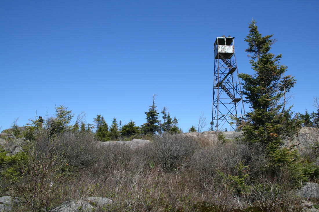
St. Regis Mountain Fire Tower
The 3.4-mile trail to the restored 1918 fire tower over the Saint Regis Canoe Area, an hour from the cabins: route, history, winter, kids and dogs.
St. Regis Mountain is the 2,874-foot summit in the middle of the Saint Regis Canoe Area, west of Paul Smiths, and the 35-foot steel fire tower on top has stood there since 1918. A 3.4-mile trail from Keese Mills Road climbs to a bare rock summit with dozens of ponds and lakes below and the High Peaks to the south. The trailhead is about 33 road miles from the cabins, roughly an hour's drive, so the climb fits in a day with time to spare.
The mountain and the canoe area
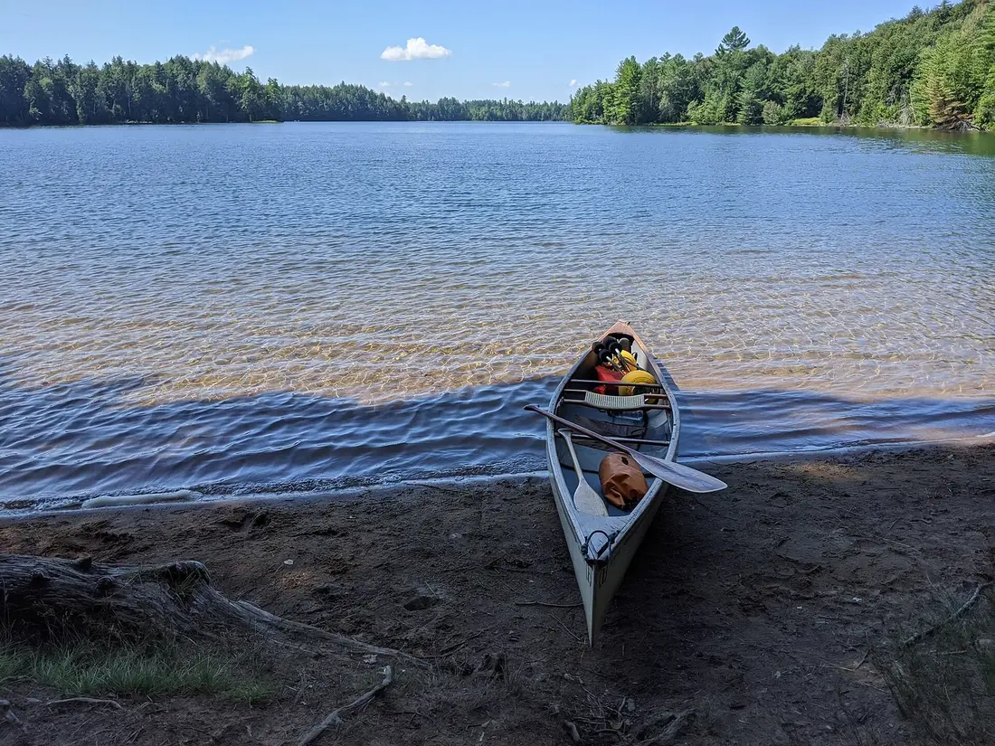
The mountain stands in the Town of Santa Clara in Franklin County, inside the 18,400-acre Saint Regis Canoe Area, the only designated canoe area in New York. The state manages the canoe area as wilderness, and the summit with its fire tower can be seen from most of the ponds within it. The half acre around the tower is its own small unit of state land, the Saint Regis Mountain Fire Tower Historic Area, set apart so the tower could stay.
The summit has been mostly bare since 1876. That year Verplanck Colvin's survey crew and their guides set a fire to clear brush that loggers had left behind, and it got away from them and burned off most of the summit's vegetation. Today the top is open rock with ferns and white birch around it. That open rock gives the wide view, and it is why the state could post a fire observer on the summit in 1910 without building a tower at all.
When the steel tower went up in 1918, William Rockefeller owned the mountain and much of the land around it, and his estate at Bay Pond lay nearby. In February 1910 his son wrote to the state that the family would gladly let it set up an observation station on St. Regis, and asked that their superintendent at Bay Pond be told at once of any fire spotted on their property. Today the mountain is public Forest Preserve.
Getting there from the cabins
Take County Route 25 to NY 30 and follow NY 30 south past Meacham Lake to Paul Smiths, about 31 road miles. Paul Smith's College sits at the four-way junction of NY 30 and NY 86. Keese Mills Road leaves NY 30 to the west about 100 feet north of the college's main entrance, so driving south you turn right onto it just before the junction. Follow Keese Mills Road for about 2.6 miles to the DEC parking area on the left. From the cabins that is about 33 road miles, roughly an hour each way.
Pack lunch and water before you leave the cabins. Meacham Lake, about 20 road miles from the cabins beside NY 30, makes a summer swim stop on the way home while its campground is open. From the trailhead, the Paul Smith's College Visitor Interpretive Center is about 3.7 road miles away, back on NY 30 just north of the college, and the 6er bell in downtown Saranac Lake is about 14.6 road miles away by NY 86.
The parking area and the start of the trail
The DEC lot on Keese Mills Road is also one of the main ways into the Tongue Tract, 706 acres of Paul Smith's College land on Lower St. Regis, Spitfire and Upper St. Regis lakes, open to the public under a state conservation easement. The tract has five lean-tos and the Purple Dot Trail, a 0.4-mile canoe carry between the North Bay of Upper St. Regis Lake and Lower St. Regis Lake, so some of the cars in the lot belong to paddlers and campers.
The hike begins on a gravel road that soon crosses the St. Regis River near the outlet of Lower St. Regis Lake. After a few hundred yards the footpath turns right into the woods at the trail register. Sign in there, and sign out on the way back. The road continues to the privately owned Topridge estate, so leave it at the register and follow the yellow markers. The original trail crossed private land owned by Marjorie Merriweather Post and by Paul Smith's College, and DEC later rerouted it onto state land.
The trail
DEC measures the trail at 3.4 miles from the trailhead to the summit, 6.8 miles round trip, and puts the climb at more than 1,200 feet. Published figures for the total climbing run from about 1,260 to 1,650 feet. The footing is good most of the way, with stone steps on some of the steeper pitches. Plan on half a day.
The first two miles
Past the register the trail climbs gently into conifers, passes a small wetland pond and soon reaches a junction, where you veer right and stay with the yellow markers. The first two miles are easy going, up to a ridgeline, down a little and up again. The path passes huge mossy cliffs and a cluster of glacial erratics, the big boulders the ice sheet left behind, crosses a few patches of open bedrock, follows a ridge of tall balsam and white pine, and runs through a flatter stretch of hardwoods with big white pines, hemlocks and maples. Expect a few muddy patches in wet weather, and walk straight through them so the trail does not widen.
About two miles in, a small footbridge crosses a rocky stream. A steady but unhurried hiker gets there in about an hour, and it makes a good place for a snack and a drink, because the easy part of the day ends here.
The climb to the summit
Past the bridge the trail climbs for real, though it holds a moderate grade until the last 0.3 mile. Higher up there is a short stretch of rock-lined trail and a short stone staircase, and in one place the path squeezes up between big rock walls on both sides. The last 0.3 mile is the steepest part of the hike, with some steep sections but no hard scrambles.
Near the top, a side path on the right leads to an overlook bordered by blueberries, with a view north over forest and rolling hills. Back on the main trail you come out onto open rock just below the summit, and the tower appears.
The view from the summit
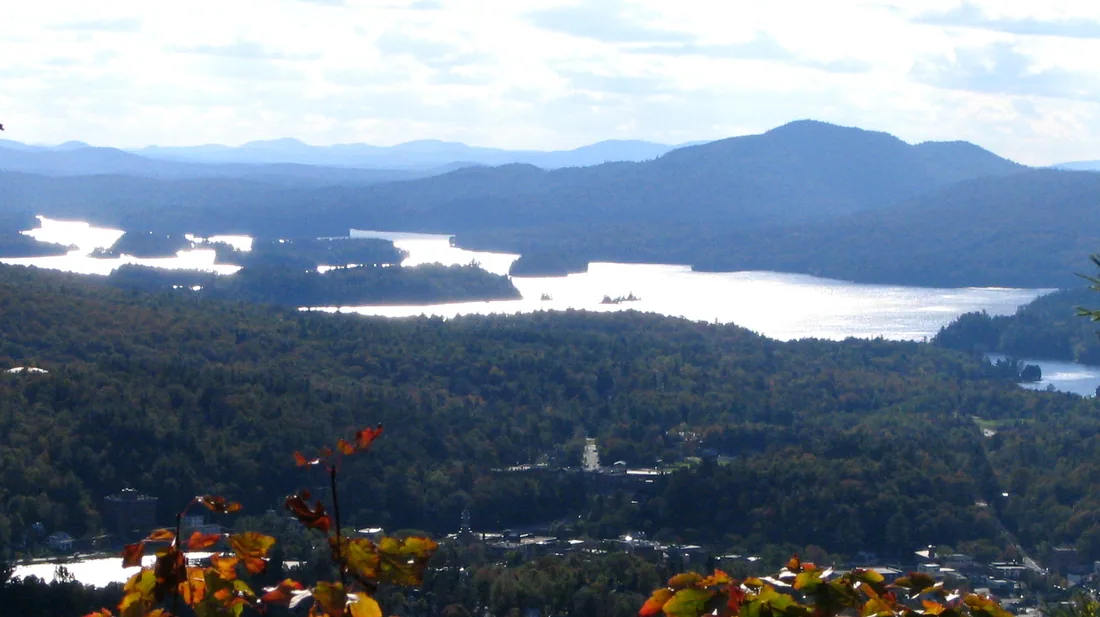
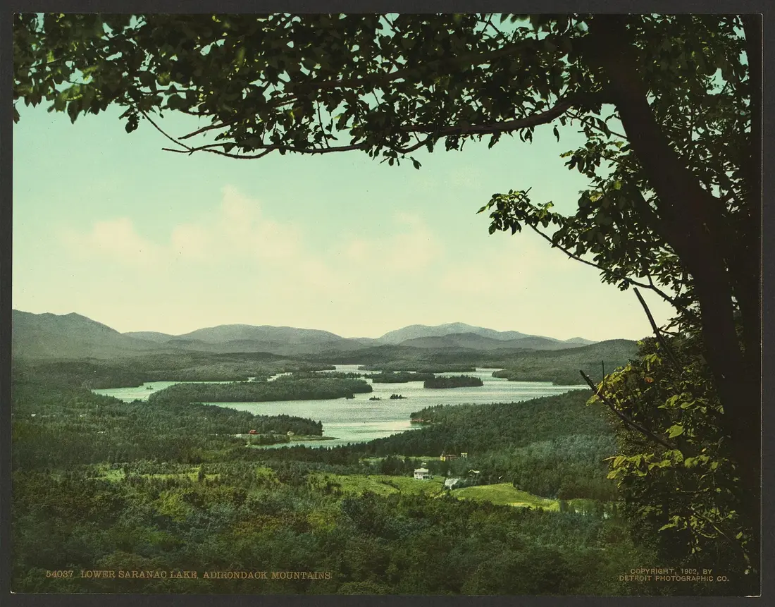
From the open summit you look down on the ponds of the canoe area and out to the larger lakes around them: Upper and Lower St. Regis lakes, Upper and Lower Saranac lakes, and Lake Clear. The Friends group that cares for the tower counts about thirty lakes in the view. McKenzie Mountain and the High Peaks rise to the south and east, Whiteface shows on a clear day, and Loon Lake Mountain stands to the north. In the 1970s a DEC visibility study found that an observer in the cab could see about 20 miles, over some 115,000 acres of state land and 334,000 acres of private land, close to half a million acres in all.
Four labeled panoramic panels in the cab, one for each direction, name the mountains and lakes you are looking at. Volunteers installed the south and east panels in 2021, the west panel in August 2024 and the north panel in September 2024, packing the heavy plates and the tools up the trail themselves. Look down at the rock near the tower, too. Three survey markers set in it date from 1942, when the U.S. Coast and Geodetic Survey placed a triangulation station, the disk with a triangle stamped in the center, and two reference marks to help surveyors find it.
The summit is much colder and windier than the parking lot. Bring a warm layer and a wind shell, and find a sheltered spot in the rocks for lunch.
The fire tower
The tower is a 35-foot Aermotor LS40 galvanized steel tower, measured from the ground to the floor of the cab, put up in 1918 by the state's Conservation Commission. The stairs climb in five flights with four landings. Because the stairs are narrow and the cab is small, DEC allows no more than six people on the tower at a time, so wait at the base if it is full. Hold the rails, keep children close, and at the first sound of thunder, near or far, come down and get off the summit.
Fire watching from 1910 to 1990
The fires of 1903 and 1908 burned about 464,000 and 368,000 acres of the Adirondacks, and the state began posting observers on the summits. In April 1910 an observer was stationed on St. Regis Mountain, with a clear view about twelve miles east, fifteen miles north and south and thirty miles west. That first year state workers built a three-mile telephone line to the summit so fires could be reported to the local forest ranger quickly. The first observer, George F. Brown, reported 55 fires in his first year. On May 31, 1915, a small fire probably left by fishermen in Santa Clara, fanned by strong winds, burned 1,550 acres of state land.
The steel tower came in 1918. In 1919 a map table was added, a circular map with a sketch of the skyline around its edge and a sighting arm that pivoted at the center, so the observer could read the bearing of any smoke. The observers lived in a cabin on the mountain; the last one, built by the Civilian Conservation Corps in 1939, was 16 by 20 feet with a porch and a fireplace, and the state took it down in June 1995. The state began counting tower visitors in 1921, when 944 people came to St. Regis, and 1,639 hikers registered in 1934.
Newer methods spotted fires more cheaply, and in the towers' last years observers reported only about 4 percent of the fires in the state. In 1988 DEC decided to phase the towers out. A November snowstorm that year wrecked the St. Regis telephone line, and it was never restored. In 1990 St. Regis was one of the last four Adirondack towers to close, along with Rondaxe, Hadley and Blue Mountain. It had been staffed continuously from April 1910 through 1990, the longest run of any fire tower in New York.
How the tower was saved
Once the observers left, the tower began to deteriorate, and DEC removed the lower stairs to keep people off. Under the Adirondack Park State Land Master Plan, a fire tower in a canoe area was a nonconforming structure, and DEC made two attempts to remove it, in 2001 and 2002. One plan would have had a Canadian military group move it to the visitor center in Paul Smiths and put it back up as an attraction; that fell through. In the summer of 2003 a volunteer from the Azure Mountain friends group began collecting signatures to save the tower, and by March 2005 more than 2,000 people had signed. That same month the St. Regis Mountain Fire Observation Station was placed on the State and National Registers of Historic Places.
That did not settle it. A DEC fire tower study released in February 2010 still called for the tower to be removed. The Adirondack Park Agency held public hearings at which nearly every speaker asked to keep the towers, and in October 2010 its board voted to classify the land beneath the towers on St. Regis and Hurricane mountains as historic, which let both stay and be restored. Governor David Paterson approved the change in December 2010. On November 7, 2014, DEC issued the final management plan for the new historic area, and restoration could begin.
The restoration
The Friends of St. Regis Mountain Fire Tower organized in May 2013, and in May 2015 the group signed a volunteer stewardship agreement with DEC. Before work could start, a Paul Smith's College ornithologist and his students surveyed for Bicknell's thrush, and finding none cleared the way. On August 25, 2015, a State Police helicopter flew lumber, hardware and the bottom two sets of stair stringers to the summit. That September the Friends, other volunteers and a Student Conservation Association crew spent a week on top installing railings, stairs, landings and safety fencing and replacing the floor of the cab.
In July 2016 a new roof, fabricated by a Bloomingdale contractor, was flown to the summit, and the old roof came off and the new one went on in a two-day effort. Volunteers painted the cab inside and out that August. On September 1, 2016, four members spent the day installing the window frames and the safety railing in the cab and putting up the occupancy sign, and the tower opened to the public for the first time in 26 years.
The work kept going after the opening. On August 5, 2018, the Friends threw the tower a 100th birthday party at the Lake Clear Lodge. A $2,000 grant from the Cloudsplitter Foundation, DEC funding and hundreds of small donations paid for new steel for all 24 diagonal braces, made by a welder in Keeseville. A State Police and DEC helicopter crew flew them to the summit on October 31, 2018, after two days of weather delays. A crew replaced the first set that November, and the rest were in by May 12, 2019. Since then volunteers have primed and painted the stairs, landings and legs, a mason has repaired the footings, and from 2024 through 2026 volunteers replaced the safety fencing. The fencing on all five flights of stairs was finished in August 2026, and work on the landings began that September. During some past projects the tower closed while crews worked, so be patient if you meet a work party.
Stewards, stickers and the yearly lighting
In the 2026 hiking season the Friends had two summit stewards, one on the tower Fridays through Sundays and the other on Mondays and Tuesdays. Stewards greet hikers, tell the tower's history, point out the mountains and lakes and give hiking tips. The program grew out of a partnership between the Friends, DEC and the Adirondack Watershed Institute of Paul Smith's College, which first put a steward on the summit on Fridays in the summer of 2015. Volunteers working on the tower hand out St. Regis stickers, and they have given hiking certificates to people who make the top.
Each year around Labor Day weekend, the New York chapter of the Forest Fire Lookout Association lights fire towers across the state for one evening, and the Friends carry lights up St. Regis. In 2026 the lighting fell on Saturday, September 5. It was the 13th statewide lighting and the tenth for St. Regis, with a dinner and viewing party at Hohmeyer's Lake Clear Lodge and the lights due on at 8:30 p.m. That night the summit drifted in and out of the clouds, and the crowd at the lodge caught only a few dim glimpses. The party watches from the shore of Lake Clear; watch the Friends' website for the next date.
The lake trail from Upper St. Regis Lake
Paddlers have a second way up. Launch at the Upper St. Regis Lake boat launch off NY 30, which serves both as a private marina for lake residents and as a public launch, or at the Paul Smith's College launch, where campus security will tell you where to park. Paddle around the corner of Ward Island to Spring Bay, where a small dock and a DEC sign mark the trailhead. Tie the boat up out of the way of other paddlers and hikers. The trail climbs an esker steeply at first, then flattens, follows Spectacle Pond on the right and joins the main trail from Keese Mills Road after about a mile.
The round trip from the dock is about 4.6 miles, roughly 2.2 miles shorter than the hike from the road. The Friends call it the Judy Cameron Trail, and their work crews use it when they have tools to carry. The cabins do not list canoes or kayaks, so rent a boat from an outfitter in Saranac Lake; the Saint Regis Canoe Area guide covers the outfitters, the launches and the paddling rules on these lakes.
St. Regis in winter
St. Regis makes an excellent snowshoe climb. Ice and snow can cover the upper trail from mid-October to mid-May, and microspikes are highly recommended for the icy rock near the top. The lower trail is gentle enough to ski. Novice skiers can ski as far as the bridge, a little over two miles in, and switch to snowshoes there. Past about three miles, with less than half a mile to go, the trail steepens sharply, and all but expert skiers should walk. If you ski, carry snowshoes too.
Skip the tower stairs in winter. The Adirondack Mountain Club's winter Fire Tower Challenge counts tower hikes made between December 21 and March 21, but it asks hikers not to climb the towers themselves in that season: high winds and ice and snow on the stairs make them unsafe, and crampon spikes damage the wooden steps. The open summit still gives the view. Days are short, so start early, carry a headlamp, and pack dry spare layers, because the summit is far colder and windier than the lot.
The cabins do not supply snowshoes. Blue Line Sports in Saranac Lake rents them, and the cross-country skiing and snowshoeing guide lists other rentals and trails. For the drive down NY 30 in snow, read winter driving first.
Children and dogs
St. Regis is a family hike. There are no ledges to clamber up and no difficult stream crossings, so the question for a family is distance: 6.8 miles round trip is a long day for children. Break it into pieces. The bridge at two miles is a natural first stop, and the blueberry overlook just below the summit is a second. On top, keep children back from the edges of the rock and hold their hands on the tower stairs.
Dogs are common on the trail and on the summit. Keep yours under control, leash it when other people approach, and carry water for it. Dozens of dogs turn up in the summit photos the Friends collect, and some get nervous when their people climb the tower and they cannot follow. The dog guide covers ticks, hunting season and the cabins' pet rules.
Safety on the mountain
- Thunderstorms. The summit is open rock with a steel tower on it. Leave the tower and the summit at the first sound of thunder or the first sight of a storm, and encourage others to do the same.
- Spring mud. DEC asks hikers to stay off trails above 2,500 feet while snow and mud melt out in spring, and the St. Regis summit is above that line. Wait for the trail to dry.
- Bugs. Black flies are worst from late May into June; the bug guide covers them and ticks.
- Fall. Wear blaze orange or pink on fall climbs and carry a headlamp; the hiking guide lists the hunting seasons and the early sunsets.
- Emergencies. Call 911 and ask for a DEC Forest Ranger, or call Forest Ranger dispatch at 1-833-NYS-RANGERS (1-833-697-7264). If you are lost or hurt, stay calm and stay put.
The Paul Smith's College VIC
The Paul Smith's College Visitor Interpretive Center, known as the VIC, is about 3.7 road miles from the trailhead lot, on NY 30 just north of the college, and it is the natural stop on the way home. More than 25 miles of trails start there, open from dawn to dusk every day. In fall 2026 the lodge was open from 9 a.m. to 5 p.m., Thursday through Monday; check the hours before you plan around it.
Inside the lodge, in the main room, the Friends keep a museum display case of artifacts and memorabilia used by observers on St. Regis and other fire towers, with posters, replica panoramic panels, a trail sign and the original map table. The VIC's view across Heron Marsh has the fire tower in the background. The VIC gives away a free two-inch St. Regis sticker and sells larger stickers, hats and patches, and the proceeds help both the VIC and the Friends. The cabins are about 30 road miles from the VIC, roughly 45 minutes. The Saranac Lake and Paul Smiths guide covers the VIC's trails and the village down the road.
The 6er and the Fire Tower Challenge
St. Regis is one of the six mountains of the Saranac Lake 6er, the village's hiking challenge, which ends with ringing a bell on Berkeley Green in downtown Saranac Lake. The village lists it second of the six in order of difficulty, after Baker, and it is the only one of the six with a fire tower still standing. Ampersand had one until 1977.
St. Regis also counts toward the Adirondack Mountain Club's Fire Tower Challenge. Finishers document at least 23 fire-tower summits, 18 of the 27 in the Adirondack Park and all 5 in the Catskill Park, and show proof of some stewardship of public land, such as a Leave No Trace course or a volunteer project. Two more towers are within a reasonable drive of the cabins: Azure Mountain, whose trailhead is about 42 road miles away, and Lyon Mountain, about 45. The tower on Loon Lake Mountain, about 20 road miles from the cabins and the closest of all, is closed to climbing.
A day from the cabins
Leave the cabins at 8 a.m. and you can be signing the register by about 9. Reach the bridge around 10 and the summit before noon, with time for lunch in the rocks and a turn in the tower. Back at the car by mid-afternoon, drive the 3.7 miles to the VIC to see the observers' display, and you are home about 45 minutes later. In fall the hardwoods along the trail turn color; the fall foliage guide has the timing.
For a bigger day, take NY 86 to Saranac Lake instead. The village is about 14.6 road miles from the trailhead, with lunch on Main Street, and Baker Mountain, the shortest of the 6er peaks, starts at the bell on Berkeley Green. St. Regis and Baker together make two of the six in one day and about 11 miles of walking. On summer and fall weekends, start early either way. Every one of the cabins has its own hot tub on the deck, and after this mountain you will use it.
Questions
How long is the hike up St. Regis Mountain?
DEC measures the trail at 3.4 miles from the Keese Mills Road trailhead to the 2,874-foot summit, 6.8 miles round trip, with more than 1,200 feet of climbing; published totals run up to 1,650 feet. The first two miles roll gently, and the real climbing starts at a footbridge about two miles in. Plan on half a day.
Can you climb the St. Regis fire tower?
Yes. The restored 1918 tower reopened on September 1, 2016, after volunteers rebuilt its stairs, landings, roof and cab. DEC allows no more than six people on it at a time because the stairs are narrow and the cab is small. Leave the tower and the summit at the first sound of thunder, and skip the stairs in winter.
How far is St. Regis Mountain from the cabins?
The trailhead lot on Keese Mills Road is about 33 road miles from the cabins, roughly an hour each way. Take County Route 25 to NY 30, follow NY 30 south past Meacham Lake to Paul Smiths, and turn right onto Keese Mills Road just before the junction with NY 86. The lot is about 2.6 miles in, on the left.
Is St. Regis Mountain a good hike for children?
Yes, for children who can walk 6.8 miles. There are no ledges to clamber up and no difficult stream crossings. Break the day at the bridge two miles in and at the blueberry overlook near the top, and hold hands on the tower stairs. See family stays for the cabins.
Can I bring my dog up St. Regis Mountain?
Yes. Dogs are common on the trail and the summit. Keep yours under control, leash it when other hikers approach, and carry water for it. Some dogs get nervous when their people climb the narrow tower stairs without them. The cabins allow pets for a fee; the dog guide has the details.
Can you hike St. Regis Mountain in winter?
Yes, and it is a good snowshoe climb. Ice and snow can cover the upper trail from mid-October to mid-May, so carry microspikes as well as snowshoes. The lower miles are gentle enough to ski. The summit is far colder and windier than the trailhead and the days are short, so start early with a headlamp. The cabins do not supply snowshoes; a Saranac Lake shop rents them.
Is there a shorter way up St. Regis Mountain?
Yes, for paddlers. From a dock in Spring Bay on Upper St. Regis Lake, a trail climbs about a mile to join the main trail, for a round trip of about 4.6 miles from the dock. You need a canoe or kayak and a launch, such as the Upper St. Regis Lake launch off NY 30; the canoe area guide lists boat rentals.
Sources
Facts on this page were checked against these sources in October 2026. Hours, fees and schedules change; confirm before you go.
- New York State Department of Environmental Conservation dec.ny.gov/places/saint-regis-canoe-area
- New York State Department of Environmental Conservation dec.ny.gov/things-to-do/hiking/fire-towers
- Saranac Lake tourism saranaclake.com/hiking/st-regis-mountain
- friendsofstregis.org friendsofstregis.org/
- friendsofstregis.org friendsofstregis.org/history-of-the-tower-observers-and-friends-group/
- friendsofstregis.org friendsofstregis.org/restoration/
- friendsofstregis.org friendsofstregis.org/directions
- friendsofstregis.org friendsofstregis.org/trail-via-upper-st-regis-lake/
- friendsofstregis.org friendsofstregis.org/st-regis-mountain-by-martin-podskoch/
- friendsofstregis.org friendsofstregis.org/tower-steward-handbook/
- friendsofstregis.org friendsofstregis.org/summit-markers/
- friendsofstregis.org friendsofstregis.org/lighting-the-tower-all-the-years/
- friendsofstregis.org friendsofstregis.org/centennial-party-2/
- friendsofstregis.org friendsofstregis.org/critters-of-st-regis-mountain/
- Adirondack Explorer adirondackexplorer.org/outdoor-recreation/hiking/saranac-lake-6ers-gui
- adirondackalmanack.com adirondackalmanack.com/2014/11/st-regis-mountain-bring-your-skis-and-s
- protectadks.org protectadks.org/hike-up-st-regis-mountain/
- pureadirondacks.com pureadirondacks.com/blogs/adirondack-hiking/st-regis-mountain
- New York State Department of Environmental Conservation dec.ny.gov/places/paul-smiths-college-conservation-easement-tract
- Adirondack Mountain Club adk.org/adk-fire-tower-challenge/
- Paul Smith's College paulsmiths.edu/vic/
- Saranac Lake tourism saranaclake.com/saranac-lake-6er
- Saranac Lake tourism saranaclake.com/story/2017/09/st-regis-mountain-paddle-hike
- nysffla.org nysffla.org/towers5.htm
- New York State Department of Environmental Conservation dec.ny.gov/things-to-do/hiking/trail-etiquette
- New York State Department of Environmental Conservation dec.ny.gov/things-to-do/camping/state-land-rules
- New York State Department of Environmental Conservation dec.ny.gov/environmental-protection/public-safety/forest-rangers
- New York State Department of Environmental Conservation dec.ny.gov/news/press-releases/2025/5/dec-issues-spring-conditions-adv
- bluelinesportsllc.com bluelinesportsllc.com/deparments.html
- Saranac Lake tourism saranaclake.com/shopping
- router.project-osrm.org router.project-osrm.org/
In this guide
Stay nearby
The first of the cabins: a big stone fire pit you see as you walk up, a screened corner of the deck, direct trail access, and a short walk to an observation deck over the pond.
 The Modern Tiny HomeCabin 1 · 2 bd · 1 ba · sleeps 4
More in Trails & Hiking
Sources
31 references, listed in full at the end of this guide: official park, state, tourism-office and business sources, checked October 2026.
Related guides


Photos on this page: Saint Regis Fire Tower 2010 t6 by John Sweeney, CC BY-SA 3.0; St Regis Canoe Area by Marty Plante, CC BY-SA 4.0; SaranacLake by Mwanner at en.wikipedia, CC BY-SA 3.0. Resized and cropped for this site. All photo credits