
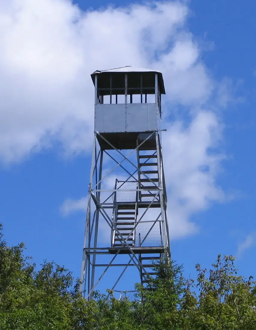
Azure Mountain Fire Tower
Azure Mountain's fire tower: the one-mile, 944-foot trail, the 1918 tower and its volunteers, the view, winter, St. Regis Falls and the drive from the cabins.
Azure Mountain is a short, steep fire-tower climb in the northern Adirondacks: a mile of trail and 944 feet of climbing to a 2,518-foot summit, where a steel tower from 1918 stands open to the public. The trailhead on Blue Mountain Road is about 42 road miles from the cabins, roughly an hour and a quarter by car. Go for the view from the cab, with the High Peaks on the southern horizon and the St. Lawrence Valley to the north.
Azure Mountain at a glance
| Item | Detail |
|---|---|
| Trail | 1 mile each way, about 2 miles round trip, out and back on one route |
| Climb | 944 feet from the parking lot to the 2,518-foot summit |
| Trail markers | Red |
| Land | Forest Preserve, the 528-acre Azure Mountain parcel of the Debar Mountain Wild Forest, Town of Waverly, Franklin County |
| Tower | 35-foot Aermotor steel tower from 1918, restored in 2002, cab open to the public |
| Trailhead | A short access road on the west side of Blue Mountain Road, about 7 miles south of NY 458 |
| From the cabins | About 42 road miles, roughly an hour and a quarter |
| Time on foot | Two hours or more for the round trip, with time on top |
| Summit stewards | Volunteers on many summer weekends, 10 a.m. to 4 p.m. in good weather; no schedule is posted |
| Fire Tower Challenge | On the Adirondack list |
The trail from the parking lot to the summit
The hike begins on an old dirt road at the back of the parking area. After a few hundred yards it reaches the trail register and an information kiosk; sign in on the way up and out on the way down. From the register, red markers lead all the way to the top on a path worn wide and easy to follow.
The first stretch is close to level, through young beech and maple with ferns thick on the ground. At about 0.3 mile the trail passes a small, sunny clearing around an old foundation and fire ring. The fire observer's cabin, built in 1936, stood beside this trail until the DEC removed it in 1995, and its remains are still along the path a few tenths of a mile in, by a small stream.
Past the clearing the trail begins to rise. Lone glacial boulders, called erratics, sit in the woods on either side, and then the path winds through a jumble of jagged bedrock that makes a natural rest stop. Above it the climbing turns steep, and from about halfway up it stays steep nearly to the summit. A short side trail leads to the first open view. Higher up, the ferny beech and maple woods give way to dense spruce and white pine mixed with maple, the trail crosses bare bedrock, and a stone staircase climbs the last stretch to the tower.
The descent follows the same route. The steep half is harder on knees going down than coming up, so take it slowly, and watch your footing on bare rock after rain and on fallen leaves in October.
The trail does not suit wheelchairs: the second half is steep and rocky, and the last few yards are stone steps. For everyone else, the path is heavily used and easy to follow.
The fire tower and its history
The state set up a fire observation station on the summit in 1914, built of wood. In 1918 it put up the galvanized steel tower that stands today, a 35-foot Aermotor tower, measured to the floor of the cab, erected at a cost of $530. Observers watched for smoke from the cab and lived in a cabin below the summit.
The DEC closed the tower in 1978 and took out the lower two flights of stairs so no one could climb it. In 2001 hikers learned that the DEC planned to dismantle the tower. The state would let a tower outside a designated wilderness stay if it served an educational purpose, so they formed the Azure Mountain Friends to give it one. The same year the tower was named to the National Register of Historic Places along with six other fire towers. DEC staff, AmeriCorps workers and volunteers from the Friends restored it in 2002, and it officially reopened with a ceremony on September 27, 2003.
The tower turned 100 in 2018. Its centennial was celebrated on July 29 of that year, and the tower was renovated that July. Today the cab is open to the public, with a full 360-degree view. Azure Mountain is also one of the summits on the Adirondack Mountain Club's challenge list; see the Fire Tower Challenge from the cabins for the rules and the other towers within reach.
How Blue Mountain became Azure Mountain
The first settlers called it Blue Mountain, for the blue color its summit gives off from a distance. When Verplanck Colvin surveyed the northern part of the Park in 1883, he labeled this peak Blue Mountain, then crossed the name out and wrote Azure Mountain in its place.
The change became official in 1914. That year the state was building fire towers across the Park and realized it already had a Blue Mountain with a fire tower, so it took Colvin's name for this one to avoid confusion. The people who lived here kept the old name for the road, which is why you drive Blue Mountain Road to climb Azure Mountain. The other Blue Mountain, over Blue Mountain Lake in Hamilton County, has a tower built in 1917, the first restored on the Adirondack Forest Preserve, and it counts toward the same challenge.
The old name also belonged to the Blue Mountain House, a sportsman's lodge that Chauncey Merrill, a settler from Canada, opened around 1866. It burned in 1869 and again in 1871, and Merrill rebuilt it both times. Later owners included Darwin Day of Nicholville, who bought it in 1895, and Eugene Elliot of Washington, D.C., who bought it in 1925 hoping to make it the biggest hotel in the Park and a lavish summer residence. The Depression brought hard times, a fire in 1932 finished it, and today it survives only as the faint outline of a foundation in the woods.
The Azure Mountain Friends and the summit stewards
The Azure Mountain Friends, the volunteer group that formed in 2001 to save the tower, still look after it, working with the DEC and under its supervision. The group maintains the tower, the trail and the parking lot for safe public use, holds informal work days in the warmer months, and teaches visitors about the mountain's history and natural features.
The summit steward program began in 2003. Stewards are on top from 10 a.m. to 4 p.m. when the weather allows, on weekend days and holidays between Memorial Day and Columbus Day. Since 2006 the group has given two to four $750 scholarships a year to college-bound students, nearly 40 in all, and each winner serves five days as a fire tower and summit steward; four students earned one in 2025. A 2017 account found stewards on top every weekend of the season, but the schedule depends on volunteers and is not posted, so count a steward as a bonus. They hang an interpreter sign at the parking lot, greet hikers on the summit, do trail and rock work, pick up trash on the way down, and sign observer cards for anyone who wants one.
Two rules shape what they can do. The DEC does not allow anything to be sold on state land, and it does not allow donations to be taken there either, so the group's patches, trail guide and T-shirts are sold only through its website. If you would rather give time, the Friends are always looking for more summit stewards.
The summit and the south bluff
The top of the mountain is open rock, grass and low trees. A stone staircase leads up to the tower, and the grassy patches are lined with rocks to hold the thin soil in place. Stay on the rock and the path; these mountaintop plants are fragile.
The summit's other draw is its south-facing bluff, an open rock slab with the whole southern view in front of it, reached by a series of wide steps. A short walk from the tower, a large glacial boulder sits perched on a ledge, with a path along the summit edge leading to it. On a calm day the bluff makes a good lunch spot, with or without a climb of the tower.
A bluff is a steep drop, so set rules before you get there. Keep children back from the edge, keep dogs leashed, and sit well back from the lip when the rock is wet or the wind is gusting.
The view from the bluff and the cab
From the bluff the view runs south. The forest along the St. Regis River fills the foreground, wetlands and woods spread out below, and Adirondack peaks line the horizon, with the High Peaks visible in the distance on a clear day.
The tower completes the circle. From the cab you look north over the Deer River country and out to the St. Lawrence River valley, and on a clear day you can see into the provinces of Ontario and Quebec. In every direction the near view is the boreal forest of the northern Adirondacks.
A paper map turns the view into names. National Geographic's Trails Illustrated map 746, Saranac and Paul Smiths, covers the Debar Mountain Wild Forest, which takes in the Azure Mountain parcel, and the Saint Regis Canoe Area, at about 1:75,000 on waterproof paper; orient it to the tower's windows and match the ridges.
Children and dogs on the trail
Children
Azure Mountain suits children who already like to walk. The distance is short, about two miles round trip, and the first part is nearly flat, which gives everyone a warm-up. The second half is a steady, steep climb, and the summit has an open edge and a tower with steep stairs, so plan the day around those three places.
- Allow two hours or more for the round trip, and longer with children.
- Stop at the jagged bedrock below the steep section for a snack before the hard part.
- On the tower, an adult climbs just below each child going up and just ahead going down.
- Pack a warm layer for the summit even in summer; the top catches wind that the woods block.
- Check everyone for ticks that evening; the bug guide explains how.
Back at the cabins, each of the three has a private hot tub for tired legs that evening.
Dogs
Dogs are welcome on the trail. The DEC asks that dogs be leashed at trailheads and whenever they meet another group of hikers, and under the owner's complete control at all times. On Azure Mountain that means a leash in the parking lot and on the summit, where hikers gather around the tower and along the bluff.
Tower stairs are steep, and most dogs do not belong on them; one adult can wait with the dog on the summit while the others climb. Carry water for the dog, since the climb is steady, and put a bright vest on it in hunting season. The cabins allow pets for a fee; see bringing your dog for the rules at the cabins and on the trails.
Spring, summer and fall on the mountain
Spring
The summit sits at 2,518 feet, just above the 2,500-foot line in the DEC's mud-season advice, which asks hikers to avoid trails above that height until mid-June while the ground thaws. When you do go, walk through the middle of the mud; stepping around a puddle widens the trail. Black flies are worst from late May into early June; see the bug guide.
Summer
Long days make an afternoon climb easy: on June 21 the sun sets at about 8:50 p.m. at the cabins. Summer weekends are also the likeliest time to find a steward on top. Watch the sky on hot afternoons. At the first thunder, come down from the tower and leave the open summit, and wait at least 30 minutes after the last thunder before going back out in the open.
Fall
The color and the hunting seasons arrive together. Hikers share these woods with hunters carrying firearms or bows, and the DEC asks hikers to wear blaze orange or blaze pink. The days shorten quickly: sunset is at about 6:15 p.m. on October 15, and after the clocks change on November 1 it falls to about 4:30 p.m. by mid-November, so carry a headlamp on any afternoon start. The fall foliage guide covers when the leaves turn.
Azure Mountain in winter
The trail makes a popular snowshoe. Snowshoes keep you from post-holing through the snowpack, and microspikes help on the steep upper half when it is icy. The cabins do not supply snowshoes; cross-country skiing and snowshoeing covers where to rent them.
Leave the tower alone in winter. Fire towers are extremely unsafe in that season: high winds add risk, the stairs are often covered with ice and snow, and crampon points damage the wooden steps. The Adirondack Mountain Club's winter challenge asks hikers not to climb the towers between December 21 and March 21, and the summit and the bluff give most of the view without the stairs. The club also recommends winter fire-tower hikes only for fit hikers with winter experience and proper gear, in groups of at least four.
The drive needs the same care. Blue Mountain Road is a narrow dirt road for most of its length, and travel on it can be tricky in winter and in mud season. Plowing has varied. In March 2015 the north end, from NY 458, was plowed but wash-boarded and potholed, with the trailhead lot cleared, while the south end toward Paul Smiths was a seasonal road left unmaintained through March. In winter, come and go by NY 458, turn back if the road or the lot has not been plowed, and read winter driving before you set out. On December 21 the sun sets at about 4:20 p.m.
Driving there from the cabins
The trailhead is about 42 road miles from the cabins, roughly an hour and a quarter. Take County Route 25 to NY 30 and turn south. Follow NY 30 for about 15 miles, passing the Meacham Lake turn, then turn right onto NY 458, which meets NY 30 about 2.7 miles beyond it. Stay on NY 458 for about 13 miles and turn left onto Blue Mountain Road. After about 7 miles, watch for the large brown and yellow DEC sign on the right; the parking lot is at the end of a short access road on the west side.
Blue Mountain Road is paved for its first two and a half miles or so from NY 458, then turns to dirt for the last four miles or so to the trailhead. It is narrow, winding and little used, so drive it slowly and watch for oncoming cars on the curves. The parking area is small.
Listings give the trailhead different postal towns, Saranac Lake in one and Paul Smiths in another, though by road it is closer to St. Regis Falls than to either. Set your map to the parking lot's coordinates, 44.5377, -74.4858, before you lose signal, and save the route offline on the cabin wifi.
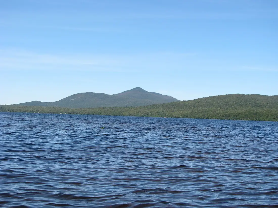
If you come home the way you went, NY 30 passes the Meacham Lake state campground, with a sand beach and a day-use fee while it is open; the Meacham Lake guide has the season and the rules.
A day on Azure Mountain
This plan suits a family or a relaxed pair of hikers in summer or early fall. Shift it earlier on hot days and in October, when the light goes sooner.
| Time | Plan |
|---|---|
| 8:30 a.m. | Leave the cabins with lunch packed; County Route 25 to NY 30 south |
| 9:45 a.m. | Park at the trailhead and sign the register |
| 10:00 a.m. | Start up: the easy first half, a rest at the jagged bedrock, then the steep half |
| 11:00 a.m. | The summit: climb the tower, then lunch on the south bluff; a steward may be on top |
| 12:30 p.m. | Back at the car |
| 1:00 p.m. | St. Regis Falls, about 11 road miles: a look at the river and the falls, and a snack if the village store is open |
| 2:30 p.m. | Home by County Route 5, NY 11B and Malone, about 30 road miles, with groceries in Malone |
| Evening | The hot tub on your own deck |
Fit hikers who want more can swap the St. Regis Falls afternoon for a second tower; the pairing section below has the two best options.
St. Regis Falls and the river
St. Regis Falls is about 11 road miles from the trailhead: north on Blue Mountain Road to NY 458, then left for about 4 miles. It lies at the north end of the Town of Waverly, along the north side of the St. Regis River, a tributary of the St. Lawrence, and the falls it is named for are on the river at the west end of the hamlet. Waverly was formed in 1880 from part of the Town of Dickinson. The area was a major lumber producer, linked to the outside by the Northern Adirondack Railroad, built from Moira to connect with the Ogdensburgh and Lake Champlain Railroad.
The town has owned and run the St. Regis Falls Scenic Campsite, at 19 Water Street, since 1967. It overlooks the river and the falls, with RV and tent sites, lean-tos and rental cabins, and the town rates the trout fishing as excellent, with northern pike, bass and bullhead above the dam. Wading and swimming are not allowed at the campsite. Anyone 16 or older needs a New York fishing license; see fishing trips.
For a snack on the way home, the St. Regis Falls Quick Stop at 14 Spring Street sells groceries, a deli with fresh-cut meats, pizza by the slice and soft ice cream. Its hours differ from one listing to the next, so call ahead (518-856-9934) before you count on it. For a sit-down dinner, Malone has more choice; see where to eat.
From St. Regis Falls the way home runs north on County Route 5 and east on NY 11B into Malone, then south on County Route 25, about 30 road miles. That makes a loop of the day: down NY 30 and NY 458 in the morning, back through St. Regis Falls and Malone in the afternoon, with the supermarkets in Malone on the way; see groceries and supplies.
Pairing Azure Mountain with a second tower
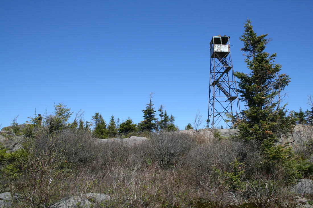
The climb is short enough to leave room for another, and St. Regis Mountain is the natural partner. From the Azure Mountain lot, keep going south on Blue Mountain Road for about 11 miles, then turn east on Keese Mills Road for about 4 miles to the St. Regis trailhead: 15 road miles in all, about 10 of them on dirt, so allow about an hour. St. Regis adds a 6.8-mile round trip and about 1,250 feet of climbing to a restored tower over the Saint Regis Canoe Area, so the day comes to about 8.8 miles on foot and about 2,200 feet of climbing. From the St. Regis lot the cabins are about 33 road miles away by Paul Smiths and NY 30. Skip this pairing in winter, when the south end of Blue Mountain Road may not be plowed. See the St. Regis Mountain guide.
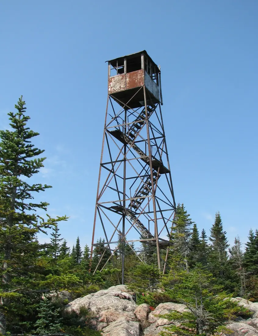
Loon Lake Mountain puts the second climb closer to home. From Azure Mountain, drive back out to NY 458, east to NY 30, south about 8 miles, then County Route 26 to the trailhead, about 40 road miles in all; from there the cabins are about 20 miles away. The trail is 2.8 miles each way with more than 1,600 feet of climbing, and the tower's cab is closed, so the open summit is the reward. See the Loon Lake Mountain guide.
Lyon Mountain, the biggest of the nearby climbs, deserves its own day; the Lyon Mountain guide has the details, and hiking near the cabins lists every trail by distance from the door.
Safety and emergencies
Before you leave the cabins, tell someone where you are going and when you expect to be back, and give them the emergency numbers. In an emergency, call 911 and ask for a DEC Forest Ranger, or call DEC dispatch at 1-833-NYS-RANGERS (1-833-697-7264). Do not count on a cell signal on Blue Mountain Road or on the trail; note where you last had one on the drive in.
If you get lost or hurt, the DEC's advice comes down to four steps: sit down to stay calm, think about how much daylight is left, observe the landmarks and sounds around you, and plan whether to walk out or stay where you are. The nearest hospital by road is UVM Health's Alice Hyde Medical Center in Malone, with a 24-hour emergency department, about 33 road miles from the trailhead by NY 458, St. Regis Falls, County Route 5 and NY 11B; see health and safety.
What to bring
- Water and food. Carry all the water you need, and treat any stream water before you drink it.
- Layers. A warm layer and a wind or rain shell for the summit, in every season.
- Footwear. Hiking boots or shoes with grip for the steep half and the bare rock.
- Navigation. The downloaded route, the parking lot's coordinates and a paper map; plan on no signal.
- A headlamp from September on, and blaze orange or pink in hunting season.
- Winter extras. Snowshoes, microspikes, spare dry layers and a thermos.
- Bug protection from mid-May into July, with a head net in black-fly season.
Sign the register coming and going, carry out everything you carry in, and leave the rock edges and summit plants as you found them. For the rest of the trip, the cabins page compares the three places to stay.
Questions
How long does it take to hike Azure Mountain?
The trail is a mile each way with 944 feet of climbing, and most of that climbing comes in the second half, which stays steep nearly to the top. Allow two hours or more for the round trip with time on the summit and in the tower, and more with children or in snow.
Is the Azure Mountain fire tower open to climb?
Yes. The 1918 tower was restored in 2002 and reopened in 2003, and its cab is open to the public with a 360-degree view. Stay off it in thunderstorms, strong wind and winter ice. The south-facing bluff next to the tower has the southern view without the stairs.
How far is Azure Mountain from the cabins?
About 42 road miles to the trailhead, roughly an hour and a quarter: County Route 25 to NY 30 south, NY 458 west, then about 7 miles on Blue Mountain Road to the DEC sign on the right. Coming home through St. Regis Falls and Malone is about the same distance.
Can I bring my dog up Azure Mountain?
Yes. Keep the dog leashed at the trailhead and whenever you meet other hikers, and under your control the rest of the time. Leash it on the summit, keep it off the tower stairs, and put a bright vest on it in hunting season. See bringing your dog.
Can you hike Azure Mountain in winter?
Yes, with snowshoes, and microspikes for the icy steep half. Do not climb the tower in winter; the stairs ice up and the wind is strong. Blue Mountain Road is a dirt road and its plowing has varied, so come in from NY 458, the end found plowed in a 2015 report, and turn back if the road or the lot has not been cleared.
Does Azure Mountain count for the Fire Tower Challenge?
Yes. It is one of the 27 Adirondack Park summits on the Adirondack Mountain Club's list; finishers need 18 of them plus all 5 Catskill towers. See the Fire Tower Challenge from the cabins for the rules and the other towers nearby.
Sources
Facts on this page were checked against these sources in October 2026. Hours, fees and schedules change; confirm before you go.
- azuremountain.org azuremountain.org/
- azuremountain.org azuremountain.org/history
- azuremountain.org azuremountain.org/about
- azuremountain.org azuremountain.org/volunteer
- azuremountain.org azuremountain.org/scholarship-program
- northcountrynow.com northcountrynow.com/stories/azure-mountain-friends-announces-2025-scho
- New York State Department of Environmental Conservation dec.ny.gov/things-to-do/hiking/adirondack-day-hikes
- New York State Department of Environmental Conservation dec.ny.gov/things-to-do/hiking/fire-towers
- New York State Department of Environmental Conservation dec.ny.gov/places/saint-regis-canoe-area
- protectadks.org protectadks.org/wp-content/uploads/2020/08/Azure-Mountain-Trail-web-2.
- protectadks.org protectadks.org/hike-azure-mountain/
- Saranac Lake tourism saranaclake.com/hiking/azure-mountain
- Saranac Lake tourism saranaclake.com/cycling/blue-mountain-road
- Saranac Lake tourism saranaclake.com/story/2019/09/azure-mountain-adventure
- Saranac Lake tourism saranaclake.com/story/2014/08/hiking-and-exploring-azure-mountain
- Visit Malone visitmalone.com/hiking/azure-mountain
- Franklin County tourism (Always Franklin) alwaysfranklin.com/listing/azure-mountain
- tupperlake.com tupperlake.com/story/2015/03/azure-mountain-winter-fire-tower-challeng
- natureupnorth.org natureupnorth.org/justmynature/patrick-chase/brief-history-azure
- natureupnorth.org natureupnorth.org/trailhead/azure-mountain-trail
- experienceouradirondacks.com experienceouradirondacks.com/hiking/blue-mountain
- Adirondack Mountain Club adk.org/adk-fire-tower-challenge/
- adk-gfs.org adk-gfs.org/FTC/FTC.Brochure.2018-02-01.pdf
- Adirondack Mountain Club adk.org/mud-season-quick-facts/
- Adirondack Mountain Club adk.org/product/map-746-saranacpaul-smiths/
- New York State Department of Environmental Conservation dec.ny.gov/things-to-do/hiking/trail-etiquette
- New York State Department of Environmental Conservation dec.ny.gov/things-to-do/hiking/lost
- New York State Department of Environmental Conservation dec.ny.gov/news/press-releases/2025/10/dec-reminds-new-yorkers-to-hunt
- National Weather Service weather.gov/safety/lightning-tips
- townofwaverlyny.org townofwaverlyny.org/about
- townofwaverlyny.org townofwaverlyny.org/campsite
- townofwaverlyny.org townofwaverlyny.org/area-info
- stregisfallsquickstop.com stregisfallsquickstop.com/
- Saranac Lake tourism saranaclake.com/hiking/st-regis-mountain
- content.govdelivery.com content.govdelivery.com/accounts/NYSDEC/bulletins/8f1d39
- OpenStreetMap (road distances) openstreetmap.org/
- router.project-osrm.org router.project-osrm.org/
- epqs.nationalmap.gov epqs.nationalmap.gov/v1/json
- api.sunrise-sunset.org api.sunrise-sunset.org/json
In this guide
Stay nearby
The first of the cabins: a big stone fire pit you see as you walk up, a screened corner of the deck, direct trail access, and a short walk to an observation deck over the pond.
 The Modern Tiny HomeCabin 1 · 2 bd · 1 ba · sleeps 4
More in Trails & Hiking
Sources
39 references, listed in full at the end of this guide: official park, state, tourism-office and business sources, checked October 2026.
Related guides


Photos on this page: Azure Mountain Fire Tower by Mwanner, CC BY-SA 3.0; Saint Regis Fire Tower 2010 t6 by John Sweeney, CC BY-SA 3.0; Fire Observation Tower on the summit of Loon Lake Mountain, Loon Lake, New York, Franklin County by Marc Wanner, CC BY-SA 3.0; Meacham Lake Franklin County New York by Mwanner, CC BY-SA 3.0. Resized and cropped for this site. All photo credits