
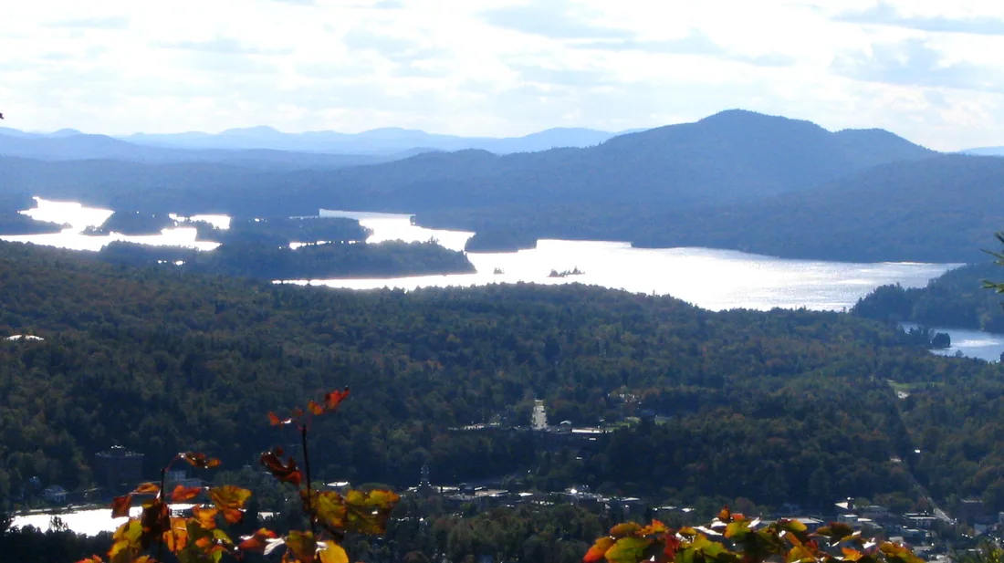
The Saranac Lake 6er
Six mountains around Saranac Lake, a patch and a bell on Berkeley Green: every trail, the rules, the winter 6er and a four-day plan from the cabins.
The Saranac Lake 6er is the village of Saranac Lake's hiking challenge: climb six mountains around the village, register, and you get a patch and the right to ring the 6er bell on Berkeley Green. The peaks run from 2,452 feet at Baker to 3,861 feet at McKenzie, and their trailheads are about 33 to 51 road miles from the cabins, an hour to an hour and a quarter away. Spread over a week's stay with rest days between, the six make a full plan for a group of hikers.
How the challenge works
The Village of Saranac Lake started the 6er on May 25, 2013, as an introduction to hiking in this part of the Adirondacks. The six mountains are Baker, St. Regis, Scarface, Ampersand, Haystack and McKenzie. Climbs count only if they were made on or after May 25, 2013, and there is no deadline for finishing. You can do the standard challenge in spring, summer and fall, or the winter challenge, and either one can be done as an Ultra, all six inside one documented 24-hour period. That makes four patches: summer, winter, Ultra summer and Ultra winter.
Its popularity has brought problems. By July 2022 about 5,600 people had registered as 6ers. That month, after years of parking, traffic, erosion and safety trouble on Forest Hill Avenue, the residential street where the Baker trail starts, the village board voted 3 to 2 to cut back its promotion of the challenge and to change the rules for Baker. The resolution said the village would retire the 6er on May 25, 2023, if the changes did not help. The challenge continued. Then DEC closed the Scarface trail in December 2023 because its bridge over Ray Brook was unsafe, which put the challenge on hold for anyone who still needed Scarface. A new bridge went in, and the trail reopened in late September 2025, restoring access to all six.
Registering and the patch
When you finish your sixth peak, register on the village's online form. It asks whether you did the standard challenge or the Ultra and the date you completed each mountain, and it charges $15 per person. Each registrant receives the 6er patch, or the Ultra patch, and goes on the roster of finishers. Finishers have also received a certificate with their name and an official finisher number, and a 6er sticker. The Saranac Lake Area Chamber of Commerce handles questions about a registration or a patch. Keep a note of each date as you go, with a summit photo for your own record; fees and rules can change, so read the village's 6er page before you register.
The fees pay for trail work. In 2022 the village voted to send future 6er revenue to the Saranac Lake Local Development Corporation for trail stewardship and maintenance, and in 2023 about $7,000 of it paid for nearly five days of work by the Adirondack Mountain Club's professional trail crew on Baker. The crew dug trenches to carry runoff off the trail and laid brush across the entrances of the side paths hikers had worn into the mountain, to bring the trail back to one corridor.
Berkeley Green and the bell
Berkeley Green is the park at 8 Broadway, at the corner of Broadway and Main Street in downtown Saranac Lake, about 43 road miles from the cabins. The 6er bell is there, and the official 6er kiosk and trail register are on the green's stage. The green is the official start and finish for Baker Mountain and for anyone going for an Ultra. When you finish, the custom is to ring the bell once for each peak. Look for the Walk of Fame plaque for Herb Clark, a guide from Keeseville who settled in Saranac Lake and climbed all 46 High Peaks with Bob and George Marshall between 1918 and 1925. In winter the green gets a big holiday tree, lights, carolers and a fire pit.
Parking in the village is free. The lot beside Berkeley Green has a two-hour limit, too short for most hikes, while the Dorsey Street lot behind Blue Line Sports, the outdoor store across from the green, has had no time limit, which suits a Baker climb from the bell. Check the posted signs when you park.
The six peaks at a glance
| Peak | Summit | Trailhead | Road miles from the cabins | Round trip | Climb |
|---|---|---|---|---|---|
| Baker | 2,452 feet | On foot from the bell to Forest Hill Avenue | About 43, to Berkeley Green | About 4.2 miles from the bell | About 884 feet |
| St. Regis | 2,874 feet | Keese Mills Road, west of Paul Smiths | About 33 | 6.8 miles | About 1,260 to 1,650 feet |
| Scarface | 3,088 feet | Ray Brook Road, Ray Brook | About 47 | 7.6 miles | About 1,500 feet |
| Ampersand | 3,352 feet | NY 3, about 8 miles west of the village | About 51 | 5.4 miles | About 1,780 feet |
| Haystack | 2,878 feet | NY 86 lot east of the village | About 48 | 6.6 miles | About 1,210 feet |
| McKenzie | 3,861 feet | The same NY 86 lot | About 48 | 10.4 miles | About 2,195 feet |
Added up, the six come to about 41 miles of walking and roughly 9,000 feet of climbing. Published figures for distance and climb vary a little from one trail guide to the next, so treat the climbs as close estimates.
Baker Mountain
Baker is the shortest of the six and the most popular hike in the McKenzie Mountain Wilderness. The trail starts on Forest Hill Avenue across from Moody Pond, on the edge of the village, and climbs about 884 feet in 0.8 to 0.9 mile to the 2,452-foot summit; from the trailhead the round trip is 1.6 miles. About a hundred yards past the register the trail forks; bear right to stay on the official route, marked with red disks. At 0.4 mile, after a series of sweeping bends, there is a short level stretch, and then the path dips and climbs steeply, sometimes over short ledges and bare rock. Near the top you cross bare bedrock slabs with the village directly below; keep children close there. The summit is a hump of bedrock with a survey disk. Bear right just before it to reach the overlook, with the village to the right, the McKenzie Mountain Wilderness to the left, the High Peaks straight ahead and three other 6ers, McKenzie, Haystack and Scarface, in view.
For the 6er, Baker counts only if you start and finish on foot at the bell on Berkeley Green. Starting at the trailhead has not counted since 2022. The walk from the green adds about 1.3 miles each way on village streets, by Broadway, Bloomingdale Avenue, Pine Street and Forest Hill Avenue, so the 6er version is about 4.2 miles round trip, with little extra climbing. The rule came out of the trouble on Forest Hill Avenue, a narrow residential street with no parking lot for the trail. The short stretch with the trailhead lies in the Town of St. Armand, which has used volunteer parking enforcement officers, and drivers who park outside the designated spots get ticketed. Even if you are not counting it, park downtown and walk.
Stay on the marked trail; the 2023 trail crew brushed in the side paths. There is no trash can or portable toilet at the trailhead, so carry everything out. In winter, snowshoes are needed and microspikes help on the steep pitches.
St. Regis Mountain
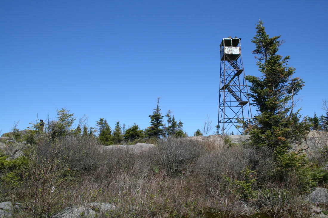
St. Regis is the 6er closest to the cabins, about 33 road miles away, and the only one with a fire tower you can climb. The trail runs 3.4 miles each way from Keese Mills Road west of Paul Smiths, through rolling woods to a bridge at about two miles and then up to a bare summit and a 35-foot steel tower from 1918, with the ponds of the Saint Regis Canoe Area below it. The village ranks it second easiest of the six, and it also counts toward the Adirondack Mountain Club's Fire Tower Challenge. The St. Regis Mountain guide covers the trail, the tower's history and restoration, the paddle-in route and winter conditions, and the canoe area guide covers the water you see from the top.
Scarface Mountain
Scarface starts with a long, easy walk and finishes steep, with its view on a ledge short of the wooded top. The trailhead is on Ray Brook Road, County Route 32, just south of NY 86 in the hamlet of Ray Brook, about 47 road miles from the cabins and about 3.8 road miles east of Berkeley Green. The round trip is 7.6 miles with about 1,500 feet of climbing to a 3,088-foot summit in the Saranac Lakes Wild Forest.
Near the start the trail crosses the gravel Adirondack Rail Trail, and about half a mile in it crosses Ray Brook on a new bridge with two 40-foot stringers. The old bridge was declared unsafe and the trail closed in December 2023. DEC paid for the replacement and supplied planning and labor, students from the Franklin-Essex-Hamilton BOCES cut the lumber for the cribbing, and a Student Conservation Association crew took down the old bridge, hauled in materials and built the new one. The trail reopened in late September 2025.
Tall red and white pines line the first part, and past the bridge the trail stays easy. At a well-marked split, go left. Soon the trail starts to climb and gets steep, with some scrambling. A staircase of placed rock ends at the foot of a nearly vertical slab; tree roots give good handholds, and the right side goes best. As the grade eases there are a few views over the trees to the distant High Peaks, and then the trail reaches an open ledge, the unofficial summit, with views over Oseetah Lake and the Saranac Lakes chain. Many hikers stop there. A narrow path goes on through darker woods to the true summit, which has no view; a disk on a tree marks it at 3,088 feet. In winter, snowshoes are needed to keep from post-holing and microspikes are required on the steep sections.
Ampersand Mountain
Ampersand is the steep one, with a bare summit and views in every direction. The parking area is on the north side of NY 3 about 8 miles west of Saranac Lake, toward Tupper Lake, and about 51 road miles from the cabins. A short trail to Middle Saranac Lake starts from the lot; the Ampersand trail starts directly across the highway, so cross with care. It runs 2.7 miles each way, 5.4 round trip, with about 1,780 feet of climbing to a 3,352-foot summit in the High Peaks Wilderness, and red markers show the way.
The first part is easy. The trail crosses Dutton Brook within earshot of the highway and rolls through tall, mature forest with stands of hemlock, and at 0.8 mile a long boardwalk crosses a wet section. Then it starts uphill. At about 1.7 miles a small clearing on the right marks the site of the old fire observer's cabin; rubble and an old metal bedframe are all that remain. Past it the grade turns relentless: the trail gains more than 1,000 feet in the next 0.7 mile or so, with stone steps on many of the worst pitches, built to stop the heavy erosion from runoff and foot traffic. At about 1.9 miles it steepens into something like a rock slide; take special care when it is wet. This is the shady north side of the mountain, and ice can linger here well into spring after it has melted elsewhere.
The trail reaches a ridge and levels at about 2.4 miles, then enters a jumble of boulders the size of small houses, with narrow passages between them. At the summit headwall you hoist yourself up about four feet through a gap in the rock; a dog may need a lift. Yellow paint blazes on the bare summit rock lead to the top, 2.7 miles from the road.
The view runs all the way around. One way you look over Middle Saranac Lake toward Mount Arab and Tupper Lake. Turn around and Seward and Seymour stand just across the Ampersand Lake valley, with Algonquin about 12 miles off, and Whiteface shows to the northeast. The state posted a fire observer on the summit in 1911 and put up a 22-foot steel tower in 1921; it closed after the 1970 season and came down in 1977, and a plaque on the summit honors Walter Rice, one of the early observers. Ampersand was also the first mountain Bob Marshall and his brother George climbed in the Adirondacks, in 1916; with their guide, Herb Clark, they went on to climb all 46 High Peaks.
Parking is the hard part. The lot is small and often full by early morning, with more cars along the roadside. DEC's 2018 High Peaks plan called for a new trailhead parking lot for Ampersand off NY 3, and a DEC advisory group repeated the call in 2021, but as of 2026 hikers still park at the old lot and cross the highway. For the 2026 season DEC also listed the Ampersand parking area among rotating locations it announces each week on its Adirondack backcountry information page, so check that page and arrive early. On the way up, walk on the stone steps, not on the ground beside them; hikers stepping around the steps keep the erosion going.
Haystack Mountain
Haystack and McKenzie share a large parking area on the north side of NY 86 a little over five miles east of Saranac Lake, toward Lake Placid, about 48 road miles from the cabins. This Haystack is a 2,878-foot peak in the McKenzie Mountain Wilderness; do not confuse it with Mount Haystack, one of the 46 High Peaks. The trail runs 3.3 miles each way and climbs about 1,210 feet.
The first 2.2 miles are mostly flat, through open forest at the base of Little Burn Mountain, with gentle ups and downs. At about 1.5 miles the trail swings right and descends to Ray Brook, passes an old stone foundation with a crumbling wall, and climbs gently beside Little Ray Brook. At the junction at 2.4 miles the Haystack trail goes left and the McKenzie trail goes right. The Haystack trail crosses the brook at a concrete spillway and then climbs hard; at about 3 miles it goes steeply up an eroded gully and the views begin. The open summit ledge comes at 3.3 miles. The view looks south to the High Peaks, which look especially big from here. It is a moderate climb with a steep finish, perhaps too much for some children, and in winter a fairly hard snowshoe that also needs microspikes.
McKenzie Mountain
McKenzie is the tallest and hardest of the six, at 3,861 feet, just short of the 4,000-foot mark for a High Peak. From the NY 86 lot it is 5.2 miles each way with about 2,195 feet of climbing, the first 2.4 miles on the Haystack trail. At the fork, bear right. At 3.6 miles you reach a four-way junction with the Jackrabbit Ski Trail and the trail from Whiteface Inn Road; the climbing to this point is moderate. Go straight and follow the red markers. The path climbs, levels off, and then the serious climbing begins: the trail gains about 1,000 feet in a little over half a mile, to a lookout at about 4.3 miles with views of the High Peaks and three other 6ers, Haystack, Scarface and Ampersand.
Above the lookout the trail goes up and down over McKenzie's five bumps, and the false summits can fool you. A balcony facing southwest is the one to watch for; the true summit is about 0.1 mile past it, so keep following the red markers. The last bump has a couple of ledges with wide views, from Whiteface in the north to Mount Marcy in the south, and a ledge west of the trail looks over the village of Saranac Lake and the Saranac Lakes chain. McKenzie is for experienced hikers, especially in winter, when the rugged terrain is often icy and slippery; microspikes are required on the steeper sections and snowshoes keep you from post-holing. Another main approach climbs from the Lake Placid side on the Jackrabbit Trail and meets this route at the four-way junction.
Which order to climb them
The village suggests climbing them from least to most difficult: Baker, St. Regis, Scarface, Ampersand, Haystack and McKenzie. That order builds your legs and saves the longest, steepest climb for last. For winter, the village's suggested order swaps two of them: Baker, St. Regis, Scarface, Haystack, Ampersand and McKenzie.
From the cabins, geography matters as much as difficulty. St. Regis sits off NY 30 on the way south, closest to the cabins. Scarface, Haystack and McKenzie are east of the village on NY 86 toward Lake Placid, within a few miles of each other. Ampersand is west of the village on NY 3, about 8.3 road miles from Berkeley Green. Baker starts in the middle of town. Grouping the climbs by road saves driving, and saving Baker for last means your final summit ends at the bell, with lunch on Main Street after you ring it.
A plan from the cabins
For fit hikers, four hiking days with rest days between them cover all six:
| Day | Climbs | Driving | Walking |
|---|---|---|---|
| First | St. Regis, then the Paul Smith's College VIC | About 33 miles each way | 6.8 miles |
| Second | Ampersand, then lunch in Saranac Lake | About 51 miles out, 8 to the village, 43 home | 5.4 miles |
| Third | Haystack and McKenzie from the NY 86 lot | About 48 miles each way | About 12.2 miles for both |
| Fourth | Scarface, then Baker from the bell | About 47 miles out, 4 to the village, 43 home | About 11.8 miles |
That is about 360 road miles in all. The third day combines the two peaks that share a trailhead: walk 2.4 miles to the fork, climb Haystack and come back to the fork, then climb McKenzie and walk out, about 12.2 miles. If that is too long, give each its own day: Haystack alone is 6.6 miles and McKenzie alone 10.4. For a shorter visit, St. Regis and Baker make a good first day together, about 11 miles of walking, with the 14.6-mile drive from the St. Regis lot to Saranac Lake in between. Families can spread the six over two or three stays and start with Baker and St. Regis.
Start early on summer and fall weekends. Ampersand's lot often fills, Baker has almost no parking, and an early start leaves time for a long lunch in the village. Every day ends with the drive home to the cabins, about an hour from Saranac Lake; the hiking guide lists shorter climbs closer to the cabins for the rest days.
The winter 6er
A winter 6er counts only climbs made between December 21 and March 21. Every peak needs snowshoes once the snow is deep, and most need traction too. The village's notes, peak by peak:
- Baker: snowshoes are needed, with microspikes suggested for the steep sections; the summit ledges are exposed and colder.
- St. Regis: an excellent snowshoe, with microspikes highly recommended because it can be icy.
- Scarface: snowshoes to keep from post-holing, and microspikes required on the steep sections.
- Haystack: a fairly challenging snowshoe that calls for both snowshoes and microspikes.
- Ampersand: a challenging snowshoe for experienced hikers, with spikes required on the steep sections and an exposed summit much colder than the trail below.
- McKenzie: microspikes required on the steeper sections, snowshoes to keep from post-holing.
On Ampersand the snowshoe rule is the law: state rules in the High Peaks Wilderness require snowshoes or skis once the snow is eight inches deep or more. Pack wool or synthetic layers, never cotton, spare heavy socks, a hat, gloves, snow pants, a face mask and a wind shell for the summits, a headlamp, extra food and a warm drink. Late-winter thaws bring their own danger: in March 2026 DEC warned that warm weather and rain had washed out bridges and made some winter routes impassable, so check DEC's Adirondack backcountry information page before you go.
The cabins do not supply snowshoes; Blue Line Sports rents them, and the snowshoeing guide lists more rentals. A winter climb pairs well with the Saranac Lake Winter Carnival, which begins February 5 in 2027. Read winter driving before the drive down NY 30.
The Ultra 6er
The Ultra is the endurance version: all six summits inside one documented 24-hour period, starting and finishing at Berkeley Green, with Baker climbed from the bell like everyone else's. Only a small group of hikers has done it. Many rely on a driver who runs them between trailheads, keeps water, food and fresh socks handy and keeps the time. A common route takes McKenzie first, while legs are fresh, then Haystack from the same lot, Scarface, Ampersand and St. Regis, and finishes with Baker and the bell. On the first day of the challenge, May 25, 2013, rain slowed everyone down, and one team beat the 24-hour deadline by less than a couple of hours.
On the night of September 5, 2026, volunteers who had lit the St. Regis fire tower for the statewide tower lighting were packing up on the summit when a group of hikers chasing the Ultra arrived, with one more mountain still to climb before their night was over. If you want to try it, climb the six separately first, so you know every trail and every turn in the dark.
Saranac Lake as a base for the day
Every 6er day passes through or near the village, about 43 road miles from the cabins. Blue Line Sports, at 81 Main Street across from Berkeley Green, is a full outdoor store with camping and backpacking gear, maps and guidebooks, hiking footwear and winter gear, and it rents snowshoes, cross-country skis and bear canisters. Its posted hours are 9 a.m. to 5:30 p.m. Monday through Saturday and 10 a.m. to 4 p.m. on Sunday, and it closes on major holidays; check before you count on it.
For breakfast or a trail lunch, Origin Coffee Co. at 77 Main Street serves breakfast and lunch all day, Tuesday through Saturday from 7 a.m. to 2 p.m. and Sunday from 8 a.m. to 2 p.m. The Blue Moon Cafe at 55 Main Street is another breakfast and lunch stop. If you want to paddle to St. Regis by the lake trail, outfitters in the village rent boats. The Saranac Lake and Paul Smiths guide covers the rest of the village, from the Paul Smith's College VIC to things to do after a climb, and the Lake Placid guide covers the town just past the Haystack and McKenzie trailhead.
Families, dogs and trail rules
Families do the 6er together. Baker and St. Regis are the best starts for children; keep them close on Baker's open slabs. Haystack's steep finish may be too much for some children, and McKenzie is a hike for experienced hikers. If the six leave your group wanting more, the Cascade Mountain guide covers the next step up, the High Peaks.
Dogs are welcome on these trails if they are under control; DEC asks hikers to leash them when other people approach, and the dog guide covers the rest. The state's basic trail manners apply on all six: sign the register at each trailhead, carry out everything you carry in, and step aside for hikers coming uphill. Each spring DEC asks hikers to stay off trails above 2,500 feet until the mud dries, which takes in every 6er except Baker. Black flies are worst from late May into June; see the bug guide. In an emergency, call 911 or DEC Forest Ranger dispatch at 1-833-NYS-RANGERS (1-833-697-7264). After the climb, every one of the cabins has its own hot tub waiting.
Questions
What is the Saranac Lake 6er?
It is a hiking challenge the Village of Saranac Lake started on May 25, 2013. Climb Baker, St. Regis, Scarface, Ampersand, Haystack and McKenzie, register online, and you receive the 6er patch, a place on the roster of finishers and the right to ring the 6er bell on Berkeley Green downtown. The peaks run from 2,452 to 3,861 feet.
How do I register for the 6er, and what does it cost?
After your sixth summit, fill in the village's online registration form with the date you completed each mountain and pay the $15 fee per person. Each registrant gets the 6er patch, or the Ultra patch, and goes on the roster; finishers have also received a numbered certificate and a sticker. The Saranac Lake Area Chamber of Commerce answers questions. Fees can change, so check the form when you finish.
Does Baker Mountain count if I start at the trailhead?
No. Since 2022, Baker counts for the 6er only if you start and finish on foot at the 6er bell on Berkeley Green, at Broadway and Main Street. The walk adds about 1.3 miles each way on village streets, making the round trip about 4.2 miles. The rule eased parking and traffic problems on Forest Hill Avenue, where the trail starts.
When does the winter 6er season run?
Climbs count toward the winter 6er only between December 21 and March 21. Every peak needs snowshoes in deep snow, and microspikes are recommended or required on all six. Ampersand is in the High Peaks Wilderness, where snowshoes or skis are required once the snow is eight inches deep or more. See the snowshoeing guide for rentals.
Which 6er peak is easiest and which is hardest?
The village lists them from least to most difficult as Baker, St. Regis, Scarface, Ampersand, Haystack and McKenzie. Baker is 1.6 miles round trip from its trailhead. McKenzie is 5.2 miles each way with about 2,195 feet of climbing, including a pitch that gains about 1,000 feet in a little over half a mile.
How far are the 6er trailheads from the cabins?
St. Regis is closest, about 33 road miles away. Berkeley Green, where Baker starts, is about 43; Scarface about 47; the shared Haystack and McKenzie lot about 48; and Ampersand about 51. Allow an hour to an hour and a quarter each way, and group the climbs by road, as in the plan on this page, to keep the driving down.
Can children do the Saranac Lake 6er?
Many families do it together. Start with Baker and St. Regis, keep children close on Baker's open rock slabs, and save McKenzie, a hike for experienced hikers, for when they are older. Spreading the six over several visits works well; see family stays.
Is the Scarface Mountain trail open?
Yes. DEC closed the Scarface trail in December 2023 because the bridge over Ray Brook, about half a mile from the trailhead, was unsafe. A new bridge of about 40 feet replaced it, and the trail reopened in late September 2025. Check DEC's Adirondack backcountry information page for current trail conditions before any climb.
Sources
Facts on this page were checked against these sources in October 2026. Hours, fees and schedules change; confirm before you go.
- Saranac Lake tourism saranaclake.com/saranac-lake-6er
- legacy.adkdata.com legacy.adkdata.com/p/challenges/register/saranac-lake-6er
- Saranac Lake tourism saranaclake.com/parks/berkeley-green
- Saranac Lake tourism saranaclake.com/hiking/baker-mountain
- Saranac Lake tourism saranaclake.com/hiking/st-regis-mountain
- Saranac Lake tourism saranaclake.com/hiking/scarface-mountain
- Saranac Lake tourism saranaclake.com/hiking/ampersand-mountain
- Saranac Lake tourism saranaclake.com/hiking/haystack-mountain
- Saranac Lake tourism saranaclake.com/hiking/mckenzie-mountain
- Saranac Lake tourism saranaclake.com/story/2015/05/ultra-challenge-ultra-6er
- Saranac Lake tourism saranaclake.com/story/2019/01/how-become-saranac-lake-winter-6er
- Saranac Lake tourism saranaclake.com/story/2021/ampersand-in-winter
- edits.nationalmap.gov edits.nationalmap.gov/apps/gaz-domestic/public/summary/956798
- epqs.nationalmap.gov epqs.nationalmap.gov/v1/json?x=-74.03214&y=44.33632&wkid=4326&units=Fe
- New York State Department of Environmental Conservation dec.ny.gov/places/mckenzie-mountain-wilderness
- New York State Department of Environmental Conservation dec.ny.gov/places/saranac-lakes-wild-forest
- New York State Department of Environmental Conservation dec.ny.gov/things-to-do/hiking/winter-safety
- law.cornell.edu law.cornell.edu/regulations/new-york/6-NYCRR-190.13
- New York State Department of Environmental Conservation dec.ny.gov/things-to-do/hiking/trail-etiquette
- New York State Department of Environmental Conservation dec.ny.gov/things-to-do/camping/state-land-rules
- New York State Department of Environmental Conservation dec.ny.gov/news/press-releases/2026/3/dec-issues-recreational-use-advi
- New York State Department of Environmental Conservation dec.ny.gov/news/press-releases/2026/5/dec-announces-suite-of-actions-t
- New York State Department of Environmental Conservation dec.ny.gov/news/press-releases/2025/5/dec-issues-spring-conditions-adv
- New York State Department of Environmental Conservation dec.ny.gov/environmental-protection/public-safety/forest-rangers
- content.govdelivery.com content.govdelivery.com/accounts/NYSDEC/bulletins/208f4eb
- adirondackalmanack.com adirondackalmanack.com/2021/04/hpag-report-transportation-parking-and-
- Adirondack Explorer adirondackexplorer.org/outdoor-recreation/hiking/saranac-lake-6ers-gui
- Adirondack Explorer adirondackexplorer.org/communities/scarface-mountain-trail-reopens-aft
- Adirondack Explorer adirondackexplorer.org/adirondacks/outdoor-conditions-9-25-scarface-mo
- northcountrypublicradio.org northcountrypublicradio.org/news/story/48935/20231211/saranac-lake-s-s
- northeastexplorer.com northeastexplorer.com/scarface-mountain-new-york-reopens/
- Adirondack Explorer adirondackexplorer.org/recreation/hiking/ampersand-mountain-5-2-mile-h
- adirondackwilderness.org adirondackwilderness.org/wild-thoughts-articles/explore-ampersand-moun
- nysffla.org nysffla.org/towers5.htm
- Adirondack Explorer adirondackexplorer.org/stories/baker-mountain-trail-receives-some-fixe
- wcax.com wcax.com/2023/08/02/popular-saranac-lake-trail-gets-some-tlc/
- dailygazette.com dailygazette.com/ade/news/local_news/to-hike-baker-start-from-the-6er-
- adirondackdailyenterprise.com adirondackdailyenterprise.com/news/local-news/2023/08/maintaining-bake
- issuu.com issuu.com/adirondackdailyenterprise/docs/summerguide2022/s/15898232
- adirondack.net adirondack.net/hiking/challenges/6er/
- courses.hamilton.edu courses.hamilton.edu/hiking-the-46ers/marshall-brothers-and-herbert-cl
- bluelinesportsllc.com bluelinesportsllc.com/storehoursdirections.html
- bluelinesportsllc.com bluelinesportsllc.com/deparments.html
- origincoffeeadk.com origincoffeeadk.com/
- yelp.com yelp.com/biz/blue-moon-cafe-saranac-lake
- Saranac Lake tourism saranaclake.com/shopping
- friendsofstregis.org friendsofstregis.org/lighting-the-tower-all-the-years/
- Adirondack Mountain Club adk.org/adk-fire-tower-challenge/
- router.project-osrm.org router.project-osrm.org/
In this guide
Stay nearby
The aviation cabin: flight-themed décor, a Jøtul gas stove, a large open deck with its own hot tub, and a smokeless fire pit on the lawn.
 The AviatorCabin 3 · 2 bd · 1 ba · sleeps 4
More in Trails & Hiking
Sources
49 references, listed in full at the end of this guide: official park, state, tourism-office and business sources, checked October 2026.
Related guides


Photos on this page: SaranacLake by Mwanner at en.wikipedia, CC BY-SA 3.0; Saint Regis Fire Tower 2010 t6 by John Sweeney, CC BY-SA 3.0; SaranacLakeIcePalace2020A by DanielPenfield, CC BY-SA 4.0. Resized and cropped for this site. All photo credits