
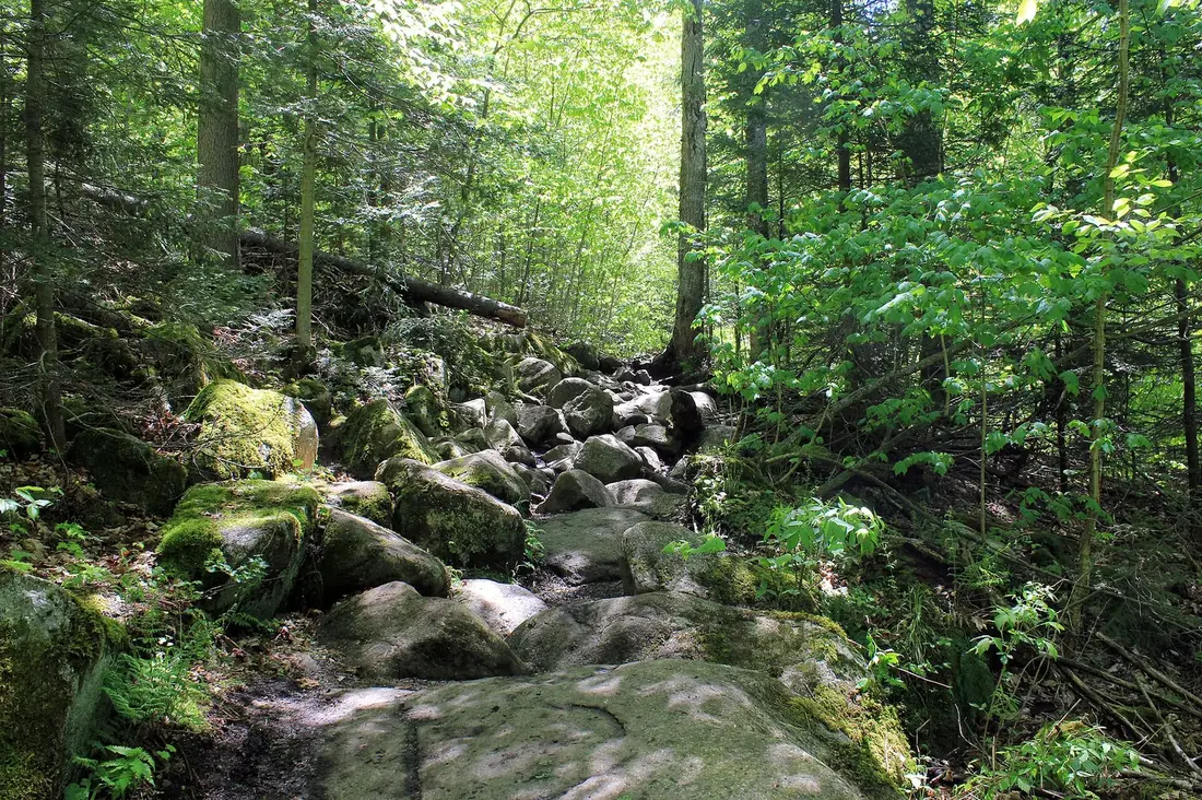
Hiking Near the Cabins
Every hike near the cabins in order of road distance, from the Tiny Home's pond trail to Owls Head, the fire towers and Cascade, with seasons, rules and gear.
At The Modern Tiny Home the first walk starts at the door, on a short trail to an observation deck over a pond. Owls Head and the three marked trails of the Titusville Mountain State Forest all start within ten road miles of the cabins. Fire-tower climbs, Debar Mountain and the trail network of Paul Smith's College lie 20 to 45 road miles away, and the High Peaks are about an hour and a half away. This page lists them in order of road distance, with the numbers you need to pick one, then covers the seasons, rules and gear that apply to all of them.
The hikes at a glance
| Hike | From the cabins | Trail | Time | Best season |
|---|---|---|---|---|
| Pond trail and observation deck | On the Tiny Home's property | A short walk to a deck over the pond | Minutes | Spring through fall, at dusk |
| Owls Head | About 4 road miles | 1.3 miles each way, about 725 feet of climbing | About 2 hours | Summer and fall; early May for open views |
| High Falls | About 5 road miles | About 0.75 mile each way, nearly level | 1 to 2 hours | Spring runoff and hot summer days |
| The Ledges | About 5 road miles | 0.6 mile each way, 700 feet, steep rock | A short morning | Summer and fall |
| Elephant's Head | About 9 road miles to the gate | 0.8 mile each way, 320 feet, from the upper lot | 1 to 2 hours, more with the gate shut | Summer and fall |
| Loon Lake Mountain | About 20 road miles | 2.8 miles each way, more than 1,600 feet | Half a day | Summer and fall |
| Debar Mountain | About 21 road miles | 3.7 miles each way, 1,725 feet | About 4 hours of walking | Summer and fall |
| Paul Smith's College VIC | About 30 road miles | More than 25 miles of trails and boardwalks | An hour to a day | All year, on skis or snowshoes in winter |
| St. Regis Mountain | About 33 road miles | 6.8 miles round trip, 1,650 feet | Half a day | Summer and fall; winter with snowshoes |
| Saranac Lake 6er peaks | About 33 to 51 road miles | Six summits from 2,452 to 3,861 feet | Varies by peak | All year |
| Bloomingdale Bog | About 38 road miles | A level old rail bed, about 4 miles end to end | As long as you like | Spring through fall |
| Azure Mountain | About 42 road miles | About 1 mile each way, 944 feet | Short and steep | Summer and fall |
| Lyon Mountain | About 45 road miles | 3.4 miles each way, about 1,900 feet | Half a day | Summer and fall |
| Cascade Mountain | About 60 road miles | 2.4 miles each way, about 1,940 feet | About 5 hours | Summer and early fall |
Drive times are conservative, and each guide linked below has the full directions and parking.
On the property
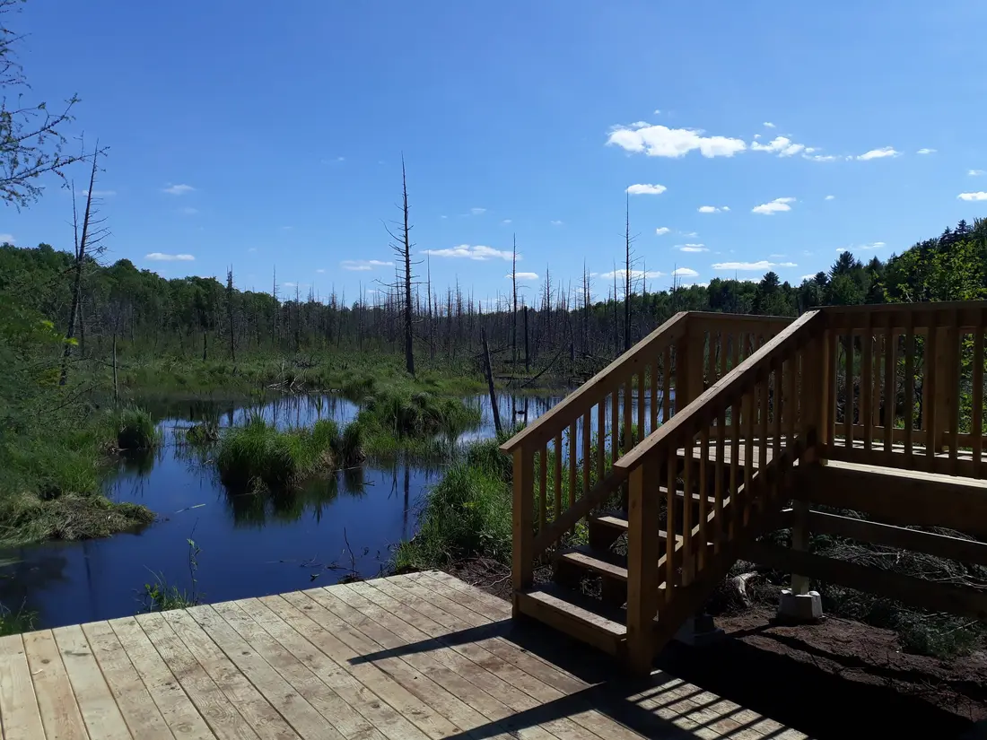
The Modern Tiny Home's listing describes a short hike from the cabin to its observation deck, which looks over a pond, and recommends the deck for watching wildlife. The cabin stands on more than 300 acres that it shares with one other cabin, which is not one of ours, and when that cabin is booked, the trails, the deck and the parking area are shared. One guest described the walk after a November stay:
"There's a trail off the property that even the newest hikers can do. It leads to a sitting area overlooking a pond."
Walk it at dusk, when the animals around the pond are most active; the wildlife guide covers what to look for, and The Modern Tiny Home page covers the cabin. The Modern Pine and The Aviator share a separate wooded property of more than 100 acres, and their listings do not describe a walking trail of their own, so for those guests the nearest marked hike is Owls Head, about four road miles away.
Hikes within ten miles
Four marked trails start within ten road miles of the cabins. Owls Head climbs from the hamlet of the same name into a public use area of the Sable Highlands easement lands, crossing private land on the way, and the other three are in the Titusville Mountain State Forest.
Owls Head
About four road miles away, roughly ten minutes by car. The trail climbs 1.3 miles and about 725 to 750 feet to open rock ledges near the 2,250-foot summit, facing south and east over Indian Lake, Mountain View Lake and the peaks of the Sable Highlands. Two hours covers the round trip with a rest on top. The grade is moderate, but the path was worn in by hikers over generations and never built up as a modern trail, so expect mud, roots and trickling water, and one short steep pitch beside an old mine shaft just past the one-mile mark. The trailhead on Station Road has no sign; the Owls Head guide has the landmarks and the parking.
High Falls
About five road miles, roughly 15 minutes, to a small parking spot on gravel Barnesville Road north of Mountain View. This is the easiest hike in this guide: about three-quarters of a mile each way beside the Salmon River on nearly level ground, following blue markers, to a falls whose main drop is a curtain of water about 30 feet high. Allow an hour or two. Keep children close near the bank and on the short, wet staircase down to the pool. Directions are in the Titusville Mountain State Forest guide.
The Ledges
Also about five road miles, but the last stretch is rough Lee Road off Studley Hill Road, where a high-clearance vehicle is recommended. The trail is only 0.6 mile each way, yet it gains 700 feet, about 600 of them in one steep quarter mile of rock scrambling, and the yellow markers are far apart. The vista at about 2,120 feet looks south, with Debar Mountain large in the foreground and Whiteface and Esther beyond. Carry a map that works without a signal, turn back if you lose the markers, and save this one for steady walkers.
Elephant's Head
About nine road miles to the gate on NY 30, roughly 20 minutes. From the upper parking lot the trail runs 0.8 mile with 320 feet of climbing to a lookout over Lake Titus and Titus Mountain, about twenty minutes of climbing. The catch is the 1.5 miles of gravel road between the gate and that lot: it is not maintained in winter, the state locks the mud gate each spring until it dries, and low cars may have trouble on it even when it is open. With the gate shut, the road walk adds about three miles to the round trip. The old wooden staircase near the top was decaying in 2025, so test each step.
Loon Lake Mountain and Debar Mountain
About 20 road miles south, the land rises to two summits above 3,300 feet.
Loon Lake Mountain
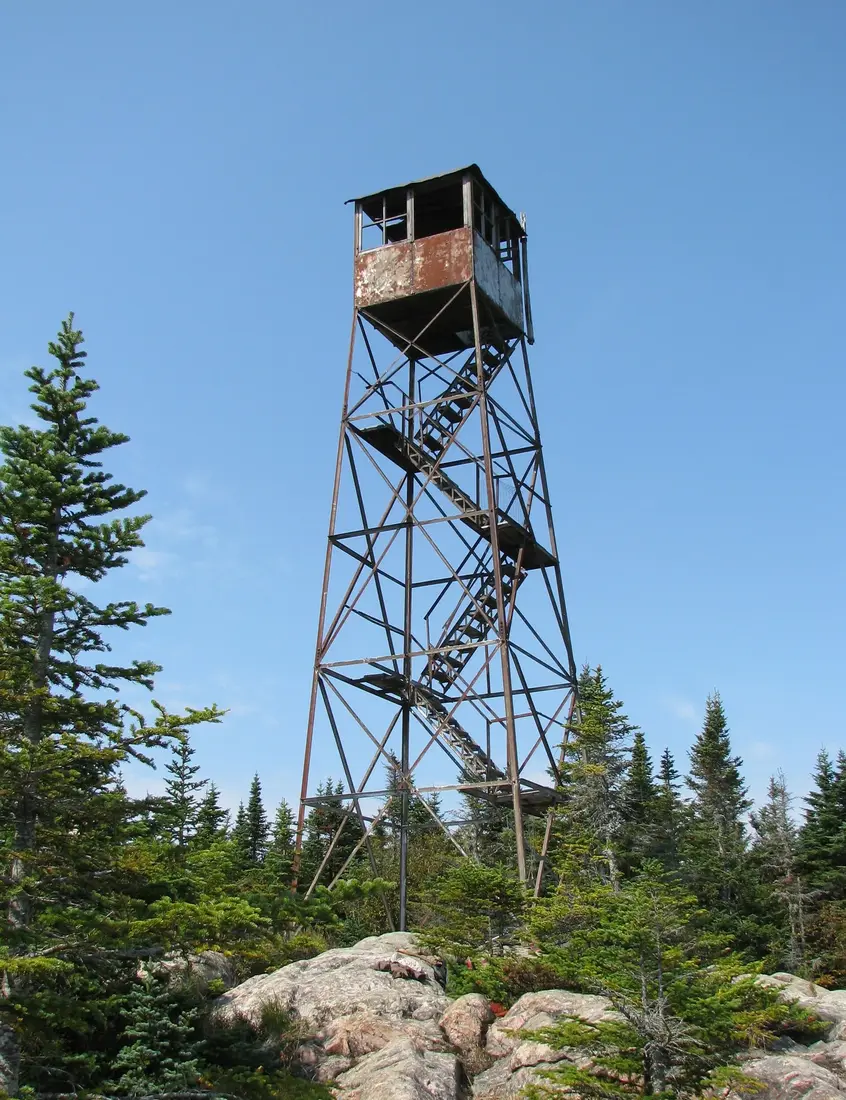
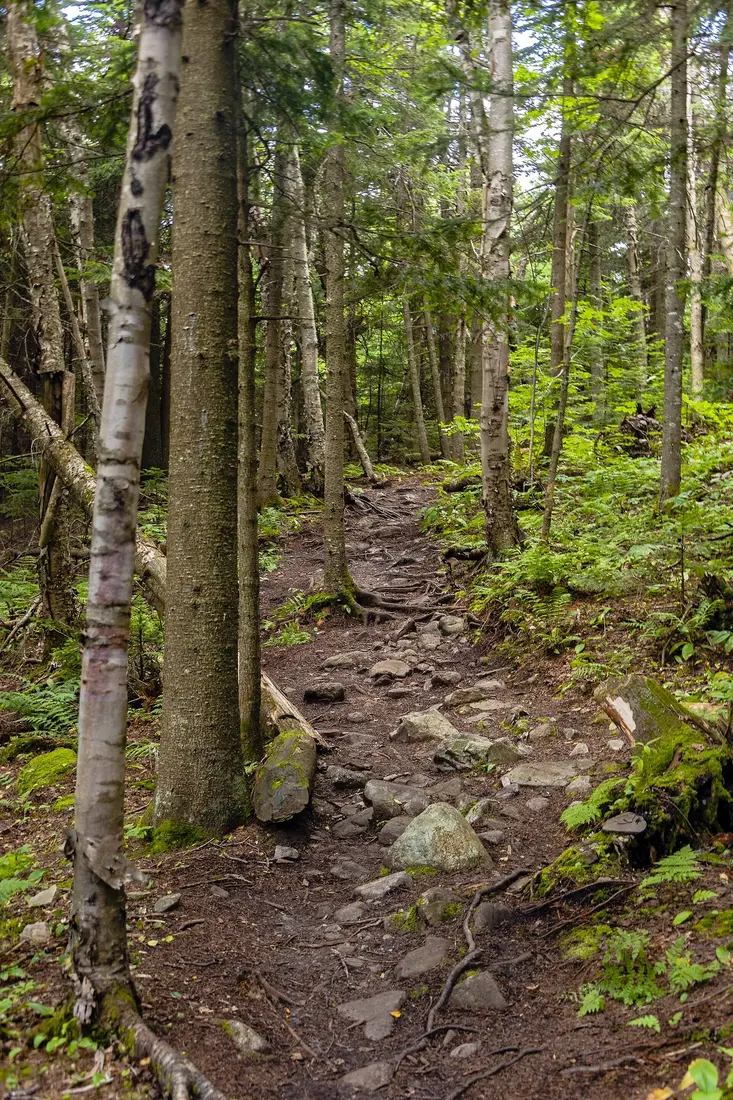
About 20 road miles, roughly 40 minutes: south on County Route 27 through Owls Head and Mountain View, then County Route 26 to a parking area on the west side of the road, about 4.7 miles north of the hamlet of Loon Lake. The state opened this trail in 2013. It runs 2.8 miles and climbs more than 1,600 feet to a summit of about 3,340 feet, about 5.7 miles round trip, and a half day is the usual allowance. The lower part follows an old logging road across conservation easement land; the upper part is Forest Preserve and grows steeper, finishing up a mossy, rocky streambed that is steep and slippery. The open bedrock summit looks out to Lyon Mountain, Whiteface, the High Peaks and Debar Mountain. Its 35-foot steel fire tower, raised in 1917 and rebuilt in 1928, is closed: the lowest flight of stairs has been removed. See the Loon Lake Mountain guide.
Debar Mountain
About 21 road miles, roughly 35 minutes, to the Meacham Lake campground off NY 30, where the trail begins. Debar rises to 3,305 feet, and the trail saves the work for last: 3.7 miles and 1,725 feet in all, but only 170 feet of that in the first 1.9 miles, then 755 feet over the next 1.3 miles, and a steep 800 feet in the final half mile. A lean-to stands just below that last pitch. Trees limit the summit views, though you can see the High Peaks to the south. The round trip is 7.4 miles; at two miles an hour that is close to four hours of walking before stops. While the campground is open, hikers pay its day-use fee. The Debar Mountain Wild Forest guide covers the rest of the unit.
The Debar Meadows trail
For distance without a summit, the Debar Meadows to Meacham Lake trail runs 7.7 miles from the campground to Debar Meadows Road and climbs only about 200 feet to its high point. The first 1.1 miles are shared with the Debar Mountain trail, and in winter the route is part of snowmobile corridor C8. Walk out for an hour and turn back, or leave a car at each end. The Meacham Lake guide covers the campground, the beach and the fee.
Paul Smiths, St. Regis and the Saranac Lake peaks
Paul Smith's College VIC
About 30 road miles, roughly 45 minutes, at 8023 NY 30 just north of Paul Smiths. The college's Visitor Interpretive Center covers about 3,000 acres with more than 25 miles of trails through forest, marsh, bog and pond shores, open from dawn to dusk every day and free from spring through fall. The Heron Marsh Trail is flat and accessible, with a long boardwalk; the Boreal Life Trail crosses a spruce bog on another; Jenkins Mountain is the summit hike for anyone who wants a climb. From December 1 to April 1 the trails are groomed for skiing and snowshoeing, and winter visitors buy a day or season pass. In fall 2026 the lodge is open 9 a.m. to 5 p.m. Thursday through Monday; check hours before you go. The Saranac Lake and Paul Smiths guide covers the area.
St. Regis Mountain
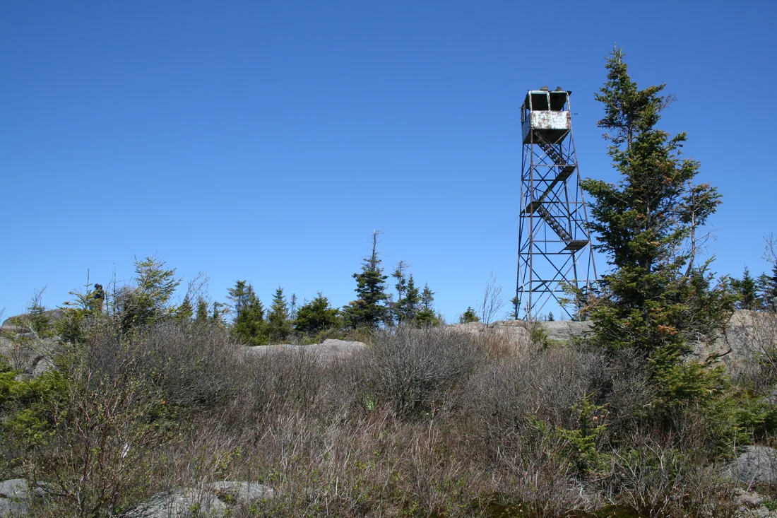
About 33 road miles, roughly an hour. Keese Mill Road leaves NY 30 at Paul Smiths, by the college, and the trailhead lot is on the left about two and a half miles west. The round trip is 6.8 miles with 1,650 feet of climbing to a 2,874-foot summit, a half-day outing. The first two miles roll gently, the climbing starts at a bridge just past them, and the steepest rock is in the last 0.3 mile. The 35-foot steel tower went up in 1918 and served as a fire lookout until 1990, then sat closed and deteriorating until volunteers began restoring it in 2015; it reopened to the public in September 2016. From the cab you look down on the ponds of the Saint Regis Canoe Area. In winter it is a good snowshoe climb, with microspikes for the icy upper rock. See the St. Regis Mountain guide.
The Saranac Lake 6er
St. Regis is one of six mountains around Saranac Lake in this challenge, with Baker, Scarface, Ampersand, Haystack and McKenzie, from 2,452 feet at Baker to 3,861 at McKenzie. Finish all six and you ring the 6er bell on Berkeley Green, the small park at Broadway and Main in downtown Saranac Lake; register for $15 and you get a certificate with a finisher number, a patch and a sticker. There are summer and winter patches, plus ultra versions for climbing all six within 24 hours. The trailheads are about 33 to 51 road miles from the cabins; see the 6er guide.
Bloomingdale Bog
About 38 road miles to the north lot on Bloomingdale-Gabriels Road, County Route 55, and about 40 to the south lot off NY 86 just north of Saranac Lake. The trail is the bed of the Delaware and Hudson's old Chateaugay line, which ran from Plattsburgh to Saranac Lake, and it crosses one of the largest bogs in northern New York on a level path of sand, dirt and gravel. The two lots are about four miles apart, so it suits anyone who wants a long walk with no climbing, and it is one of the best places in the Adirondacks for northern birds.
Fire towers to the west and east
Azure Mountain
About 42 road miles, roughly an hour and a quarter: south on NY 30, then NY 458 toward St. Regis Falls, then left onto Blue Mountain Road for about seven miles, turning right at the DEC sign for the parking area. Azure Mountain is the short fire-tower climb: about a mile each way with 944 feet of climbing, 1.9 miles round trip, to a 2,518-foot summit, steepest in the second half. The steel tower dates from 1918; volunteers began restoring it in 2002 and reopened it in September 2003, and the cab is open, with a full circle of views over the northern Adirondacks and north into the St. Lawrence Valley. Volunteer summit stewards may be on top in summer. See the Azure Mountain guide.
Lyon Mountain
About 45 road miles, roughly an hour and a quarter: through Malone, east on US 11 to Chateaugay, south on NY 374 past the Chateaugay Lakes, then Chazy Lake Road and about a mile of seasonal dirt road, once called Lowenburg Road, to the trailhead lot. At 3,830 feet Lyon is the highest point in Clinton County and the highest summit north of the Saranac River. The trail runs 3.4 miles each way with about 1,900 feet of climbing, on switchbacks through the steepest sections; plan on a half day. The 35-foot steel tower, put up in 1917 and since restored, gives a full circle, from Chazy Lake and Vermont's Green Mountains to the High Peaks, with Montreal in the distance on clear days. See the Lyon Mountain guide.
With Loon Lake Mountain and St. Regis, these make four fire-tower summits within reach of the cabins. The Adirondack Mountain Club's Fire Tower Challenge asks for 23, 18 of them in the Adirondack Park; the challenge guide explains how to plan them.
The High Peaks
The 46 High Peaks begin about an hour and a half south, and most people start with Cascade Mountain: about 60 road miles away on NY 73 between Lake Placid and Keene, 2.4 miles and about 1,940 feet of climbing to a bare 4,098-foot summit, about five hours round trip. Its small free lots fill early on pleasant weekends, so leave the cabins by about 5 a.m. No permit was needed in 2026, but the High Peaks Wilderness has rules of its own: day groups of 15 or fewer, dogs leashed in the eastern zone and above 4,000 feet, no campfires in the eastern zone, a bear-resistant canister for anyone camping there from April 1 to November 30, and snowshoes or skis once the snow is more than eight inches deep. The Cascade guide covers the climb, the parking and gentler peaks nearby.
Choosing a hike for your group
| Your group | Start with | Why |
|---|---|---|
| Children or first-time hikers | The pond trail, High Falls, the VIC boardwalks | Short and nearly flat |
| Children who want a summit | Owls Head; Elephant's Head when the gate is open | Two hours or less |
| Fit teenagers and adults | Loon Lake Mountain, St. Regis, Debar, Lyon | Half-day climbs of 1,200 to 1,900 feet |
| Experienced hikers | Cascade; the Ledges for scrambling | Bare rock, mountain weather and route-finding |
| A group that wants different things | Paul Smith's College VIC | Boardwalks for some, Jenkins Mountain for others, one parking lot |
| Dogs | The Titusville trails and Owls Head, on a leash | Close, short and on state or public-use land |
| Limited mobility | The Heron Marsh boardwalk, Bloomingdale Bog | Level surfaces; none of the Titusville trails suit a wheelchair |
Let the slowest walker set the pace, agree on a turnaround time before you start, and keep it even if the top looks close. Dogs are not allowed on the beach or in the day-use areas at Meacham Lake; bringing your dog covers the rest.
Choosing a hike by season
Spring
Spring is mud season. Each spring DEC asks hikers to stay off trails above 2,500 feet until they dry out, and that takes in Debar, Loon Lake Mountain, St. Regis, Lyon, the High Peaks and Azure Mountain's 2,518-foot summit. The short climbs near the cabins all top out lower: Owls Head at about 2,250 feet, the Ledges at 2,120 and Elephant's Head at about 1,980. The state also locks the mud gates on seasonal roads, Elephant Head Road included; in 2026 they were shut by March 20, and they reopen only when the roads are dry. Black flies peak in late May and early June, so walk at midday on dry, breezy days in those weeks; the bug guide has the details.
Summer
The days are long: around June 21 the sun rises at the cabins at about 5:10 a.m. and sets at about 8:50 p.m. Start early on hot days and weekends, when the popular lots fill. Meacham Lake's beach makes a good finish after Debar or Loon Lake Mountain while the campground is open; in 2026 its season runs from May 15 to October 11.
Fall
The color and the hunting seasons arrive together, and the days shorten fast. Sunset at the cabins moves from about 6:55 p.m. at the September equinox to about 6:15 p.m. by mid-October, and to about 4:45 p.m. once the clocks change on November 1. Carry a headlamp on any climb that starts after noon, and wear orange. The fall foliage guide covers when the leaves turn.
Winter
From December into March the light is short, with sunset at about 4:20 p.m. on December 21 and less than nine hours of daylight. Snowshoes open up the close hikes: walk Elephant Head Road from the gate on NY 30, a winter outing that a local Adirondack Mountain Club chapter put at 4.2 miles round trip with 577 feet of climbing. The VIC grooms its trails from December 1 to April 1, and St. Regis and Azure Mountain make good winter summits with snowshoes and microspikes. Leave the High Peaks in winter to hikers with winter experience. The cabins do not supply snowshoes; cross-country skiing and snowshoeing covers rentals and more trails.
Hunting season and blaze orange
Most of the land on this page is open to hunting in season: the state forest, the Forest Preserve and the Owls Head easement lands alike. Around the cabins, in Wildlife Management Unit 5C, the 2026 bear season runs from September 19 to December 6, deer bowhunting starts September 27, and the regular firearms season for deer and bear runs from October 24 to December 6. Turkey hunters are out on May mornings until noon. The Titusville guide lists every date, and DEC posts new ones each year.
You can still hike through all of it. DEC asks hikers to wear blaze orange or blaze pink so they can be seen from farther away, and warns that you may meet hunters carrying firearms or bows. Put a bright vest or bandanna on the dog too, tell someone your route, and carry a light, because a November afternoon ends before 5 p.m.
Ticks
Ticks are the one hazard on every trail here from spring into fall. Blacklegged ticks, also called deer ticks, can spread Lyme disease, anaplasmosis, babesiosis and Powassan virus in New York. The state health department's advice: wear light-colored long sleeves and pants tucked into your socks, use an EPA-registered repellent, treat clothes and gear with permethrin and never your skin, and keep out of tall grass. Back at the cabin, shower within about two hours, check everyone from head to toe, children and dogs included, and run the day's clothes through a hot dryer; every cabin has a washer and dryer. The bug guide covers tick removal, mosquitoes and black flies.
Trail etiquette and Leave No Trace
DEC's trail manners are short. Hikers coming uphill have the right of way, so step aside on the way down. On trails shared with horses and bikes, hikers yield to horses, and cyclists yield to hikers and horses. Keep dogs under control at all times, leash them when you meet another group, and bag and carry out their waste. Sign the trail register coming and going wherever there is one.
Leave No Trace, applied to these trails:
- Plan ahead and prepare. Read DEC's Backcountry Information for the Adirondack Park page and the summit forecast the night before.
- Travel and camp on durable surfaces. Walk through mud instead of around it; the side paths spreading beside the wet spots on Owls Head show what stepping around does.
- Dispose of waste properly. Carry out everything, apple cores and orange peels included. Where there is no privy, dig a hole six to eight inches deep at least 150 feet from water and campsites.
- Leave what you find. Leave flowers, rocks and anything old where it lies, and do not build rock stacks.
- Minimize campfire impacts. Use an existing fire ring and only dead and down wood. At the cabins, the fire pit is the place for a fire.
- Respect wildlife. Watch from a distance and never feed animals.
- Be considerate of other visitors. Keep voices down, and at Owls Head park so the neighbors on Station Road can get in and out of their driveways.
Safety rules and the Forest Rangers
New York's Forest Rangers run search and rescue on state land, and in 2025 they carried out 362 search and rescue missions across the state. The state's Hike Smart NY advice is worth following on every outing, even a short one:
- Leave your route and your return time with someone who is not hiking with you.
- Know when the sun sets, set a turnaround time, and keep to it.
- Program the DEC dispatch number into your phone, and do not count on a signal to use it.
- Check the forecast for the summits; the National Weather Service office in Burlington, Vermont publishes one for peaks of 3,000 to 5,000 feet.
- Treat any stream or pond water before you drink it.
In an emergency, call 911 and ask for a DEC Forest Ranger, or call Forest Ranger dispatch at 1-833-NYS-RANGERS (1-833-697-7264). If you are lost or hurt, stay calm and stay where you are. The nearest hospital is UVM Health's Alice Hyde Medical Center in Malone, with a 24-hour emergency department, about 10.5 road miles from the cabins; see health and safety.
Phones, maps and apps
One guest who spent eight weeks at The Modern Tiny Home in 2020 wrote that "our Verizon cellular service worked all over the property," and the cabins have wifi, but that was one carrier at one cabin. On the trails, plan on having no signal, and carry a way to find your position without one.
- DEC maps. DEC posts free maps of its state lands, and some, the Debar Mountain Wild Forest among them, also come as georeferenced PDF maps. Load one into an offline app such as Avenza Maps on the cabin wifi, and the app shows your position on it from the phone's GPS, with no cell signal.
- Paper. National Geographic's Trails Illustrated map 746, Saranac and Paul Smiths, covers the Debar Mountain Wild Forest, the Saint Regis Canoe Area and the Saranac Lakes, and reaches north to Saint Regis Falls and Lyon Mountain, at about 1:75,000 with 50-foot contours, on waterproof paper; the Adirondack Mountain Club listed it at $14.95 in 2026. Map 742 covers Lake Placid and the High Peaks.
- Guidebook. The 15th edition of the club's High Peaks Trails guide now covers Lyon Mountain and the other trails east of NY 30 north of Paul Smiths.
- Map apps. They do not always know the small roads; some do not name Station Road at Owls Head, so follow the landmarks in each guide.
What to carry
| Outing | Bring |
|---|---|
| Short walks: the pond, High Falls, the boardwalks | Water, repellent, a light layer, the downloaded map, and a head net from mid-May through June |
| Half-day climbs: Owls Head to Lyon | DEC's ten essentials: map and compass or GPS, rain shell and warm layers, a headlamp, first aid, fire starter, food with some extra, at least two liters of water each with a filter, sun and bug protection, and a space blanket or tarp |
| Fall, from mid-September to early December | Blaze orange or pink for everyone and the dog, and a headlamp on every hike |
| Winter | Snowshoes and microspikes, spare dry layers, and food and water packed in the middle of the pack so they do not freeze |
| Dogs | Leash, water and a bowl, waste bags, and a bright vest in hunting season |
Wear boots you do not mind muddying. Back at the cabin, the washer and dryer take care of the muddy clothes and the private hot tub takes care of the legs.
A three-day plan from the cabins
Day one, close to home
Leave after breakfast for Owls Head, ten minutes away, and be back at the car in about two hours. Drive about 2.5 miles to the High Falls trailhead and walk to the falls with a packed lunch. You are back at the cabin by mid-afternoon, and Tiny Home guests can walk to the pond deck as the light goes.
Day two, a fire tower and Paul Smiths
Leave by 8 for St. Regis Mountain, about an hour away, and give the climb half a day. On the way home, stop at the VIC, just north of Paul Smiths on NY 30, for an easy hour on the Heron Marsh boardwalk; the cabins are about 45 minutes from there. For a shorter drive, climb Loon Lake Mountain instead and finish at Meacham Lake's beach while the campground is open.
Day three, the big view
Strong hikers drive about an hour and a quarter to Lyon Mountain, the highest summit north of the Saranac River. Experienced hikers leave at 5 a.m. for Cascade. Families take the short, steep climb up Azure Mountain to its open tower and are back by mid-afternoon. In winter, swap in snowshoes on Elephant Head Road, a day at the VIC and St. Regis with microspikes. Every day ends the same way, in the hot tub on your own deck.
Questions
What is the easiest hike near the cabins?
High Falls in the Titusville Mountain State Forest, about five road miles away: roughly three-quarters of a mile each way beside the Salmon River on nearly level ground, to a falls with a 30-foot main drop. Guests at The Modern Tiny Home also have a short trail to a pond deck on the property. For a boardwalk, try the Heron Marsh Trail at Paul Smith's College VIC, about 30 road miles away.
Which fire tower is closest to the cabins?
Loon Lake Mountain, about 20 road miles away on County Route 26. Its trail runs 2.8 miles each way and climbs more than 1,600 feet, but the tower itself is closed and cannot be climbed. The nearest towers you can climb are St. Regis Mountain, about 33 road miles away, and Azure Mountain, south of St. Regis Falls, about 42.
Do I need a permit to hike near Malone?
Not for a day hike on state land. Campers need a permit from the local Forest Ranger only for a group of ten or more or a stay of more than three nights in one spot. Cascade needed no permit or parking reservation in 2026. The Debar Mountain trail starts in the Meacham Lake campground, where hikers pay the day-use fee while the campground is open.
Is there cell service on the trails?
Do not count on it. DEC tells hikers to program the Forest Ranger dispatch number into their phones but not to rely on a signal. Download maps on the cabin wifi and use an app that works offline. In an emergency, call 911 and ask for a Forest Ranger, or call 1-833-NYS-RANGERS (1-833-697-7264), and stay where you are if you are lost.
When is hunting season around the cabins?
In the unit around the cabins in 2026, bear season runs September 19 to December 6, deer bowhunting starts September 27, and the regular deer and bear season runs October 24 to December 6. Turkey hunters are out on May mornings until noon. Wear blaze orange or pink on any trail in those weeks, put something bright on the dog, and see the Titusville guide for every date.
Can I bring my dog on these hikes?
Yes, on a leash and under control. In the High Peaks Wilderness dogs must be leashed throughout the eastern zone and above 4,000 feet, which includes the top of Cascade. Dogs are not allowed on the beach or in the day-use areas at Meacham Lake. All three cabins take pets for a fee; see bringing your dog.
Sources
Facts on this page were checked against these sources in October 2026. Hours, fees and schedules change; confirm before you go.
- The cabin's Airbnb listing airbnb.com/rooms/41023086
- The cabin's Airbnb listing airbnb.com/rooms/53628054
- The cabin's Airbnb listing airbnb.com/rooms/1168252128174283244
- New York State Department of Environmental Conservation dec.ny.gov/places/titusville-mountain-state-forest
- Adirondack Explorer adirondackexplorer.org/recreation/titusville-triad-three-hiking-opport
- Adirondack Explorer adirondackexplorer.org/recreation/owls-head-a-popular-hike-in-the-othe
- Visit Malone visitmalone.com/hiking/high-falls-titusville-mountain
- content.govdelivery.com content.govdelivery.com/accounts/NYSDEC/bulletins/8f1d39
- Saranac Lake tourism saranaclake.com/hiking/loon-lake-mountain
- New York State Department of Environmental Conservation dec.ny.gov/things-to-do/hiking/fire-towers
- New York State Department of Environmental Conservation dec.ny.gov/places/debar-mountain-wild-forest
- Paul Smith's College paulsmiths.edu/vic/
- Paul Smith's College paulsmiths.edu/vic/explore/
- adirondackvic.org adirondackvic.org/Birding-the-VIC.html
- Saranac Lake tourism saranaclake.com/hiking/st-regis-mountain
- friendsofstregis.org friendsofstregis.org/restoration/
- Saranac Lake tourism saranaclake.com/saranac-lake-6er
- wildadirondacks.org wildadirondacks.org/bloomingdale-bog-trail.html
- Saranac Lake tourism saranaclake.com/hiking/azure-mountain
- azuremountain.org azuremountain.org/
- protectadks.org protectadks.org/hike-azure-mountain/
- Saranac Lake tourism saranaclake.com/hiking/lyon-mountain
- protectadks.org protectadks.org/hike-lyon-mountain/
- Adirondack Mountain Club adk.org/adk-fire-tower-challenge/
- Lake Placid tourism (ROOST) lakeplacid.com/hiking/cascade-mountain
- New York State Department of Environmental Conservation dec.ny.gov/places/high-peaks-wilderness-complex
- Adirondack Explorer adirondackexplorer.org/recreation/mud-season-advisory/
- perugazette.com perugazette.com/2026/03/20/dec-closes-seasonal-access-roads-and-associ
- Adirondack Mountain Club shatageeadk.org/2025/01/01/ski-snowshoe-elephants-head/
- New York State Department of Environmental Conservation dec.ny.gov/things-to-do/hunting/deer-bear/seasons
- New York State Department of Environmental Conservation dec.ny.gov/news/press-releases/2025/10/dec-reminds-new-yorkers-to-hunt
- New York State Department of Health health.ny.gov/publications/2813/
- New York State Department of Environmental Conservation dec.ny.gov/things-to-do/hiking/trail-etiquette
- lnt.org lnt.org/why/7-principles/
- New York State Department of Environmental Conservation dec.ny.gov/things-to-do/hiking/adirondack-backcountry
- New York State Department of Environmental Conservation dec.ny.gov/things-to-do/hiking/winter-safety
- New York State Department of Environmental Conservation extapps.dec.ny.gov/docs/lands_forests_pdf/hikesmarttenessentials.pdf
- New York State Department of Environmental Conservation dec.ny.gov/environmental-protection/public-safety/forest-rangers
- National Weather Service weather.gov/btv/recreation
- New York State Department of Environmental Conservation dec.ny.gov/things-to-do/camping/state-land-rules
- New York State Department of Environmental Conservation dec.ny.gov/places-to-go/maps/debar-mountain-wild-forest-georeferenced-
- store.avenza.com store.avenza.com/
- Adirondack Mountain Club adk.org/product/map-746-saranacpaul-smiths/
- Adirondack Explorer adirondackexplorer.org/stories/as-hiking-season-approaches-adk-provide
- Adirondack Mountain Club adk.org/explore/high-peaks-conditions-report/
- api.sunrise-sunset.org api.sunrise-sunset.org/json
- router.project-osrm.org router.project-osrm.org/
- New York State Department of Environmental Conservation extapps.dec.ny.gov/docs/lands_forests_pdf/debarump.pdf
- epqs.nationalmap.gov epqs.nationalmap.gov/v1/json
- New York State Department of Environmental Conservation dec.ny.gov/places/chazy-highlands-wild-forest
- newyorkalmanack.com newyorkalmanack.com/2022/08/recreation-highlight-lyon-mountain-fire-to
- nhlr.org nhlr.org/lookouts/us/ny/st-regis-mountain-fire-tower/
- Saranac Lake tourism saranaclake.com/hiking/mckenzie-mountain
- Saranac Lake tourism saranaclake.com/hiking/baker-mountain
- adirondack.net adirondack.net/hiking/challenges/6er/
- Paul Smith's College paulsmiths.edu/vic/ski-snowshoe/
- New York State Department of Environmental Conservation dec.ny.gov/news/press-releases/2026/5/dec-forest-rangers-week-in-revie
- New York State Department of Health health.ny.gov/diseases/communicable/powassan/fact_sheet.htm
- natgeomaps.com natgeomaps.com/ti-746-saranac-paul-smiths-adirondack-park
In this guide
Stay nearby
The first of the cabins: a big stone fire pit you see as you walk up, a screened corner of the deck, direct trail access, and a short walk to an observation deck over the pond.
 The Modern Tiny HomeCabin 1 · 2 bd · 1 ba · sleeps 4
More in Trails & Hiking
Sources
59 references, listed in full at the end of this guide: official park, state, tourism-office and business sources, checked October 2026.
Related guides
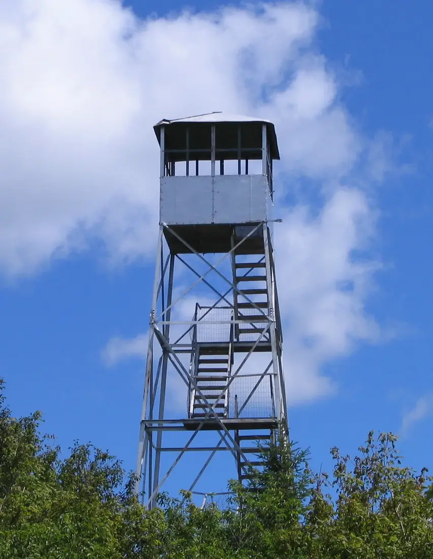


Photos on this page: Fire Observation Tower on the summit of Loon Lake Mountain, Loon Lake, New York, Franklin County by Marc Wanner, CC BY-SA 3.0; Saint Regis Fire Tower 2010 t6 by John Sweeney, CC BY-SA 3.0; Lyon Mountain hiking trail at forest transition by Daniel Case, CC BY-SA 3.0; Azure Mountain Fire Tower by Mwanner, CC BY-SA 3.0. Resized and cropped for this site. All photo credits