
The Saint Regis Canoe Area
New York's only canoe area, 32 to 42 road miles from the cabins: the rules, put-ins, the Seven and Nine Carries carry by carry, 2026 outfitters and maps.
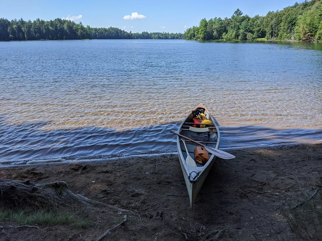
The Saint Regis Canoe Area is the only designated canoe area in New York: 18,400 acres of state land where 58 lakes and ponds, linked by short footpaths called carries, are closed to motors. Its first put-ins are 32 to 35 road miles south of the cabins, at Paul Smiths and Upper St. Regis Lake, and the main one, Little Clear Pond near Lake Clear, is about 42, close enough for a day paddle or a night on a pond. Guides took hotel guests along these same routes in the 1800s, and the routine has not changed: paddle a pond, shoulder the boat, walk to the next one.
What the designation means
New York's Adirondack Park State Land Master Plan sorts state land into classes, and a canoe area is one of them. The plan defines it as an area where the waterways, or the number and closeness of lakes and ponds, make possible "a remote and unconfined type of water-oriented recreation in an essentially wilderness setting." Saint Regis is the only unit in the state with that label. It was designated in 1972, when the master plan was adopted, and the state manages it as wilderness.
The label changed how people use it. Before 1972 motorboats and snowmobiles were allowed, and the state let campers put up tent platforms that turned into something close to permanent camps. Once the plan was adopted, motors were banned and the platforms were removed. Most of today's campsites sit where a platform used to be, and the remains of a few can still be seen. The canoe-area class allows a few things a wilderness does not: state crews can use vehicles, motors and aircraft to manage the fish and the water, and the old truck trails stay open for that work, gated against everyone else.
The unit lies mostly in the Town of Santa Clara, with small corners in Harrietstown and Brighton. Floodwood Road and the old railroad bed, now the Adirondack Rail Trail, form much of its southern edge, and Keese Mills Road runs along the north. Water covers 1,621 acres, from a half-acre unnamed pond to St. Regis Pond, the largest at roughly 400 acres. About two-thirds of the land bordering the canoe area is private, much of it owned by Paul Smith's College and Bay Pond Park, and conservation easements on both keep much of it undeveloped.
The rules
No motors
The canoe area is closed to motorboats, motor vehicles and aircraft. Three popular put-ins are not part of the canoe area itself, so their rules differ: Little Clear Pond belongs to the neighboring Saranac Lakes Wild Forest but is closed to motors too, the St. Regis lakes have private camps along much of the shore, and Hoel Pond has motorboats.
Group size
Camping is limited to eight people per site. Keep day groups to 15 or fewer, the standard for wilderness areas, and split a bigger party into groups that camp at least a mile apart. Any group of ten or more needs a permit to camp anywhere on state land. DEC's 2026 rulemaking agenda includes a new rule for the canoe area that would set limits on group size, camping and campfires, so check its canoe area page for changes before a big trip. Anyone guiding paying clients on state land needs a New York guide's license.
Camping and permits
About 70 designated tent sites sit along the shores of 20 of the ponds, plus three lean-tos. All are first come, first served, and none can be reserved. Each designated site is marked with a yellow Camp Here disc. Expect a flat spot for a tent and a ring of stones for a fire; an outhouse or a picnic table is a bonus. Most people camp at these sites; camping anywhere else has to be at least 150 feet from water, trails and roads. You need no permit for an ordinary trip, but staying more than three nights at one site takes a permit from a Forest Ranger. Camping is not allowed on Little Clear Pond, and camping on Little Green Pond takes a permit from the Adirondack Fish Hatchery, part of the effort to keep bait fish out of the hatchery's ponds.
Fires, waste and food
Fires are allowed only in designated areas: use the existing fire ring at your site, and burn only dead and down wood. Carry out everything you carry in. Wash dishes and yourself away from the water, and bury human waste at least six inches deep and 150 feet from water and camp.
Take food storage seriously. In July 2026 DEC closed paddle-in campsites 5 through 11 on Long Pond after a bear began approaching people for food, damaging tents and food containers and shrugging off deterrents. The bear was put down and the sites reopened on July 25. Bear-resistant canisters are required by law only in the Eastern High Peaks, but DEC urges campers to use them across the Adirondack backcountry. Put food, trash, toiletries, medicine and pet food in the canister, and leave it on level ground at least 100 feet from your tent and cooking area.
Little Clear Pond and the hatchery
Little Clear Pond, the main put-in, is the state's brood stock water for landlocked Atlantic salmon, the fish raised at the Adirondack Fish Hatchery on Fish Hatchery Road. In 2025 the state put 2,856 young salmon and 9,624 round whitefish into the pond. Little Green Pond next door holds brood stock for the endangered round whitefish. Fishing is banned on both ponds and their tributaries. It is a violation even to have a lure or hook on a line on the water or the shore, or to have an Atlantic salmon within 200 yards of Little Clear. Paddling across Little Clear is fine; it is the start of the Seven Carries.
The hatchery raises landlocked salmon for waters across the state. Its visitor center at 103 Fish Hatchery Road has an indoor pool full of salmon, a monitor showing brood fish in the pond and exhibits on how fish are raised. It is open 9 a.m. to 3:30 p.m. daily from April 1 to October 31; check the hours before you stop.
The ponds
St. Regis Pond is the largest water in the canoe area. A 2016 count found 17 campsites around it, and the state stocks it by air with splake, a cross of lake trout and brook trout; it got 2,170 in 2025. Long Pond, 338 acres, is shaped like a cross, with bays on all four sides. A trail climbs Long Pond Mountain from its western bay, about 930 feet in 1.5 miles, a carry leads from the same bay to Slang Pond, and a trail from the northern bay heads to Nellie and Bessie ponds.
Fish Pond, 51 acres, is the deep, remote center of the Nine Carries country, with two lean-tos, one on the north shore and one on the south. The north one, the Blagden lean-to, stands near the site of an older lean-to built for a boys' camp. The eastern Little Long Pond covers 82 acres. Bear Pond, on the Seven Carries, is a favorite for a day trip. A steep esker, a long gravel ridge left by glacial meltwater, cuts through the middle of the area, and some stands of forest here were never logged and still hold old growth.
Loons nest on these ponds. Pairs with chicks have been seen on Little Clear Pond, and eight loons were counted there on one paddle. Bald eagles come to Little Clear to feed on hatchery fish. Give nesting loons and chicks a wide berth; the Meacham Lake guide covers loon etiquette in full, and wildlife watching has more on what lives here.
The Seven Carries
The Seven Carries is the classic route: about nine miles from Little Clear Pond to Paul Smith's College on Lower St. Regis Lake, through a string of small ponds and the three St. Regis lakes. Despite the name, it has six carries today. The longest is the first, about 0.6 mile, and the rest are short. Fit paddlers with a light boat do it in a day, five hours or more with breaks, and many people make it a two-day trip with a night on St. Regis Pond. You need a second car or a shuttle, since the two ends are about 10 road miles apart.
| Carry | From | To | Length |
|---|---|---|---|
| 1 | Little Clear Pond | St. Regis Pond | About 0.6 mile, the longest |
| 2 | St. Regis Pond | Green Pond | About 100 to 200 feet |
| 3 | Green Pond | Little Long Pond | About a quarter mile |
| 4 | Little Long Pond | Bear Pond | About a quarter mile |
| 5 | Bear Pond | Bog Pond | About 150 feet |
| 6 | Bog Pond | Upper St. Regis Lake | About 150 feet |
Put in at the DEC launch at the south end of Little Clear Pond and paddle north up the pond, keeping well clear of any loons. The first carry, the longest of the trip, takes you to St. Regis Pond; cross it to the short carry into Green Pond. Two carries of about a quarter mile each lead through Little Long Pond to Bear Pond. The last two carries, Bear Pond to Bog Pond and Bog Pond to Upper St. Regis Lake, are each only about 150 feet. The final one climbs a slight rise over private land, past a stone wall and across a dirt road, so stay on the path.
From Upper St. Regis Lake, the three St. Regis lakes are joined by wide channels. Paddle through Spitfire Lake into Lower St. Regis Lake, past the Great Camps on the shore, to the take-out at Paul Smith's College. One Saranac Lake outfitter runs it the other way, from Paul Smith's College to Little Clear Pond, which saves the long carry for last. Either direction works. Go light: one outfitter recommends a lightweight Kevlar tandem canoe or a very light solo canoe for this trip.
The Nine Carries
The Nine Carries is the harder trip, into the middle of the area, and it has several versions. All of them head for the cluster of ponds around remote Fish Pond and link two of the three main starting points: Little Clear Pond, Hoel Pond or Long Pond. Starting from Hoel Pond or Long Pond, the carries add up to about a mile and a half; from Little Clear Pond, about two and a half. The whole trip runs about 12 to 18 miles, depending on the version. Most people take two or three days, though strong paddlers do it in one long day of eight hours or more. The reward is brook trout and solitude.
One version, offered by a Saranac Lake outfitter, runs about 15 miles from Little Clear Pond to Hoel Pond:
- Little Clear Pond to St. Regis Pond, the same 0.6-mile carry that starts the Seven Carries, long but easy and well kept.
- St. Regis Pond to Ochre Pond, from the western end of St. Regis, a fairly long carry on a rougher trail. From here the trip turns into backcountry travel.
- Ochre Pond to Mud Pond, another rugged carry, about a mile.
- Mud Pond to Fish Pond, the camping goal: paddle across Mud or stay on the trail straight to Fish, then go on to Little Fish Pond.
- Little Fish Pond to the western Little Long Pond, then Lydia Pond and Nellie Pond.
- Nellie or Bessie Pond to Long Pond, about 1.5 miles, the longest carry in the canoe area and the hardest, often very muddy.
- Long Pond to Slang Pond, by the carry from Long Pond's western bay.
- Slang Pond into Turtle Pond through a narrow connection.
- Turtle Pond to Hoel Pond, less than 100 feet up and over the rail trail embankment, or through the culvert under it when the water allows.
Beavers move the water around here. A carry may include a short paddle where a dam has flooded the path, and old bog bridging on the longer carries can be rotten, so watch your footing with a boat on your shoulders. Kit Fox Pond sits on another variation between Nellie Pond and Little Long Pond, and Bessie Pond has a designated campsite off the main route.
Put-ins and parking
| Put-in | Turn off NY 30 | Road miles from the cabins | Notes |
|---|---|---|---|
| Paul Smith's College, Lower St. Regis Lake | College entrance at NY 86, Paul Smiths | About 32 | Public access on the lake; park in the large lot to the right of the library |
| Upper St. Regis Lake | St. Regis Carry Road, between Paul Smiths and Lake Clear | About 35 | Town of Harrietstown launch at the end of the road |
| Little Clear Pond | Fish Hatchery Road, 2.8 miles past Lake Clear Junction | About 42 | DEC launch at the south end; no fishing, camping or motors |
| Hoel Pond | Floodwood Road, then Hoel Pond Road | About 44 | Outside the canoe area; motorboats allowed on Hoel |
| Long Pond | Floodwood Road, 5.1 miles in | About 48 | A carry of about 0.3 mile to the pond |
Little Clear Pond
From the cabins, take NY 30 south through Paul Smiths to Lake Clear Junction, where NY 30 turns toward Tupper Lake. Go 2.8 miles and turn right on Fish Hatchery Road, then after 0.4 mile turn right at the brown and yellow DEC sign and follow the signs across the old rail line, now the rail trail, to the launch lot. It holds about 50 cars and trailers and has rarely filled. It is about 42 road miles from the cabins, roughly an hour.
Upper St. Regis Lake
St. Regis Carry Road leaves NY 30 between Paul Smiths and Lake Clear Junction, about 35 road miles from the cabins. At its end, the Town of Harrietstown public launch sits to the left of a private launch run by the shore owners; use the public one. It has a sandy beach for loading. From here, cross the lake to the short carry to Bog Pond and the Seven Carries.
Paul Smith's College
The college entrance is at the junction of NY 30 and NY 86, about 32 road miles from the cabins, roughly 45 minutes. The public put-in is on Lower St. Regis Lake, and paddlers park in the large lot to the right of the library. It is the northern end of the Seven Carries, and a good place to leave a second car.
Long Pond and Hoel Pond
Floodwood Road leaves NY 30 about 5.5 miles south of Lake Clear Junction. For Hoel Pond, turn right after 0.35 mile on Hoel Pond Road, then left on the rough dirt access road along the Saranac Inn golf course, about half a mile to the state launch. Hoel Pond itself is outside the canoe area and has motorboats; it is about a mile across to the carry into Turtle Pond. For Long Pond, stay on Floodwood Road for 5.1 miles to the Long Pond trail lot, then carry a quarter to a third of a mile, gently downhill on a wide path with good footing. A second lot, at the Floodwood crossing, means a 1.1-mile carry. The Long Pond lot has overflowed on peak summer weekends, so come early.
The Adirondack Rail Trail, finished in fall 2025, runs 34 miles from Lake Placid to Tupper Lake along the old rail line. Its 9.4-mile Lake Clear to Floodwood section runs along the canoe area's southern edge, with a parking area on Floodwood Road, and it makes a good bike ride for anyone in the group who would rather not paddle.
History
Paul Smith and his wife Lydia opened their hotel on Lower St. Regis Lake in 1859, one of the first wilderness resorts in the Adirondacks. It had 255 guest rooms, housing for 60 wilderness guides, a boathouse, a casino and a bowling alley, and three presidents stayed there. The Prospect House opened on Upper Saranac Lake in 1864. Guests moved between the hotels by water, and the Seven Carries linked Paul Smith's Hotel with the Prospect House. Visitors hired guides who rowed them in Adirondack guide boats to the ponds for hunting and fishing. The ponds those guests paddled are the same ones paddled today, and many of the carries follow paths in use by the middle of the 1800s.
Paul Smith died in 1912. His son Phelps ran the hotel until fire destroyed it in 1930, and when Phelps died he left most of his estate to found Paul Smith's College. It opened on the hotel site in 1946 with 150 students, many of them veterans of the Second World War.
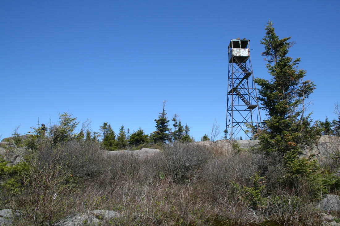
Logging and fire shaped the land around the hotels. The Maine Company bought a township here in 1850 and began cutting. The summit of St. Regis Mountain burned in 1876 during survey work. Dr. Seward Webb built the railroad along the southern edge in 1892, and the state constitution's protection of the Forest Preserve took effect in 1895. William Rockefeller began buying land in Santa Clara in 1896 for what became Bay Pond Park. In 1898 the state bought much of the township, including 14,207 acres that became the core of the canoe area, and in 1903 fire burned 7,400 acres of it. In 1926 the state bought another 3,219 acres from Rockefeller. In 1936 the Civilian Conservation Corps built fire truck trails here, including the one to Fish Pond. The steel fire tower on St. Regis Mountain went up in 1918; its story is in the St. Regis Mountain guide.
The fishing has its own history. In the early 1950s the state treated the Fish Pond chain of ponds to remove yellow perch, which crowd out native brook trout, and brook trout fishing was excellent for years afterward. Lake trout then turned up in Fish Pond, brought in by accident or by someone without permission, and by 1965 they were the main game fish there. From 1978 on, the state bought land and easements from Paul Smith's College, which added several hundred acres to the canoe area.
Outfitters and rentals in 2026
The cabins do not list boats, so most guests rent. Two Saranac Lake shops were operating in 2026, both about 43 road miles from the cabins, roughly an hour away:
- St. Regis Canoe Outfitters, 73 Dorsey Street, (518) 891-1838, downtown on the Saranac River. It rents canoes, kayaks and camping gear, puts together outfitting packages from a full kit to a day rental, and offers boat and paddler transportation, including shuttles for the rail trail. The shop publishes the Adirondack Paddler's Map and guidebook.
- Adirondack Lakes and Trails Outfitters, 8 Church Street, (518) 891-7450, which lists its hours as 9 a.m. to 5 p.m. every day; call ahead late in the season. It rents canoes, kayaks and paddleboards, offers transport to the start and from the end of a route, and sends guides out by the half or full day. Its trip list includes the Seven Carries and the Nine Carries, and the Nine Carries package comes with a boat, paddles, life jackets, transport and a waterproof map.
The old Floodwood outpost on Floodwood Road is no longer part of St. Regis Canoe Outfitters. It opens in season as a general store, Thursday through Sunday, selling outdoor gear, maps, books, food and drinks, but it does not rent canoes. In summer, reserve a boat a few days ahead and ask for the lightest one the shop has. A light boat makes every carry easier.
Maps
- The Adirondack Paddler's Map, North, 12th edition, 2022: waterproof and tear-resistant, at 1:50,000, showing launches, parking, carries, campsites, lean-tos and hiking trails for the Saranac Lakes, the canoe area and the Osgood River country.
- The St. Regis Canoe Wilderness close-up map: 1:31,250, about half a mile to the inch, waterproof, 18 by 24 inches and folded to about 4 by 9.
- The Adirondack Paddlers Guide, fifth edition: 312 spiral-bound pages, sized to fit in a gallon zip bag.
- National Geographic Trails Illustrated map 746, Saranac and Paul Smiths: 1:75,000 with 50-foot contours, covering the canoe area and the Debar Mountain Wild Forest.
- DEC's free map of the canoe area, a georeferenced PDF that a phone map app can read, showing parking, carries, campsites, lean-tos and ski trails.
Carry a paper map and a compass even with the DEC map on your phone. The ponds look alike from the water, and carries start at small signs on long shorelines; the carry from Little Clear Pond to Grass Pond, for one, is marked by a white portage sign on the right shore.
Fishing
Bring a New York fishing license if you plan to cast; everyone 16 and older needs one, and the Meacham Lake guide lists the fees. Using bait fish is banned throughout the canoe area, to keep out the fish that crowd out trout. About 20 ponds in the unit hold enough brook trout for good fishing, and the state stocks many of them by air. In 2025 brook trout went into Ochre Pond, Kit Fox Pond, Clamshell Pond and the western Little Long Pond, and splake into St. Regis Pond. Lake trout now live in Fish Pond, Ochre Pond, Little Fish Pond and St. Regis Pond. Fish Pond, Little Fish Pond and St. Regis Pond have their own lake trout rules, April 1 through October 15 with a 15-inch minimum and three a day in the current regulations, so read them before you keep a fish. Largemouth and smallmouth bass, which are not native here, have spread through the Long Pond chain. Little Clear and Little Green ponds are closed to fishing, and the fishing trips page covers other waters near the cabins.
Safety
Canoeing here runs from May to November, with the busiest weeks from late June to Labor Day. In spring and late fall the water is cold, and New York requires everyone in a canoe or kayak to wear a life jacket from November 1 to May 1; the Meacham Lake guide covers the life jacket rules in full.
Plan the carries. Pack so you can move everything in one or two trips, lash in the paddles, and wear shoes you can walk a muddy mile in. Leave your route and your return time with someone at the cabin, and download the DEC map before you lose a signal. If you get lost or hurt, stay put and call 911 or the DEC Forest Ranger dispatch at 1-833-NYS-RANGERS (1-833-697-7264). Black flies are worst from late May into June; see the bug guide.
A day trip from the cabins
For a first visit, paddle Little Clear Pond to St. Regis Pond and back. Leave the cabins by 7:30; it is about 42 road miles, roughly an hour, to the Little Clear Pond launch. Paddle north up the pond, watching for loons and eagles, and make the 0.6-mile carry to St. Regis Pond. Have lunch on the largest pond in the area, paddle as far as you like, and come back the same way. With a light boat and a steady pace, you are back at the car by mid-afternoon.
With children or a short day, try Little Clear Pond to Grass Pond instead. It is about 2.5 miles round trip and two to three hours, with a 0.1-mile carry from the northwest end of Little Clear. Grass Pond has a sandy landing in the shallows and a campsite on a small rise on its northern shore.
For a bigger day, paddle the whole Seven Carries one way, starting at Paul Smith's College, with a shuttle from a Saranac Lake outfitter. On the way home, stop at the hatchery visitor center if it is still open. From Little Clear Pond it is about an hour back to the cabins and the hot tub.
An overnight from the cabins
Sites cannot be reserved, so an overnight works best midweek, outside the busiest weeks from late June to Labor Day, with an early start. Leave the cabins at 7 and be on Little Clear Pond soon after 8. Carry to St. Regis Pond and take the first open designated site you like. Spend the afternoon on Green Pond and Bear Pond without the gear. The next morning, break camp early and finish the Seven Carries to Paul Smith's College, where your second car or an outfitter's shuttle waits; the cabins are about 45 minutes from there.
For a quieter night, go deeper: from St. Regis Pond, carry on through Ochre Pond and Mud Pond to Fish Pond, with its two lean-tos, and come back the way you went in. Keep the group to eight or fewer, pack a bear-resistant canister, a stove, a water filter, rain gear and warm layers, and leave the site cleaner than you found it.
Nearby
- St. Regis Mountain, the fire tower on the canoe area's north side, and one of the six peaks of the Saranac Lake 6er.
- Saranac Lake and Paul Smiths, for the outfitters, food and the college on Lower St. Regis Lake.
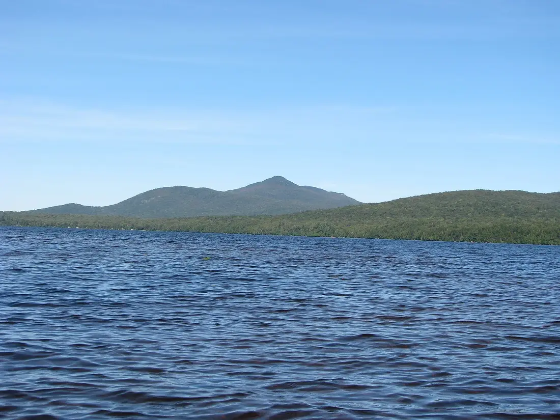
- Meacham Lake and the Deer River Flow, on the drive down, about 21 road miles from the cabins, for a beach day or a sheltered paddle.
- The Debar Mountain Wild Forest, north of Paul Smiths, for hiking and more lakes.
- The Wild Center in Tupper Lake, the town at the western end of the rail trail.
- Back at the cabins, a private hot tub and a washer and dryer for wet gear.
Questions
Do I need a permit to paddle or camp in the Saint Regis Canoe Area?
No permit is needed to paddle or for an ordinary camping trip. Most people camp at designated sites, each marked with a yellow Camp Here disc, and camping is limited to eight people per site. A permit from a Forest Ranger is required to stay more than three nights at one site, and any group of ten or more needs a permit to camp on state land. Camping on Little Green Pond takes a permit from the Adirondack Fish Hatchery, and camping is not allowed on Little Clear Pond.
Can I reserve a campsite in the canoe area?
No. The roughly 70 designated tent sites and the lean-tos are all first come, first served. For the best chance at a site, start early on a weekday, and avoid the busiest weeks from late June to Labor Day if you can. In July 2026 DEC briefly closed several Long Pond sites because of a nuisance bear, so check for closures before you go.
How long is the Seven Carries, and can it be done in a day?
It is about nine miles from Little Clear Pond to Paul Smith's College, with six carries today, the longest about 0.6 mile. Fit paddlers with a light boat do it in a day, five hours or more with breaks, and many make it a two-day trip. Leave a second car at the far end or book a shuttle; the two ends are about 10 road miles apart.
Why can't I fish or camp on Little Clear Pond?
Little Clear Pond is New York's brood stock water for landlocked Atlantic salmon, the fish raised at the Adirondack Fish Hatchery on Fish Hatchery Road. Fishing is banned, and even having a lure on a line on the water or the shore is a violation. Camping and motors are not allowed either. Paddling across is fine; it is the start of the Seven Carries.
Where can I rent a canoe near the Saint Regis Canoe Area?
In Saranac Lake, about 43 road miles from the cabins. St. Regis Canoe Outfitters on Dorsey Street and Adirondack Lakes and Trails Outfitters on Church Street both rent canoes and kayaks and can arrange transport to and from a route. The cabins do not list boats, and the Floodwood general store near the canoe area does not rent canoes.
How far is the canoe area from the cabins?
The closest put-ins are Paul Smith's College, about 32 road miles, and Upper St. Regis Lake, about 35, roughly 45 minutes. Little Clear Pond, the main put-in, is about 42 road miles, roughly an hour, and Long Pond about 48. All of them are reached by NY 30 south through Paul Smiths. See Meacham Lake for water on the way.
Sources
Facts on this page were checked against these sources in October 2026. Hours, fees and schedules change; confirm before you go.
- New York State Department of Environmental Conservation dec.ny.gov/places/saint-regis-canoe-area
- New York State Department of Environmental Conservation extapps.dec.ny.gov/docs/lands_forests_pdf/srcafinal.pdf
- Saranac Lake tourism saranaclake.com/paddling/st-regis-canoe-area
- Saranac Lake tourism saranaclake.com/story/2018/08/three-mind-blowing-facts-about-st-regis-
- Saranac Lake tourism saranaclake.com/story/2023/celebrate-wilderness-paddling
- Saranac Lake tourism saranaclake.com/story/2014/08/short-paddles-st-regis-canoe-area
- Saranac Lake tourism saranaclake.com/paddling/little-clear-pond-to-grass-pond
- Saranac Lake tourism saranaclake.com/story/2014/08/paddling-little-clear-pond
- Saranac Lake tourism saranaclake.com/paddling/st-regis-chain-of-lakes
- Saranac Lake tourism saranaclake.com/attractions/adirondack-fish-hatchery
- Saranac Lake tourism saranaclake.com/adirondack-rail-trail
- adirondacklife.com adirondacklife.com/2016/09/06/carry-on/
- canoeoutfitters.com canoeoutfitters.com/guided-trips/seven-carries-0
- canoeoutfitters.com canoeoutfitters.com/trip-planning/routes/nine-carries-st-regis-canoe-a
- canoeoutfitters.com canoeoutfitters.com/
- canoeoutfitters.com canoeoutfitters.com/about/our-location
- canoeoutfitters.com canoeoutfitters.com/products/maps-guidebooks
- canoeoutfitters.com canoeoutfitters.com/trip-planning/orientation-permits-fishing
- canoeoutfitters.com canoeoutfitters.com/trip-planning/camping
- adirondackoutfitters.com adirondackoutfitters.com/
- adirondackoutfitters.com adirondackoutfitters.com/trips/seven-carries
- adirondackoutfitters.com adirondackoutfitters.com/trips/nine-carries
- tupperlake.com tupperlake.com/story/2016/09/5-carries-st-regis-wilderness-area
- visitadirondacks.com visitadirondacks.com/sites/default/files/2023-04/Paddling_2023.pdf
- Visit Malone visitmalone.com/paddling/little-clear-pond-boat-launch
- northeastexplorer.com northeastexplorer.com/st-regis-canoe-area/
- adkforum.com adkforum.com/forum/the-adirondack-forum/trip-reports/26514-nine-carrie
- natureintoaction.com natureintoaction.com/2012/09/19/adirondacks-st-regis-wilderness-area-n
- law.cornell.edu law.cornell.edu/regulations/new-york/N-Y-Comp-Codes-R--Regs-Tit-6-SS-1
- eregulations.com eregulations.com/newyork/fishing/region-5-regulations
- New York State Department of Environmental Conservation dec.ny.gov/things-to-do/freshwater-fishing/regulations/region-5-specia
- New York State Department of Environmental Conservation dec.ny.gov/sites/default/files/2024-07/actualstocking.pdf
- newyorkalmanack.com newyorkalmanack.com/2026/07/nuisance-black-bear-campsites/
- New York State Department of Environmental Conservation dec.ny.gov/news/press-releases/2026/7/dec-announces-campsite-closures-
- New York State Department of Environmental Conservation dec.ny.gov/nature/animals-fish-plants/black-bear/management/bear-resis
- Paul Smith's College paulsmiths.edu/the-smitty-story/
- Paul Smith's College paulsmiths.edu/news/
- Adirondack Mountain Club adk.org/product/map-746-saranacpaul-smiths/
- cms7files1.revize.com cms7files1.revize.com/franklincoedcny/recreation/outdoor_activities/do
- New York State Department of Environmental Conservation dec.ny.gov/places-to-go/maps/saint-regis-canoe-area-georeferenced-map
- New York State Parks parks.ny.gov/documents/recreation/boating/PFDLawsofNewYork.pdf
- New York State Department of Environmental Conservation dec.ny.gov/environmental-protection/public-safety/forest-rangers
- OpenStreetMap (road distances) openstreetmap.org/
- law.cornell.edu law.cornell.edu/regulations/new-york/6-NYCRR-190.4
- law.cornell.edu law.cornell.edu/regulations/new-york/6-NYCRR-190.13
- New York State Department of Environmental Conservation dec.ny.gov/regulatory/agenda
In this guide
Stay nearby
The first of the cabins: a big stone fire pit you see as you walk up, a screened corner of the deck, direct trail access, and a short walk to an observation deck over the pond.
 The Modern Tiny HomeCabin 1 · 2 bd · 1 ba · sleeps 4
More in Lakes & Paddling
Sources
46 references, listed in full at the end of this guide: official park, state, tourism-office and business sources, checked October 2026.
Related guides
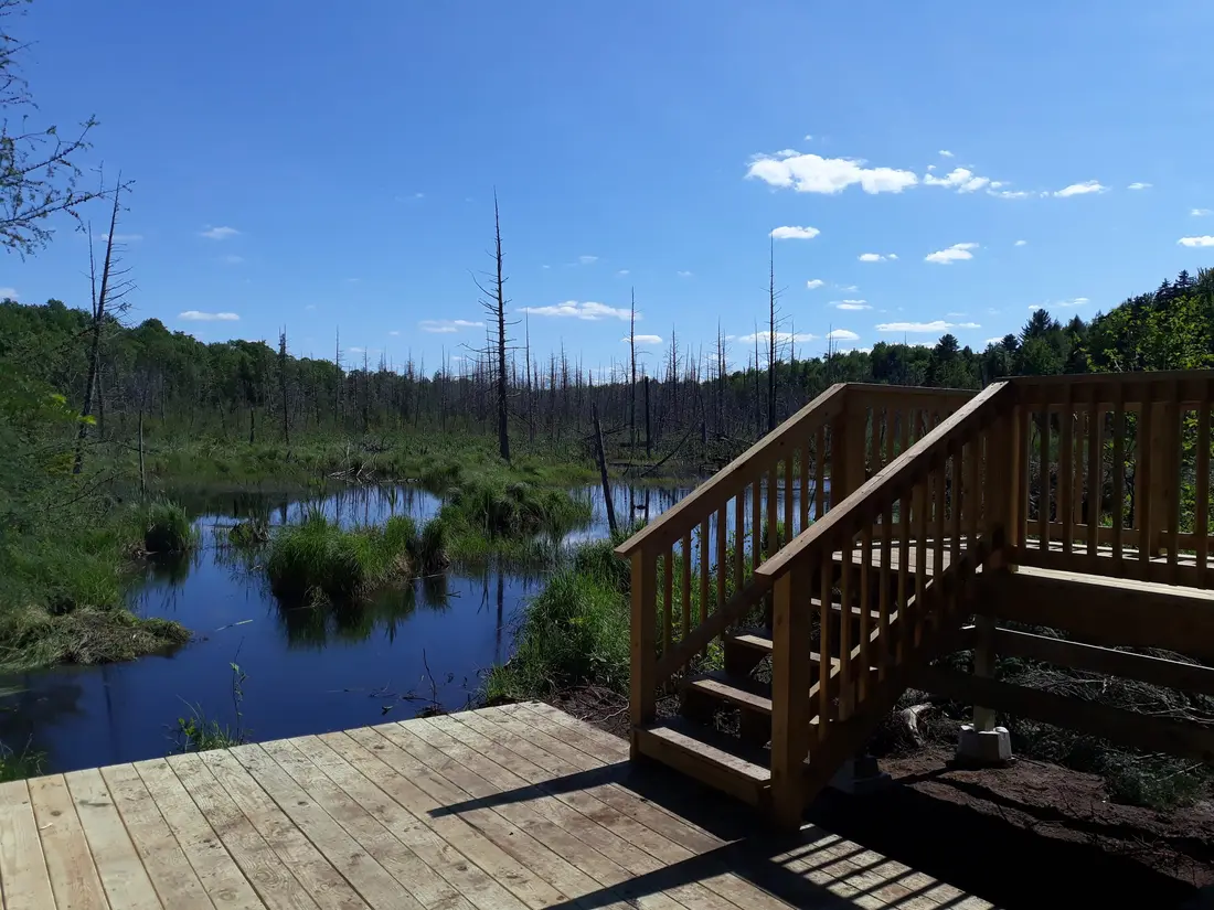


Photos on this page: St Regis Canoe Area by Marty Plante, CC BY-SA 4.0; Saint Regis Fire Tower 2010 t6 by John Sweeney, CC BY-SA 3.0; Meacham Lake Franklin County New York by Mwanner, CC BY-SA 3.0. Resized and cropped for this site. All photo credits