
The Tupper Lake Triad
Mount Arab, Coney and Goodman near Tupper Lake: each trail, the Arab fire tower and cabin museum, how the patch works, and a day plan from the cabins.
The Tupper Lake Triad is a patch for climbing three small mountains around Tupper Lake: Mount Arab, Coney Mountain and Goodman Mountain. All three trailheads are about 67 road miles from the cabins, roughly an hour and a half each way, and the longest of the three trails is 1.7 miles each way. You get a restored fire tower with a museum in the old observer's cabin, a bald summit with a view all the way around, and a mountain named for a civil rights worker who climbed it as a young man.
The three mountains at a glance
All three summits sit in the Horseshoe Lake Wild Forest, state land west and south of Tupper Lake. Mount Arab is in the Town of Piercefield in St. Lawrence County, west of the village off NY 3. Coney and Goodman stand close together in the Town of Tupper Lake along NY 30, the road south to Long Lake, and their trailheads are 1.1 road miles apart.
| Mountain | Round trip | Climb | Summit | Trailhead | From the cabins |
|---|---|---|---|---|---|
| Mount Arab | 2 miles | About 750 feet | 2,545 feet | Mount Arab Road, Piercefield | About 67 road miles |
| Coney Mountain | 2.2 miles | About 550 feet | 2,265 feet | NY 30, about 10 miles south of the village | About 68 road miles |
| Goodman Mountain | 3 to 3.4 miles | About 580 feet | 2,178 feet | NY 30, about 9 miles south of the village | About 67 road miles |
The Triad program lists Arab at 1 mile each way with 750 feet of climbing, Coney at 1.1 miles with 548 feet and Goodman at 1.7 miles with 581 feet. Trail guides differ by a few tenths of a mile and a few dozen feet, Goodman most of all. Added up, the Triad comes to roughly 7 to 7.6 miles of walking and about 1,900 feet of climbing.
How the Triad patch works
Climb all three mountains inside one season window, then register. Hikes between March 21 and December 19 count toward the summer patch, and hikes between December 20 and March 20 count toward the winter patch. No set order is required and the three need not fall on one day, as long as all of them land inside the same window. A weekend suits it well: finish the last peak in the morning and have lunch in town in the afternoon.
When you finish, fill in the registration form on the Tupper Lake tourism website, tupperlake.com, which has separate forms for the spring-summer-fall Triad, the winter Triad and the Canine Triad for dogs. To register by mail, print the form and send it with the $10 fee, by check made out to ROOST, to Regional Office of Sustainable Tourism, attn: TL Triad, PO Box 641, Tupper Lake, NY 12986. Patches can take up to three weeks to arrive. The fee has changed over the years, so check the current form before you mail anything.
A retired Tupper Lake physical education teacher, Charlie Hoffer, started the Triad in 2015 with help from the Tupper Lake Rotary Club. By October 2018, 3,600 summer patches, 623 winter patches and 349 dog patches had gone out. Since the spring of 2018 the program has been run by the Regional Office of Sustainable Tourism, the tourism office for Tupper Lake, Saranac Lake and Essex and Hamilton counties. Part of the proceeds has gone back to the mountains: in 2020 the Triad gave the Friends of Mount Arab $1,000. The same year ROOST added a Tupper Lake Paddling Triad, three paddling routes on the Raquette River and nearby ponds, with a patch and a sticker of its own.
Mount Arab trail
To reach Mount Arab, take NY 3 west out of the village toward Piercefield for about 7.25 miles; signs point the way to Conifer Road. Turn left on Conifer Road, which is St. Lawrence County Route 62, go almost 2 miles, and turn left on Mount Arab Road. The trailhead is about a mile in. The big lot is on the right side of the road, with room for plenty of cars, and the trail and register are across from it on the left. Mount Arab Road was once the stagecoach road to the Childwold Park Hotel at Massawepie, and the old Conifer Station of the New York Central's Adirondack Division stood beside the tracks you cross on the way in.
The trail is 1 mile to the summit. The first 0.7 mile crosses the Conifer Emporium Conservation Easement, private forest land open to hikers, and the rest is Forest Preserve. Red markers lead the way, and ten of them carry numbers that match an interpretive guide from the Friends of Mount Arab, kept at the trail register. Stop 3 shows rock steps built to a newer, sustainable trail design, stop 4 a piece of igneous rock and stop 5 an old maple stump.
The trail starts with a quick climb along the north ridge, with steeper slopes falling away on your right. The steepest pitch comes about halfway up, where a large boulder sits at the top of a steep section. Expect stone steps, one wooden staircase, a few wooden walkways and some muddy spots on the ridge. Near 0.8 mile a small cliff comes into view and the trail splits: the direct line is steeper, and a marked switchback winds around the headwall. Either way you come out on the semi-open, grassy summit behind the observer's cabin, with the tower a few yards away.
A short side path to the right of the summit looks down on Mount Arab Lake and Eagle Crag Lake to the southwest. Both lakes are private, and some of the land around the mountain is private easement land, so stay on the marked trails. A primitive campsite sits beyond the tower.
The fire tower and the observer's cabin
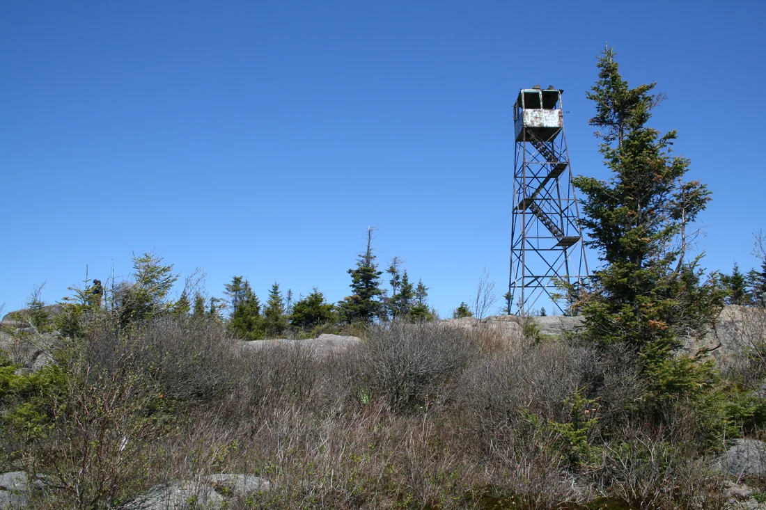
Mount Arab became a fire lookout in 1912, when the state put up a log tower and a log cabin on the summit. The first observer, Angus LaRocque, spotted three fires that summer. The 35-foot steel Aermotor tower that stands today went up in 1918. A standard state cabin replaced the log one in 1923, and the cabin you see now, the third on the site, went up around 1950. Observer "Doc" LaVasseur kept watch from 1937 to 1964 and welcomed about 10,800 visitors to the summit. During the Depression an observer earned $50 to $60 a month, and the state paid $12 a month more to one who agreed to live in the cabin.
The tower was decommissioned in 1988; Howard Wood was the last observer. Empty, the tower and cabin went downhill fast. In 1997 the St. Lawrence and Franklin county legislatures asked the state to save them, and that year the Friends of Mount Arab formed, a volunteer nonprofit that works with the Department of Environmental Conservation. The Friends rebuilt the tower's steps, landings and floors, added safety caging along the stairs and set new footings and anchor bolts into the bedrock, and the tower was fully restored by 1999. The first summer steward took up the post in 2000, and the work went on for years after: a map table in the cab, panorama panels above the windows, new Plexiglas windows in aluminum frames and rust-resistant paint from the Student Conservation Association. The Friends also built an outhouse and two benches.
The Arab Mountain Fire Observation Station was listed on the National Register of Historic Places in 2001, and it is the last fire tower in St. Lawrence County still standing where it was built. The cabin is a small museum run by the Friends, with exhibits on the mountain's history, a list of past observers, the restoration work and other Adirondack towers, and a note on how many fires Doc LaVasseur reported. It is open when a summit steward is on duty, from late spring to early fall, and it has traditionally opened on Victoria Day weekend, Canada's May holiday. The Friends provide a steward on many summer days to talk with visitors about the tower and the mountain. Steward days vary, so treat an open cabin as a bonus.
No evidence ties the name to the Arab world. The earliest known map to show Arab Mountain is an 1858 survey map of the Mortlake, or Atherton, township, an early name for the Piercefield area, and that map notes maple timber on the mountain's northeast side. The Friends believe the name grew out of érable, the French word for maple. Federal maps still call the peak Arab Mountain; nearly everyone else says Mount Arab, and a small hamlet about two miles to the south carries that name too.
From the tower you can see Tupper Lake to the southeast, the Raquette River valley, Mount Morris, the High Peaks and, on a clear day, Whiteface. To the north, Mount Matumbla, the highest point in St. Lawrence County, fills the horizon, with Debar Mountain far beyond. To the west the view runs out across the western Adirondacks. In winter the cab windows can frost over, and the view from the top flight of stairs is still wide open.
Coney Mountain trail
From the junction of NY 3 and NY 30 in the village, follow NY 30 south toward Long Lake for 10.3 miles, about 1.5 miles past the turn for Route 421. The lot is on the left, the east side, a short way up off the road, marked by a DEC sign. It is small and often full, and the road shoulders are wide enough for overflow. Pull fully off the pavement.
The trail you climb today was built by an Adirondack Mountain Club crew, with DEC overseeing the work, and opened around 2010. Before that, hikers followed a herd path more or less straight up the side. The newer trail is 1.1 miles long with about 550 feet of climbing and blue markers. It starts on the west side of the mountain, runs nearly level along the base for the first quarter mile, then angles up the north and east slopes and comes at the summit from the south. It gets steep at the saddle between Coney and a knob to the south, and the last tenth of a mile crosses scrub and open slab rock. No scrambling is needed, and switchbacks keep the grade easy.
At an easy family pace the climb takes about an hour, and a fit hiker reaches the top in about half an hour. Near the start you pass a register and a kiosk on the mountain's history. DEC posted plans in 2025 for two stone stairways near the summit and in 2026 for more stone steps, check steps and drainage on worn sections, so you may meet a trail crew. Give them room to work.
Coney's open summit
Coney's top is bare rock and almost treeless, so the view goes all the way around. Tupper Lake lies to the north with Goodman Mountain close by in the same direction, Mount Morris rises to the northeast, the Seward Range and other High Peaks line the east, and Blue Mountain stands to the southeast. Round Lake and Little Tupper Lake are in view, and the low wooded hills of the Horseshoe Lake Wild Forest roll off to the west. Look for the survey medallion set in the rock.
Coney sits right on the line between Franklin and Hamilton counties, and that line has a story. In 1772 the surveyor Archibald Campbell, working with a party of Mohawks, ran the north line of the Totten and Crossfield Purchase east to this mountain and stopped. Two old stories explain why: the view of the High Peaks ahead, or the rum running out. Neither is proven. The unfinished survey left the purchase about 300,000 acres off, and in 1903 the state drove nearly 300 steel I-beams into the ground to settle the line. The old herd path follows the county line, and some of those I-beams still stand in the woods along it. The mountain was once called Monument Mountain, and the name Coney comes from cone.
With open sky on every side, Coney is one of the most popular stargazing spots around Tupper Lake, a town known for its dark skies. Photographers carry tripods up for sunsets, eclipses and, now and then, the northern lights. If you stay for dark, bring headlamps for the walk down and plan on about an hour and a half of driving back to the cabins. On a cold night you can save the stars for the hot tub instead; the stargazing post has what to look for from the cabins.
Goodman Mountain trail
Goodman's trailhead is on NY 30 about 9.3 miles south of the NY 3 junction, just south of the turn for Route 421 toward the Bog River and Lows Lake. The lot is on the left, the east side, down a short slope from the road, with a kiosk on the mountain's history and a trail register at the back. Sign in and out.
The first stretch follows the old highway between Tupper Lake and Long Lake, the route of old Highway 10 before the road was rebuilt closer to the lake. Old pavement still shows through the leaves, and the grade is gentle. Just past the lot a footbridge crosses Cold Brook, and a short way in the road runs beside an esker, a long ridge of glacial gravel. The trailhead parking and the first quarter mile were built to be wheelchair accessible, so a friend using a wheelchair can share the start of the walk.
About 0.75 to 1 mile in, at a height of land, the trail turns left off the old road and climbs a stone staircase onto the foot trail. The summit is only a quarter mile away as the crow flies, and the trail swings around the steep slopes through open hardwoods to keep erosion down, so the grade is never very steep. Near the end it turns toward the peak, climbs a little more steeply to the shoulder and follows the ridgeline to the top.
The open rock summit faces mostly south and southeast. Coney is right there, with ponds and mountains beyond, and with the leaves down you can see Tupper Lake to the north on the way up. With binoculars on a clear day you can pick out Litchfield Castle on Lake Madeleine, about three miles away. Back at the lot, a short side path leads to Lumberjack Spring, an artesian spring in a small springhouse that Charles Goodman developed in 1937 and dedicated to the area's lumberjacks.
The trail made the news in 2025, when a young bull moose that showed little fear of people stayed near it for weeks. DEC closed the trail on June 6, the sick moose was euthanized in July, and the trail reopened on August 22. Moose are scarce here, about 716 in the Adirondack region by DEC's 2024 estimate, so a sighting is a story. If you meet one, give it a wide berth and turn back.
Andrew Goodman and the mountain's name
Until 2002 this was Litchfield Mountain, named for the family that built Litchfield Castle in the early 1900s. In 1933 Charles Goodman, a New York City contractor whose firm worked on the subway, the George Washington Bridge and the Lincoln Tunnel, had stone masons build a granite cottage on 644 acres near Bog River Falls, south of the village. The family has summered at Tupper Lake since the 1930s. Charles Goodman's grandsons David, Andrew and Jonathan climbed the mountain without a trail, marking their way with soup-can lids tacked to trees, and painted the family name on the summit rock.
In June 1964, during Freedom Summer, Andrew Goodman went to Mississippi to help Black citizens register to vote. He was 20. He and two fellow civil rights workers, James Chaney and Michael Schwerner, were murdered by the Ku Klux Klan, aided by the Neshoba County Sheriff's Department. The national outcry over their disappearance is credited with helping pass the Civil Rights Act of 1964.
Bill Frenette, a Tupper Lake historian, asked the U.S. Board on Geographic Names to rename the peak, and in 2002 it became Goodman Mountain, honoring Charles Goodman and his grandson Andrew. The summit still had no official trail until 2014, when DEC staff and local volunteers, working with the Adirondack Park Agency, built the parking lot, bridge, signs and trail for about $4,350 from the state's Environmental Protection Fund. The Town of Tupper Lake, DEC and The Wild Center held the dedication that summer, 50 years after Andrew Goodman's death; about 40 or 50 people came, and most of them hiked up with the DEC commissioner. The kiosk at the trailhead tells his story, along with the older history of the spot as a watering place for wagons and stagecoaches in the 1800s.
The order to climb them
Coming from the cabins you reach Tupper Lake from the east on NY 3 and NY 30. Coney and Goodman sit together on NY 30 south of the village, and Mount Arab is on the far side of town, about 19 road miles from Goodman's trailhead. For one day, take the pair first and save Arab for the afternoon:
- Leave the cabins around 7:30 and drive about 67 road miles to Goodman, the longest of the three. Its lot is the larger of the two on NY 30.
- Drive 1.1 miles south to Coney. Its lot is small, so a morning arrival helps on summer weekends.
- Head back into the village, about 10 road miles, for lunch.
- Drive about 10 road miles west to Mount Arab for the afternoon. On summer days when a steward is on duty, the cabin museum is open.
- From Arab it is about 67 road miles back to the cabins, an hour and a half.
That day is about 155 road miles of driving and roughly 7.5 miles of hiking. Plan on an hour and a half to two and a half hours per mountain with time on top, and the whole day runs about ten to eleven hours door to door. For a sunset, flip the order: Arab in the morning, Goodman after lunch and Coney last, for the evening light from its open top.
Over two days the hiking days are shorter, and the driving comes to about 135 road miles each day. Do Mount Arab and The Wild Center on one day, since the museum is about 11 road miles from Arab's trailhead, and Goodman and Coney with a long lunch in the village on the other. If you want a third hiking day, St. Regis Mountain and its fire tower are on the way at Paul Smiths.
Winter on the Triad
The winter window runs from December 20 to March 20, and the Triad makes a good winter outing: short trails, gentle grades, parking close to the road and summits under 2,600 feet. Heavy snow is normal here, and all three trails are popular on snowshoes. These tips help:
- Carry microspikes and snowshoes. Spikes handle the packed and icy days, and snowshoes the days after a storm.
- Mount Arab's lot is plowed. Take off spikes or snowshoes before you climb the tower stairs.
- Goodman's lot sits down a short slope from NY 30, and that slope is not always plowed. If it is not, park well off the road on the shoulder.
- Coney's open summit takes the full wind, with cold wind chills, so pack a shell and a warm layer for the top.
- Snow slows the pace. In February 2026 one party took about 75 minutes to climb Arab's mile in deep snow and 50 minutes to come down.
- Skiing the trails takes deep powder over the rocks and roots, so snowshoes are the usual choice. When Phil Brown of the Adirondack Explorer skied all three in one day in March 2018, it came after weeks of storms, with about a foot of new snow on Coney.
- Days are short in December and January. Start early, carry a headlamp, and check the road report for NY 30 before you leave the cabins.
The winter driving guide covers NY 30 in snow, and the snowshoeing guide has trails nearer the cabins for a shorter day.
Dogs on the Triad
Dogs have a patch of their own. The Canine Triad has its own registration form and a paw-print patch, and by October 2018, 349 dogs had earned one. The cabins welcome pets for a fee; the dog guide and the pet-friendly cabins page have the details.
On the trails, the state asks that you keep a dog under control, leash it whenever other people are near, and clean up after it well away from water and the trail. Mount Arab's trail starts on the private conservation easement, and signs there have asked for leashes at all times, so keep your dog leashed the whole way up. On the summit, take turns on the tower so one person can stay with the dog at the foot of the stairs. Coney's summit is popular with dog owners, and Goodman's old road is easy on paws. After the hike, Raquette River Brewing in the village welcomes leashed dogs in all its areas.
Lunch in Tupper Lake
The village sits between the two halves of the Triad, about 10 road miles from Coney and Goodman and about 10 from Mount Arab. Hours change with the season, so check before you go.
- Spruce & Hemlock, 111 Park Street: a gift shop and café with breakfast sandwiches, soups, sandwiches, salads, coffee and baked goods such as cinnamon buns and pies. The café is open weekdays from 10 to 3, and on weekends it sells grab-and-go food from 10 until it runs out, which suits a summit lunch.
- Raquette River Brewing, 11 Balsam Street: a brewery with food trucks on site, LJ's and PorkBusters BBQ year-round and The Marketplace from April through October, and room for leashed dogs everywhere. Its Oktoberfest falls on Columbus Day weekend, and its gift shop has carried Triad merchandise.
- P-2's Irish Pub, 31 Main Street: an Irish pub with pints of Guinness and fish and chips on the menu.
- The Woodshed on Park, 218 Park Street: a bistro and cocktail bar with a seasonal menu, good for an early dinner before the drive home.
- Stewart's Shops, 124 Park Street: coffee, ice cream and gas for the drive.
If you pair a climb with The Wild Center, its Waterside Café is covered in the Wild Center guide.
Pairing the Triad with The Wild Center
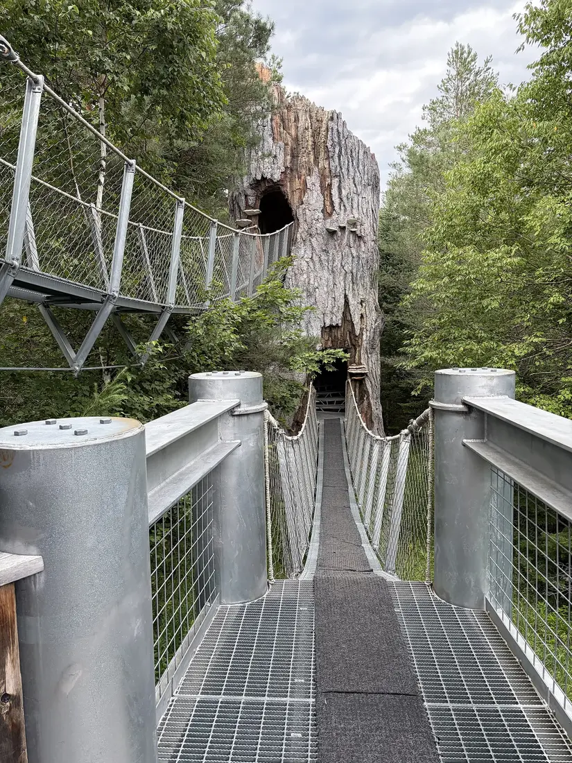
Mount Arab and The Wild Center make an easy pair, about 11 road miles apart: the tower in the morning, then the Wild Walk and the exhibits in the afternoon. The Wild Center also helped dedicate the Goodman Mountain trail in 2014. Tickets, hours and the rest of the museum are in the Wild Center guide, along with the Adirondack Sky Center's public nights, for anyone who wants a telescope after a sunset on Coney.
Other challenges these climbs count toward
Mount Arab is one of the towers in the Adirondack Mountain Club's Fire Tower Challenge, so the same climb counts toward that patch; the fire tower guide has its rules and the other towers within reach of the cabins. The Saranac Lake 6er, six peaks around Saranac Lake and Paul Smiths with a bell to ring downtown, is the next patch to the east.
The drive from the cabins
From the cabins, local roads and County Route 25 take you about seven miles to NY 30. Turn south and stay on NY 30 for about 45 miles, past Meacham Lake and through Paul Smiths, until it joins NY 3. Tupper Lake village is about five miles west of that junction, about 58 road miles from the cabins, and every Triad trailhead is about 67 road miles away. Plan on about an hour and a half each way. Stewart's in the village sells gas, and Malone, about ten road miles north of the cabins, has groceries and fuel, so you can pack lunch and fill the tank the night before.
Before you go
- Black flies are out from mid-May to late June; the bug guide has what works.
- In the fall hunting seasons, wear blaze orange or blaze pink on state land; the hiking guide has the dates and the rest of the safety basics.
- Sign the register at each trailhead. It helps rangers if anyone needs help.
- Check DEC's trail notices before you go. Goodman was closed for most of the summer of 2025, and DEC has planned step-building on Coney.
- For leaf color on the drive and from the summits, the foliage guide has the timing.
- All three cabins have a private hot tub, which is a fine way to end a three-summit day.
Questions
How long does the Tupper Lake Triad take?
The three hikes add up to roughly 7 to 7.6 miles and about 1,900 feet of climbing. Plan on an hour and a half to two and a half hours for each mountain, with time on top. From the cabins, a one-day Triad with lunch in Tupper Lake runs about ten to eleven hours, with about 155 road miles of driving. Over two days it pairs well with The Wild Center.
How do I get the Tupper Lake Triad patch?
Climb Mount Arab, Coney and Goodman inside one season window, March 21 to December 19 for the summer patch or December 20 to March 20 for the winter patch. Then register online at tupperlake.com, or by mail with the $10 fee by check to ROOST. The patch can take up to three weeks to arrive, and the fee has changed over the years, so check the current form.
Do I have to climb all three in one day?
No. Any order and any number of days count, as long as all three fall inside the same season window. Goodman and Coney pair well, since their trailheads on NY 30 are about a mile apart, and Mount Arab makes a good half day with a visit to The Wild Center, about 11 road miles away.
Is the Mount Arab fire tower open?
You can climb the 35-foot tower's stairs, and the old observer's cabin beside it is a small museum run by the Friends of Mount Arab. The cabin opens when a summit steward is on duty, which has meant many days from late spring to early fall; steward days vary, so treat an open cabin as a bonus. In winter, take off spikes or snowshoes before you climb the stairs. The fire tower guide covers the other towers nearby.
Can I bring my dog on the Triad?
Yes. Dogs earn their own Canine Triad patch with a separate form. Keep your dog under control, leash it around other hikers, and keep it leashed on Mount Arab, where the trail crosses a private conservation easement. The cabins accept pets for a fee; bringing your dog has the details.
How far is the Triad from the cabins?
All three trailheads are about 67 road miles from the cabins, about an hour and a half each way by County Route 25, NY 30 and NY 3. Coney and Goodman are on NY 30 south of Tupper Lake, about a mile apart, and Mount Arab is west of the village off NY 3, about 19 road miles from Goodman.
Can you do the Triad in winter?
Yes, and hikes between December 20 and March 20 earn a separate winter patch. Carry microspikes and snowshoes, pack a warm layer for Coney's windy summit, and be ready to park on the shoulder at Goodman if its slope is not plowed. Mount Arab's lot is plowed. The winter driving guide covers NY 30 in snow.
Sources
Facts on this page were checked against these sources in October 2026. Hours, fees and schedules change; confirm before you go.
- tupperlake.com tupperlake.com/tupper-lake-hiking-triad
- tupperlake.com tupperlake.com/hiking/mount-arab
- tupperlake.com tupperlake.com/hiking/coney-mountain
- tupperlake.com tupperlake.com/hiking/goodman-mountain
- content.govdelivery.com content.govdelivery.com/accounts/NYSDEC/bulletins/cc5770
- New York State Department of Environmental Conservation dec.ny.gov/news/press-releases/2025/6/dec-announces-closure-of-goodman
- New York State Department of Environmental Conservation dec.ny.gov/news/press-releases/2025/8/dec-reopens-goodman-mountain-tra
- New York State Department of Environmental Conservation dec.ny.gov/news/environmental-notice-bulletin/2026-02-18/public-notice
- New York State Department of Environmental Conservation dec.ny.gov/news/environmental-notice-bulletin/2025-03-19/public-notice
- New York State Department of Environmental Conservation dec.ny.gov/things-to-do/camping/state-land-rules
- npgallery.nps.gov npgallery.nps.gov/AssetDetail/1bf3c90f-d386-40d6-b95f-5f1a2b637568
- usgs.gov usgs.gov/us-board-on-geographic-names/download-gnis-data
- epqs.nationalmap.gov epqs.nationalmap.gov/v1/docs
- roostadk.com roostadk.com/news/2020/tupper-lake-triad-continues-tradition-supportin
- Adirondack Explorer adirondackexplorer.org/communities/tupper-lake-triad-adds-to-community
- Adirondack Explorer adirondackexplorer.org/recreation/why-mount-arab-is-the-adirondacks-be
- Adirondack Explorer adirondackexplorer.org/adirondacks-almanack/history-of-arab-mountain-b
- tupperlake.com tupperlake.com/story/2015/05/mount-arab-fire-tower-peak-museum
- Adirondack Explorer adirondackexplorer.org/recreation/featured-hike-mount-arab-tupper-lake
- Adirondack Explorer adirondackexplorer.org/recreation/coney-mountain-snowshoe/
- Adirondack Explorer adirondackexplorer.org/recreation/hiking/coney-mountain-an-easy-trek-t
- Adirondack Explorer adirondackexplorer.org/recreation/featured-hike-coney-mountain-tupper-
- Adirondack Explorer adirondackexplorer.org/recreation/hiking/goodman-mountain-3/
- Adirondack Explorer adirondackexplorer.org/recreation/featured-hike-goodman-mountain-tuppe
- Adirondack Explorer adirondackexplorer.org/communities/history/goodman-mountain-how-a-civi
- Adirondack Explorer adirondackexplorer.org/environment/wildlife/report-goodman-mountain-mo
- Adirondack Explorer adirondackexplorer.org/adirondacks-almanack/dec-reopens-goodman-mounta
- Adirondack Explorer adirondackexplorer.org/general/skiing-the-tupper-lake-triad-video/
- Adirondack Explorer adirondackexplorer.org/general/skiing-coney-mountain/
- Adirondack Explorer adirondackexplorer.org/general/skiing-goodman-mountain-in-tupper-lake/
- Adirondack Explorer adirondackexplorer.org/recreation/dogs-on-a-mission/
- protectadks.org protectadks.org/hike-mount-arab/
- protectadks.org protectadks.org/?p=14679
- tupperlake.com tupperlake.com/dining/raquette-river-brewing
- tupperlake.com tupperlake.com/dining/spruce-and-hemlock
- tupperlake.com tupperlake.com/do/good-eats
- ADK Taste adktaste.com/adirondack-events/p2s-irish-pub-st-patricks-day-tupper-la
- tupperlake.com tupperlake.com/story/2018/07/mount-arab-celebrates-100-years-celebrate
- roostadk.com roostadk.com/news/2020/tupper-lake-announces-paddling-challenge
- tupperlake.com tupperlake.com/dining/p2s-irish-pub
- ADK Taste adktaste.com/blog/tupper-lake-woodshed-on-park
- usgs.gov usgs.gov/3d-elevation-program
- New York State Department of Environmental Conservation dec.ny.gov/news/press-releases/2025/10/dec-reminds-new-yorkers-to-hunt
In this guide
Stay nearby
The first of the cabins: a big stone fire pit you see as you walk up, a screened corner of the deck, direct trail access, and a short walk to an observation deck over the pond.
 The Modern Tiny HomeCabin 1 · 2 bd · 1 ba · sleeps 4
More in Trails & Hiking
Sources
43 references, listed in full at the end of this guide: official park, state, tourism-office and business sources, checked October 2026.
Related guides


Photos on this page: Wild Center 01 by Dclemens1971, CC BY 4.0; Saint Regis Fire Tower 2010 t6 by John Sweeney, CC BY-SA 3.0; SaranacLake by Mwanner at en.wikipedia, CC BY-SA 3.0. Resized and cropped for this site. All photo credits