
Lake Titus, Indian Lake and Mountain View
Lake Titus, Indian Lake and Mountain View Lake near the cabins: size and depth, launches, fishing and ice rules, invasive species and the hamlets' history.
Lake Titus, Indian Lake and Mountain View Lake are the lakes closest to the cabins, and all three are camp lakes, with private shore, largemouth bass and quiet water early in the day. Indian Lake and Mountain View Lake lie south of the cabins, about six road miles away by way of the hamlet of Owls Head, and one car-top launch reaches both. Lake Titus lies to the west, about seven road miles to its north end, and has no developed public launch. This page covers what is in each lake, how to get on the water, the fishing and ice rules, and the history of the hamlets and camps around them.
The lakes at a glance
| Lake | Lake Titus | Mountain View Lake | Indian Lake |
|---|---|---|---|
| Size | About 435 acres | About 235 acres | About 330 acres |
| Deepest point | About 30 feet | About 9 feet | About 16 feet |
| Shoreline | 4.8 miles | About 8 miles | About 3 miles |
| Water clarity, 2014 average | About 14 feet | About 5 feet | About 8 feet |
| How it formed | A natural lake, once Branch Pond, dammed at its outlet in 1852 | The Salmon River backed up behind a state dam built in the 1850s | A natural lake, once Round Pond, joined to Mountain View Lake by a channel |
| Main fish | Largemouth bass, rock bass, yellow perch | Northern pike, largemouth bass, yellow perch, pumpkinseed | Largemouth bass, northern pike, yellow perch, pumpkinseed |
| Getting on the water | No public launch; the north-end marina is private | Car-top launch on Mountain View Avenue in the hamlet | By water through the channel from Mountain View; the shore is private |
| From the cabins | About 7 road miles to the north end | About 6 road miles | About 6 road miles |
Lake Titus
Lake Titus is the biggest, deepest and clearest of the three. It covers about 435 acres in the Town of Malone, just outside the northern edge of the Adirondack Park, runs about two miles from north to south and has 4.8 miles of shoreline. The deepest spot is about 30 feet. Volunteers who sampled it for the Adirondack Lake Assessment Program from 2010 to 2014 found yearly average clarity of about 11 to 16 feet, about 14 feet in 2014, and the lake sits near the line between the low-nutrient lakes and the moderately rich ones. The state classes it as B(T) water: its best use is swimming, and the T marks water that can support trout.
Three quarters of its 6.4-square-mile watershed is hardwood forest. The lake drains north from its outlet as Branch Brook, which runs about eight miles to Malone, feeds Rotary Lake in the village's recreation park and joins the Salmon River inside the village. The fish are the warm-water kind: largemouth bass, rock bass and yellow perch.
Who owns the shore
Nearly all of the shore is private camps and homes. When the Town of Malone was rewriting its zoning in 2007, some townspeople argued at a public meeting that the shore owners were keeping the public off a public lake, and members of the owners' association answered that the lake was theirs to manage. DEC's position at the time was that the water belongs to the people of the state, but that owning the water does not by itself give the public a way in. The department owns a small parcel on the west shore near the dam, and the public may reach the lake through it to boat, fish and swim on the water, but not to anchor, touch bottom or step ashore anywhere else around the lake. DEC said the parcel had no sign, no parking and no facilities, and that legal parking near it was a problem. Ask DEC's Region 5 office before you count on it.
Smallmans' Marine and the old Main Dock
For generations the way onto Lake Titus was the Main Dock at the north end. Tom Burton, who owned the property before 1890, rented rowboats from it. Henry Badore, a hotel man who bought it later, laid out a nine-hole golf course and built log cabins; the pines have taken back the golf course, but the cabins, renovated several times, are still in use. In 1946 Bill Smallman built the marina there, with a store and gas pumps. Roads had not yet been cut to many of the camps, so for years campers put in at the north end, bought fuel and groceries at the store and went to camp by boat.
Smallmans' Marine is still run by the family, now in its fourth generation, and the business has changed with the lake. It builds and repairs docks and camps, opens and closes camps each season, winterizes boats, and rents covered and uncovered boat slips and boathouses. It is a private business and does not advertise a public launch or a launch fee. The launch at the dam is a members' benefit of the Lake Titus Protective Association, the shore owners' group. For a visitor with a canoe or kayak, that leaves Lake Titus without a developed public launch, so plan your paddling for Mountain View and see Lake Titus from above.
From Branch Pond to Lake Titus
The lake was Branch Pond until the Titus family came. Henry B. Titus bought the land around it in 1830, and James H. Titus built a mill and a dam at the outlet in 1852. The family's settlement on the Salmon River to the east, Glen Hope or Titusville, is now the hamlet of Chasm Falls, and its story is in the Titusville Mountain State Forest guide. The Titus holdings grew to something like 40,000 acres. Ashbel Parmalee bought a half interest in them in 1866, and they later passed to the family firm, A. B. Parmalee and Son. By 1882 the Parmalees were calling the water Lake Titus and selling cottage lots along the shore. A Parmalee map from about 1910 shows the lot owners all the way around the lake, and the Adirondack Experience museum keeps a copy in its library.
Getting there was the hard part. Before work started on the first hard-surfaced road in 1915, the nine miles from Malone could take three hours by horse and buggy. Once the cottages went up, people stopped thinking of the lake as wilderness.
Mountain View Lake and Indian Lake
These two lakes work as one water. Mountain View Lake is the Salmon River backed up behind a dam: long and fairly narrow, about 235 acres, with about eight miles of shoreline and no spot deeper than about nine feet. Indian Lake, about 330 acres and about 16 feet at its deepest, is a natural lake, nearly round and a bit under a mile across. A twisting, narrow channel joins them, and camps line all three: the lake, the Channel and Indian Lake. The hamlet of Mountain View sits on the west side of Mountain View Lake, about 1,500 feet above sea level and a dozen miles south of Malone.
The two lakes behave differently. Everything that drains to the Salmon River above the dam, about 44 square miles of mostly hardwood forest, passes through Mountain View Lake, so its water is replaced about 135 times a year. It carries a lot of dissolved organic material, which cuts the clarity: the 2014 average was only about five feet. Indian Lake has a small watershed of its own, about two and a half square miles, and its water turns over only about once a year; it was clearer in the same sampling, about eight feet. Lake scientists rate both as moderately rich, with Mountain View Lake at times richer than that, and both have weed beds. Mountain View Lake also has plenty of old stumps.
Mountain View Lake holds northern pike, largemouth bass, yellow perch and pumpkinseed, and its weeds and stumps give the pike plenty of cover. Indian Lake holds the same four species, with less underwater cover than its neighbor; look for bass around the docks and boathouses and pike along the weed beds. Pleasure boats keep Indian Lake busy in summer, so spring and fall mornings are the quiet time to fish it.
The launch
The way onto these lakes is the car-top launch on the west side of Mountain View Lake, in the hamlet. Park on Mountain View Avenue; the launch is by the bridge. It suits canoes, kayaks and small boats you can carry, and the lake association keeps a sign there on cleaning boats. Neither lake is on DEC's list of boat launch sites, and the land around Indian Lake is private, so reach Indian Lake by water through the channel and not from its shore. From the launch, the main body of Mountain View Lake opens to the south and east, and the channel leads north into Indian Lake.
The state dam
The dam is older than the hamlet. The Legislature voted $5,000 in 1855, and the same again in 1857, to clear the rafting channel of the Salmon River and build piers, booms and dams, and part of the money built a dam here between 1855 and 1857, so that water could be held back and let out to send logs down to the sawmills farther north. For years the place was known as State Dam. The flooding killed the timber along the old channel. A Malone writer who first saw it in 1863 found a tumble-down barn and a stream full of standing dead trunks, half-sunken logs and roots, and in 1893 the state spent another $2,000 to clear the dead wood away. The backwater also flooded the little stream that ran from Round Pond, today's Indian Lake, to the river, and that is the channel you paddle today.
Keeping the dam in repair has been a local job ever since. The Mountain View Association was founded in 1907, when the dam was already about 50 years old and needed work, and in the 1990s it joined the Town of Bellmont in winning the state's approval to replace the gates that control the lake level. In 2019 a leaking timber-crib dam from the late 1800s was replaced with a 110-foot concrete spillway, concrete abutments and a 10-by-20-foot gate, a $2.4 million project that raised the lake level once it was done. Before the new dam, winter drawdowns used to expose the shallows and set back the milfoil beds; changes in policy and regulation have ended them.
The hamlets of Owls Head and Mountain View
The hamlet of Owls Head started as Ringville. Charles Ring and John Monk came from Tompkins County about 1852 to log, and built two sawmills on the Ingraham stream; for twenty or thirty years the place hardly grew. The railroad changed that. The Adirondack and St. Lawrence line through Bellmont opened in 1892 with stations at Owls Head and Mountain View, and by 1918 Owls Head had become a busy hamlet with a station, shops, stores and a Methodist Episcopal church, built in 1898. Voting used to be a trip: until the area became its own election district, residents had to drive by way of Malone to Bellmont Center, nearly 18 miles. The Owls Head guide covers the mountain over the hamlet and more of its past.
Mountain View grew up around the dam and the fishing. Before the Civil War, Round Pond and State Dam, a dozen miles south of Malone, were hunting and fishing grounds; State Dam was once one of the most productive trout waters in the Adirondacks, and Round Pond was a well-known place to hunt. In 1909 cottage lots at Mountain View were surveyed for sale. By the mid-1910s Mountain View and Indian Lake had about a hundred cottages between them, and the hamlet had 40 to 50 year-round residents, a schoolhouse, a Catholic church, a Protestant church, two hotels, two stores and several boarding houses. One unofficial count on a July day in 1915 found 810 people in the cottages and camps.
The trains carried the summer people. The first scheduled train through Mountain View ran on July 1, 1892, and by 1915 the station had a full-time agent; in summer as many as four passenger trains a day, northbound and southbound, stopped there. St. Elizabeth's Catholic church went up in 1907, and priests staying at the hotels sometimes filled in at Mass. One hotel, the Indian Lake House, later ran as Hyde Park; an advertising brochure for it from about 1938 is in the Adirondack Experience library. After World War II the trains declined, and the hamlet with them. Passenger trains stopped calling at Mountain View in 1957, the tracks came out in 1960, and by 2004 the stores, the dance hall, the station and the post office were gone.
Two places are worth knowing. The First Union Protestant Church of Mountain View, at 7 Church Road, was built in 1915 and 1916 by a handful of residents after years of fundraising, chicken-pie suppers for the summer visitors among them. It was listed on the National Register of Historic Places in 2005, by which time it opened only in July and August, and the Mountain View railroad station once stood across the road from it. At Mountain View, 4-H Camp Overlook has held summer camp since 1945 on 25 acres along Indian Lake and the channel. Cornell Cooperative Extension of Franklin and St. Lawrence counties owns and runs it, so give its waterfront a wide berth when campers are out.
Paddling the lakes
A good paddle from the cabins is a loop from the Mountain View launch: south and east into Mountain View Lake to follow its coves and weedy edges, back north through the channel into Indian Lake, around its roughly three miles of shore, and back to the car. Mountain View Lake alone has about eight miles of shoreline, so you can make the trip as short or as long as you like. Milfoil beds have long been a nuisance here for boaters, paddlers and swimmers; the section on clean, drain and dry below explains why the association fights them.
Lake Titus is a different matter: about two miles of open, clear water with camps all the way around and no developed public launch. For most visitors it is a lake to look at, from Elephant's Head and from NY 30, which runs along its west shore.
Motorboats share all three lakes. Stay near shore without crowding docks and swim floats, cross open water quickly, and wear something bright. The cabins do not list canoes or kayaks, so bring your own or rent; the Meacham Lake guide covers the nearest rentals. If the dog comes along, see bringing your dog.
Boating rules
- Every boat, canoes and kayaks included, needs a life jacket for each person aboard. Children under 12 must wear one, and from November 1 to May 1 everyone in a boat under 21 feet must wear one.
- Anyone operating a motorboat or a personal watercraft needs a New York boating safety certificate. Adults 18 and older renting from a livery are exempt, and an out-of-state certificate counts only if it was issued by your home state for a course approved by the National Association of Boating Law Administrators.
- Within 100 feet of the shore, a dock, a pier, a raft, a float or an anchored boat, the speed limit is 5 mph.
- Motorized boats launching here need proof that they were cleaned, drained and dried; see below.
Fishing the lakes
Everyone 16 and older needs a New York fishing license; the fishing trips page has the 2026 prices and the free fishing days. None of the three lakes has special regulations of its own, but two Franklin County rules cover all of them: the bass season in the table below, with no bass fishing at all outside it, and a limit on ice fishing in trout water, covered in the next section. Otherwise the statewide seasons and limits apply. These were the rules in force in 2026. DEC has proposed ending the pike season on March 1 instead of March 15, so check the current DEC guide before you keep anything.
| Fish | Open season | Minimum length | Daily limit |
|---|---|---|---|
| Largemouth and smallmouth bass | June 15 to November 30 | 12 inches | 5 |
| Northern pike | May 1 to March 15 | 18 inches | 5 |
| Yellow perch | All year | Any size | 50 |
| Sunfish, including pumpkinseed | All year | Any size | 25 |
Most of New York allows catch-and-release bass fishing with artificial lures from December 1 to June 14. Franklin County does not: outside the open season, fishing for bass is closed here, catch and release included. For bait, use certified baitfish from a dealer, or minnows you catch yourself only in the lake where you caught them, and never empty a bait bucket into a lake. Carp, goldfish, round goby and European rudd may not be used as bait at all.
Where to start: the weed edges and stump fields of Mountain View Lake for pike, the docks and boathouses of Indian Lake for bass, fished from your boat and not from someone's dock, and the perch and rock bass of Lake Titus if you are a guest at a camp there. Early morning beats the afternoon boat traffic on all three.
Ice fishing
Franklin County has a rule most of the state does not: no one may fish through the ice on any water inhabited by trout unless DEC's special regulations list it, and none of these three lakes is on that list. Lake Titus and Mountain View Lake both carry the state's trout-water class, B(T). Mountain View Lake is the local pick for ice fishing, mostly for pike, but before you drill on any of the three, call DEC's Region 5 fisheries office in Ray Brook, 518-897-1333, and ask whether that lake counts as trout water.
- Each angler may run up to seven ice-fishing lines, in any mix of tip-ups and jigging rods, with no more than five baits or lures and 15 hook points on a line.
- You must be in immediate attendance whenever your lines are in the water.
- An ice shanty must show the owner's name and address on the outside in letters at least three inches high, and shanties must be off the ice by March 15. A portable shelter you take off the ice each day does not count as a shanty.
The ice itself is the bigger risk. DEC's rule of thumb is at least four inches of clear, solid ice for anyone on foot. Slush ice is only about half as strong, clear ice over moving water is about a fifth weaker, and white ice needs double the thickness. On Mountain View Lake the moving water is the Salmon River itself, which runs through the lake from its inlet to the dam, and the channel to Indian Lake. Stay well away from both, and from docks where camp owners run bubblers to keep the ice off, because a bubbler leaves thin ice some distance out. Check the thickness as you go; it is never even across a lake. The winter guide covers the rest of the season.
Clean, drain and dry
Eurasian watermilfoil, an invasive water plant, was first found in Mountain View Lake in the 1980s and was spreading by the 1990s. It is the only invasive species on the state's list for the lake, and it is the one the lake association has spent decades fighting. The Mountain View Association laid mats over the bottom under a 1996 permit, then from 2002 hired professional divers to hand-harvest the plant, stretching their contract from three to five weeks a summer. In May 2025 the Adirondack Park Agency approved the association's plan to treat two beds of about 20 acres each with the herbicide ProcellaCOR, a single application of up to 11.8 gallons in the spring of 2025 or 2026, with hand harvesting to continue alongside. The application has since been made.
The state's rule for motorboats is strict here. Since June 2022, anyone launching a motorized boat into a waterbody in the Adirondack Park, or within 10 miles of its boundary, which takes in all three lakes, must have proof that the boat was cleaned, drained and dried before launch: a certificate from a boat steward after a free inspection or decontamination, or a self-issued certificate filled out on DEC's form. The form has boxes for canoes, kayaks and docks too, and a false statement on it is a misdemeanor. Boat stewards in blue vests work more than 60 launches and wash stations around the Park from Memorial Day weekend to Labor Day, in a program run by the Adirondack Watershed Institute of Paul Smith's College with DEC.
DEC's steps are short. Inspect the boat, trailer, motor, paddles and lines, and pull off every bit of plant or animal matter. Drain everything that held water, bait wells and live wells included. Let gear dry at least five days before it goes into another lake, or, if it cannot dry, disinfect it with water of at least 140 degrees or steam for at least 30 seconds, and keep the rinse water out of the lake. One piece of good news from the 2014 samples: calcium in all three lakes was below the level zebra mussels need to take hold.
Etiquette near private camps
On these lakes the shore is somebody's yard. Do not land, picnic or tie up at a dock or float without an invitation; on Lake Titus, DEC has said that public access covers the water only, not anchoring, touching bottom or stepping ashore. Slow to 5 mph within 100 feet of the shore, docks and floats, give swimmers more room than that, and keep your wake down along the shore, where shore owners have long worried about erosion. Voices carry over water, so keep early mornings and evenings quiet. At the launch, park only where parking is allowed, keep driveways and the ramp clear, and load and unload quickly. Carry out trash, fishing line and dog waste.
Swimming
None of the three lakes has a public beach or a state campground, and nearly all of the shore is private. If you are out in a boat, swim in open water away from the weed beds and the boat traffic, with someone staying in the boat. In late summer, watch for algae blooms. A harmful bloom is hard to tell from a harmless one, so DEC's advice is to stay out of any bloom and keep the dog out too. None had been reported on Mountain View Lake through 2024.
For a lifeguarded swim, Malone's recreation park has a pool that opened in 2025; see the Salmon River guide. Meacham Lake's state campground, about 20 road miles south, has a beach in season; see the Meacham Lake guide.
Views from Owls Head and Elephant's Head
To understand the lakes, see them from above first. Owls Head, over the hamlet of the same name, is a climb of 1.3 miles and about 725 feet from Station Road, about four road miles from the cabins, and its open ledges look south and east down on Indian Lake and Mountain View Lake, with the Sable Highlands behind them. The Owls Head guide has the parking and the route.
Elephant's Head, in the Titusville Mountain State Forest, is 0.8 mile and 320 feet of climbing from the upper lot on Elephant Head Road to a lookout over Lake Titus. The 1.5-mile gravel road in from NY 30 is not kept open in winter and is gated each spring until it dries, and walking it adds about three miles to the round trip. The Titusville guide has the details, and the hiking guide lists every walk near the cabins.
Getting there from the cabins
For Mountain View, take the local roads to Pond Road, County Route 27, at the hamlet of Owls Head, about 3.5 road miles from the cabins, and follow it south to Mountain View, about 6.4. Allow 15 to 20 minutes. The launch is on Mountain View Avenue by the bridge.
For Lake Titus, go through Chasm Falls and west on Fayette Road, which ends at NY 30 at the north end of the lake, about seven road miles from the cabins; allow 15 to 20 minutes. NY 30 then runs south along the west side of the lake, and the Elephant's Head gate is about 2.4 miles farther, about nine road miles from the cabins.
Plan on bringing everything you need: water, food, bait and a full tank. Do the shopping in Malone on the way in; see groceries and supplies.
A day on the lakes
- 8:00. Leave the cabins for Owls Head; the trailhead is about ten minutes away.
- 8:15 to 10:15. Climb Owls Head and look down on the two lakes you are about to paddle.
- 10:45. Launch at Mountain View Avenue. Paddle south into Mountain View Lake, then north through the channel into Indian Lake.
- 12:30. Lunch in the boat, out on open water, since the shore is private.
- 2:00. Back at the cabin and into the hot tub.
- 6:30. Back to Mountain View Lake with a rod for an hour along the weed edges at dusk, licenses in your pocket and the season dates checked.
In winter, trade the paddle for an afternoon on the ice at Mountain View Lake once it is safely thick and DEC has confirmed you may fish it. For Lake Titus, drive NY 30 along the west shore and climb Elephant's Head for the view down the lake when the road is open. Families with children 10 and up will find more ideas on the family cabins page.
Questions
Is there a public boat launch on Lake Titus?
No developed one. DEC lists no launch on the lake, and nearly all of the shore is private. Smallmans' Marine at the north end is a private business that rents slips and boathouses and does not advertise launching, and the launch at the dam is a members' benefit of the shore owners' association. In 2007 DEC said its small parcel near the dam had no sign, parking or facilities. See the lake from Elephant's Head and paddle at Mountain View.
Where can I put a canoe or kayak into Mountain View Lake?
At the car-top launch on the west side of the lake, in the hamlet of Mountain View: park on Mountain View Avenue, and the launch is by the bridge. The main lake opens to the south and east, and a narrow channel leads north into Indian Lake, whose shore is private, so this one launch is the way onto both. It is about six road miles from the cabins, through Owls Head.
Can you ice fish on Mountain View Lake and Lake Titus?
Mountain View Lake is the local pick for ice fishing, mostly for pike. Franklin County bans ice fishing on any water inhabited by trout unless DEC's special regulations list it, none of these lakes is listed, and Lake Titus and Mountain View Lake both carry the state's trout-water class, so call DEC's Region 5 fisheries office at 518-897-1333 before you drill. DEC's rule of thumb is four inches of clear, solid ice for anyone on foot.
Is there a beach for swimming on these lakes?
No. None of the three lakes has a public beach or a state campground, and nearly all of the shore is private. You can swim from a boat in open water, away from the weed beds and boat traffic. For a lifeguarded swim, use the pool at Malone's recreation park, opened in 2025; see the Salmon River guide. Meacham Lake's state campground has a beach in season.
What fish are in Lake Titus, Indian Lake and Mountain View Lake?
Lake Titus has largemouth bass, rock bass and yellow perch. Mountain View Lake and Indian Lake both hold northern pike, largemouth bass, yellow perch and pumpkinseed, with more weeds and stumps for cover in Mountain View Lake. In Franklin County bass season runs June 15 to November 30, and bass fishing, even catch and release, is closed the rest of the year; pike season runs May 1 to March 15.
Do I need anything special to launch a motorboat here?
Yes. Since 2022, motorized boats launching in the Adirondack Park or within 10 miles of it need proof they were cleaned, drained and dried: a boat steward's certificate or DEC's self-issued form. The operator also needs a New York boating safety certificate, and within 100 feet of shore, docks, rafts or anchored boats the speed limit is 5 mph. On these lakes the only public launch is the car-top site at Mountain View.
Sources
Facts on this page were checked against these sources in October 2026. Hours, fees and schedules change; confirm before you go.
- pressrepublican.com pressrepublican.com/news/local_news/lake-titus-ownership-being-discuss
- protectadks.org protectadks.org/wp-content/uploads/2015/03/ALAP-2014_Lake-Titus.pdf
- protectadks.org protectadks.org/wp-content/uploads/2015/03/ALAP-2014_Mountain-View-Lak
- adkwatershed.org adkwatershed.org/s/ALAP-2015_26_Indian-LakeFC.pdf
- New York State Department of Environmental Conservation extapps.dec.ny.gov/data/IF/CSLAP/0902MOU0050/2024_Lake_Report_Mountain
- smallmansmarine.wordpress.com smallmansmarine.wordpress.com/history-of-lake-titus/
- smallmansmarine.wordpress.com smallmansmarine.wordpress.com/
- smallmansmarine.wordpress.com smallmansmarine.wordpress.com/contact-us/
- archive.org archive.org/details/cu31924079502492
- catalog.archives.gov catalog.archives.gov/id/75317826
- mountainviewassn.com mountainviewassn.com/history-and-board
- mountainviewassn.com mountainviewassn.com/
- apa.ny.gov apa.ny.gov/meeting/2025/05/files/regpro/P2025-0052/6 - P2025-0052-Mana
- apa.ny.gov apa.ny.gov/meeting/2025/05/files/regpro/P2025-0052/1%20-%20P2025-0052-
- Adirondack Explorer adirondackexplorer.org/environment/invasive-species/procellacor-next-l
- northcountrypublicradio.org northcountrypublicradio.org/news/story/51774/20250523/apa-approves-her
- mymalonetelegram.com mymalonetelegram.com/top_stories/mountain-view-dam-replacement-reaches
- Visit Malone visitmalone.com/fishing/mountain-view-lake
- adirondack.net adirondack.net/business/mountain-view-indian-lake-12463/
- New York State Department of Environmental Conservation dec.ny.gov/things-to-do/boating/launch-sites/franklin-county
- New York State Department of Environmental Conservation extapps.dec.ny.gov/docs/fish_marine_pdf/nyboatlaunching.pdf
- New York State Department of Environmental Conservation dec.ny.gov/things-to-do/freshwater-fishing/places-to-fish/adirondack-l
- New York State Department of Environmental Conservation dec.ny.gov/things-to-do/freshwater-fishing/regulations/region-5-specia
- law.cornell.edu law.cornell.edu/regulations/new-york/6-NYCRR-10.4
- New York State Department of Environmental Conservation dec.ny.gov/things-to-do/freshwater-fishing/regulations/general
- content.govdelivery.com content.govdelivery.com/accounts/NYSDEC/bulletins/30f437d
- New York State Department of Environmental Conservation dec.ny.gov/things-to-do/freshwater-fishing/fisheries-management-resear
- New York State Department of Environmental Conservation dec.ny.gov/things-to-do/ice-fishing
- New York State Department of Environmental Conservation dec.ny.gov/things-to-do/freshwater-fishing/regulations/baitfish
- adkwatershed.org adkwatershed.org/stewardship-program
- adkwatershed.org adkwatershed.org/newsroom/2026-boat-stewardship-launch
- New York State Department of Environmental Conservation extapps.dec.ny.gov/docs/lands_forests_pdf/selfissuedcertificate.pdf
- New York State Parks parks.ny.gov/boating/education.aspx
- New York State Parks parks.ny.gov/boating/non-motorized-boats.aspx/1000
- New York State Parks parks.ny.gov/boating/law-enforcement.aspx/1000
- Adirondack Explorer adirondackexplorer.org/adirondacks-almanack/4-h-camp-overlook/
- 4hcampoverlook.org 4hcampoverlook.org/
- franklin.cce.cornell.edu franklin.cce.cornell.edu/camps
- adirondack.pastperfectonline.com adirondack.pastperfectonline.com/Library/5A059ABF-D51D-43D8-9C34-42442
- adirondack.pastperfectonline.com adirondack.pastperfectonline.com/library/9D051359-67FF-4A25-B7A5-35531
- Visit Malone visitmalone.com/blog/2016/07/fishing-malone
- lake-link.com lake-link.com/new-york-lakes/franklin/lake-titus/30157/
- Franklin County tourism (Always Franklin) alwaysfranklin.com/listing/malone-memorial-recreation-park
- OpenStreetMap (road distances) openstreetmap.org/
- New York State Department of Environmental Conservation extapps.dec.ny.gov/data/WQP/PWL/0902-0036.html
- New York State Department of Environmental Conservation extapps.dec.ny.gov/data/WQP/PWL/0902-0030.html
- services6.arcgis.com services6.arcgis.com/DZHaqZm9cxOD4CWM/arcgis/rest/services/Waterbody_I
- New York State Department of Environmental Conservation gisservices.dec.ny.gov/arcgis/rest/services/dil/dil_water_activities/M
- New York State Department of Environmental Conservation gisservices.dec.ny.gov/arcgis/rest/services/dil/dil_reference/MapServe
- New York State Department of Environmental Conservation dec.ny.gov/things-to-do/freshwater-fishing/regulations/statewide-seaso
- New York State Department of Environmental Conservation dec.ny.gov/news/press-releases/2026/2/dec-proposes-changes-to-coolwate
- Visit Malone visitmalone.com/fishing/indian-lake
- laketitus.org laketitus.org/home
- facebook.com facebook.com/SmallmansMarine/
- mountainviewassn.com mountainviewassn.com/application-pictures-1
- New York State Department of Environmental Conservation dec.ny.gov/things-to-do/freshwater-fishing/places-to-fish/adirondack-l
In this guide
Stay nearby
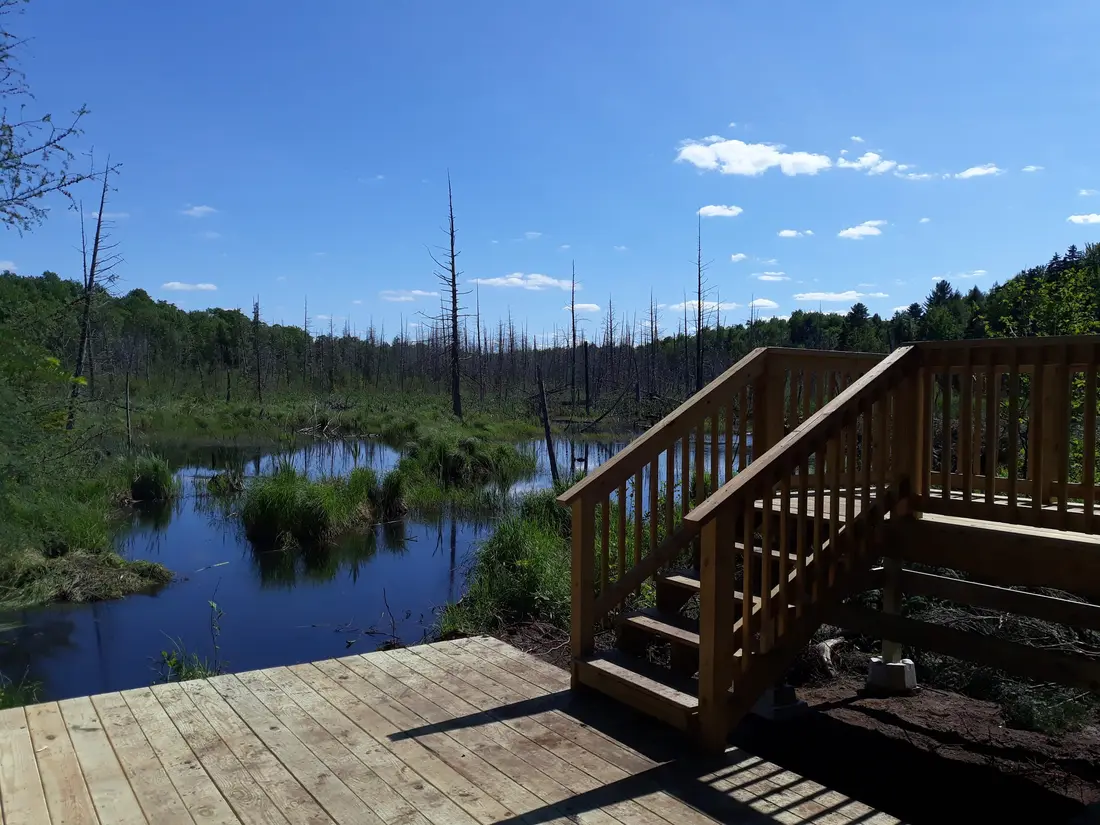
The first of the cabins: a big stone fire pit you see as you walk up, a screened corner of the deck, direct trail access, and a short walk to an observation deck over the pond.
 The Modern Tiny HomeCabin 1 · 2 bd · 1 ba · sleeps 4
More in Lakes & Paddling
Sources
56 references, listed in full at the end of this guide: official park, state, tourism-office and business sources, checked October 2026.
Related guides


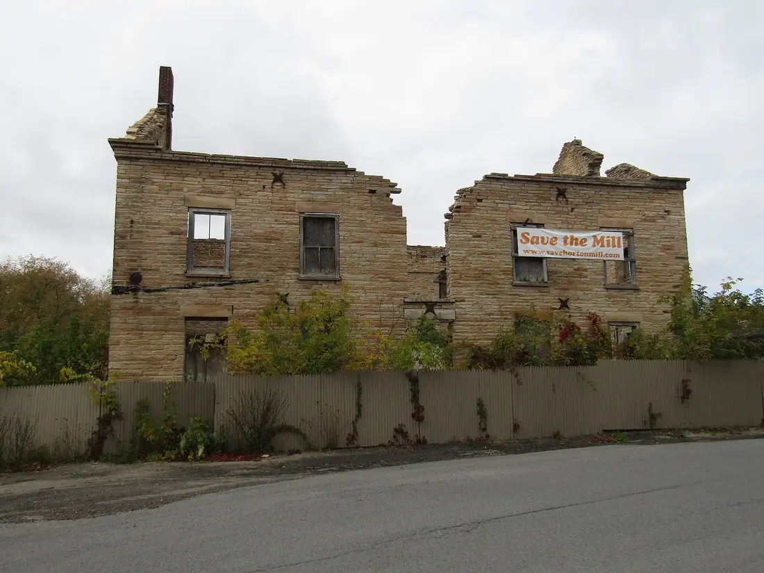
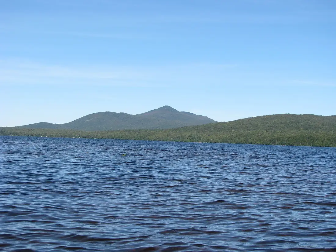
Photos on this page: Ruins of Horton Grist Mill, Malone, NY Front View by OneEagle, CC BY-SA 4.0; Meacham Lake Franklin County New York by Mwanner, CC BY-SA 3.0. Resized and cropped for this site. All photo credits