
Titusville Mountain State Forest
Elephant's Head, High Falls on the Salmon River and the Ledges near Malone: trailheads, gravel roads, gates, distances, hunting seasons and winter use.
Titusville Mountain State Forest is 7,566 acres of state land in the towns of Malone and Bellmont, and it holds three of the closest marked hikes to the cabins. Elephant's Head is a short climb to a lookout over Lake Titus, High Falls is a nearly level walk along the Salmon River to a waterfall, and the Ledges is a steep scramble to a long view south toward Whiteface. The High Falls and Ledges trailheads are each about five road miles from the cabins, and the gate for Elephant's Head is about nine.
The forest and who runs it
The New York State Department of Environmental Conservation, DEC for short, manages the forest from its Region 5 office in Ray Brook, (518) 897-1200 on weekdays. The state set the land aside for reforestation, wildlife management, timber production, recreation and watershed protection, so this is working woods: gravel roads, logged stands, brooks, a big beaver pond and a marsh, with the trails in among them. It is open for recreation all year. Its main uses are hunting, fishing, hiking, camping, cross-country skiing, snowshoeing, snowmobiling and wildlife watching.
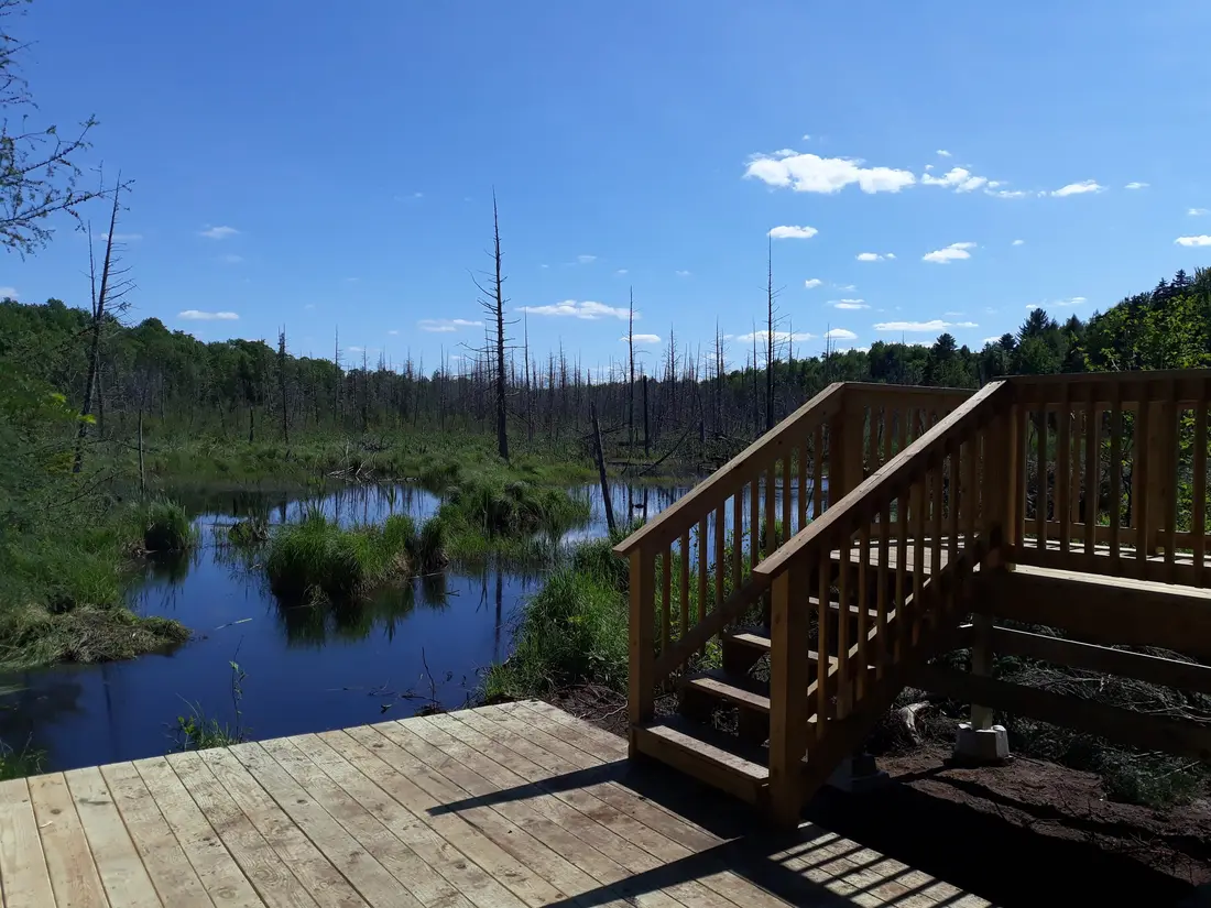
The Adirondack Park boundary, the Blue Line, runs across the forest, so part of it lies inside the Park and part outside. The state map also labels a block of land at the forest's southern edge as the Chazy Highlands Wild Forest, the name of the wild forest unit that takes in Lyon Mountain and its fire tower farther east. In the middle, along the Salmon River east of Studley Hill Road, lies Huckleberry Marsh.
The state map of the forest shows three hiking trails. Elephant's Head is on the west side, off NY 30. The Ledges Trail climbs from Lee Road in the north-central part of the forest. High Falls is on the east side, off Barnesville Road, close to the hamlets of Owls Head and Mountain View. A snowmobile trail crosses the forest in winter, and state forests are open to hunting, so the fall seasons matter here. Both are covered further down.
Henry Titus and the name
Henry Titus bought the big tract in 1830 and tried to start a sawmill, a gristmill and a scythe factory in the settlement then called Titusville. With no way to get goods to market, the venture failed. When the railroad arrived in 1850, his son tried again and did better. Titusville is now the hamlet of Chasm Falls, about two road miles from the cabins, and the dam there is your landmark for the Ledges Trail.
The peaks of this range carry names like Humbug, Immortelle and Elephant Head. On its northern slopes are the ski trails of Titus Mountain, which began in 1960 as Moon Valley, with a rope tow driven off the back wheel of an old Buick sedan.
There is more to do here now than there was a generation ago. In the 1980s, Barbara McMartin's Discover the Adirondacks guidebooks named only one destination in this forest, the Ledges, and her route to them was a bushwhack. Today all three trails are marked, Elephant Head Road was repaired and reopened in 2019, the High Falls trail has newer bog bridges, and Elephant's Head has a kiosk at its upper parking area.
Elephant's Head
Elephant's Head may be the easiest climb to a view anywhere near the cabins: 0.8 mile and 320 feet of climbing from the upper parking area to a lookout at about 1,980 feet over Lake Titus. The name comes from the hill's shape. From the shore of Lake Titus its ridges look like the back, head and trunk of an elephant. The one catch is the access road.
Elephant Head Road and the gate
The trailhead sign is on NY 30 about ten miles south of downtown Malone, on the left side as you drive south, marked for the Titusville Mountain State Forest and the Elephant Head trailhead. There is a small parking area at the gate beside the highway.
Past the gate, Elephant Head Road runs 1.5 miles to the upper parking area. Some state trail listings call it Alan Road; it is the same road. It is dirt and gravel. DEC brushed and graded it, repaired the surface and reopened it in June 2019, and warned then that low-clearance vehicles may have trouble on it. A car that sits low should stay at the highway. Walking the road adds about three miles to the round trip, on a gentle grade past a couple of brooks and a large beaver pond, with trilliums blooming along it in spring.
The gate is not always open. The road is not maintained in winter, and each spring DEC closes the mud gates on seasonal roads on state land until the roads are dry enough for cars and any repairs are done. In 2026 those gates were shut across the region by March 20. In late April 2025 the Elephant Head gate was still closed. There is no set opening date, so from the first snow until late spring, plan on the longer walk and check the state's page for the forest before you go.
The climb
From the upper parking area and kiosk, the trail follows the old woods road for about a tenth of a mile, then turns right at a sign and starts to climb on switchbacks, marked with yellow blazes. It goes gradually for about half a mile over a knob, with Little Humbug Mountain off to the south, then dips slightly before the last pitch. An old wooden staircase takes you up the steepest part. In spring 2025 the stairs were decaying, with threaded rod showing. Test each step, take them slowly and keep children close. From the top of the stairs it is about 200 feet to two big boulders at the lookout.
The top is about twenty minutes from the kiosk. Allow an hour or two for the round trip with time on top, plus the road walk if the gate is closed. The trail is easy to moderate, and mellow enough for hikers of any level who go at their own speed.
What you see from the top
The open view faces north, where someone has cut back the brush. Lake Titus lies below, with Titus Mountain in view and Malone and the St. Lawrence Valley beyond, and on a clear day maybe even Mount Royal in Montreal. A second view, partly blocked by trees, looks toward the Humbug Mountains.
Birch and beech have grown up over the rest of the summit, so in summer the north lookout is the only clear view. With the leaves down in late fall and early spring you can see more through the trees, and on an October visit you may catch a glimpse of Debar Mountain far to the south. For the lake itself, its fishing and its launch, see Lake Titus, Indian Lake and Mountain View.
High Falls on the Salmon River
High Falls, sometimes called Titusville Falls, is where the Salmon River pours through a rock flume in the eastern part of the forest. It is the easiest of the three walks: about three-quarters of a mile each way along the river, roughly 1.5 miles round trip over nearly level ground, an hour or two with time at the falls. Blue markers lead the way.
Barnesville Road and the closed bridge
The trailhead is on Barnesville Road, a gravel road off County Route 27 north of the hamlet of Mountain View. In a phone map, search for Barnesville Road in Owls Head, NY 12969. From downtown Malone, take Duane Street south from Main Street (US 11); it becomes County Route 25, the Duane Road. At 7.6 miles bear left onto County Route 27 (Pond Road) for 3.1 miles, then turn right in Owls Head to stay on Route 27. If you cross the old railroad grade, you have gone about 100 yards too far. Go 1.6 miles and turn right onto Barnesville Road. The small parking spot is on the right at 0.7 mile, next to a bridge that is closed to cars.
In spring 2025 a sign there said the bridge was out, and it was barricaded, though people could still walk across. You do not need to cross it. Coming in from the north end of Barnesville Road, the trail starts on your side of the river, just before the bridge. Drive the gravel slowly, and if it is soft in spring, park sooner and walk the rest.
The walk along the river
The trail heads downstream with the river, sometimes only a few feet from the edge, through ferns and mossy rocks. Some stretches stay muddy even with the bog bridges, and a few spots get overgrown, but most of the trail is well marked and easy to follow. You hear the falls well before you see them. Above the drop the river runs through rapids, and there are a few spots along the bank to look down on the water.
The falls
At the falls the river squeezes into the flume and drops about 80 feet in a tenth of a mile, ending in a vertical splash into a shallow-looking pool. The main drop is a curtain-shaped slide about 30 feet high, with smaller cascades above it. At the bottom the river turns sharply west against a wide rocky shore. A short wooden staircase, often wet with spray, takes you down to the scoured rock at the base, where two big stone blocks face the falls like chairs. Sit in them and you will get damp.
Wet rock and fast water are the hazards. Stay back from the edge on the walk in and at the lip of the drop, and keep children and dogs close on the stairs. People fish below the falls and where the trail skirts the river; you need a New York fishing license, and the fishing trips page has the details.
Do not confuse this waterfall with the High Falls near the village of Chateaugay, a separate falls about 22 road miles from the cabins. That one is in the Chateaugay guide.
The Ledges Trail
The Ledges Trail is the hardest of the three. It runs 0.6 mile from a parking area 0.4 mile up Lee Road to a maintained vista at about 2,120 feet on the side of Titusville Mountain, with 700 feet of climbing. Most of that comes in one short, steep stretch of rock.
Lee Road and parking
Lee Road leaves Studley Hill Road 1.75 miles south of the dam at Chasm Falls, about three-quarters of a mile east of the Titus Mountain upper lodge. Some maps and phone apps label Studley Hill Road as Duane Road, so look for both names. From Malone the state's directions are NY 30 south for 7.68 miles, left on Fayette Road for 3.73 miles, then right on Studley Hill Road; after 1.75 miles the state forest is on both sides of the road.
Lee Road is rough, and a high-clearance vehicle is recommended. The parking area is 0.4 mile up it. Snow can linger into spring: in late April 2025 a car could get only a quarter mile up the road before snow stopped it. If you cannot drive it, there is room for a car or two at a turnaround at the start of the road, and you can walk from there.
The climb and the view
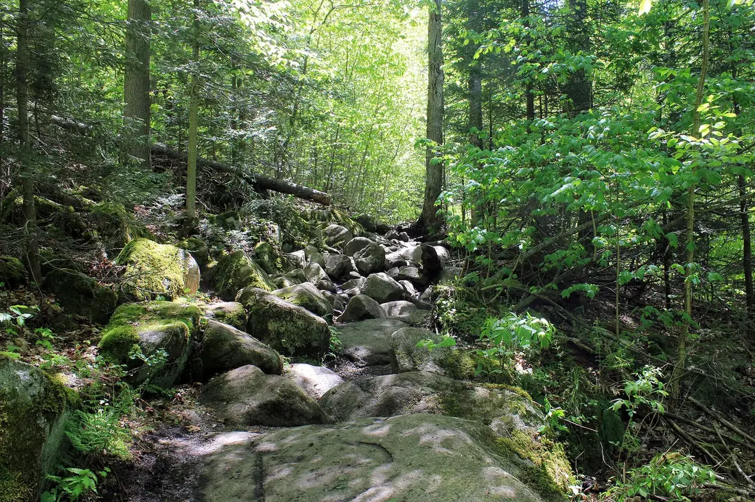
The trail starts to the left of several posts at the parking area and is marked with yellow disks. It rises about 100 feet in the first tenth of a mile, runs along a low ridge for another tenth, then climbs a rock face through scrambles, switchbacks and rock gardens, gaining about 600 feet in a quarter mile. The path is faint in places and the markers are far apart. About a third of the way up, bear left. Carry a map and compass or a downloaded map, and turn back if you lose the markers.
The trail tops out on a rocky outcrop above the headwaters of the Salmon River. To the south you see several ranges: Whiteface, Esther and, behind a shoulder of the Loon Lake Mountains, Algonquin, with Debar Mountain big in the foreground. A yellow disk marks a short spur to the south with a better view, and there are more vistas just west of the trail's end. One of Titusville Mountain's summits is a short walk to the west if you want a top. On the way down, look for traces of old pasture and logging along the ridge.
Changes on the way
DEC started a management plan for the state forests of northern Franklin County, Titusville among them, in 2014. By spring 2025 no draft had been released, but DEC said the plan would recommend a gate at the bottom of Lee Road, closed in mud season and whenever the road is in poor shape, an eight-car parking area with a sign and kiosk at the bottom of the road, and a reroute of the trail onto a more sustainable line. None of it was in place at last report, so check the state's page for the forest before you go.
Which hike to choose
| Hike | Distance | Climb | Markers | Trailhead | From the cabins |
|---|---|---|---|---|---|
| Elephant's Head | 0.8 mile each way from the upper lot, 1.5 miles more each way from the gate | 320 feet from the upper lot | Yellow blazes | Elephant Head Road, off NY 30 | About 9 road miles to the gate |
| High Falls | About 0.75 mile each way | Nearly level | Blue | Barnesville Road, off County Route 27 | About 5 road miles |
| The Ledges | 0.6 mile each way from the lot 0.4 mile up Lee Road | 700 feet | Yellow disks | Lee Road, off Studley Hill Road | About 5 road miles |
Pick High Falls for children, a hot day or a short outing. Pick Elephant's Head for a view without much effort, on a day the gate is open. Pick the Ledges if you like scrambling, want the long view south to the High Peaks and are comfortable following a faint trail.
Getting there from the cabins
High Falls and the Ledges are each about five road miles from the cabins. For High Falls, drive into the hamlet of Owls Head, then follow County Route 27 south about 1.6 miles to Barnesville Road; allow about 15 minutes. For the Ledges, go through Chasm Falls and south on Studley Hill Road to Lee Road, again about 15 minutes. The two trailheads are about seven road miles apart if you want both in one morning.
Elephant's Head is the long way around. Go through Chasm Falls, west on Fayette Road to NY 30, then south about 2.4 miles to the sign. That is about nine road miles to the gate, roughly 20 minutes, and 10.7 miles to the upper lot when the gate is open.
The trailheads are just parking spots, with no water and nothing for sale. Fill bottles at the cabin, and do the shopping in Malone on the way in; see groceries and supplies.
Hunting seasons
State forests are open to public hunting, and that includes this one. You can hike here in every season, but dress for it. DEC asks hikers to wear blaze orange or blaze pink so hunters can see them from farther away, and you may meet hunters carrying guns or bows on the trails. Put something bright on the dog as well.
The forest lies in Wildlife Management Unit 5C, in the Northern Zone. Its 2026 seasons:
- Black bear: September 19 to December 6.
- Deer, early bowhunting: September 27 to October 23.
- Youth deer hunt, for hunters 12 to 15: October 10 to 12.
- Deer, early muzzleloader: October 17 to 23.
- Regular season for deer and bear: October 24 to December 6.
- Spring turkey: May 1 to 31, from half an hour before sunrise until noon, after a youth weekend in late April.
The deer and bear seasons here end December 6. The extra week of late bow and muzzleloader hunting, December 7 to 13, applies only in other units. Dates shift every year, so check DEC's season pages before a fall or spring visit. Spring turkey hunting stops at noon each day, which makes May afternoons the quiet time in the woods.
Winter in the forest
Snow changes how you get in. Elephant Head Road is not maintained in winter, so you start at the gate on NY 30. When the Shatagee Woods chapter of the Adirondack Mountain Club set a ski and snowshoe outing here for January 2025, it put the round trip at 4.2 miles with 577 feet of climbing. The first 1.5 miles follow the gradual road and suit skis or snowshoes. The last 0.7 mile is narrower and moderately steep in places, hard going on skis, so snowshoes are the better tool for the climb. For more places to ski and snowshoe, see cross-country skiing and snowshoeing.
Snowmobiles use the forest too. Secondary trail S78, listed at 7.38 miles from Owls Head, is a there-and-back ride through the state forest. On the state map, the sled route through the forest follows Barnesville Road, County Route 27, Run Road, California Road, Studley Hill Road and Lee Road before heading off through the woods toward NY 30. If you snowshoe to High Falls or walk up Lee Road in winter, keep to the side and listen for sleds. The main corridor nearby is C7; see snowmobiling from the cabin door. In spring DEC closes the snowmobile trails at the same time as the mud gates, by March 20 in 2026.
Camping and the rules
You can camp on state forest land without a permit for up to three nights in one spot, in a group of fewer than ten. Pitch at least 150 feet from any road, trail, spring, stream, pond or other water, unless a Camp Here disk marks a site. A larger group, or a longer stay in one place, needs a permit from the local Forest Ranger. The state map of this forest shows no developed campsites.
Carry out everything you carry in. DEC asks hikers to keep dogs under control, to leash them when meeting other hikers, and to bag and carry out their waste. On a narrow trail, hikers going downhill step aside for those coming up.
Kids, dogs and slower walkers
High Falls is the pick for children and anyone who does not want to climb. It is short and close to flat. Hold hands where the trail runs near the bank and on the wet stairs at the bottom, and keep children off the rock at the lip of the drop.
Elephant's Head suits older children who want a summit. The climb is short and steady, and the only awkward spot is the old staircase near the top. If the gate is closed, the 1.5-mile road walk in is easy but long.
The Ledges are steep scrambling on rock with a faint trail. Leave anyone unsteady on rock for another day. None of the three trails works for a wheelchair.
Dogs can do all three on a leash. Watch them near the water at High Falls and on the rock at the Ledges, and carry water for them. The cabins take pets for a fee; see bringing your dog for the rest.
Safety
Do not count on a phone signal at the trailheads. Download a map before you leave the cabin, tell someone where you are going, and carry water, a warm layer and a light, even for a short hike. If you get lost or hurt, stay calm and stay put. Call 911 and ask for a DEC Forest Ranger, or call the Forest Ranger dispatch at 1-833-NYS-RANGERS (1-833-697-7264). The nearest hospital is in Malone; see health and safety.
Check yourself, the children and the dog for ticks after every walk, and pack a head net for late spring. The bug guide covers ticks, mosquitoes and black flies.
When to go
Spring brings snowmelt to the river, the gates open once the roads dry, and black flies. The flies are worst from late May into early June, and they bite most in the humid hours a few hours after sunrise and an hour or two before sunset. A walk in the dry heat of midday is the better bet in those weeks.
In summer the leaves close in the views at Elephant's Head down to the north lookout, and the spray at High Falls makes it the cool choice on a hot afternoon.
Fall brings the color and the hunting seasons at the same time; see the fall foliage guide for timing and the list above for the hunting dates. Winter is for snowshoes and skis on the Elephant Head road.
A morning in the forest
Two of the three hikes fit before lunch. Leave the cabins around eight and walk High Falls first, an hour or two with time at the falls. Then drive about seven road miles to Lee Road for the Ledges. You can be back at the cabin in the early afternoon, with the hot tub waiting. Save Elephant's Head for a day when the gate is open, or for a winter day on snowshoes.
For a summit instead of a second walk, pair High Falls with Owls Head. Its trailhead in the hamlet of Owls Head is about 2.5 road miles from the High Falls parking spot, and the climb is 1.3 miles with about 725 feet of gain to ledges over Indian Lake and Mountain View Lake. The Owls Head guide has the parking and the route.
Nearby
Lake Titus, below Elephant's Head, and the two lakes at Mountain View are covered in the lakes guide linked above. For longer days, the Debar Mountain Wild Forest around Meacham Lake, about 20 road miles south, holds Debar Mountain itself, the peak that fills the foreground from the Ledges. The hiking overview lists every walk around the cabins in order of distance from the door.
Questions
Can I drive a regular car to the Elephant's Head trailhead?
To the gate on NY 30, yes. The 1.5-mile Elephant Head Road beyond it is dirt and gravel, and DEC warns that low-clearance vehicles may have trouble. The gate is also shut in winter and in spring mud season, and in late April 2025 it was still closed. If it is closed or your car sits low, park by the highway and walk the road, which adds about three miles to the round trip.
How tall is High Falls in the Titusville Mountain State Forest?
The main drop is a curtain-shaped slide about 30 feet high. Counting the flume and the cascades above it, the Salmon River falls about 80 feet in a tenth of a mile before turning west at the base. The trail to it is about three-quarters of a mile each way and nearly level.
Which Titusville hike is best for children?
High Falls. It is short and close to flat, with blue markers along the river. Hold hands where the path runs near the bank and on the wet stairs at the bottom. Elephant's Head suits older children who want a summit, and the Ledges are steep rock scrambling best left to confident hikers.
Is the forest open to hikers during hunting season?
Yes. State forests are open to hunting, and hikers share the woods with hunters. The forest is in Wildlife Management Unit 5C, where the 2026 regular deer and bear season runs October 24 to December 6, with bear and bow seasons starting in September. Wear blaze orange or blaze pink, put something bright on the dog, and check the full list on this page.
Can I snowshoe or ski in the Titusville Mountain State Forest?
Yes. Elephant Head Road is not maintained in winter, so start at the gate on NY 30; the round trip to the summit is about 4.2 miles with 577 feet of climbing. The road suits skis, but the last 0.7 mile is steep in places, so bring snowshoes. Sleds use Barnesville Road and Lee Road in winter, so keep to the side there. See skiing and snowshoeing.
How far is the state forest from the cabins?
The High Falls and Ledges trailheads are each about five road miles away, roughly 15 minutes. Elephant's Head is farther around by road, about nine miles to the gate on NY 30 and 10.7 miles to the upper parking area. Owls Head, the other close hike, is about four road miles away; see the Owls Head guide.
Sources
Facts on this page were checked against these sources in October 2026. Hours, fees and schedules change; confirm before you go.
- New York State Department of Environmental Conservation dec.ny.gov/places/titusville-mountain-state-forest
- New York State Department of Environmental Conservation extapps.dec.ny.gov/docs/lands_forests_pdf/maptitusvillemtn.pdf
- content.govdelivery.com content.govdelivery.com/accounts/NYSDEC/bulletins/24c819f
- Adirondack Explorer adirondackexplorer.org/recreation/titusville-triad-three-hiking-opport
- Visit Malone visitmalone.com/hiking/elephant-head
- Visit Malone visitmalone.com/hiking/high-falls-titusville-mountain
- Visit Malone visitmalone.com/blog/2019/09/top-5-fall-hikes-malone
- pureadirondacks.com pureadirondacks.com/blogs/adirondack-hiking/elephants-head-trail
- adirondackfamilytime.com adirondackfamilytime.com/2017/10/easy-short-adirondack-hikes-hike-to.h
- bobbieswaterfalls.com bobbieswaterfalls.com/bobbieswaterfalls-waterfalls-of-new-york-state-a
- New York State Department of Environmental Conservation dec.ny.gov/news/press-releases/2026/3/dec-closes-seasonal-access-roads
- perugazette.com perugazette.com/2026/03/20/dec-closes-seasonal-access-roads-and-associ
- adirondackbasecamp.com adirondackbasecamp.com/2014/12/dec-management-plan-franklin-county-for
- Adirondack Mountain Club shatageeadk.org/2025/01/01/ski-snowshoe-elephants-head/
- Visit Malone visitmalone.com/blog/2019/01/snowmobile-trails-where-start-where-stop
- Franklin County tourism (Always Franklin) alwaysfranklin.com/recreation/snowmobiling
- New York State Department of Environmental Conservation dec.ny.gov/things-to-do/hunting/deer-bear/seasons
- New York State Department of Environmental Conservation dec.ny.gov/news/press-releases/2026/9/dec-announces-2026-27-early-big-
- New York State Department of Environmental Conservation dec.ny.gov/news/press-releases/2026/4/dec-announces-annual-youth-turke
- services6.arcgis.com services6.arcgis.com/DZHaqZm9cxOD4CWM/arcgis/rest/services/Wildlife_Ma
- New York State Department of Environmental Conservation dec.ny.gov/news/press-releases/2025/10/dec-reminds-new-yorkers-to-hunt
- New York State Department of Environmental Conservation dec.ny.gov/news/press-releases/2024/10/dec-reminds-outdoor-enthusiasts
- New York State Department of Environmental Conservation dec.ny.gov/things-to-do/camping/state-land-rules
- New York State Department of Environmental Conservation dec.ny.gov/things-to-do/hiking/trail-etiquette
- New York State Department of Environmental Conservation dec.ny.gov/environmental-protection/public-safety/forest-rangers
- New York State Department of Environmental Conservation dec.ny.gov/places/chazy-highlands-wild-forest
- New York State Department of Environmental Conservation dec.ny.gov/places/debar-mountain-wild-forest
- Adirondack Explorer adirondackexplorer.org/environment/natural-history/bug-season-tips-for
- Adirondack Explorer adirondackexplorer.org/recreation/owls-head-a-popular-hike-in-the-othe
- OpenStreetMap (road distances) openstreetmap.org/
In this guide
Stay nearby
The first of the cabins: a big stone fire pit you see as you walk up, a screened corner of the deck, direct trail access, and a short walk to an observation deck over the pond.
 The Modern Tiny HomeCabin 1 · 2 bd · 1 ba · sleeps 4
More in Trails & Hiking
Sources
30 references, listed in full at the end of this guide: official park, state, tourism-office and business sources, checked October 2026.
Related guides


Photos on this page: Azure Mountain Fire Tower by Mwanner, CC BY-SA 3.0. Resized and cropped for this site. All photo credits