
Owls Head in the Sable Highlands
The 1.3-mile Owls Head hike near Malone: parking on Station Road, the climb past an old iron mine, the view over the Sable Highlands, land rules and seasons.
Owls Head is the small mountain over the hamlet of Owls Head, about four road miles and ten minutes by car from the cabins. Its trail climbs 1.3 miles and about 725 feet to open rock ledges that look south and east over Indian Lake, Mountain View Lake and the peaks of the Sable Highlands, with Whiteface on the far horizon. Local people and visitors have climbed it for generations, and it suits children who can handle a muddy, rooty trail.
Which Owls Head this is
Several Adirondack mountains share the name. This one rises over the hamlet of Owls Head in the Town of Bellmont, Franklin County, about ten miles south of Malone, on the northern edge of the Adirondack Park. It is the only one with a hamlet of the same name at its foot. Others include an Owls Head near Elizabethtown, one in Keene, and one near Long Lake, where a 35-foot fire tower built in 1919 stands at the end of a trail about three miles long.
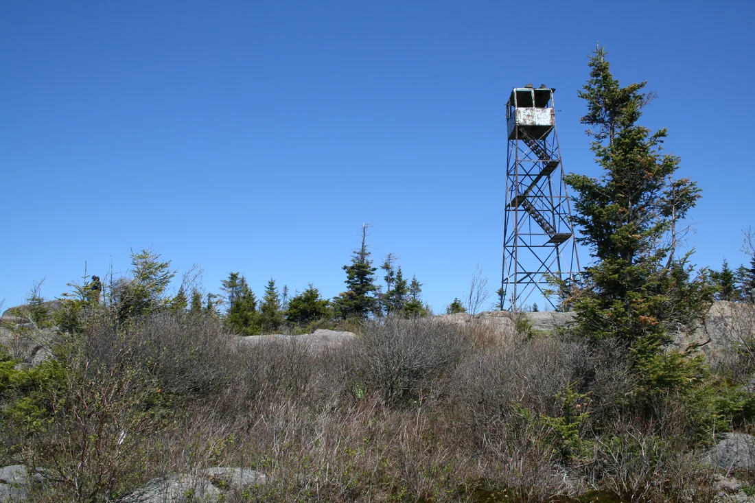
With several mountains of one name in the Park, check that the trail your map app finds is in Owls Head, NY 12969, before you set off. This one has no fire tower, only rock ledges and the view. The Long Lake mountain is a much bigger outing, 3.05 miles each way with about 1,600 feet of climbing.
If you read that an Owls Head trail is closed on weekends, that is the one in Keene. Its trail crosses private land for all but the last 0.1 mile, and since 2017, after parked cars blocked the landowners' road, it has been open on weekdays only. That rule has nothing to do with this mountain.
For paper maps, the U.S. Geological Survey's 7.5-minute quadrangles for this corner include sheets named Owls Head and Chasm Falls. DEC's 2009 recreation plan for the Sable Highlands carries maps of the public use areas, and its Map 1 covers Owls Head and the Ingraham West tract next to it.
Owls Head at a glance
| Distance | 1.3 miles to the main ledges, about 2.7 miles round trip |
|---|---|
| Climb | About 725 to 750 feet |
| Summit | About 2,250 feet |
| Markers | Blue disks on the trail, nothing at the trailhead |
| Time | About two hours round trip with a stop on top |
| Trailhead | Station Road, off Ragged Lake Road in the hamlet of Owls Head |
| Parking | Road shoulder or an unmarked pull-off in the power-line corridor; no sign, no register |
| Land | A public use area on the Sable Highlands easement, with private land along part of the trail |
| From the cabins | About 4 road miles, roughly 10 minutes |
The trailhead on Station Road
There is no sign for the mountain and no marker at the trailhead, so go by the landmarks. In the hamlet, find the junction of County Route 27 and Ragged Lake Road. Drive east on Ragged Lake Road for 0.2 mile and turn left onto Station Road, a dead-end lane heading north, across the road from the volunteer fire station at 46 Ragged Lake Road. Some map apps do not show the name Station Road, and some label this first stretch of Ragged Lake Road as Drain Pond Road, so count the 0.2 mile and watch for the fire station.
The lane runs toward a high-voltage power line. Where it looks as if you are about to drive into someone's garage, a rough gravel track jogs left and then right under the wires. Hikers park on the shoulder of Station Road or along that power-line corridor, where there is an unmarked pull-off just past the second wooden pole. Walk the corridor a short way, and the trail leaves it on the right, worn and easy to see. People live along this lane, so leave it and every driveway clear.
There is no official lot, kiosk or trail register. In its 2009 recreation plan for the Sable Highlands, DEC proposed off-street parking and a trailhead register here once the access questions were settled, along with a reroute of the trail. Neither had been built by 2020, and in 2022 the trailhead still had no sign or marker of any kind. Check DEC's Sable Highlands page before you go in case that has changed.
The trail
The trail began as a herd path, worn in by hikers over many decades, and DEC has since marked it with blue disks. It climbs the main summit of a small group of hills that the state's plan calls the Owls Head Range. It is a moderate hike: 1.3 miles to the main ledges with 725 to 750 feet of climbing, about 2.7 miles round trip, topping out near a summit of about 2,250 feet. Two hours is plenty for most people, with time to sit on the rock.
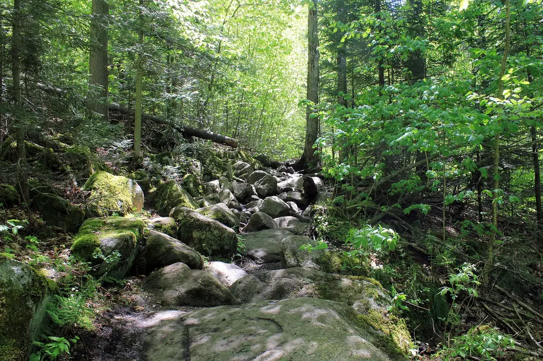
The first stretch is easy walking through the woods. Once the trail starts up the flank of the mountain it gets rough: rocks, roots, little streams running down the tread, and several kinds of mud. It was never built and hardened the way newer trails are, and in 2009 DEC rated it in fair to poor condition. Side paths have formed where people step around the wet spots, which only spreads the damage. Stay in the main path, even if your boots pay for it.
Just past the one-mile mark you reach an old mine shaft, now usually called the bear cave. Here the trail doglegs to the left for the only steep pitch of the climb, and it eases soon after. A side path on the right leads to an overlook of the hamlet, looking southwest toward the mountains around Debar Pond. The main trail continues to the ledges at 1.3 miles.
On the way down, take the steep pitch above the mine shaft slowly. Wet roots and mud are easier to slip on in descent, and poles help.
The view from the ledges
The main ledges face south and east. Below are Indian Lake and Mountain View Lake. Beyond them stand the peaks of the Sable Highlands: Norton Peak at 2,870 feet, Ragged Lake Mountain at 2,750 feet, Sugarloaf Mountain, Wolf Pond Mountain and the Elbow Range, with many more peaks behind. Due south, perhaps 40 miles off, are the familiar outlines of Whiteface and Esther.
The view holds up even before the leaves come out. On an early May visit the hills were still brown, and the outlook was well worth the climb. From the side overlook on the way up you get a second angle, down onto the hamlet and across to the hills around Debar Pond. To see the two lakes from the water rather than from above, see the lakes guide.
The iron mine on the mountain
The shaft past the one-mile mark is what is left of a small iron mine. An early hotel owner worked it, then gave it up because the ore was high in sulfur, though not before thousands of tons of rock had come out of the hill.
Mining and timber went together in this country. The land that became the Sable Highlands has been logged for well over a century, much of the logging was tied to the area's mining history, and large amounts of wood were cut to make charcoal.
Look at the shaft from the trail. Keep children and dogs out of the opening; old mine workings are not a place to explore.
Whose land this is
Owls Head is part of the Sable Highlands, a block of commercial forest in eastern Franklin County and western Clinton County, all of it north of NY 3. Domtar, the paper company, acquired the land in 1962 and ran it as a working forest for pulpwood and sawlogs, leasing parts of it to private recreation clubs. In 2004 Domtar sold its roughly 104,000 acres in the Park: about 84,000 acres to Chateaugay Woodlands, a Lyme Timber company, and about 20,000 acres to The Nature Conservancy. The state bought the conservancy's share for $9.8 million in late 2008, Lyon Mountain included, and most of it became Forest Preserve. Two months later the state paid $10.8 million for conservation easements on the other 84,000 acres. Logging continues under the easement. Lyme later sold its company to the Forestland Group, and the easement, with its public rights, stays with the land.
It is a big, wet piece of country. The easement lands take in shoreline on 59 lakes and ponds that cover 2,631 acres, and more than 400 miles of streams, draining both north to the St. Lawrence and east to Lake Champlain.
The easement opens 14 public use areas, about 28,100 acres in all, where anyone may hike, bike, paddle, hunt, fish and cross-country ski. Most of the rest, close to 56,000 acres, is leased to private hunting and fishing clubs and is off limits to the public, apart from designated corridors across it. The Owls Head public use area covers 598 acres around the summit.
The trail is older than Domtar's ownership. As it was laid out, it crosses land belonging to two neighboring private owners on its way up. The state planned either to move it fully onto the public area or to secure access across those parcels, and as of 2020 that work had not been done. Stay on the marked trail, do not wander off the summit onto leased land, and respect posted signs.
Other public land in the Sable Highlands
Owls Head is the one well-known hiking trail on the easement lands, and for most visitors it is the place to go. The rest takes more effort. Norton Peak, the 2,870-foot summit in the view, lies inside the Cold Brook public use area, so hikers may bushwhack to its top, but there is no trail. As of 2020, nearby Haystack and Wolf Pond mountains, outside the public area, were off limits until a planned trail is built, and the Ingraham West public use area, north of Owls Head, had no legal access at all, pending a trail the state intends to build to it from the Owls Head area.
Of the 23 parking areas the 2009 plan proposed, only nine had been built by 2020. Many corridors lacked signs, and the edges of the public areas were not marked, so it is easy to stray onto club land without knowing it. The Sugarloaf public use area, the largest at 5,460 acres, and the 561-acre Barnes Brook area in Bellmont both lacked official parking. Unless you are good with a map and compass and have studied the state's maps, stick to Owls Head and the marked trails of the Titusville Mountain State Forest.
DEC has built two other short trails on the easement lands, both on old woods roads in the Town of Franklin, in the southern part of the Sable Highlands and a long drive from the cabins. One runs about a third of a mile from a parking area on County Route 26, 9.1 miles north of NY 3, to the outlet of Fishhole Pond, a tributary of Plumadore Brook. The other leaves a parking area 1.6 miles down Goldsmith Road from NY 3 and takes about 20 minutes under tall white pines to a wheelchair-friendly campsite with a privy, a fire pit and a fishing platform on the North Branch of the Saranac River. Of the 56 campsites the plan allows, nine had been built by 2020. That year, most people met on the easement lands were riding ATVs, and hikers were scarce.
The hamlet below
The hamlet sits on County Route 27 in the Town of Bellmont. In 1822 the state offered free land in Bellmont to settlers who would clear and fence 15 acres and build a house, and more land to anyone who would build a gristmill or sawmill.
Owls Head was once known as the Ice Box of the North. Two researchers from Rensselaer Polytechnic Institute tested the claim in 1936 and found other Adirondack spots just as cold or colder, though they allowed that a place on the northern rim of the mountains, open to wind off the plains, might seem colder. The nickname was still in use in the 1970s.
The railroad came through in 1892, when William Seward Webb's line across the northern Adirondacks opened with through trains from Herkimer to Montreal. It became the New York Central's Adirondack Division, and its old bed still runs through the hamlet. Through passenger trains between Utica and Montreal ended in 1953, commuter runs from Malone to Montreal lasted until 1958, and in 1960 the line was cut between Gabriels and Malone.
The Salmon River, which runs north through Chasm Falls and Malone, flows out of the Sable Highlands, and the state lists it as a recreational river. High Falls on that river, in the state forest a couple of miles from the hamlet, is an easy walk to add to a morning on Owls Head.
Getting there from the cabins
The hamlet of Owls Head is about 3.5 road miles from the cabins, and the trailhead about four, roughly ten minutes. Drive into the hamlet on the county roads, turn east onto Ragged Lake Road at County Route 27, and look for Station Road on the left after 0.2 mile.
Coming back from Malone, the hamlet is 10.7 miles from Main Street: south on County Route 25, the Duane Road, for 7.6 miles, then the left fork onto County Route 27 for the last 3.1. That puts Owls Head right on the way home from a grocery run; see groceries and supplies. From Lake Placid, the hamlet is a little over an hour's drive north.
Nothing is for sale at the trailhead, so bring water and a snack from the cabin. Guests have made the climb from the cabins. One wrote after a November stay:
"My friend & I enjoyed hiking Owls Head Mtn trail"
Hunting season on the easement lands
Hunting is allowed on conservation easement lands, and the leased land around the public area is hunting-club country. From mid-September through early December, wear blaze orange or blaze pink on this trail, and give the dog a bright vest or bandanna.
Owls Head lies in Wildlife Management Unit 5C. In 2026, bear hunting here runs from September 19, deer bowhunting begins September 27, and the regular firearms season for deer and bear lasts from October 24 through December 6. In spring, turkey hunters are out on May mornings until noon. The Titusville guide lists every 2026 season, and DEC posts new dates each year.
A quiet weekday is no guarantee of empty woods, so dress bright whenever a season is open. DEC's advice for sharing the woods in the fall goes beyond color: tell someone your route and when you will be back, dress for the weather, and carry a light, a map and a first-aid kit, because fall afternoons end early.
Winter and snowmobiles
In winter, bring snowshoes and traction devices for your boots. The steep pitch above the mine shaft and the open rock on top are where you will want them. Start early in the day, since winter daylight is short.
On the Sable Highlands easement lands, groomed snowmobile trails are limited to public roads and the corridors set aside for sleds. The Owls Head trail is a foot trail. The sleds you hear are on the network nearby: the C7 corridor runs south from Malone along the Salmon River, and secondary trail S78, listed at 7.38 miles from Owls Head, is a there-and-back ride into the Titusville forest. See snowmobiling from the cabin door for registration and the routes.
Children and dogs
On one warm, sunny Saturday in early May 2020, a hiker counted 15 other groups on this trail, most of them with children. It is a moderate climb, the steep part is short, and the mine shaft and the side overlook give children something to aim for along the way. The mud and roots slow the pace more than the grade does, so good shoes matter more than a big pack. If a child runs out of steam, the bear cave makes a natural turnaround: it is past the one-mile mark, and the steepest climbing starts there.
At the top, the ledges are open rock. Keep children close there and at the side overlook. Keep the dog on a short leash on the rock and whenever you meet other hikers, and carry water for it. For more, see bringing your dog and the cabins for families.
For an injury on the mountain, call 911 and ask for a DEC Forest Ranger; the nearest hospital is in Malone, and health and safety has the details.
When to go
Early May, before the leaves, gives a brown but open view and a muddy trail. Black fly season peaks in late May and early June; climb at midday on a dry, sunny day in those weeks, and see the bug guide for the rest. Summer is green. In fall the color on the Sable Highlands comes during the hunting seasons, so wear orange and see the fall foliage guide for timing.
A sunny weekend brings a crowd, by local standards. Go early, or on a weekday, if you want the ledges to yourself.
What to bring
- Waterproof boots, or shoes you do not mind ruining. Mud is the main obstacle on this trail.
- Trekking poles for the steep pitch above the mine shaft, especially on the way down.
- Water and a snack. There is nothing at the trailhead, and any water you find on the mountain needs treating before you drink it.
- A warm layer and a wind shell for sitting on the open ledges.
- A map downloaded to your phone. The trailhead has no sign, and the side paths around the wet spots can pull you off line.
- A head net in late May and June, and traction devices from late fall into spring.
- Something bright to wear in the hunting seasons, for you and the dog.
Respect the neighbors on the way in and out. Keep voices down at the trailhead early in the morning, turn around in the power-line corridor rather than in a driveway, and carry out everything you bring, including dog waste.
Make a morning of it
Leave after breakfast and you can be on the trail in about ten minutes and back at the car in about two hours. Then pick one. Drive about 2.5 miles south to the easy riverside walk to High Falls, or spend the afternoon on the lakes you looked down on from the top. Lunch back at the cabin, and the hot tub after. If the shoulder of Station Road is full on a sunny weekend, do High Falls first and come back to Owls Head later in the day.
Just west and south of the hamlet, the Titusville Mountain State Forest has three more short hikes: Elephant's Head over Lake Titus, the Ledges on Titusville Mountain, and High Falls. For a fire tower summit, Loon Lake Mountain is the closest to the cabins, and the Debar Mountain Wild Forest to the south has the bigger days. The wildlife guide covers what you might see along the way.
Questions
Where do you park for the Owls Head hike near Malone?
There is no official lot and no sign. From the junction of County Route 27 and Ragged Lake Road in the hamlet of Owls Head, drive east 0.2 mile and turn left onto Station Road, the dead-end lane across from the volunteer fire station. Park on its shoulder or at the unmarked pull-off in the power-line corridor at the end, keeping driveways clear. The trail leaves the corridor on the right.
How long does the Owls Head hike take?
About two hours round trip for most people, with time on the ledges. It is 1.3 miles each way with roughly 725 to 750 feet of climbing. The only steep pitch starts at the old mine shaft just past the one-mile mark, and the mud and roots slow the pace more than the grade does.
Is the Owls Head trail on private land?
Partly. The summit is in the 598-acre Owls Head public use area on the Sable Highlands conservation easement, which is open to the public. On the way up, though, the trail crosses land of two private owners, and the state's plan to reroute it had not been carried out as of 2020. Stay on the blue-marked trail and respect posted land.
Is this the Owls Head with a fire tower?
No. The fire tower stands on the Owls Head near Long Lake, a climb of 3.05 miles each way much farther south. This Owls Head, in the Town of Bellmont about ten miles south of Malone, has open rock ledges and no tower. Check that your map app shows Owls Head, NY 12969 before you drive.
Can children hike Owls Head?
Yes. It is a moderate climb suited to families, and on one sunny May Saturday most of the groups on the trail had children. Expect mud and roots, hold hands on the open ledges, and use the old mine shaft past the one-mile mark as a turnaround if a child tires. See the cabins for families.
Can you hike Owls Head during hunting season?
Yes, but dress for it. Hunting is allowed on conservation easement lands, and private hunting clubs lease the land around the public area. Owls Head is in Wildlife Management Unit 5C, where the 2026 bear season opens September 19 and the regular deer and bear season runs October 24 to December 6. Wear blaze orange or pink. Every 2026 date is in the Titusville guide.
Sources
Facts on this page were checked against these sources in October 2026. Hours, fees and schedules change; confirm before you go.
- Adirondack Explorer adirondackexplorer.org/recreation/owls-head-a-popular-hike-in-the-othe
- Adirondack Explorer adirondackexplorer.org/recreation/owls-head-malone/
- Adirondack Explorer adirondackexplorer.org/general/missed-opportunities-sable-highlands/
- New York State Department of Environmental Conservation extapps.dec.ny.gov/docs/lands_forests_pdf/sableirmp1.pdf
- New York State Department of Environmental Conservation dec.ny.gov/places/sable-highlands-conservation-easement-tract
- content.govdelivery.com content.govdelivery.com/accounts/NYSDEC/bulletins/1a10418
- townofkeeneny.com townofkeeneny.com/hiking-information/
- New York State Department of Environmental Conservation dec.ny.gov/things-to-do/hiking/adirondack-backcountry/backcountry-info
- tupperlake.com tupperlake.com/hiking/owls-head-mountain
- nycshs.blogspot.com nycshs.blogspot.com/2008/10/adirondack-division.html
- digitalfirehouse.com digitalfirehouse.com/info/ny/franklin/owls-head/owls-head-mountain-vie
- OpenStreetMap (road distances) openstreetmap.org/way/95182745
- Visit Malone visitmalone.com/hiking/high-falls-titusville-mountain
- Visit Malone visitmalone.com/blog/2019/01/snowmobile-trails-where-start-where-stop
- Franklin County tourism (Always Franklin) alwaysfranklin.com/recreation/snowmobiling
- New York State Department of Environmental Conservation dec.ny.gov/news/press-releases/2025/10/dec-reminds-new-yorkers-to-hunt
- New York State Department of Environmental Conservation dec.ny.gov/news/press-releases/2024/10/dec-reminds-outdoor-enthusiasts
- New York State Department of Environmental Conservation dec.ny.gov/things-to-do/hunting/deer-bear/seasons
- New York State Department of Environmental Conservation dec.ny.gov/news/press-releases/2026/4/dec-announces-annual-youth-turke
- services6.arcgis.com services6.arcgis.com/DZHaqZm9cxOD4CWM/arcgis/rest/services/Wildlife_Ma
- New York State Department of Environmental Conservation dec.ny.gov/things-to-do/hiking/trail-etiquette
- New York State Department of Environmental Conservation dec.ny.gov/environmental-protection/public-safety/forest-rangers
- Adirondack Explorer adirondackexplorer.org/environment/natural-history/bug-season-tips-for
- The cabin's Airbnb listing airbnb.com/rooms/53628054
- OpenStreetMap (road distances) openstreetmap.org/
In this guide
Stay nearby
The first of the cabins: a big stone fire pit you see as you walk up, a screened corner of the deck, direct trail access, and a short walk to an observation deck over the pond.
 The Modern Tiny HomeCabin 1 · 2 bd · 1 ba · sleeps 4
More in Trails & Hiking
Sources
25 references, listed in full at the end of this guide: official park, state, tourism-office and business sources, checked October 2026.
Related guides


Photos on this page: Saint Regis Fire Tower 2010 t6 by John Sweeney, CC BY-SA 3.0. Resized and cropped for this site. All photo credits