
The Salmon River in Malone
The Salmon River from Chasm Falls through Malone: the 1853 Horton Gristmill, trout stocking and public fishing rights, river walks, paddling and flood cautions.
The Salmon River comes down out of the Sable Highlands, passes a couple of miles from the cabins at Chasm Falls and runs north through the middle of Malone on its way to the St. Lawrence. Its falls powered the mills that built the village, and it is still known across the region for trout, stocked by the state every spring. Malone is about ten road miles from the cabins and Chasm Falls about two. This page follows the river: the falls and dams, the 1853 stone gristmill, the walks and the park beside it, where to fish and paddle, and when to keep back from it.
From the Sable Highlands to the St. Lawrence
The Salmon starts in the Sable Highlands, the big tract of working forest to the south and east of the cabins. From the outlet of Elbow Ponds the state classes it as a recreational river for about 12.3 miles, to the point where it leaves the Adirondack Park. Along the way it runs into Mountain View Lake, which is the river held back by a dam first built in the 1850s, then runs on past High Falls in the Titusville Mountain State Forest and over Chasm Falls. Below Chasm Falls it passes Whippleville and runs into the village of Malone, then on north past Westville and Fort Covington. It crosses into Quebec and runs about 6 kilometers, a little under four miles, before it empties into the south side of Lac Saint-François on the St. Lawrence, near Dundee. In all it covers about 50 miles from its headwaters to the St. Lawrence.
The river gathers water as it goes. At Chasm Falls it drains 132 square miles, at Malone 180 and at Fort Covington 276. Its larger tributaries include Hatch Brook, which comes in above Chasm Falls, and Branch Brook, which drains Lake Titus and passes through Rotary Lake and the village's children's fishing pond before it joins the river. The river matters underground too. In the 147 square miles around Malone that the U.S. Geological Survey studied for a 2025 report, more than four in five residents drink public water from two wells in a thick bed of sand and gravel, which likely draws in water from the river.
The name is old. The Iroquois name for the river, Nikentsiakowahne, means the salmon river, and the French name, Rivière aux Saumons, likely recalls how many salmon it held in the 1700s and 1800s. Salmon do not reach Malone, though. A natural falls at the Macomb dam site north of the village has long blocked fish coming up from the St. Lawrence, and the river once had freshwater runs of walleye, muskellunge and northern pike as well. The Owls Head guide covers the Sable Highlands, where the river starts.
For a time the lower river was a highway. Barges and steamboats drawing eight or nine feet could come up it to about a mile above Dundee, which made Fort Covington the natural port for the whole county, until silt clogged the channel. Late in 1813 General Wilkinson's army came down the St. Lawrence to the mouth of the Salmon and up the river to French Mills, now Fort Covington, to spend the winter; what that winter meant for Malone is on the Malone history page.
Dams on the river
Five major dams hold back the Salmon between Mountain View and the north end of the Town of Malone. From south to north:
- Mountain View Lake Dam, the old State Dam of the 1850s, rebuilt in concrete in 2019. It makes Mountain View Lake; see the lakes guide.
- Chasm Falls Dam, a concrete dam 202 feet long and 32 feet high with a 100-foot spillway, built for a hydroelectric plant in 1913. Its reservoir covers 22 acres.
- Ballard Mill Dam, behind the Ballard Mill, the old home of the J. O. Ballard and Company woolen mills and now the Malone campus of North Country Community College.
- Whittlesey Dam, just upstream of the Main Street bridge, which gave the Horton Gristmill its head of water.
- Lamica Lake Dam, the Macomb hydro dam north of the village, 106 feet long and 32 feet high, first built in 1899 at the site of a natural falls. Its small reservoir is Lamica Lake.
The Chasm and Macomb hydro plants belong to Erie Boulevard Hydropower, part of Brookfield Renewable, and both offer free public access to the water. Macomb runs in pulses when the river carries more than 125 cubic feet per second, so the water below that dam rises and falls; fish and wade there only where you can climb out quickly.
Chasm Falls and Bill King Park
The stretch of river closest to the cabins is at Chasm Falls, about two road miles away. On one side of the county road the river roars down a rocky gorge; on the other, behind the dam, lies a calm reservoir. Henry Titus started a settlement here that he named Glen Hope, later called Titusville; the Titusville Mountain State Forest guide tells that story.
The power plant came in 1913. A company that later merged into the Malone Light and Power Company bought the old sawmill site, turned the river into a new channel, built a concrete dam and ran a steel pipe six feet across two-thirds of a mile down the stream to a powerhouse in the old riverbed, a drop of 270 feet. With the land and the nine-mile power line to Malone it cost about $425,000. In June 1914 an overflow at the old dam wrecked part of the pipe and washed out a long stretch of the county road, which had to be rebuilt on a different route. The plant now has 3.35 megawatts of capacity. Below the dam the river runs through a bypassed reach about 4,800 feet long, past the remains of an old sawmill that became a pulp mill.
Two places let you reach the water. The plant's owner keeps a seasonal day-use area about 500 feet below the spot where the bypassed river and the powerhouse outflow meet again, with parking, a trail to the river, picnic tables and a fishing area. Farther north, toward Whippleville, Bill King Memorial Park, a gift from Niagara Mohawk, has a parking area lined with old millstones that once ground local grain and wooded trails down to the river, gentle enough for children and dogs. Allow an hour or two. It is on Duane Road, County Route 25, about 4.7 road miles from the cabins and 3.1 miles south of the Malone Golf Club turn.
Do not try to boat the falls. The half-mile Chasm Falls section is rated Class V+ whitewater, and the gorge below it is for looking at from the road.
The falls that built Malone
The first road through this country followed the edge of the mountains and crossed the rivers at the fall line, where the water drops off the hills; that road is now US 11, and the settlement at the crossing used both the road and the water power. The Salmon falls perhaps 600 feet in its first ten miles through the Town of Malone and a couple of hundred feet more from the village north to Constable, with four falls or cascades in that distance. By 1918 the town had had 18 sawmills, nine of them on the Salmon, and the village had long had tanneries, gristmills and carding mills for wool. A gristmill has stood beside the Main Street crossing since the first decade of the 1800s. John and Nathan Wood, two of the earliest settlers, built the first one; a flood carried off their dam, and in 1809 Hiram Horton bought the site and built a new mill. The families and the village's history are on the Malone history page.
The Horton Gristmill
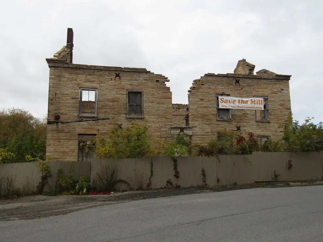
The stone mill that stands today replaced Horton's old frame mill in 1853, in the boom that followed the Northern Railroad's arrival in 1850, the same boom that produced the stone railroad freight house of 1852. It sits on the east bank in the center of the village, with the dam that gave it a head of water just south of it. It is two and a half stories under a gable roof, five bays across the street front, with a single central door and a second door above it that may have been used to take in supplies. Its long sides run with the river, and the back wall drops straight into the water, taking the place of the riverbank. A stone wall formed a raceway that carried water from above the dam into the mill's lowest level at the south end, through a broad keystone arch.
What makes it rare is the stone. Walls, window lintels and cornice are all thin slabs of warm-toned Potsdam sandstone quarried in Malone, and the molded stone cornice, with short returns on the gable ends, is a feature very seldom seen. Anchors shaped like four-pointed stars tie the walls to the floor joists. The Historic Malone marker at the bridge calls the mill the village's oldest standing structure.
The mill changed hands several times. The King family held a share, and in 1917 the Malone Milling Company was formed to run it; in the late 1950s the company gave up its rights in the mill to the Town of Malone. When the mill was listed on the National Register of Historic Places in April 1975, most of its machinery was gone and it was slowly falling into decay. By 2015 the roof had caved in, leaving four cracked stone walls around debris piled two stories high. That year a local group, the North Star of the Adirondacks Foundation, set out to save it, with plans to clear the debris and build a business and technology center for local teenagers inside the old walls. The walls still stood roofless in 2020; ask in town how far the work has come, and view the mill from the street.
Walking the river in the village
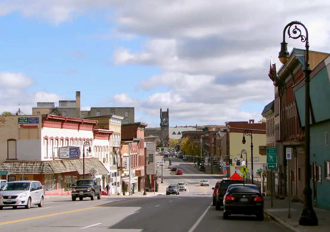
Main Street crosses the river in the middle of downtown, and the best short walk in town follows the water. The River View Loop is a 1.4-mile square with three river crossings. Start at East Main and Pearl streets, with the octagonal railroad towers behind you, and walk east on Main Street to Willow Street. Turn right and cross the river, turn right on College Avenue and cross it again, then turn right on Pearl Street for the third crossing and walk back to the start. Allow an hour or two with stops.
From the small overlook at the east end of the Main Street bridge you look down on the dam and the gristmill, and downstream you can still pick out the abutments of the old railroad bridge. Mill Street runs along the east bank past the mill. This stretch is about to change: the projects named in May 2026 for Malone's Downtown Revitalization Initiative award include $2,666,000 for the first phase of work on Mill Park, with new sidewalks, a scenic overlook at Harrison Place, clearing along the riverbank and plantings to hold the slope, and another $450,000 to turn two long-vacant buildings at 19 and 23 Mill Street into apartments, with work along the river. The town guide has the rest of the list.
East of downtown, the grounds of the Ballard Mill, home of the college's Malone campus, run along the river behind the old mill dam, with plenty of parking, and anglers fish the water behind the dam. At Pearl Street, a cleared area by the bridge gives anglers a place to park. North of the village, a parking area on Lower Park Street gives anglers another way down to the river.
Malone Memorial Recreation Park
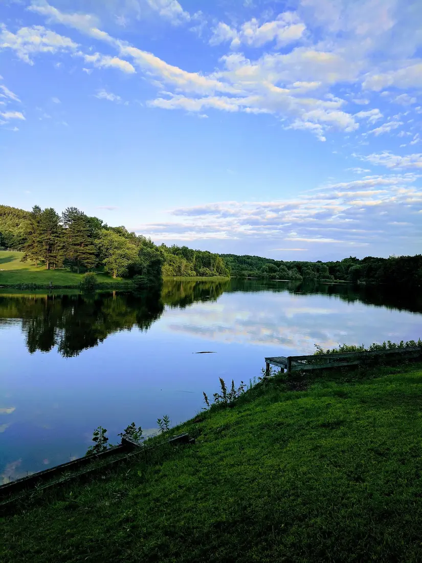
The village's big park, more than 100 acres on Duane Street, is on your way into town from the cabins. Rotary Lake at its center is fed by Branch Brook, the stream that drains Lake Titus, and a footbridge on the park's walking paths crosses the water where the brook comes in. A paved loop of about a mile runs through the park, and on Wednesday evenings in July and August the park holds free fun runs with 1.5-mile and 5K courses. In summer 2026 the park also lent out kayaks, bikes and sports gear free every day and ran kayak lessons on Wednesday mornings.
Swimming here now means the pool. The village opened it near the Duane Street entrance in summer 2025: 20 meters long with about three lanes, five feet deep at the deep end, with lifeguards. A new splash pad was in steady use by summer 2026, and in September 2026 the pool was named the SeaComm Pool after the credit union gave $110,000 toward the pool, the splash pad and the filtration system. The village's 2026 pool calendar ran lap swims and swim lessons on Monday to Thursday mornings, family swims on those afternoons and open swim from 1 to 5 p.m. Friday through Sunday. Village rules allow swimming in Rotary Lake only during posted hours with lifeguards on duty, and the park's 2026 swim schedule covered the pool only, so plan on the pool. Check the current calendar on the village website or the park's Facebook page before you pack towels.
Fall is the park's big show. Thousands of snow geese and Canada geese come down on Rotary Lake each day during the migration, sometimes with cackling, greater white-fronted or Ross's geese among them, and mergansers on the water; the wildlife guide has the timing and the yearly goose watch. In winter the park's ice rink, the Malone Civic Center, holds public skating sessions; see the town guide for those.
For young anglers, the village keeps a small trout pond, the Malone Village Pond, on Reservoir Street just off College Avenue, where Branch Brook runs on toward the river. DEC's spring 2026 stocking list had it down for 100 rainbow trout in April and 210 brown trout in May, 120 of them 12 to 15 inches long. The Malone Fish and Game Club holds a free kids' fishing derby there for ages 5 to 14, usually on the first Saturday in June.
Trout fishing
The Salmon is Malone's trout river. DEC's spring 2026 stocking list for the river in the Town of Malone called for 10,630 rainbow trout and 13,800 brown trout, about 24,400 fish in all, in four rounds: the second and fourth weeks of April and the second and fourth weeks of May. Most were 9 to 10 inches long; about 2,600 were larger fish of 12 to 15 inches. DEC gives these as planned numbers that can change with fish supply and weather. Wild fish live here too. Below the Chasm Falls dam the river holds wild brook trout and brown trout, while above it the resident fish are white suckers, smallmouth bass and yellow perch.
Seasons and rules
Most of the river follows New York's standard rules for trout streams: the season runs from April 1 to October 15, with a limit of five trout a day of any size, no more than two of them longer than 12 inches. From October 16 to March 31 you may keep fishing, but only catch and release with artificial lures. Below the village the rules change by section:
- From the Lamica Lake dam down to 200 yards below the Cargin Road bridge, and from the Flatrock Road bridge down to the Route 37 bridge in Westville Center: April 1 to October 15 with a limit of three a day, no more than one longer than 12 inches, then catch and release with artificial lures.
- From 200 yards below the Cargin Road bridge down to the Flatrock Road bridge: catch and release only, artificial lures only, all year.
Bass in the river follow Franklin County's own rule: the season runs June 15 to November 30, with a 12-inch minimum and five a day, and fishing for bass is closed the rest of the year, catch and release included. Anglers 16 and older need a New York license; the fishing trips page has the prices and the free fishing days. Rules change, so read DEC's current trout stream regulations for the section you plan to fish.
Public fishing rights
Much of the bank is private, so DEC has bought permanent public fishing rights from willing landowners along long stretches of the Salmon, from above Mountain View down to Westville, and on Hatch Brook too. Each is usually a 33-foot strip on one or both banks, marked with yellow signs, where you may walk and wade for the sole purpose of fishing. They fall into six areas, from south to north:
- Mountain View to the Oxbow, bordering state land in Bellmont, reached by a path of about three-quarters of a mile from County Route 27.
- The Oxbow toward Chasm Falls, including a short right-bank stretch called the Needle's Eye.
- Chasm Falls to Whippleville, on both banks south of Bull Run Road and on the left bank farther north.
- Whippleville toward Malone, along River Road almost to the Pinnacle Reservoir.
- Lamica Lake north toward the Island, on the left bank, with parking on Cady Road and a foot trail to the river.
- The Island to Westville Center, a short stretch north of Westville Center and south of Route 37.
DEC has only a few official parking areas along the river, so where there is none, pull fully off the road where it is legal and stay inside the posted strip. Left and right bank are named as you face downstream.
The Hendrickson Hatch
Each June the Salmon River Preservation Club helps run the Hendrickson Hatch, a catch-and-release fly-fishing tournament on the river between the Chasm Falls dam and Route 37 in Westville, with money raised going to the river and to stocking larger trout. The 20th was held on June 6 and 7, 2026, limited to 75 anglers, with registration at the Malone American Legion on Morton Street. Plaques go to the anglers with the most total inches across their five biggest trout. Check the dates if you want to fish that weekend or avoid the crowd.
Paddling where it is safe
The Salmon is mostly shallow and rocky, good water for trout and poor water for boats. Through Malone, canoes, kayaks and tubes fit only a few places, and the flat water is behind the dams:
- Lamica Lake, the last impoundment, north of the village. A free car-top launch off Lower Park Street goes with a shoreline fishing area, an angler trail below the dam and a recreation trail. Stay well back from the dam.
- The Chasm Falls reservoir, 22 acres of calm water above the dam, good for fishing and a short paddle; ask locally where to put in. Hatch Brook, which comes into the river above it, is flat water too; see the Meacham Lake guide.
- The pool above the Ballard Mill dam, behind the college in the village.
Leave the rest to experts. The half mile at Chasm Falls is Class V+, the river below the Macomb dam runs through a deep stone gorge, and every dam has a spillway and intakes you never want to drift toward. New York requires a life jacket aboard for every paddler; children under 12 must wear one, and from November 1 to May 1 everyone in a boat under 21 feet must wear one. The cabins do not list boats, so bring your own.
High water, ice jams and floods
In 1918 a Malone historian wrote that through most of the town the river winds between high banks, so floods seldom did serious damage. The north end of the village has learned otherwise. Ice jams on the Salmon have flooded streets there again and again. In January 2013 four homes in Malone were evacuated; in March 2017 water stood a foot and a half to two feet deep on West, Lane and Park streets from Wednesday night through Friday; and in January 2019 an ice jam that formed in Lamica Lake put about a quarter mile of Lower Park Street under water and ice. Nine houses that flooded again and again have been bought and torn down. The flooding is blamed on sediment building up in the riverbed, and in 2018 the village's mayor traced part of it to a large release of silt by a power company about ten miles upstream in the late 1990s.
The problem is old. In 1958 and 1959 the Army Corps of Engineers cleared and snagged the riverbed from above the Willow Street bridge to the Cady Road bridge, removing shoals and deepening channels so ice and debris could pass, for about $45,000. The Town of Malone maintains the work.
For a visitor, the lesson is simple caution. In late winter and spring, stay off river ice entirely and keep back from the banks, where ice and snow can give way. Don't wade or fish from the rocks when the water is high and brown, and treat the gorges at Chasm Falls and below the Macomb dam as places to look, not to climb. When the National Weather Service puts out a flood watch for Malone, stay away from the low streets at the north end of the village.
The river in winter
Winter does not close the river. Open-water trout fishing goes on from October 16 to March 31 on most of it, catch and release with artificial lures, wherever you can reach the water safely. From Malone Junction, the Corridor 7 snowmobile trail runs south along the Salmon River toward the cabins; see snowmobiling the C7. The geese leave Rotary Lake by late November, and skaters move indoors to the Civic Center rink.
A half day in Malone built around the river
- 9:00. Leave the cabins and stop at Chasm Falls, about two road miles away, for the gorge on one side of the road and the reservoir on the other.
- 9:30. Walk the wooded paths at Bill King Memorial Park down to the river.
- 10:15. Drive north on Duane Road to the recreation park and walk the paved loop, crossing the footbridge where Branch Brook comes in.
- 11:00. Park downtown and walk the River View Loop, with a stop at the overlook at the east end of the Main Street bridge for the gristmill and the dam.
- 12:30. Lunch in town; the town guide has the choices.
- 1:30. In trout season, cast at the Ballard Mill dam behind the college or from the Lower Park Street access, or carry a kayak to Lamica Lake for an hour on flat water.
- 3:00. Back at the cabin.
On a fall evening, end at Rotary Lake instead, when the geese come in to roost just after sunset.
Children and dogs
For children, Bill King Memorial Park is the easy walk, the recreation park has the pool, the splash pad and the playgrounds, and the village pond off College Avenue is kept for young anglers. Hold hands near the dams, the gorges and the steep banks, and keep children off the rocks at the edge of fast water. Dogs do well on the Bill King Park trails; in the recreation park, check the posted rules first, since the village has rules on animals there. The cabins take pets for a fee; see bringing your dog.
Getting there from the cabins
County Route 25, the Duane Road, is the river road. From the cabins you meet it at Chasm Falls, about two road miles out, and heading north you pass Bill King Memorial Park, about 4.7 road miles from the cabins; then the road runs on past Whippleville, the turn for the Malone Golf Club and the recreation park into the village. There it becomes Duane Street and runs to Main Street, about ten road miles from the cabins. Allow about 20 minutes to downtown. Lamica Lake and the Macomb dam, at the north end of the town, are about 12 road miles from the cabins. For the lakes in the other direction, see Lake Titus, Indian Lake and Mountain View.
Questions
When is trout season on the Salmon River in Malone?
On most of the river the season runs April 1 to October 15, five trout a day of any size, with no more than two over 12 inches; from October 16 to March 31 it is catch and release with artificial lures. Sections below the Lamica Lake dam have their own rules. DEC's spring 2026 stocking list called for about 24,400 brown and rainbow trout in the Town of Malone. Licenses: see the fishing trips page.
Where can I fish the Salmon River without trespassing?
On DEC's public fishing rights, which cover long stretches from above Mountain View down to Westville: usually a 33-foot strip on one or both banks, marked with yellow signs, where you may walk and wade to fish. In Malone, anglers also fish behind the Ballard Mill dam, by the Pearl Street bridge and from the Lower Park Street access. DEC has few official parking areas, so park legally off the road.
Can you kayak or canoe the Salmon River?
Only in a few places. The river is mostly shallow and rocky, and the flat water is behind the dams: Lamica Lake north of the village, with a free car-top launch off Lower Park Street; the 22-acre reservoir above the Chasm Falls dam; and the pool above the Ballard Mill dam. The half mile at Chasm Falls is Class V+ whitewater, for experts only.
Can you visit the Horton Gristmill?
You can see it from outside, from the small overlook at the east end of the Main Street bridge or from Mill Street. The 1853 Potsdam sandstone mill was listed on the National Register of Historic Places in 1975 and is a roofless shell. A local foundation set out in 2015 to save it, and the walls still stood roofless in 2020; the Malone history page has more on the village around it.
Where can you swim in Malone?
At the pool in Malone Memorial Recreation Park on Duane Street, opened in 2025 and named the SeaComm Pool in 2026: 20 meters long, five feet deep at the deep end, with lifeguards, and a new splash pad. The 2026 calendar had open swim from 1 to 5 p.m. Friday through Sunday, with lessons, lap swims and family swims on weekdays. Check the current calendar on the village website or the park's Facebook page.
How far is the Salmon River from the cabins?
Closer than Malone. The river runs through Chasm Falls, about two road miles from the cabins, and Bill King Memorial Park, with trails down to the water, is about 4.7 road miles away on Duane Road. Downtown Malone, with the gristmill and the River View Loop, is about ten road miles, roughly 20 minutes.
Sources
Facts on this page were checked against these sources in October 2026. Hours, fees and schedules change; confirm before you go.
- New York State Department of Environmental Conservation dec.ny.gov/regulatory/permits-licenses/waterways-coastlines-wetlands-p
- toponymie.gouv.qc.ca toponymie.gouv.qc.ca/ct/ToposWeb/Fiche.aspx?no_seq=58428
- lowimpacthydro.org lowimpacthydro.org/lihi-certificate-159-macomb-hydroelectric-project-n
- lowimpacthydro.org lowimpacthydro.org/lihi-certificate-158-chasm-hydroelectric-project-ne
- pubs.usgs.gov pubs.usgs.gov/publication/sir20255048/full
- waterservices.usgs.gov waterservices.usgs.gov/nwis/site/?format=rdb&sites=04270000,04270030,0
- dos.ny.gov dos.ny.gov/system/files/documents/2019/05/malonesii.pdf
- archive.org archive.org/details/cu31924079502492
- Visit Malone visitmalone.com/cycling/chasm-falls-loop
- Visit Malone visitmalone.com/hiking/bill-king-park-trails
- Visit Malone visitmalone.com/paddling/chasm-falls-section-of-the-salmon-river
- hmdb.org hmdb.org/m.asp?m=78997
- catalog.archives.gov catalog.archives.gov/id/75317830
- northcountrypublicradio.org northcountrypublicradio.org/news/story/29532/20150917/group-has-big-id
- spectrumlocalnews.com spectrumlocalnews.com/us/snplus/news/2016/12/16/save-horton-mill-wants
- rivercitymalone.com rivercitymalone.com/culture/miracle-on-mill-street/
- Visit Malone visitmalone.com/hiking/river-view-loop
- nny360.com nny360.com/communitynews/business/malone-to-get-9-7m-in-dri-funds-10-l
- Visit Malone visitmalone.com/blog/2016/07/fishing-malone
- nccc.edu nccc.edu/about/campuses/malone/
- Visit Malone visitmalone.com/parks/malone-memorial-recreation-park
- Visit Malone visitmalone.com/events/fun-run-at-the-malone-rec-park
- Franklin County tourism (Always Franklin) alwaysfranklin.com/listing/malone-memorial-recreation-park
- mymalonetelegram.com mymalonetelegram.com/news/publicservicenews/rec-park-pool-opening-thur
- ecode360.com ecode360.com/15034470
- New York State Department of Environmental Conservation dec.ny.gov/things-to-do/freshwater-fishing/stocking/spring-trout-stock
- New York State Department of Environmental Conservation dec.ny.gov/things-to-do/freshwater-fishing/regulations/inland-trout-st
- New York State Department of Environmental Conservation dec.ny.gov/things-to-do/freshwater-fishing/places-to-fish/adirondack-l
- Visit Malone visitmalone.com/fishing/salmon-river
- New York State Department of Environmental Conservation extapps.dec.ny.gov/docs/fish_marine_pdf/r7ebrsrpfr.pdf
- hendricksonhatch.org hendricksonhatch.org/
- mymalonetelegram.com mymalonetelegram.com/top_stories/hendrickson-hatch-fly-fishing-tournam
- Visit Malone visitmalone.com/recreation/canoe-kayak
- New York State Parks parks.ny.gov/boating/non-motorized-boats.aspx/1000
- cnycentral.com cnycentral.com/news/local/ice-jams-cause-salmon-river-to-flood-several
- spectrumlocalnews.com spectrumlocalnews.com/tx/austin/news/2017/03/18/malone-flooding
- mymalonetelegram.com mymalonetelegram.com/news/malone-s-lower-park-street-perennial-site-of
- New York State Department of Environmental Conservation extapps.dec.ny.gov/docs/water_pdf/fcpprjmalone.pdf
- Visit Malone visitmalone.com/blog/2019/01/snowmobile-trails-where-start-where-stop
- mountainviewassn.com mountainviewassn.com/history-and-board
- Visit Malone visitmalone.com/blog/2015/10/snow-geese-spectacle
- maloneminorhockey.com maloneminorhockey.com/maloneciviccenter
- OpenStreetMap (road distances) openstreetmap.org/
- villageofmalone-ny.com villageofmalone-ny.com/rec-park
- nny360.com nny360.com/communitynews/malone-rec-park-reports-on-busy-summer/articl
- newyorkminute.blog newyorkminute.blog/2026/09/23/the-new-york-minute-scholarships-communi
- facebook.com facebook.com/MaloneRecPark/
- Visit Malone visitmalone.com/events/annual-kids-fishing-derby
- governor.ny.gov governor.ny.gov/news/governor-hochul-announces-18-transformational-pro
- New York State Department of Environmental Conservation dec.ny.gov/things-to-do/freshwater-fishing/regulations/statewide-seaso
- New York State Department of Environmental Conservation dec.ny.gov/things-to-do/freshwater-fishing/regulations/region-5-specia
- New York State Department of Environmental Conservation dec.ny.gov/things-to-do/freshwater-fishing/places-to-fish/public-fishi
- New York State Department of Environmental Conservation dec.ny.gov/things-to-do/freshwater-fishing/places-to-fish/trout-stream
- New York State Department of Environmental Conservation dec.ny.gov/things-to-do/freshwater-fishing/places-to-fish/western-ny/s
- New York State Department of Environmental Conservation dec.ny.gov/places/titusville-mountain-state-forest
- New York State Department of Environmental Conservation gisservices.dec.ny.gov/arcgis/rest/services/dil/dil_water_activities/M
- New York State Department of Environmental Conservation gisservices.dec.ny.gov/arcgis/rest/services/dil/dil_reference/MapServe
- northcountrypublicradio.org northcountrypublicradio.org/news/story/35512/20180125/stefanik-tours-f
- Wikimedia Commons commons.wikimedia.org/wiki/File:Ruins_of_Horton_Grist_Mill,_Malone,_NY
In this guide
Stay nearby
The first of the cabins: a big stone fire pit you see as you walk up, a screened corner of the deck, direct trail access, and a short walk to an observation deck over the pond.
 The Modern Tiny HomeCabin 1 · 2 bd · 1 ba · sleeps 4
More in Lakes & Paddling
Sources
59 references, listed in full at the end of this guide: official park, state, tourism-office and business sources, checked October 2026.
Related guides


Photos on this page: Ruins of Horton Grist Mill, Malone, NY Front View by OneEagle, CC BY-SA 4.0; Rotary Lake Malone NY 20170703 by DBull360, CC BY-SA 4.0; Malone NY by P199, CC BY-SA 3.0. Resized and cropped for this site. All photo credits