
Meacham Lake and the Deer River Flow
Meacham Lake and the Deer River Flow, 16 to 21 road miles from the cabins: launches, fees, the 2026 season, paddling routes, fishing, loons and history.
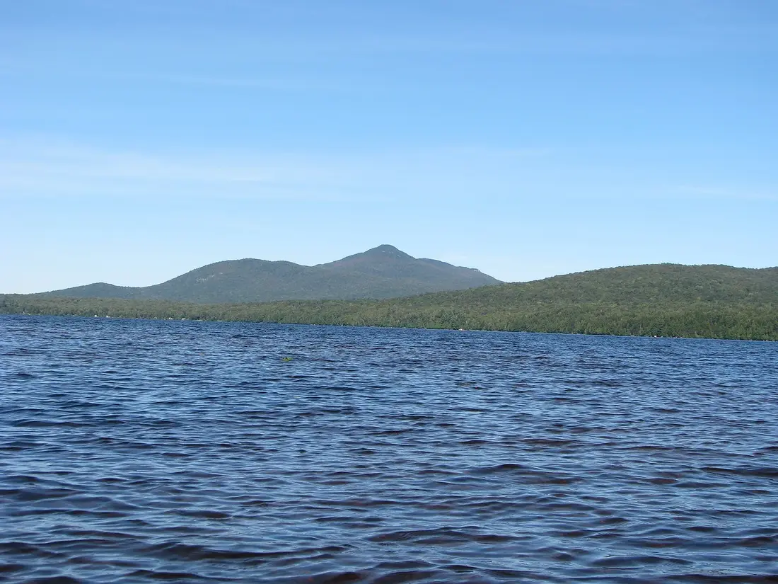
Meacham Lake is the big water south of the cabins: a 1,185-acre lake in the Town of Duane, surrounded by state Forest Preserve, with a state campground, a sand beach and three places to launch a boat. It is about 21 road miles from the cabins, roughly 35 minutes, and the Deer River Flow, a sheltered reservoir of marsh and open water, is about four miles closer off the same road. Come for an easy paddle, a summer swim, the loons and the Osgood River, which winds into the lake's south end.
The lake
Meacham Lake is about two miles long and a mile wide, with roughly five and a half miles of shoreline, at about 1,552 feet above sea level. The average depth is 36 feet and the deepest water reaches about 80 feet. It is the largest body of water in the Debar Mountain Wild Forest, ahead of Rainbow Lake, Osgood Pond, Lake Kushaqua and Debar Pond, and 3,305-foot Debar Mountain rises to the northeast.
The state campground on the north and west shores is the only development on the lake. The Osgood River flows in at the south end, and the lake drains out through the East Branch of the St. Regis River, which passes under NY 30 near the junction with NY 458.
Motorboats are allowed, but they are few. The state's planning counts showed that most boat traffic comes from campers, and that even on the campground's busiest days there were about 15 acres of water for every boat. The lake gets little public use for its size, which is good news for anyone in a canoe.
The state campground
The Department of Environmental Conservation, DEC for short, runs the Meacham Lake Campground and Day Use Area at 119 State Camp Road in Duane, phone (518) 483-5116. In 2026 it opened on May 15, and the last night of camping is Sunday, October 11, on Columbus Day weekend. The dates change every year, so check them before you plan a day around the beach or the booth.
It is a big campground, with more than 200 sites, hot showers, flush toilets, a trailer dump station, a playground and an amphitheater. Most sites are along the north shore. Meacham Lake West, on the west shore, has primitive and walk-in sites, many with a view of the water. Campsites are reserved through ReserveAmerica, online or at 1-800-456-CAMP, up to nine months ahead, and some sites have been closed for a restoration project. Ice and firewood are sold at the campground. Buying firewood there or from a local seller, instead of bringing it from home, keeps invasive insects from riding along.
Day use and fees
Day visitors pay a fee per car at the entrance booth while the campground is open. It has been $8 a car; check the posted fee when you arrive. One payment covers the beach, the picnic area, the boat launch and the Debar Meadows trailhead inside the campground. An Empire Pass, $80 for 2026 and good through December 31, covers day-use entry here and at most state parks and DEC campgrounds. Campers launch boats for free, and once the campground closes for the season, the launch is free to everyone.
Where to launch on Meacham Lake
| Launch | Where | Boats | Cost |
|---|---|---|---|
| Campground launch | East shore, inside the campground just past site 173 | Trailered boats and car-top boats | Day-use fee while the campground is open, free after it closes |
| Old launch | Meacham Road, in the northwest corner of the lake | Canoes, kayaks and other car-top boats | Free |
| Outlet bridge | NY 30 over the East Branch of the St. Regis River, 0.2 mile from NY 458 | Car-top boats | Free |
The campground launch opened in 2017 on the east shore, at a spot the state picked partly because it is sheltered from wind and waves. It has a concrete ramp, accessible docks, an information kiosk and 21 parking spaces for cars and trailers, one of them reserved for drivers with disabilities. Restrooms are about 200 feet away. If the launch lot is full, the day-use parking area a quarter mile away holds several hundred cars.
The old launch, in the shallow northwest corner along Meacham Road, was the state's only launch on the lake before 2017, and it stayed open for canoes and kayaks at no charge. The third choice is the NY 30 bridge over the lake's outlet. It is the shortest way to the Osgood River: from the bridge it is about half a mile across the south shore to the river mouth.
Clean, drain and dry your boat before you launch, here and at every lake. Anyone launching a motorboat in the Adirondack Park must carry a certificate saying the boat was cleaned, drained and dried, and paddlers are asked to take the same steps. A boat steward may be at the launch in summer to offer a free inspection.
Paddling routes on Meacham Lake
Around the shore
A lap of the whole shoreline is about five and a half miles. At an easy two miles an hour, that is close to three hours with a few stops. Apart from the campground, the shore is undeveloped Forest Preserve, with Roaring Brook and Winnebago Brook coming in on the east side and the Osgood River marsh at the south end. Start into the wind, so the paddle home is the easy half.
The Lower Osgood River
The best paddle at Meacham leaves the lake. The Osgood River enters at the south end, and from the outlet bridge on NY 30 it is about half a mile along the sandy south shore to its mouth. From the campground, cross the lake or follow the shore south. Watch for a huge eagle's nest on your left as you enter the river.
The river meanders through a wide marsh beside a forested esker, a long ridge of sand and gravel left by the glaciers, covered in large pines. You can paddle a few miles upstream. Expect beaver dams, plenty of bends and possibly an obstruction or two. Three small ponds, Mud, Baker and McCollums, sit behind an esker east of the river and make good goals for the day. The route has no carries, and it works as a day trip or as a one-night trip to a campsite on the tributary ponds. On an early August trip, paddlers found lily pads covering the slow water and cardinal flower, a fairly rare plant, blooming red along the banks. State law lists the Osgood, from Osgood Pond to Meacham Lake, as a river under study for the Wild, Scenic and Recreational Rivers system.
Longer trips to the south
The Osgood starts at Osgood Pond, reached from White Pine Road, which meets NY 86 just south of Paul Smiths. The upper river is a smooth, narrow channel, little more than a stream in places, lined with tamarack, spruce and balsam, with campsites scattered along it and old beaver dams to cross. Osgood Pond itself is often windy in the afternoon. Another route, about 12 miles, links Lake Kushaqua to Osgood Pond through a chain of lakes and channels, with a 0.75-mile carry between Rainbow Lake and Jones Pond; at low water you may have to wade parts of the channel between Jones Pond and Osgood. For the land around these lakes, see the Debar Mountain Wild Forest guide.
The Deer River Flow
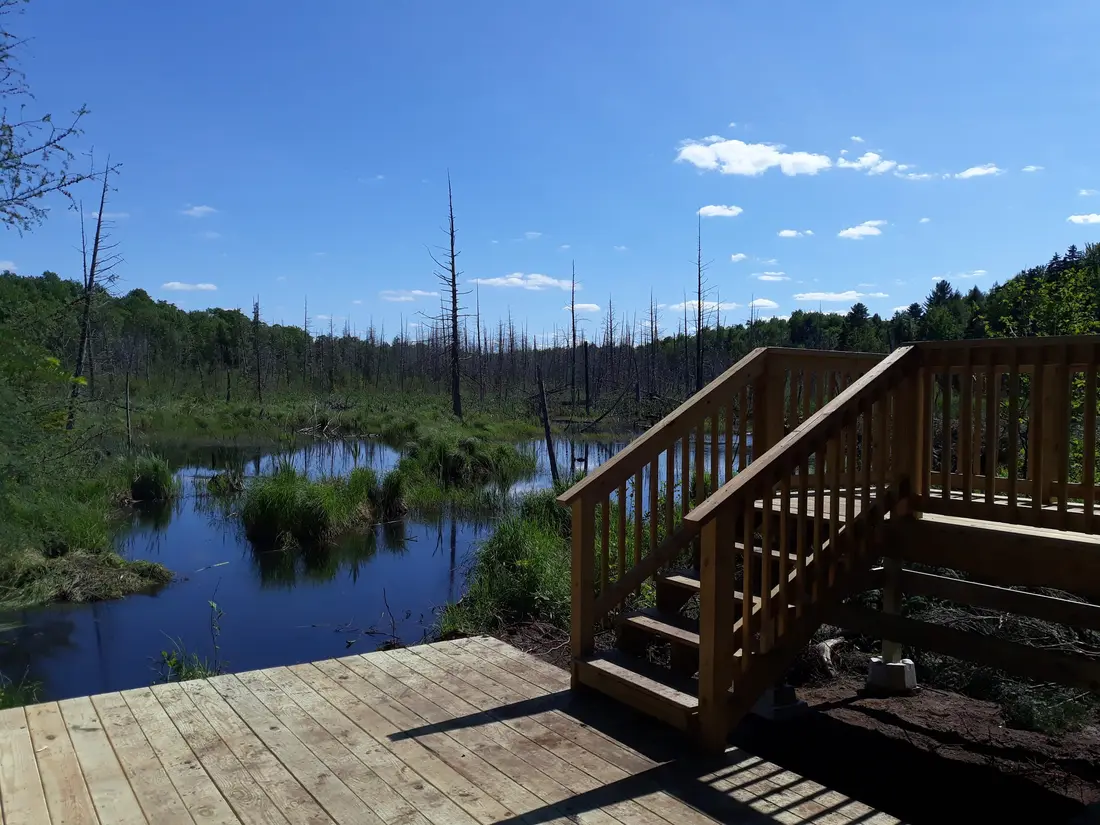
The Deer River Flow is a 408-acre reservoir on the Deer River, in the Town of Duane, a few miles north of Meacham Lake on NY 30. It is a 2.7-mile marsh-lined waterway with mountain views and good bird watching, and it is well sheltered and calm under most conditions, which makes it the place to go when Meacham is choppy. Blue herons, several kinds of ducks and beaver lodges are the usual sights.
The flow is shaped like a Y. From the put-in at the south end, a narrow channel through the grass leads north into open water, and the concrete dam that holds the reservoir is nearly three miles away. The dam is about 300 feet long and makes a good lunch stop, with Debar Mountain straight up the flow. Head south from the put-in instead and the river is very narrow and at times hard to get through. Small outboards are allowed, but the water is shallow and large motorboats stay away.
About halfway to the dam, a winding arm branches off to the right. It is wide at first, then narrows into a grassy stream that passes under a small bridge on Red Tavern Road about a mile up, and reaches Horseshoe Pond nearly half a mile beyond, with a view of Humbug and Kary mountains. To the dam and back from Cold Brook Road is close to six miles. Add the side trip to Horseshoe Pond and the day comes to about nine miles, five hours with stops.
Most of the flow lies in the Forest Preserve, with a handful of homes on the shore, most of them at the north end. Eurasian watermilfoil, an invasive weed, grows in it, so clean your boat when you leave.
Carry-in points
The main way in is the state fishing and waterway access site on Cold Brook Road, just off NY 30 about 17 road miles from the cabins. Coming south on NY 30, Cold Brook Road is on the right. Park on the roadside dirt and gravel lot and carry your boat less than 100 feet to the water. It is a hand launch, so leave the trailer at home.
The second way in is the small bridge on Red Tavern Road, County Route 14, which leaves NY 30 on the right about two miles north of Cold Brook Road. The bridge, about half a mile in from NY 30, crosses the Horseshoe Pond arm, and putting in there makes a shorter trip: the pond is about half a mile upstream, and the dam and back is a little under five miles. The bridge is not a state access site and small camps line the channel above it, so pull well off the road and respect any posted land.
The flow is shallow, so it freezes early in winter, but it has current, so test the ice before you trust it. Ice anglers look for pike in the deeper spots. In open water the flow holds brown trout, rock bass, northern pike, largemouth and smallmouth bass, yellow perch and other panfish, and possibly wild brook trout.
Fishing and licenses
Meacham holds northern pike, smallmouth bass, yellow perch, brown bullhead, lake whitefish, rainbow smelt, brown trout, pumpkinseed, splake and landlocked Atlantic salmon. Splake, a hatchery cross of lake trout and brook trout, are stocked every year; in 2025 the lake got 1,000 six-inch fish and 3,030 that were eight and a half inches long. The weedy south end is the place for northern pike, and the eastern half, between Roaring Brook and Winnebago Brook, is where to look for smallmouth bass.
Meacham is open to ice fishing. Franklin County waters have their own bass season, June 15 through November 30 with a 12-inch minimum and five a day under the current rules, and the other species follow the general regulations, so read the current DEC rules before you keep a fish.
Everyone 16 and older needs a New York fishing license, and licenses are not sold at the campground, so buy one online or by phone before you go. In 2026 a resident license cost $25 for the year, $12 for seven days or $5 for a day. A non-resident paid $50 for the year, $28 for seven days or $10 for a day. Children under 16 fish free. The last free fishing day of 2026, when no license is needed, is November 11. The fishing trips page covers the other waters near the cabins.
Loons
Common loons nest on Meacham, and one estimate put six or seven pairs on the lake. New York lists the loon as a Species of Special Concern, and loons, their chicks and their nests are protected by state and federal law.
Loon nests sit right at the water's edge. A canoe or kayak that comes too close can flush a loon off its nest, leaving the eggs open to predators, chilling, overheating or abandonment, and a boat's wake can flood a nest. Keep at least 200 feet away, and farther from a loon with chicks. Back off at once if a loon stretches its neck up to watch you, sinks low in the water, swims away, gives the wavering tremolo call or rears up out of the water with its wings spread. Binoculars do the rest.
Fishing gear kills loons. They swallow small stones to grind their food, and a loon that picks up a single lead sinker or jig, off the bottom or in a fish that broke a line, can die of lead poisoning. Loose monofilament can tangle and kill them too. Use non-lead sinkers and jigs, and take every scrap of line home. To report a loon being harassed or hurt, call the DEC wildlife office in Ray Brook at (518) 897-1291 on weekdays or (518) 897-1304 after hours and on weekends. For other places to watch birds and animals near the cabins, see wildlife watching.
Swimming at the beach
The beach is a large stretch of sand on the north shore, with a picnic area, a playground and a beach house with showers and changing rooms. Swimming here has been unsupervised since 2023, as at every DEC campground beach: there is no lifeguard, campground staff maintain and patrol the beach, and you go in only from the designated beach area and stay out of the water from half an hour before sunset to half an hour after sunrise.
Alcohol, glass containers, inflatables, beach balls, athletic games and underwater swimming gear are not allowed at state campground beaches, and pets are not allowed on beaches or in day-use areas. Bring a picnic and pick up food in Malone on the way south; see groceries and supplies.
Wind, life jackets and safety
A two-mile lake gives the wind room to build waves. On a windy day, stay near shore, cross open water at the narrowest point, or switch to the Deer River Flow, which stays calm in most conditions.
New York law requires a wearable, Coast Guard approved life jacket aboard for every person in any boat, canoes, kayaks and rowboats included. Children under 12 must wear one. From November 1 to May 1, the cold-water months, everyone underway in a boat under 21 feet must wear one, buckled. A Forest Ranger who stops a paddler without a life jacket can write a fine. Since January 1, 2025, anyone driving a motorboat in New York needs a boating safety certificate; paddlers do not.
In an emergency, call 911 or the DEC Forest Ranger dispatch at 1-833-NYS-RANGERS (1-833-697-7264). If you are lost or hurt on the trail, stay where you are. Tell someone at the cabin where you are going and when you expect to be back, and see health and safety for the hospital in Malone.
The Debar Meadows trail
The longest trail from the campground is the Debar Meadows to Meacham Lake Trail, 7.7 miles from its western trailhead in the campground to an eastern trailhead on Debar Meadows Road, near the old Debar Game Management Area. It is an easy grade for its length. From the campground it climbs only about 200 feet to its high point near the middle, drops 170 feet, then rises 70 feet to the far trailhead. The first 1.1 miles are shared with the Debar Mountain trail.
Hikers who start in the campground pay the day-use fee while it is open. In winter the trail is part of snowmobile corridor C8, so expect sleds. Walk it one way with a car at each end, or go out an hour and turn back. For Debar Mountain itself, the lean-tos and the rest of the wild forest, see the Debar Mountain Wild Forest guide. For winter riding, see snowmobiling from the cabin door.
Meacham's history
The lake carries the name of Thomas Meacham, a hunter and trapper from Hopkinton and Waverly who hunted and fished here so often that he named it. When he died at Hopkinton in May 1849, his obituary credited him with 77 panthers, 214 wolves, 210 bears and 2,550 deer.
For decades Meacham was known as one of the best trout lakes and deer-hunting grounds in the Adirondacks. Before the Civil War a woman known as Aunt Mary Wine lived in a cabin by the lake and put up the occasional traveler. A better house followed, kept first by John Titus and then by Henry Woodford, and in 1872 Isaac Chesley and Alonzo Fuller bought it and enlarged it. Fuller ran it alone for about twenty years. The house burned around 1900 and was rebuilt, and the Meacham Lake Hotel burned for good in 1921. Nearby, a smaller sportsmen's place called McCollom's began as a small log house where hunters put up with rough lodging for good deer hunting; it burned in 1924.
The public campground came with the Depression. Civilian Conservation Corps Camp 60, set up at Barnum Pond in 1933, started building the Meacham Lake Campground in 1934, and in 1937 the same camp built the Meacham dam on the East Branch of the St. Regis River. Construction of the campground as it stands was finished in 1971. The newest addition is the launch on the east shore, opened in 2017.
Getting there from the cabins
From the cabins, local roads lead to County Route 25. Follow it west to Fayette Road, County Route 41, which meets NY 30, then turn south. Red Tavern Road comes first, then the Cold Brook Road put-in for the Deer River Flow. The turn for the Meacham Lake campground is about three and a half miles past Cold Brook Road. The outlet bridge is under three miles farther south on NY 30, near the NY 458 junction. For the local roads between the cabins and County Route 25, see getting to the cabins.
| Stop | Road miles from the cabins | Drive |
|---|---|---|
| Red Tavern Road bridge, Horseshoe Pond arm | About 14 | About 25 minutes |
| Deer River Flow put-in, Cold Brook Road | About 17 | About 30 minutes |
| Old launch, Meacham Road | About 20 | About 35 minutes |
| Meacham Lake Campground and beach | About 21 | About 35 minutes |
| Outlet bridge, NY 30 near NY 458 | About 22 | About 40 minutes |
| Paul Smiths | About 31 | About 45 minutes |
A day at Meacham from the cabins
Here is one way to spend a summer day. Leave the cabins around 7:30 and be on the Deer River Flow by 8. Paddle north from Cold Brook Road through the channel into the open reservoir, look for herons and beaver lodges, and turn around when you have had enough. By 10:30 you can be back at the car and driving the few miles south to the campground.
Pay at the booth, take a picnic to the north shore and swim from the designated beach area. In the afternoon, launch for the Lower Osgood River, or walk the first easy miles of the Debar Meadows trail. You are back at the cabin by 5, with time for the hot tub before dinner. After the campground closes for the season, the beach is shut, but all three launches are free, the campground launch included.
Children, dogs and accessibility
Children under 12 must wear a life jacket in a canoe, kayak or other small boat. The campground runs a Junior Naturalist program for children 5 to 13 and their families, with games and activities that earn an embroidered patch; ask at the booth. The beach has a playground beside it.
Dogs may come into the campground with proof of a current rabies vaccination, on a leash no longer than six feet, and they may not be left alone. They are not allowed on the beach or in day-use areas, so a dog day is a paddle from the old launch or the outlet bridge, or the Deer River Flow. See bringing your dog for more.
The campground launch has accessible docks and a reserved parking space, and there is an accessible comfort station near campsite 127.
Boats and gear
The cabins do not list canoes or kayaks, so bring your own or rent. The campground lists canoe and rowboat rentals, and kayaks have been offered too; ask at the booth what is running that day. Saranac Lake has full-service outfitters about 43 road miles from the cabins. The Saint Regis Canoe Area guide lists them, along with the paddling maps that cover the Osgood River country.
Pack a life jacket for each person, a map, water, sun protection and a dry bag for phones and keys. In late May and June add a head net; the bug guide has the details. Back at the cabins, each one has a washer and dryer for wet gear and a private hot tub for tired shoulders.
Nearby
- The Saint Regis Canoe Area, whose northern put-in at Paul Smith's College is about 12 road miles south of the Meacham turn: ponds with no motors, the Seven Carries and canoe camping.
- St. Regis Mountain, the fire tower that looks out over the canoe area.
- Loon Lake Mountain, a fire-tower summit in the same wild forest as Meacham.
- Saranac Lake and Paul Smiths, for outfitters, food and the college on Lower St. Regis Lake.
- Closer to the cabins, Lake Titus, Indian Lake and Mountain View, and Hatch Brook, nine miles of flatwater with a swift current that ends above the dam at Chasm Falls, about two road miles from the cabins.
Questions
Is there a fee to paddle on Meacham Lake?
While the campground is open (in 2026, May 15 through Columbus Day weekend, with the last night of camping on October 11), day visitors pay a per-car day-use fee to use the campground launch, the beach and the picnic area; it has been $8. The old launch on Meacham Road and the NY 30 bridge over the outlet are free for canoes and kayaks, and once the campground closes, the main launch is free too. An Empire Pass covers the day-use fee.
Can I swim at Meacham Lake if I am not camping?
Yes. Day visitors pay the day-use fee and can use the sand beach on the north shore, the picnic area and the beach house with its showers and changing rooms. Swimming has been unsupervised since 2023, with no lifeguard on duty, so swim only from the designated beach area and be out of the water by half an hour before sunset.
Can I bring my dog to Meacham Lake?
Dogs may enter the campground with proof of a current rabies vaccination and on a leash no longer than six feet, but they are not allowed on the beach or in day-use areas. For a day out with a dog, launch from the old launch on Meacham Road or the outlet bridge, or paddle the Deer River Flow. See bringing your dog.
Where do I put in on the Deer River Flow?
At the state fishing and waterway access site on Cold Brook Road, just off NY 30 about 17 road miles from the cabins. Park on the roadside dirt and gravel lot, carry your boat less than 100 feet to the water, and paddle north through a narrow channel into the open reservoir. For a shorter trip, put in at the small Red Tavern Road bridge over the Horseshoe Pond arm, about two miles farther north; the dam and back from there is a little under five miles.
Can I rent a canoe or kayak at Meacham Lake?
The campground lists boat rentals, including canoes and rowboats, and kayaks and paddleboards have been offered too; ask at the booth what is available that day. The cabins do not list boats. Full-service outfitters are in Saranac Lake, about 43 road miles from the cabins; the Saint Regis Canoe Area guide lists them.
Do I need a fishing license at Meacham Lake?
Yes. Everyone 16 and older needs a New York fishing license, and licenses are not sold at the campground, so buy one online or by phone before you go. Meacham is open to ice fishing, and the state stocks it with splake every year. The fishing trips page covers fees and the free fishing days.
Sources
Facts on this page were checked against these sources in October 2026. Hours, fees and schedules change; confirm before you go.
- New York State Department of Environmental Conservation extapps.dec.ny.gov/docs/fish_marine_pdf/mchmlkmap.pdf
- New York State Department of Environmental Conservation dec.ny.gov/places/meacham-lake-campground-and-day-use-area
- New York State Department of Environmental Conservation extapps.dec.ny.gov/docs/permits_ej_operations_pdf/meachamlake23.pdf
- New York State Department of Environmental Conservation extapps.dec.ny.gov/docs/permits_ej_operations_pdf/meachamump.pdf
- content.govdelivery.com content.govdelivery.com/accounts/NYSDEC/bulletins/1aeab7e
- Franklin County tourism (Always Franklin) alwaysfranklin.com/listing/meacham-lake
- New York State Department of Environmental Conservation dec.ny.gov/places/debar-mountain-wild-forest
- Visit Malone visitmalone.com/fishing/meacham-lake
- Visit Malone visitmalone.com/blog/2016/08/meacham-lake-award-winning-camping
- Visit Malone visitmalone.com/paddling/deer-river-flow
- campflare.com campflare.com/campground/meacham-lake-campground-608
- New York State Department of Environmental Conservation dec.ny.gov/things-to-do/camping/annual-day-use-pass
- localsyr.com localsyr.com/news/state-news/empire-pass-2026-unlimited-access-to-adir
- adksports.com adksports.com/2023-08-paddling-camping
- visitadirondacks.com visitadirondacks.com/sites/default/files/2023-04/Paddling_2023.pdf
- canoeoutfitters.com canoeoutfitters.com/trip-planning/routes/osgood-river
- gearx.com gearx.com/blogs/news/trip-report-lower-osgood-river-meacham-lake
- Lake Placid tourism (ROOST) lakeplacid.com/story/2012/08/paddling-osgood-river
- natureupnorth.org natureupnorth.org/encounter/fayemas/reflections-deer-river-flow
- New York State Department of Environmental Conservation dec.ny.gov/sites/default/files/2024-07/actualstocking.pdf
- law.cornell.edu law.cornell.edu/regulations/new-york/N-Y-Comp-Codes-R--Regs-Tit-6-SS-1
- canoeoutfitters.com canoeoutfitters.com/trip-planning/orientation-permits-fishing
- New York State Department of Environmental Conservation extapps.dec.ny.gov/docs/administration_pdf/loon-ethics.pdf
- newyorkalmanack.com newyorkalmanack.com/2025/05/responsible-loon-watching-guide/
- New York State Parks parks.ny.gov/documents/recreation/boating/PFDLawsofNewYork.pdf
- apps.cio.ny.gov apps.cio.ny.gov/apps/mediacontact/public/view.cfm?backButton=&parm=7E7
- New York State Department of Environmental Conservation dec.ny.gov/environmental-protection/public-safety/forest-rangers
- New York State Department of Environmental Conservation dec.ny.gov/news/press-releases/2022/6/dec-launches-new-aquatic-invasiv
- adirondackcouncil.org adirondackcouncil.org/page/new-york-state-aquatic-invasive-species-tra
- New York State Department of Environmental Conservation extapps.dec.ny.gov/docs/lands_forests_pdf/debarmeadowshikingmap.pdf
- archive.org archive.org/details/cu31924079502492
- deeradvisor.dnr.cornell.edu deeradvisor.dnr.cornell.edu/sites/default/files/resources/History%20of
- New York State Department of Environmental Conservation extapps.dec.ny.gov/docs/permits_ej_operations_pdf/campgroundaccess.pdf
- New York State Department of Environmental Conservation extapps.dec.ny.gov/docs/lands_forests_pdf/srcafinal.pdf
- OpenStreetMap (road distances) openstreetmap.org/
- Adirondack Explorer adirondackexplorer.org/recreation/let-the-good-times-flow/
- Adirondack Explorer adirondackexplorer.org/wp-content/uploads/2020/12/DebarComplex-Draft-U
- New York State Department of Environmental Conservation dec.ny.gov/things-to-do/camping/campground-day-use-schedule
- New York State Department of Environmental Conservation dec.ny.gov/sites/default/files/2024-05/devilstombstonemap.pdf
- content.govdelivery.com content.govdelivery.com/accounts/NYSDEC/bulletins/362b7ec
In this guide
Stay nearby
The first of the cabins: a big stone fire pit you see as you walk up, a screened corner of the deck, direct trail access, and a short walk to an observation deck over the pond.
 The Modern Tiny HomeCabin 1 · 2 bd · 1 ba · sleeps 4
More in Lakes & Paddling
Sources
40 references, listed in full at the end of this guide: official park, state, tourism-office and business sources, checked October 2026.
Related guides
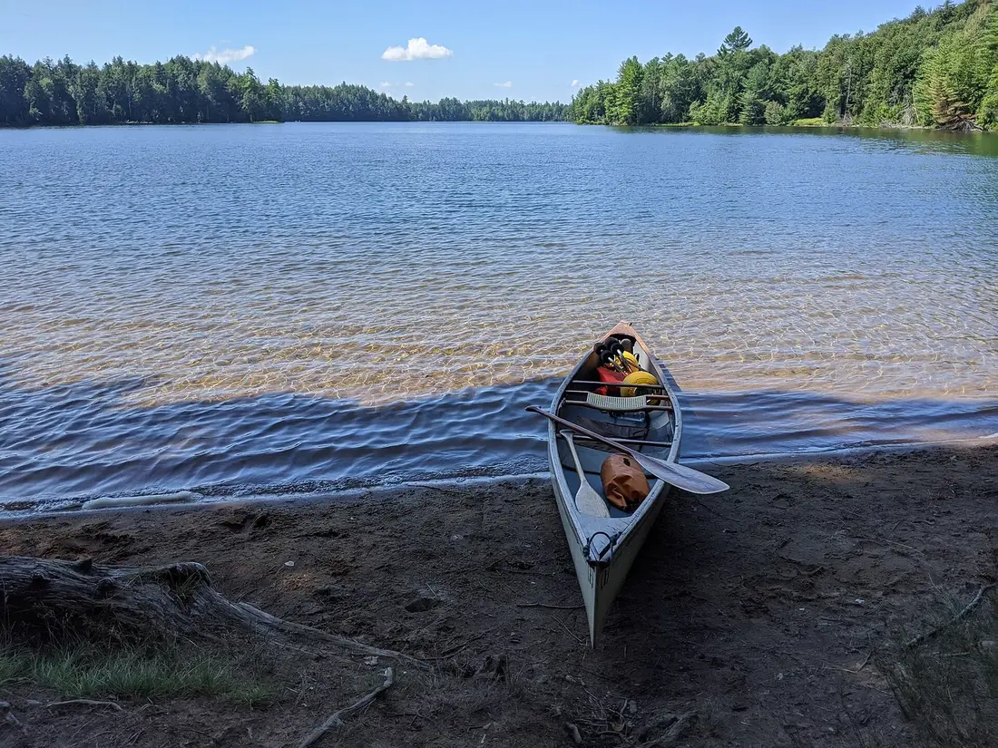


Photos on this page: Meacham Lake Franklin County New York by Mwanner, CC BY-SA 3.0; St Regis Canoe Area by Marty Plante, CC BY-SA 4.0. Resized and cropped for this site. All photo credits