
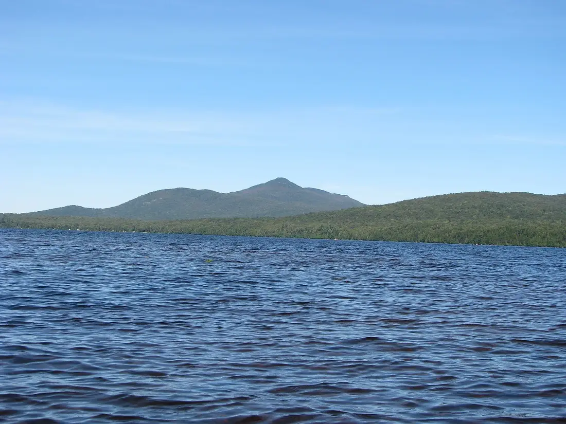
Debar Mountain Wild Forest
The 80,000-acre wild forest south of the cabins: Debar Mountain's trail, Debar Pond and its lodge, Hays Brook, Lake Kushaqua, camping and sled trails.
The Debar Mountain Wild Forest is the big block of state land south of the cabins: about 80,000 acres of Forest Preserve in southern Franklin County, with Debar Mountain, the fire-tower summit of Loon Lake Mountain, Meacham Lake, Debar Pond and a chain of lakes running down toward Paul Smiths. The road to Debar Pond, one of its closest entrances, is about 13 road miles from the cabins, roughly half an hour. Come for a long climb, an hour beside a mountain pond, a ride on the horse trails or a winter day on the snowmobile corridors.
What a wild forest is
Nearly all the state land inside the Adirondack Park belongs to the Forest Preserve, which Article XIV of the New York constitution protects as forever wild. The Adirondack Park State Land Master Plan then sorts that land into classes, and of its wild-land classes, wild forest allows the most use. The plan describes it as land that can take somewhat more human use than wilderness, primitive or canoe areas while keeping an essentially wild character. It often lacks the remoteness of a wilderness, and it is open to a wide variety of outdoor recreation.
In practice more is allowed here than in the High Peaks Wilderness. A few old roads stay open to cars, snowmobiles run on designated trails, and the plan permits bicycle trails, horse trails, lean-tos, primitive tent sites below 3,500 feet and trailheads beside public roads. It also says motor vehicle use will not be encouraged, and that the public road and snowmobile mileage should not grow much beyond what existed in 1972.
New structures go up only under a finally adopted unit management plan, and buildings that do not fit the class, which the plan calls non-conforming uses, are to be removed as soon as practicable. Keep that rule in mind; it explains the long fight over Debar Pond Lodge, described below.
The size and shape of the unit
The state's 2020 draft management plan counts 80,427 acres of wild forest inside the 88,335-acre Debar Mountain Complex, a planning unit that also takes in two primitive areas along the Deer River and at Madawaska Flow. The land lies in five Franklin County towns, Brighton, Duane, Franklin, Santa Clara and Waverly, between the park's northern boundary, the Blue Line, and NY 86 near Paul Smiths.
This is low, rounded country between the flat St. Lawrence Valley to the north and the lake region around Paul Smiths, with broad wetlands and glacial outwash plains between the hills. The ice left its mark everywhere. Kame moraines, mounds of sand left by the retreating ice sheet, formed Meacham Lake, and two large eskers, long ridges of glacial gravel, run past Rainbow Lake and along the Osgood River. The land drops to 1,299 feet at Long Pond in the town of Waverly and rises to 3,337 feet on the summit of Loon Lake Mountain, the high point of the unit. Debar Mountain, at 3,305 feet, is the peak the unit is named for.
Next door lie about 90,000 acres of private timberland under state conservation easements, the 18,989-acre Kushaqua Tract and the 72,041-acre Santa Clara Tract, which add more country open to recreation. About 30 miles of trail in the complex serve hikers, skiers, snowshoers, riders, cyclists and snowmobilers, most of it on old woods roads. DEC has never adopted a final management plan for the unit. A draft went out for comment in December 2020, a revised scope followed in July 2025, and the November 2025 edition of the master plan still lists the area as having no adopted plan.
Getting there from the cabins
Two county roads lead in. For Debar Pond, Debar Meadows and Loon Lake Mountain, take County Route 27, Pond Road, south past Owls Head and Mountain View to County Route 26, the old Port Kent–Hopkinton Turnpike, and turn left; the road to Debar Pond leaves it on the right about 0.2 mile later. For Meacham Lake, the Debar Mountain trail and Hays Brook, take County Route 25 west to NY 30 and turn south. County Route 26 runs about 4 miles west from the Pond Road junction to NY 30, so you can drive in one way and come home the other. The getting to the cabins guide covers the local roads near the cabins.
| Stop | Roads from the cabins | Road miles | Drive |
|---|---|---|---|
| Debar Pond road | County Routes 27 and 26 | About 13 | About 30 minutes |
| Loon Lake Mountain trailhead | County Routes 27 and 26 | About 20 | About 40 minutes |
| Meacham Lake Campground, Debar Mountain trailhead | County Route 25, NY 30 | About 21 | About 35 minutes |
| Hamlet of Loon Lake | County Routes 27 and 26 | About 24 | About 50 minutes |
| Hays Brook trailhead, Mountain Pond Road | County Route 25, NY 30 | About 28 | About 45 minutes |
| Buck Pond Campground, Lake Kushaqua | NY 30, NY 86, Gabriels–Onchiota Road | About 40 | About an hour |
Phone signal is patchy away from the villages, so load a map at the cabin before you leave. DEC publishes a georeferenced PDF map of the wild forest that shows your position in an offline map app, with no signal needed. Buy lunch and fill the tank in Malone before you head south; the groceries and supplies page lists the stores. For shorter walks closer to the door, see hiking near the cabins.
Debar Mountain
Seen from NY 30 between Malone and Paul Smiths, Debar Mountain is the big ridge that dominates the skyline to the east. It takes its name from John Debar, a Canadian trapper who reached the pond and the mountain in 1817. The trail starts inside Meacham Lake Campground, about 21 road miles from the cabins, and DEC measures it at 3.7 miles and 1,725 feet of climbing to the summit, a 7.4-mile round trip. While the campground is open, hikers pay its day-use fee at the booth, $8 a car in 2026; the 2026 season runs May 15 to October 12. The Meacham Lake guide covers the beach and the lake.
The route
The walk begins on a gated old road through spruce swamps and open stands of mature hardwoods. The first 1.1 miles are shared with the Debar Meadows to Meacham Lake trail, which becomes part of snowmobile corridor C8 in winter. At the fork the Meadows trail carries on toward the old game refuge and the summit trail bears left. For a long way it barely climbs: the first 1.9 miles gain only 170 feet.
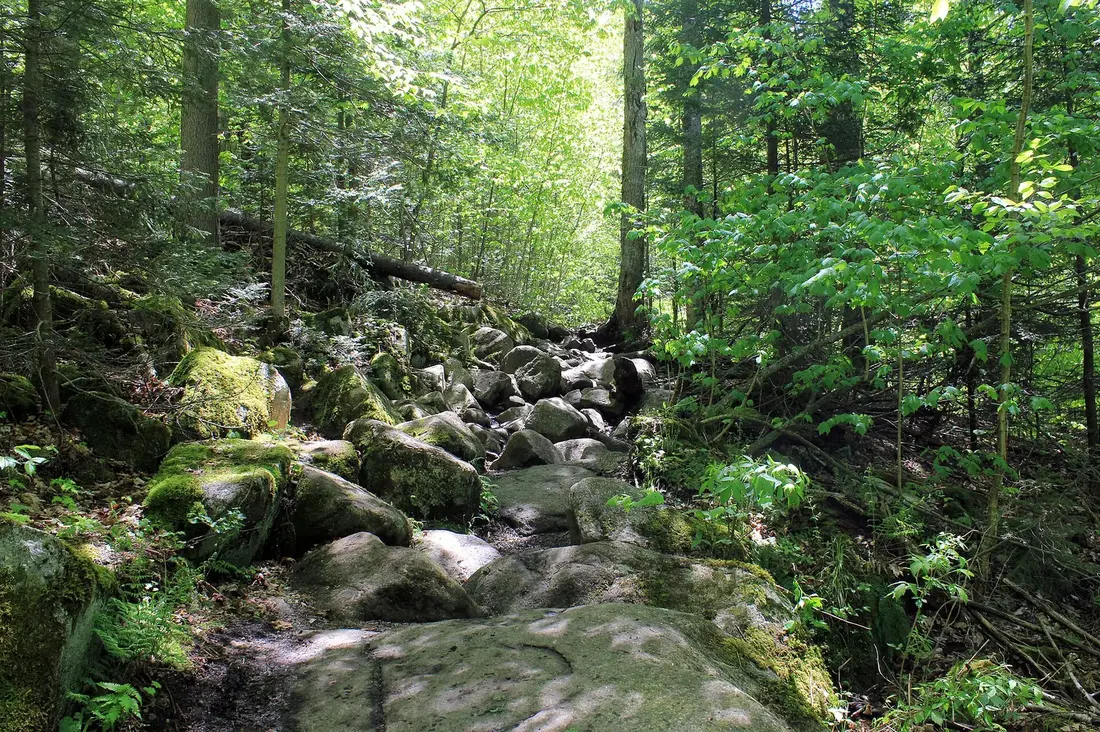
The next 1.3 miles climb 755 feet, gently at first, over rockier ground and a string of small stream crossings. After rain the water runs down the tread, which was once the access road the fire observers used. The trail crests a shoulder of Black Peak, dips toward another stream and reaches a lean-to about three-quarters of a mile below the top. The last half mile climbs 800 feet at an average grade near 30 percent, on an eroded path with two sets of rock steps. Near the top the woods change to boreal forest, and Meacham Lake shows through the trees.
Count on about four hours of walking for the whole round trip, plus your stops. DEC's 2020 draft plan names erosion on the steep section as a problem that may need a reroute, and it proposed replacing the lean-to with a tent site. With no plan adopted, both were still proposals at last check, so look at DEC's trail notices before you count on the shelter.
The old fire tower
A fire observer worked on the summit from 1912. In 1918 the state put up a 35-foot Aermotor steel tower, observers watched from it until 1970, and it came down around 1979. What remains is a small bare knob with the tower's footings and the steel loops that once anchored its cables still set in the rock. Trees have grown up around it, so the view is partial: Meacham Lake to the west, with the fire tower on Azure Mountain the easiest landmark in that direction, and the High Peaks to the south. The summit was once open enough for Verplanck Colvin to triangulate Lake Champlain and the St. Lawrence River from it. Local people have asked for a new tower, but DEC has said its policy for managing mountain summits rules one out.
Debar Mountain in winter
In winter the hike starts on NY 30 at the north end of Meacham Lake Road, which leaves the highway 2.9 miles north of NY 458 and 5.7 miles south of County Route 26. You walk the campground road about 1.6 miles to the summer trailhead, and the round trip comes to 9 or 10 miles, depending on whether the road to the lake has been plowed for ice fishing. Snowmobiles use that first stretch heavily on weekends, so keep to the side. The best snowshoeing usually comes in late February or March, after a thaw has firmed the base, and skiers can often go as far as the lean-to before switching to snowshoes for the final 0.8 mile.
Debar Pond and the lodge
Debar Pond is the easiest place in the unit to see a mountain pond up close. The 86-acre pond lies entirely inside the wild forest, with Debar and Baldface mountains rising steeply from its shores and the Loon Lake Mountains in the distance down the pond. Its road leaves County Route 26 just past the Pond Road junction, about 13 road miles from the cabins. It crosses private land on a 0.3-mile deeded right of way, continues as a DEC road to a gate and a parking area for about ten cars, and from the gate a flat 0.3-mile walk on the old road reaches the shore.
Bring a picnic, and a canoe or kayak if you have one; the pond is a hand carry, and you can paddle the whole shoreline in an hour or two, with easy landings along the way. The far end bends out of sight of the buildings. The pond is managed as a coldwater fishery: brook trout are native, and DEC stocks it, in 2025 with 600 splake and 130 landlocked salmon. Using fish as bait is banned here to protect the native fish, so check the current fishing rules before you cast. The picnic shelters and day-use facilities DEC has proposed have not been built, so carry what you need and take your trash home.
The lodge at the north end is the reason the pond keeps making the news. Robert Schroeder, the son of a wealthy German brewer, built an estate here in 1880; after it burned in 1882 he put up a 60-room mansion known as the Castle. Arthur Wheeler of Palm Beach bought the place in 1939, had the neglected Castle torn down and built the present lodge, finished in 1940. It is a rambling two-story building of 18 rooms, designed by the Saranac Lake architect William Distin, light-frame construction faced with half and full round logs, with a caretaker's house, barns and sheds around it. It is on the State and National Registers of Historic Places.
Farwell Perry, a World War II fighter pilot who landed a seaplane on the pond, bought the property in 1959 and sold the lodge and more than 1,300 acres to the state in 1979, keeping private use of the lodge grounds until 2004. Because the land is wild forest, the buildings are non-conforming, and DEC has twice proposed removing them: in the 2020 draft plan, which would also have reclassified about 41 acres as an intensive-use day area with pavilions, picnic tables, parking and restrooms, and again in a July 2025 scope that named removal as its preferred option. A land swap that would have saved the lodge died in January 2024, after the Town of Duane voted against it. Adirondack Architectural Heritage now asks the state to classify the site as historic, as the state did for Camp Santanoni, while wilderness advocates want the shore returned to the wild with an accessible path and dock. In March 2026 DEC said it had not decided and had no timeline for a new draft. Until it decides, the lodge stands empty, its lower windows boarded; enjoy it from the lawn and the water.
Debar Meadows and the old game refuge
East of Debar Mountain, the clearings called Debar Meadows mark the site of the Debar Mountain Game Refuge, a 10,000-acre preserve the state set up around 1930 to restock the Adirondacks with elk. The elk were held in pens and released. After the program ended they fell to poachers, and they were gone by the 1960s. The old pastures have grown back into young woods of aspen, cherry, red maple, white pine and birch.
The access road leaves County Route 26 about 4.5 miles past the Debar Pond turn, heading toward Loon Lake, at a corner with a concrete bridge stamped 1949. It runs 1.7 rough miles to the parking area, and a high-clearance vehicle is the safe choice. From there the Skiff Pond Trail makes a 2.4-mile loop past a small pond with a primitive tent site and rejoins the Debar Meadows trail, which runs on west to Meacham Lake. Mountain bikers who rode that through route in 2024 found it wet and rough, with blowdown across the middle and a washed-out culvert, so plan on wet feet and slow going.
Loon Lake Mountain and the western tower
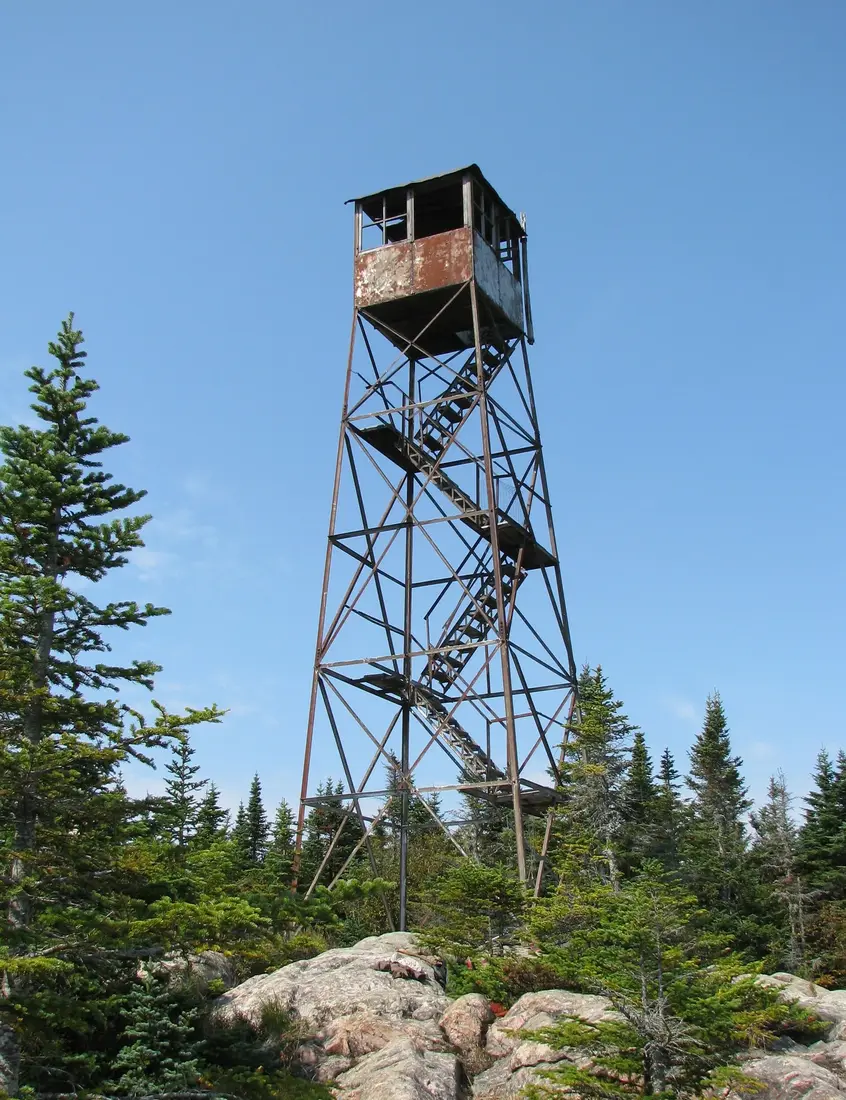
The unit's other summit trail climbs Loon Lake Mountain from County Route 26, about 20 road miles from the cabins. It runs 2.8 miles each way with more than 1,600 feet of climbing, first on logging roads across the Kushaqua Tract easement and then on Forest Preserve, to a 35-foot steel fire tower that is closed to climbing. The Loon Lake Mountain guide covers the trail, the tower's history and the old resort hamlet below.
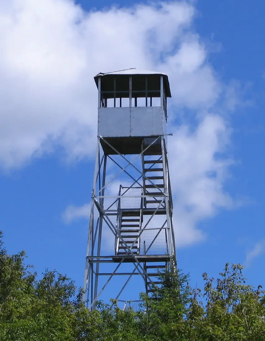
In the western part of the wild forest, near St. Regis Falls, is the trail DEC counts as the busiest in the unit: a climb of about a mile and 944 feet to the open fire tower on 2,518-foot Azure Mountain. It has its own guide, and the fire tower challenge guide explains how both summits count toward the Adirondack Mountain Club's patch.
Hays Brook and the horse trails
The southern end of the unit, just north of Paul Smiths, holds the wild forest's horse trails. The Hays Brook trailhead is on Mountain Pond Road, a 1.5-mile seasonal town road that leaves NY 30 about 3.8 miles north of Paul Smith's College; from the cabins it is about 28 road miles, roughly 45 minutes. The lot is the old Hays Brook assembly area for riders, with room for about a dozen vehicles and a hitching post. It sits on a piece of the Theodore Roosevelt International Highway, a 1920s route that ran from Portland, Maine, to Portland, Oregon.
The main line is the Hays Brook Truck Trail, a road built by the Civilian Conservation Corps that runs nearly three miles to the middle reaches of Hays Brook with almost no net change in elevation. Half a mile in, just past a bridge over the Osgood River, the Grass Pond Trail turns right and runs 1.4 miles to a lean-to with a view of the pond. At 0.9 mile the Hays Brook Horse Trail branches off and links to the Sheep Meadow Trail, which makes a 3.4-mile loop possible. At 1.4 miles the Sheep Meadow Trail turns left and runs 2.3 miles to a former sheep meadow, where a horse barn stands opposite two lean-tos and campfires are allowed. Out and back to Sheep Meadow is about 7.2 miles with roughly 430 feet of climbing on the ups and downs.
Riding has dropped off here. DEC's draft plan counts 14.2 miles of horse routes in the complex but calls current use low, and it proposes two short connectors to make riding loops. Hikers and skiers use the same trails, and in winter the roads and trails around Mountain Pond get the most use in the unit; the cross-country skiing and snowshoeing guide covers that side.
The Kushaqua Tract
The lower half of the Loon Lake Mountain trail crosses the Kushaqua Tract, about 19,000 acres of working timberland in the towns of Franklin and Brighton. International Paper owned it in 2004, when the state bought a conservation easement on the company's Adirondack lands, at the time the largest open-space conservation project in New York history. Lyme Timber bought the land in 2006 and still logs it. The easement bars development and gives the public recreation rights, which opened in 2009 after a five-year wait.
DEC's 2016 recreation plan for the tract opens, in phases, about 26 miles of roads to cars in three seasons, 30 miles to ATVs and 30 miles to snowmobiles, with 12 campsites and an accessible fishing dock at Mountain Pond. About 100 miles of logging roads are open on foot, bike and horseback. Two rules matter: motor vehicles may use only the roads signed for them, and the leased camp lots, about 30 parcels of an acre each, are private and closed to the public. Logging continues, so expect active cutting.
Lake Kushaqua and Rainbow Lake
At the south end of the unit, Lake Kushaqua and Rainbow Lake form a chain in the watershed of the North Branch of the Saranac River. Lake Kushaqua, 377 acres, was once called Round Pond, and an 1894 guidebook claimed the largest lake trout on record, 52 pounds, came out of it. A 15-foot dam at its outlet raises both Kushaqua and Rainbow Lake. Today it holds northern pike, rock bass and yellow perch along with lake trout, and DEC stocked 1,350 young lake trout there in 2025.
Buck Pond Campground sits between Lake Kushaqua and Buck Pond at 1339 County Route 60 in Onchiota. It has 116 tent and trailer sites, a sand beach, a boat launch on Lake Kushaqua and a hand launch on Buck Pond, where motorboats are not allowed. In 2026 it was open from May 15 to September 7; check next season's dates before you plan around it. From the campground the level Kushaqua Rail Trail follows an old rail bed 1.3 miles along the shore, with views of the lake and Loon Lake Mountain, and it carries snowmobile corridor C7B in winter. Another stretch of the same corridor, the D&H rail bed, runs 4.1 level miles between County Route 55 and Oregon Plains Road past wetlands and ponds, a favorite of birders and dog walkers.
Rainbow Lake, just southwest, was a fine brook trout lake in the 1880s and is now a warmwater lake with northern pike, largemouth bass and yellow perch, and walleye stocked on a limited basis. Homes and camps line much of its south and west shores, while much of the north shore is state land, including the Rainbow Lake Esker, which the master plan lists among its special geographic areas. Paddlers reach the lake from Buck Pond Campground through Lake Kushaqua and the Rainbow Narrows, or by a 0.3-mile carry from a small parking area on Clark Wardner Road. The Osgood River paddle from Meacham Lake is in the Meacham Lake guide, and the motorless ponds between Paul Smiths and Lake Clear are in the Saint Regis Canoe Area guide.
Camping and lean-tos
DEC's 2020 inventory counted 52 primitive tent sites and five lean-tos in the complex. About two dozen of the tent sites are roadside sites, within 250 feet of a road, and they get most of the use: seven along the Kushaqua–Mud Pond Road, many on the water, six on Mountain Pond Road near Hays Brook, five at Jones Pond and six along Slush Pond Road. The lean-tos are on the Debar Mountain trail, at Grass Pond, on the Osgood River and two at Sheep Meadow; in 2020 the Debar Mountain and Osgood River shelters needed repairs. All of them are first come, first served, and none can be reserved. For showers and a beach, use the Meacham Lake or Buck Pond campgrounds in season.
The state land camping rules apply everywhere in the unit:
- Camp at a designated site, or at least 150 feet from any road, trail or water.
- Stays longer than three nights, and groups of ten or more, need a permit from a Forest Ranger; call DEC at 518-897-1300 for the name of the local ranger.
- A lean-to is shared, up to its capacity, usually about eight people, and no tents go inside one. At a tent site, share for one night with a party that arrives after dark in rain or cold; they move on in the morning.
- Burn only dead and down wood and never cut standing trees. Untreated firewood may not come into New York from another state or country, or travel more than 50 miles inside it, and a violation carries a $250 fine.
- Keep food away from bears; wildlife watching has the BearWise rules.
Hunting and fishing
Hunting is still a popular use of the unit. White-tailed deer and black bear are the big game, and coyote, red and gray fox, bobcat, raccoon, weasels and snowshoe hare can also be hunted. The master plan singles out the slopes of Debar, East and Sable mountains as a challenge for big game hunters. Seasons follow the statewide Northern Zone rules; for 2026 the regular deer season runs October 24 through December 6, and bear seasons run from September 19 to December 6. Check DEC's current regulations before you go, and if you hike in the fall, wear orange and keep a dog close.
For anglers, Hays Brook, Hatch Brook and the Osgood River hold trout. DEC has bought public fishing rights on 2.72 miles of the Main Branch of the St. Regis River, 2.5 miles of the East Branch and 1.04 miles of Hatch Brook, which let you walk those private banks to fish during the open season. The ponds are easier: Debar Pond and Lake Kushaqua are stocked, and Meacham Lake, the biggest water in the unit, has its own section in the Meacham Lake guide. Everyone 16 and older needs a New York fishing license; the fishing trips page has the fees and the waters closer to the cabins.
Snowmobile corridors
Three main corridors cross the unit. The C8 follows the Debar Meadows to Meacham Lake trail, the C7B uses the D&H rail bed and the Kushaqua Rail Trail, and the C7, the corridor that also passes near the cabins, crosses the unit too. DEC also lists three secondary trails in the unit, the S78, S82 and S83. DEC's draft plan counts 26.4 miles of snowmobile routes in the wild forest, more than half of them on administrative roads, many of them old rail beds, and the Franklin County snowmobile clubs groom them under an agreement with DEC.
The snowmobiling guide covers registration, the clubs, the fuel stops and the link between the C7 and the C8, which in 2020 still used County Route 26 for part of the way. Skiers and snowshoers use the C8 out of Meacham Lake, so slow down when you meet them. DEC's draft plan would close the isolated Hays Brook trails to sleds, since they see little snowmobile use, which leaves that corner mostly to skiers.
Seasons
Spring. Mud season runs anywhere from late March into mid-June, depending on the year, and DEC asks hikers to stay off trails above 2,500 feet until mid-June. Debar Mountain and Loon Lake Mountain both rise well above that line, so spring is the time for Debar Pond, the rail trails and the Hays Brook loops. Black flies arrive in mid-May; the bug guide covers them.
Summer. Both state campgrounds are open, with unsupervised swimming at their beaches, and the long days suit an early start on Debar Mountain.
Fall. The bugs are gone, the trails are quiet and the hardwoods turn, but the hunting seasons overlap with the color.
Winter. The C7, C7B and C8 carry sleds, the old roads make long ski routes, and the Town of Franklin plows the Loon Lake Mountain lot.
A day in the wild forest
This plan covers both sides of the unit with about 47 miles of driving. Leave the cabins by 7:30 and take County Route 25 and NY 30 south to Meacham Lake Campground, about 35 minutes. Pay the day-use fee if the booth is open and be on the Debar Mountain trail by 8:15. Eat lunch at the lean-to or on the summit knob, and be back at the car by about 1:30.
In summer, cool off at the Meacham Lake beach; it has had no lifeguard since 2023, so swim only from the designated beach area. Then drive north on NY 30, turn right onto County Route 26 and follow it to the Debar Pond road, about 12 miles from the campground. Walk the 0.3 mile to the shore and sit on the lawn below the lodge, or paddle the pond for an hour. Then take Pond Road home, about 14 more miles. You are back by late afternoon, in time for the hot tub and the fire pit; every one of the cabins has both, plus a washer and dryer for muddy clothes.
What to avoid
- Private land. The roads to Debar Pond and Debar Meadows cross private land on rights of way, the leased camps on the Kushaqua Tract are off limits, and the cottages at Loon Lake are private. Stay on the road or trail and obey posted signs.
- Low cars on rough roads. The Debar Meadows road calls for high clearance, and seasonal roads such as Mountain Pond Road are not kept open for winter driving.
- High summits in mud season, and any summit or fire tower in a thunderstorm.
- Going without a plan. Tell someone at the cabin where you are going. In an emergency call 911 or DEC's Forest Ranger dispatch at 1-833-697-7264, and if you are lost or hurt, stay put. Moose and black bear both live in the unit; give them room.
- Loose dogs near wildlife. State land outside the Eastern High Peaks has no leash rule, but DEC advises a leash unless your dog stays under voice control. Dogs are not allowed on the campground beaches; see bringing your dog.
Questions
How big is the Debar Mountain Wild Forest?
About 80,000 acres. DEC's 2020 draft management plan counts 80,427 acres of wild forest inside the 88,335-acre Debar Mountain Complex, which also takes in two primitive areas. DEC's web page gives 81,160 acres for the Forest Preserve east of NY 30, a figure that takes in some Chazy Highlands Wild Forest land. The wild forest lies in the Franklin County towns of Brighton, Duane, Franklin, Santa Clara and Waverly, and the Debar Pond road is about 13 road miles from the cabins.
How hard is the Debar Mountain hike?
It is 3.7 miles each way with 1,725 feet of climbing, starting inside Meacham Lake Campground. The first 1.9 miles are nearly flat; the last half mile climbs 800 feet on a steep, eroded path. Count on about four hours of walking. While the campground is open you pay its day-use fee, $8 a car in 2026, and in winter the hike starts on NY 30 and grows to 9 or 10 miles round trip.
Can I visit Debar Pond Lodge?
You can visit the grounds and the pond, but not the buildings, which are closed and boarded. The road leaves County Route 26 near the Pond Road junction, about 13 road miles from the cabins, and a flat 0.3-mile walk from the gate reaches the shore. DEC has proposed removing the lodge twice; in March 2026 it said it had not decided. See the Loon Lake Mountain guide to pair it with a climb.
Where can I camp in the Debar Mountain Wild Forest?
DEC's 2020 count found 52 primitive tent sites and five lean-tos, all first come, first served, including roadside sites on the Kushaqua-Mud Pond Road and Mountain Pond Road and lean-tos at Grass Pond and Sheep Meadow. Camp at a designated site or 150 feet from roads, trails and water; stays over three nights or groups of ten or more need a ranger permit. Meacham Lake and Buck Pond campgrounds have showers and beaches in season.
Can I ride a snowmobile from the cabins into the wild forest?
Yes. The C7 corridor runs near the cabins, and the C7, C7B and C8 corridors all cross the wild forest; DEC also lists secondary trails S78, S82 and S83 in the unit, and Franklin County snowmobile clubs groom them. The snowmobiling guide covers registration, clubs, fuel stops and the link between the C7 and the C8.
Is hunting allowed in the Debar Mountain Wild Forest?
Yes. Deer and black bear are the main big game, and small game and furbearers are hunted too, under Northern Zone seasons; for 2026 the regular deer season runs October 24 through December 6, and bear seasons run from September 19. Hikers should wear orange from fall into early December and keep dogs close. Check DEC's current regulations before you go.
Sources
Facts on this page were checked against these sources in October 2026. Hours, fees and schedules change; confirm before you go.
- apa.ny.gov apa.ny.gov/files/laws/APSLMP.pdf
- content.govdelivery.com content.govdelivery.com/accounts/NYSDEC/bulletins/13f3c0a
- content.govdelivery.com content.govdelivery.com/accounts/NYSDEC/bulletins/8f1d39
- New York State Department of Environmental Conservation dec.ny.gov/environmental-protection/public-safety/forest-rangers
- New York State Department of Environmental Conservation dec.ny.gov/nature/animals-fish-plants/invasive-species/terrestrial/fir
- New York State Department of Environmental Conservation dec.ny.gov/places-to-go/maps/debar-mountain-wild-forest-georeferenced-
- New York State Department of Environmental Conservation dec.ny.gov/places/debar-mountain-wild-forest
- New York State Department of Environmental Conservation dec.ny.gov/places/kushaqua-conservation-easement-tract
- New York State Department of Environmental Conservation dec.ny.gov/sites/default/files/2024-07/actualstocking.pdf
- New York State Department of Environmental Conservation dec.ny.gov/things-to-do/camping/campground-day-use-schedule
- New York State Department of Environmental Conservation dec.ny.gov/things-to-do/camping/primitive
- New York State Department of Environmental Conservation dec.ny.gov/things-to-do/hunting/deer-bear/seasons
- New York State Department of Environmental Conservation extapps.dec.ny.gov/docs/lands_forests_pdf/debarmeadowshikingmap.pdf
- New York State Department of Environmental Conservation extapps.dec.ny.gov/docs/lands_forests_pdf/debarmtnhikingmap.pdf
- New York State Department of Environmental Conservation extapps.dec.ny.gov/docs/lands_forests_pdf/debarscope.pdf
- New York State Department of Environmental Conservation extapps.dec.ny.gov/docs/lands_forests_pdf/debarump.pdf
- New York State Department of Environmental Conservation extapps.dec.ny.gov/docs/permits_ej_operations_pdf/buckpond23.pdf
- Adirondack Mountain Club adk.org/mud-season-quick-facts/
- Adirondack Explorer adirondackexplorer.org/adirondacks-almanack/a-family-hike-up-debar-mou
- Adirondack Explorer adirondackexplorer.org/commentary/wild-forest-or-historic-site-decidin
- Adirondack Explorer adirondackexplorer.org/communities/economy/state-moves-ahead-on-removi
- Adirondack Explorer adirondackexplorer.org/communities/history/from-elk-herds-to-muddy-tra
- Adirondack Explorer adirondackexplorer.org/communities/history/loon-lakes-lifestyles-of-th
- Adirondack Explorer adirondackexplorer.org/communities/land-use/debar-pond-lodge-update/
- Adirondack Explorer adirondackexplorer.org/environment/dogs-in-the-adirondacks/
- Adirondack Explorer adirondackexplorer.org/general/loon-lake-mountain/
- Adirondack Explorer adirondackexplorer.org/recreation/favorite-winter-treks/
- Adirondack Explorer adirondackexplorer.org/recreation/lodge-or-no-lodge-debar-pond-provide
- Adirondack Explorer adirondackexplorer.org/recreation/snow-sports/early-tracks-to-grass-po
- OpenStreetMap (road distances) openstreetmap.org/
- tupperlake.com tupperlake.com/hiking/hays-brook-trail-to-sheep-meadow
- Visit Malone visitmalone.com/hiking/azure-mountain
- New York State Department of Environmental Conservation extapps.dec.ny.gov/docs/lands_forests_pdf/debarduaump.pdf
- New York State Department of Environmental Conservation extapps.dec.ny.gov/docs/lands_forests_pdf/kushaquarmp2.pdf
- New York State Department of Environmental Conservation dec.ny.gov/sites/default/files/2025-04/summerreccampgroundsummary.pdf
- New York State Department of Environmental Conservation extapps.dec.ny.gov/docs/permits_ej_operations_pdf/meachamlake23.pdf
- New York State Department of Environmental Conservation dec.ny.gov/things-to-do/camping/state-land-rules
- eregulations.com eregulations.com/newyork/fishing/region-5-regulations
- nysenate.gov nysenate.gov/legislation/bills/2023/S3030
- Adirondack Explorer adirondackexplorer.org/communities/debar-pond-lodges-future-remains-un
- content.govdelivery.com content.govdelivery.com/accounts/NYSDEC/bulletins/2b096c3
- epqs.nationalmap.gov epqs.nationalmap.gov/v1/json?x=-74.151699&y=44.558178&wkid=4326&units=
- edits.nationalmap.gov edits.nationalmap.gov/apps/gaz-domestic/public/summary/970320
- New York State Department of Environmental Conservation extapps.dec.ny.gov/docs/lands_forests_pdf/ftowerstudy.pdf
- New York State Department of Environmental Conservation dec.ny.gov/sites/default/files/2024-05/devilstombstonemap.pdf
- content.govdelivery.com content.govdelivery.com/accounts/NYSDEC/bulletins/362b7ec
In this guide
Stay nearby
The first of the cabins: a big stone fire pit you see as you walk up, a screened corner of the deck, direct trail access, and a short walk to an observation deck over the pond.
 The Modern Tiny HomeCabin 1 · 2 bd · 1 ba · sleeps 4
More in Trails & Hiking
Sources
46 references, listed in full at the end of this guide: official park, state, tourism-office and business sources, checked October 2026.
Related guides


Photos on this page: Meacham Lake Franklin County New York by Mwanner, CC BY-SA 3.0; Fire Observation Tower on the summit of Loon Lake Mountain, Loon Lake, New York, Franklin County by Marc Wanner, CC BY-SA 3.0; Azure Mountain Fire Tower by Mwanner, CC BY-SA 3.0. Resized and cropped for this site. All photo credits