
Waterfalls near the Cabins
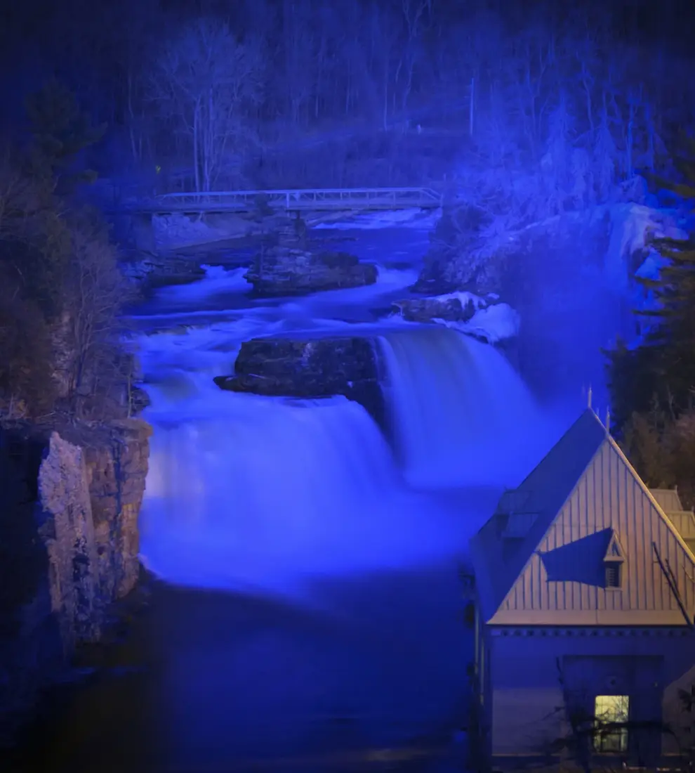
Waterfalls near the cabins, nearest first: Chasm Falls and High Falls close by, then Everton, Chateaugay, St. Regis Falls, Wilmington Notch and Ausable Chasm.
The nearest waterfall to the cabins is Chasm Falls on the Salmon River, about two road miles away, and High Falls in the Titusville Mountain State Forest is a level walk that starts about five miles from the door. This guide adds a dozen more within an hour and three quarters by car, from a Nature Conservancy preserve on the St. Regis River to the walkways of High Falls Gorge and Rainbow Falls at Ausable Chasm. They run nearest first, each with the drive, the walk, the season when the water runs best and what to know at the edge.
The falls at a glance
Road miles are from the cabins, and the fees are the ones posted for 2026. Prices and hours change from season to season, so check the current schedule before you go.
| Waterfall | Road miles | The walk | Cost |
|---|---|---|---|
| Chasm Falls | About 2 | Seen from the county road | Free |
| High Falls, Titusville Mountain State Forest | About 5 | 1.5 miles round trip, level | Free |
| Everton Falls | About 21.5 | Short trail to the shore | No fee posted |
| High Falls, Chateaugay | About 22.5 | 1.1 miles out and back, many steps | $5 a person, cash or check |
| St. Regis Falls | About 30 | Paths at the town campsite | Check in with the attendant |
| Monument Falls | About 56.5 | Seen from the road | Free |
| Stone Valley, Colton | About 57 | Out and back, or a 7.5-mile loop | No fee posted |
| Cascade Falls | About 60 | Short scramble, no marked trail | Free |
| Rocky Falls | About 60 | 4.6 miles round trip | ADK parking fee |
| High Falls Gorge | About 60 | Half-mile routes, quarter-mile accessible path | $20 adults, $15 ages 4 to 12 (summer) |
| The Flume, Wilmington | About 62 | Short paths, no railings | Free |
| Bog River Falls | About 67 | Roadside, short herd paths | Free |
| Roaring Brook Falls | About 74 | 0.3 mile to the base | Free |
| Rainbow Falls, Ausable Chasm | About 74.5 | Bridge view, or ticketed park trails | Free from the bridge; trails ticketed |
Falls you can see from the road
Several of these take almost no walking, which helps on a short day or with someone who cannot manage stairs. Monument Falls is beside NY 86 at a pull-off, Cascade Falls shows from NY 73 above the Cascade Lakes, Bog River Falls runs under the NY 421 bridge, and Roaring Brook Falls can be seen from a pull-off on NY 73. Chasm Falls is beside the county road two miles from the cabins. At High Falls Gorge a quarter-mile accessible route reaches the center of the falls.
Chasm Falls on the Salmon River
Chasm Falls is the hamlet on the Duane Road, County Route 25, about two road miles from the cabins on the way to Malone; it was once called Titusville. Here the Salmon River pours over a power dam and down a rocky gorge beside the road. The dam feeds a small hydroelectric plant downstream, and the plant decides much of what you see in the gorge.
Under its operating terms the plant must leave at least 15 cubic feet per second in the 4,800-foot stretch of river it bypasses from May 1 to October 1, and 23 the rest of the year. The river carries far more than that in spring. At the USGS gauge at Chasm Falls, on records kept from 1925 to 2013, it averaged about 550 cubic feet per second in April and about 150 in August. Come in April or after a soaking rain for the full roar; in a dry August the gorge runs thin.
Enjoy the gorge from the roadside: its half mile of river is rated Class V+, water for expert paddlers only. For a walk down to the water, the Salmon River guide covers the power company's day-use area and Bill King Memorial Park, both close by, and the falls in the village of Malone.
High Falls in the Titusville Mountain State Forest
High Falls is the closest waterfall you walk to. The parking spot on Barnesville Road is about five road miles from the cabins, about 15 minutes by car, and blue markers lead along the Salmon River to a curtain slide with a 30-foot drop, passing smaller falls on the way. The walk is about 1.5 miles round trip on level ground; give it one to two hours.
It is the same river as Chasm Falls, so it keeps the same calendar: the April melt and the day after a heavy rain bring the most water over the ledge. Black flies are out from mid-May to late June and stay close to running water; the bug guide has what works.
The Titusville Mountain State Forest guide has the turns from the cabins, the closed bridge by the parking spot and the stairs at the falls. Elephant's Head, a short climb in the same forest about nine road miles from the cabins, makes a good second stop the same morning.
Everton Falls
Everton Falls is on the East Branch of the St. Regis River, inside the Everton Falls Preserve, 530 acres owned by The Nature Conservancy that protect a mile and a half of the river. It is about 21.5 road miles from the cabins, roughly 40 minutes: County Route 25 to NY 30, south on NY 30 for about seven miles, then west on Red Tavern Road, County Route 14, for about eight.
Park on the north side of Red Tavern Road at the DEC Waterway Access Site sign. A short trail from the lot runs through mixed northern hardwoods and conifers to the shore, which has a view of the falls and room to sit with a picnic lunch. Across the road, a state launch for canoes and kayaks opens about nine miles of flat water on the East Branch above the falls, a quiet paddle if you bring a boat.
The preserve is open from dawn to dusk all year. Dogs must be on a leash, and owners pick up after them; camping, fires, cooking, bikes, hunting and trapping are not allowed, and the lot is not plowed in winter. Everton itself was a lumber settlement of the 1800s that logged itself out of existence. Brook trout, beaver, belted kingfishers, great blue herons, bald eagles and moose live along the river now, and cardinal flower grows in the preserve.
The USGS gauged the East Branch near Meacham Lake from 1958 to 1968, and it averaged about 200 cubic feet per second in April against about 45 to 50 from July through September, so spring is the time to see the falls full. St. Regis Falls is about seven miles farther west, and the two make the loop at the end of this guide.
High Falls at Chateaugay
The other High Falls is a 120-foot cascade on the Chateaugay River, inside High Falls Park, a private campground at 34 Cemetery Road just outside the village of Chateaugay. It is about 22.5 road miles from the cabins, roughly 40 minutes by County Route 25 into Malone and US 11 east. The park's falls trail is 1.1 miles out and back and takes under an hour, and the last stretch to the bottom of the gorge is a long stairway of wooden and stone steps. Walkers pay $5 a person on the park's posted rates, with children under 5 free, in cash or by check.
The Chateaugay River near the village averaged about 430 cubic feet per second in April and about 100 in late summer in the years the USGS measured it, 1926 to 1966, so spring is the time for the full cascade. The park is seasonal; call before a late-season trip. The Chateaugay guide has the hours, the walk step by step and the history of the falls.
St. Regis Falls
St. Regis Falls is about 30 road miles west of the cabins, roughly 50 minutes, in the Town of Waverly. The falls run through the St. Regis Falls Scenic Campsite at 19 Water Street, which the town owns and operates, with cabins, trailer and tent sites and seasonal sites. Everyone entering the campsite checks in with the recreation attendant, and swimming and wading are not allowed.
The town has day-use picnic areas with grills, fireplaces and tables overlooking the river, and a footbridge 150 feet long at the campsite. In early 2025 the town listed replacing that bridge among its goals after damage from debris, ice jams and floods, so cross it only if it is open.
When the USGS measured the St. Regis River here, from 1958 to 1968, it averaged about 1,090 cubic feet per second in April and a little over 200 from July through September, about five times as much water in April as in late summer. The hamlet's lumber history and a snack stop are in the Azure Mountain guide, since Azure's fire tower climb is close by, and the drive home is in the loop at the end of this guide.
Monument Falls, High Falls Gorge and the Flume
East of Lake Placid, NY 86 follows the West Branch of the Ausable River toward Wilmington, and three waterfalls sit along about six miles of it. The drive from the cabins is County Route 25 and NY 30 south to NY 86, then through Saranac Lake and Lake Placid: about 56.5 road miles to the first and 62 to the last, roughly an hour and a half. The Lake Placid and Whiteface day trip covers the rest of the corridor.
Monument Falls
Monument Falls is a wide, low falls you can see from the car, at a pull-off with two large rocks carrying metal plaques for the 50th and 100th anniversaries of the Adirondack Park. It is 4.5 miles from the Sentinel Road junction in Lake Placid and 8 miles from the bridge in Wilmington. A short, easy path leads down to the river and along it, and fly anglers use it to reach the West Branch.
High Falls Gorge
High Falls Gorge is a private park of 22 acres at 4761 NY 86, about 60 road miles from the cabins and a mile from the Whiteface ski area. Its paths and steel bridges pass four waterfalls where the Ausable drops into a deep crevice, and its pothole is one of the largest in New York. Two routes each make a half-mile round trip: the Easy Path, gravel and decking with benches and no stairs, and a loop of timber walkways over the river with open stairs and, in summer, glass-floored platforms. A wheelchair-accessible path, a quarter mile round trip, reaches the center of the falls. The walk takes about half an hour; in summer, allow 45 minutes.
The 2026 summer season runs from May 2 to October 25, 9 a.m. to 4 p.m. daily, at $20 for adults and $15 for children 4 to 12, with children 3 and under free. The park then closes until December 19, when the winter season opens: Fridays through Tuesdays, plus December 30 and 31, closed on Christmas Day, with free traction for your boots on the walk. The park does not allow pets. There is a cafe and a gift shop at the lodge. Check the park's hours and winter prices before you go.
The Flume
The Flume, free like Monument Falls, is about 62 road miles from the cabins and about two miles south of Wilmington's village center on NY 86. Coming from Lake Placid, pass the Hungry Trout and park on the left just after the bridge, at the state's Flume Trailhead. A short walk over the metal-mesh walkway on the bridge brings you to the falls, and across the river a dirt road to the left leads to a head-on view. Cross NY 86 with care, and stay back from the edges: there are no fences or railings along the gorge.
The trailhead also starts about ten miles of state trails in the Wilmington Wild Forest, built and kept up almost entirely by volunteers. The River Trail is an easy 0.4 mile, and the mile-long Flume Knob trail is for walkers only. In summer the Flume is a favorite swimming hole. Wait until the spring melt has passed, skip it when the river is high after rain, and carry out everything you bring.
Stone Valley on the Raquette River
Stone Valley is the long waterfall walk, and the one in a different direction: about 57 road miles west of the cabins, roughly an hour and a half by Malone, US 11 through Potsdam and NY 56 south to the hamlet of Colton. The Stone Valley Cooperative Recreation Area follows the Raquette River through the towns of Colton and Parishville, on land owned by Brookfield Renewable Power, St. Lawrence County and the Town of Colton. Brookfield, the Laurentian Chapter of the Adirondack Mountain Club and the county's Youth Conservation Corps keep up the trails.
Park in Colton, off Main Street. One lot is on the left just before the river bridge; the other is over the bridge, at the first left beside the fire station, with a trailhead at the lot. From there the first waterfalls are less than two minutes down the trail.
The trail system runs more than 12 miles. On each bank the trail runs 3.2 miles between trailheads, and a full loop down one side and back the other is 7.5 miles. The best stretch is the mile between the hamlet of Colton and the Tub, with rapids, waterfalls, small gorges, rock islands, overhanging cliffs and potholes. From the northeast trailhead, a gentle mile leads to a grove of tall pines where O'Malley Brook drops over rock into the river. Blue markers show the riverside trails, dark red the access trails and yellow the county trails; sign the register at each end, expect some steep pitches, and respect the private land in the eastern section.
The Colton dam at the head of the valley diverts water around these three miles to its power plant, so the river here runs on what the dam lets by: at least 200 cubic feet per second from the spring walleye spawn through June, 125 in July and early August and 90 from mid-August to mid-September, plus whatever spills over. In spring the high water turns the valley into one long cascade, and a release from the dam can raise the river suddenly even on a low-water day. Stay on the trail and off the rocks in the channel.
Cascade Falls and Rocky Falls near Lake Placid
Two more falls lie off NY 73 between Lake Placid and Keene, each about 60 road miles from the cabins, roughly an hour and a half.
Cascade Falls
Cascade Falls spills off the shoulder of Cascade Mountain above the Cascade Lakes, 9 miles from the NY 73 and NY 86 junction in Lake Placid toward Keene, and you can see it from the road. For a closer look, take the driveway on the right just past Upper Cascade Lake and park on the strip of land between the two lakes, which holds about a dozen cars and has picnic tables. Cross the bridge and follow the herd paths up the rocky base of the slide. There is no marked trail, so watch for loose rock and slick spots. The Cascade Mountain trailhead is a little way back toward Lake Placid, and the Cascade Mountain guide has that climb.
Rocky Falls
Rocky Falls is a small double waterfall on Indian Pass Brook, with a lean-to and a pool below it. The trail starts from the Adirondack Mountain Club's High Peaks Information Center at the end of Adirondack Loj Road, which turns off NY 73 toward Keene. Follow the Indian Pass trail along Heart Lake and southwest over gently rolling ground; at 2.1 miles a spur on the right goes about 100 yards to the brook. Cross only if the water is low, or follow the rougher path up the near side. The round trip is 4.6 miles with about 400 feet of climbing, and in winter it makes a good snowshoe, with ice on the rocks by the falls.
The club charges for parking. In 2026 the rate for non-members is $25 for a full day before 1 p.m. and $15 after, and $10 and $6 for members. On summer weekends the lots often fill before 6 a.m., and before 9 on weekdays, and there is no parking along the road near the booth.
Bog River Falls at Tupper Lake
Bog River Falls is a roadside cascade where the Bog River drops into the southern tip of Big Tupper Lake, in the Horseshoe Lake Wild Forest. It is about 67 road miles from the cabins, roughly an hour and a half: NY 30 south through Tupper Lake, then right onto NY 421 for about three-quarters of a mile. You cross the falls on a bridge, and a small lot for six or seven cars is on the left.
The upper falls split around a small island, and the lower, steeper part runs under the stone bridge into the lake. Herd paths lead from the lot along both banks to the top of the falls and the lake shore, a short walk. Flat rocks beside the falls make a picnic spot, anglers fish where the river enters the lake, and loons are common, with ospreys and bald eagles seen too. The spring melt brings the most whitewater.
The falls pair well with the Wild Center, about 57 road miles from the cabins in Tupper Lake, for a day of two short stops and the drive down NY 30.
Roaring Brook Falls in Keene Valley
Roaring Brook Falls drops about 300 feet in two pitches off the base of Giant Mountain. Its trailhead lot is on NY 73, 3.3 miles south of the High Peaks sign in Keene Valley and 5.6 miles north of the junction of NY 9 and NY 73, about 74 road miles from the cabins and roughly an hour and three quarters by Lake Placid and Keene. The same lot starts the Roaring Brook Trail up Giant, 3.4 miles to the summit.
The trail to the base is 0.3 mile and nearly flat; bear right a few yards past the register. Bear left instead and climb about half a mile for the view from the top, where the rounded ledge makes it hard to tell where the drop begins, so stay well back, and skip the top when the rock is wet or icy. Slides in 1963 opened the face to the shape it has now.
Park only in the lot. The state banned parking on both shoulders of NY 73 near the trailhead in 2018, because the small lot so often overflowed onto the highway, so on busy weekends have a second stop in mind. In winter the walk to the base is an easy snowshoe; wear traction, and stay off the frozen water and away from the cliff edge at the top.
Rainbow Falls at Ausable Chasm
Rainbow Falls is the waterfall at the head of Ausable Chasm, about 74.5 road miles from the cabins, an hour and three quarters by way of Plattsburgh. The Ausable is a big river by the time it gets there: at the USGS gauge near Au Sable Forks, on records back to 1910, it averages about 1,930 cubic feet per second in April and about 330 in August. You can see the falls free from the US 9 bridge outside Keeseville, and the chasm's five miles of self-guided trails are open all year. The Ausable Chasm guide has the bridges, the trails, the tickets and the winter tours.
When the water runs best
Every gauged river near these falls averages its highest flow in April. Malone gets about 95 inches of snow in an average year, and when April days reach the low 50s the melt sends it downstream. The USGS long-term averages, in cubic feet per second, show how big the swing is.
| River and gauge | Years | April average | August average |
|---|---|---|---|
| Salmon River at Chasm Falls | 1925 to 2013 | 548 | 152 |
| Chateaugay River near Chateaugay | 1926 to 1966 | 430 | 105 |
| East Branch St. Regis River near Meacham Lake | 1958 to 1968 | 203 | 51 |
| St. Regis River at St. Regis Falls | 1958 to 1968 | 1,093 | 221 |
| West Branch Ausable River near Lake Placid | 1916 to 2022 | 545 | 100 |
| Ausable River near Au Sable Forks | 1910 to 2026 | 1,935 | 328 |
Spring
Late March through May is the time for volume. The melt swells the streams and can leave ice glazing the rocks beside the falls into spring, so wear boots with grip and give the edges room. May still runs well above summer levels on every river in the table.
Summer
By July every river in the table carries less than half its April water. That is swimming season at the Flume and the pool below Rocky Falls, and a heavy rain brings the falls back up quickly. A creek you crossed on the way in can run higher on the way back after a storm, so watch the sky and turn back rather than wade fast water.
Fall
Flows climb again in October and November. The Salmon at Chasm Falls averages about 209 cubic feet per second in October and 224 in November against 152 in August, and the Ausable near Au Sable Forks about 549 and 643 against 328. The fall foliage guide has the color timing, so a falls walk and the leaves can share a day.
Waterfalls in winter
In winter the falls build ice formations and the rock around them glazes over. Wear traction devices on every waterfall walk, stay back from the water's edge, and stay off any ice over moving or running water; its thickness varies so much that a step can go through, and the current can pull a person under. Even on still water, ice does not freeze evenly: it can be a foot thick in one spot and an inch or two a few feet away, and slush is about half as strong as clear ice. A partial dunking in winter water can bring on hypothermia fast, so keep a spare warm layer in your pack.
A few places suit a winter visit:
- High Falls Gorge opens its winter season on December 19, 2026, Fridays through Tuesdays except Christmas Day, plus December 30 and 31, with free traction for your boots; its snowshoe trail costs extra, and snowshoes can be rented there.
- Ausable Chasm keeps its self-guided trails open all year; see the chasm guide for the winter tours.
- Roaring Brook Falls is an easy snowshoe to the base, a good first winter walk.
- Rocky Falls is a longer snowshoe on gentle ground from the Loj.
Snowshoes and traction devices are not among the cabins' listed amenities, so pack your own or rent snowshoes at High Falls Gorge. The winter driving guide covers the roads. Back at the cabins, The Modern Pine and The Aviator each have a Jotul gas stove, and every cabin has a private hot tub for warming up after a cold walk.
Safety at the edge
A few habits keep a waterfall day a good one:
- Stay on the trail. Wet rock beside falls is slick and loose tread gives way, and the marked path is the safe line. Several of these falls are on or beside private land; respect the postings.
- Stay well back from the top. At Roaring Brook Falls the rounded ledge hides the drop, and at the Flume there are no railings. Look from the lookouts and the bridges.
- Swim only in low summer water. Never swim or wade above a falls, and skip swimming holes in the spring melt and after heavy rain.
- Know the dam rivers. At Stone Valley a release from the dam can raise the Raquette suddenly, even on a low-water day.
- Mind the roads. At the Flume you cross NY 86 to the bridge walkway, and Cascade Falls and Roaring Brook Falls sit right off NY 73; watch for traffic and park only where it is allowed.
- Hunting season. Forest Preserve land, such as the Wilmington Wild Forest at the Flume, is open to hunting in season, so wear something bright in the fall woods. The Titusville guide has the season dates.
- Tell someone your plan. Leave your route and your return time with someone, and carry a map, water, food and warm clothing. If someone is lost or hurt, stay put and call 911 or the DEC Forest Ranger dispatch at 833-697-7264 (833-NYS-RANGERS). The health and safety page has the hospital in Malone.
- Dogs on a leash. Keep dogs leashed near the edges and on the stairs. Ausable Chasm and High Falls Gorge do not allow pets on their trails; the dog guide has more.
A waterfall day from the cabins
A morning close to home
Walk to High Falls in the Titusville forest first, about five road miles away, then stop at Chasm Falls on the drive north and go on to Malone, about ten road miles from the cabins, for lunch and groceries. The where to eat page and groceries and supplies have the options.
The St. Regis loop
A loop of about 60 road miles: County Route 25 and NY 30 to Red Tavern Road and Everton Falls (21.5 miles), seven miles west to St. Regis Falls, then home by County Route 5, NY 11B and Malone (about 31 miles). Allow about two hours of driving and half a day in all, with a picnic at Everton.
Wilmington Notch and the Cascade Lakes
A full day of about 140 road miles and roughly three hours of driving. Start at Cascade Falls (about 60 miles), go back through Lake Placid for lunch, then take NY 86 east past Monument Falls to High Falls Gorge (about 16 miles from the Cascade Lakes) and the Flume (2.4 miles farther). The drive home from the Flume is about 62 road miles back through Lake Placid and Saranac Lake. In summer that is a good day to end with a swim at the Flume once the river is low.
Questions
Which waterfall is closest to the cabins?
Chasm Falls on the Salmon River is about two road miles away on the Duane Road, County Route 25, and its gorge is beside the road. The closest one you walk to is High Falls in the Titusville Mountain State Forest: the parking spot on Barnesville Road is about five road miles from the cabins, and a level trail leads to a 30-foot slide. The Titusville guide has the directions.
When do the waterfalls run highest?
April. On USGS records every gauged river near the cabins averages its highest flow in April, when the snow melts; the Salmon River at Chasm Falls averages about 550 cubic feet per second in April and about 150 in August. May is still strong, summer runs low except after heavy rain, and flows climb again in October and November.
Can you swim at the waterfalls?
In low summer water, at a few of them. The Flume in Wilmington is a favorite summer swimming hole, and Rocky Falls has a pool below it. Wait until the spring melt has passed, skip them after heavy rain and never swim above a falls. Swimming is not allowed at High Falls Park in Chateaugay, and the St. Regis Falls campsite allows neither swimming nor wading. The Flume has no fences or railings, so take care on the rocks.
Which waterfalls can you visit in winter?
High Falls Gorge opens its winter season on December 19, 2026, Fridays through Tuesdays except Christmas Day, with free traction for your boots. Ausable Chasm keeps its self-guided trails open all year, and the short walk to the base of Roaring Brook Falls is an easy snowshoe. Wear traction devices everywhere, stay back from the water's edge and stay off ice over moving water.
Do any of the waterfalls charge admission?
High Falls Gorge charges $20 for adults and $15 for children 4 to 12 in summer 2026, High Falls Park in Chateaugay charges walkers $5 a person in cash or check, and Ausable Chasm sells trail tickets, though Rainbow Falls can be seen free from the US 9 bridge. The Adirondack Mountain Club charges for parking at the Rocky Falls trailhead. At St. Regis Falls everyone checks in with the campsite attendant, and the other falls in this guide post no fee.
Which waterfalls work for someone who cannot manage stairs?
Monument Falls, Cascade Falls, Bog River Falls and Roaring Brook Falls can all be seen from the road or a pull-off, and Chasm Falls is beside the county road two miles from the cabins. High Falls Gorge has a quarter-mile accessible route to the center of its falls and an Easy Path with no stairs. The walk to the base of Chateaugay's High Falls ends in a long flight of steps.
Can I bring my dog to the waterfalls?
To most of them, on a leash. Ausable Chasm does not allow pets on its trails and High Falls Gorge does not allow pets, so plan those two without the dog. The Everton Falls Preserve requires a leash and asks owners to pick up after their dogs, and a leash is the safe choice on every stairway and ledge. Pets are allowed at the cabins with a fee; the dog guide has the details.
Sources
Facts on this page were checked against these sources in October 2026. Hours, fees and schedules change; confirm before you go.
- Lake Placid tourism (ROOST) lakeplacid.com/do/outdoors/waterfall-hikes
- Lake Placid tourism (ROOST) lakeplacid.com/story/2019/05/roadside-falls-and-rainbow-loop
- Lake Placid tourism (ROOST) lakeplacid.com/hiking/rocky-falls
- Lake Placid tourism (ROOST) lakeplacid.com/do/activities/upper-cascade-lake
- Lake Placid tourism (ROOST) lakeplacid.com/do/hiking/monument-falls
- Lake Placid tourism (ROOST) lakeplacid.com/hiking/roaring-brook-falls
- whitefaceregion.com whitefaceregion.com/attractions/high-falls-gorge
- whitefaceregion.com whitefaceregion.com/hiking/flume-trail
- highfallsgorge.com highfallsgorge.com/tickets/
- highfallsgorge.com highfallsgorge.com/explore/
- New York State Department of Environmental Conservation extapps.dec.ny.gov/docs/regions_pdf/flumemapinfo.pdf
- New York State Department of Environmental Conservation extapps.dec.ny.gov/docs/lands_forests_pdf/route73trails.pdf
- dos.ny.gov dos.ny.gov/town-wilmington-section-ii-inventory-and-analysis
- nature.org nature.org/en-us/get-involved/how-to-help/places-we-protect/adirondack
- tupperlake.com tupperlake.com/hiking/bog-river-falls
- townofcoltonny.gov townofcoltonny.gov/stone-valley.html
- lowimpacthydro.org lowimpacthydro.org/lihi-certificate-158-chasm-hydroelectric-project-ne
- Visit Malone visitmalone.com/hiking/high-falls-titusville-mountain
- Visit Malone visitmalone.com/paddling/chasm-falls-section-of-the-salmon-river
- Visit Malone visitmalone.com/cycling/chasm-falls-loop
- Visit Malone visitmalone.com/hiking/bill-king-park-trails
- highfallsparkcampground.com highfallsparkcampground.com/120-water-falls%2Ffishing
- highfallsparkcampground.com highfallsparkcampground.com/site-fees
- highfallsparkcampground.com highfallsparkcampground.com/about-the-park
- nnywaterfalls.com nnywaterfalls.com/chateaugayriver/highfalls/
- nnywaterfalls.com nnywaterfalls.com/salmonriverfranklinco/highfalls
- visitadirondacks.com visitadirondacks.com/lodging/st-regis-falls-scenic-campsite-cottages
- apa.ny.gov apa.ny.gov/meeting/2025/02/files/communications/waverly-community-spot
- Adirondack Mountain Club adk.org/hiker-parking-at-heart-lake/
- wamc.org wamc.org/north-country-news/2018-09-18/nys-dec-to-bar-roadside-parking
- ausablechasm.com ausablechasm.com/packages-rates-hours
- ausableriver.org ausableriver.org/blog/adirondack-lake-ice-safety
- dhses.ny.gov dhses.ny.gov/node/23856
- New York State Department of Environmental Conservation dec.ny.gov/news/press-releases/2023/12/dec-advises-visitors-of-wet-and
- New York State Department of Environmental Conservation dec.ny.gov/news/press-releases/2023/7/dec-issues-muddy-trails-and-high
- waterservices.usgs.gov waterservices.usgs.gov/nwis/site/?format=rdb&sites=04270000,04270500,0
- ausableriver.org ausableriver.org/explore/hiking/rainbow-falls
- waterservices.usgs.gov waterservices.usgs.gov/nwis/stat/?format=rdb&sites=04270000&statReport
- waterservices.usgs.gov waterservices.usgs.gov/nwis/stat/?format=rdb&sites=04270500&statReport
- waterservices.usgs.gov waterservices.usgs.gov/nwis/stat/?format=rdb&sites=04268600&statReport
- waterservices.usgs.gov waterservices.usgs.gov/nwis/stat/?format=rdb&sites=04268700&statReport
- waterservices.usgs.gov waterservices.usgs.gov/nwis/stat/?format=rdb&sites=04274000&statReport
- waterservices.usgs.gov waterservices.usgs.gov/nwis/stat/?format=rdb&sites=04275500&statReport
- router.project-osrm.org router.project-osrm.org/
- visitstlc.com visitstlc.com/day-trip-colton-ny/
- adklaurentian.org adklaurentian.org/?page=stone_valley_trail.html
- lowimpacthydro.org lowimpacthydro.org/?p=2351
- americanwhitewater.org americanwhitewater.org/content/River/view/river-detail/1387/
- townofwaverlyny.org townofwaverlyny.org/campsite
- ausablechasm.com ausablechasm.com/frequently-asked-questions
- ausableriver.org ausableriver.org/explore/waterfalls/high-falls-gorge
- highfallsgorge.com highfallsgorge.com/plan/
- highfallsparkcampground.com highfallsparkcampground.com/event-calendar
In this guide
Stay nearby
The first of the cabins: a big stone fire pit you see as you walk up, a screened corner of the deck, direct trail access, and a short walk to an observation deck over the pond.
 The Modern Tiny HomeCabin 1 · 2 bd · 1 ba · sleeps 4
More in Trails & Hiking
Sources
53 references, listed in full at the end of this guide: official park, state, tourism-office and business sources, checked October 2026.
Related guides


Photos on this page: Ruins of Horton Grist Mill, Malone, NY Front View by OneEagle, CC BY-SA 4.0. Resized and cropped for this site. All photo credits