
Chateaugay Lakes and High Falls
High Falls, a 120-foot waterfall in a private park at Chateaugay, and the Chateaugay Lakes on NY 374: the walk, fees, boat launch, fishing and history.
Chateaugay is a village on US 11 about 22 road miles northeast of the cabins, and it is the start of two good outings. Just southwest of the village, High Falls drops about 120 feet into a gorge of the Chateaugay River, inside a private campground that lets walkers in for a small fee. South of the village, NY 374 climbs to the Upper and Lower Chateaugay Lakes, and the state boat launch on the Narrows between them is about 34 road miles from the cabins. With a cheese store, a border crossing open from 6 a.m. to 6 p.m. and a town history that goes back to 1796, it makes an easy half day.
High Falls Park
High Falls is a cascade of about 120 feet on the Chateaugay River, in three or four steps that spread wider as the water drops. It is on private land, inside High Falls Park Campground at 34 Cemetery Road, southwest of the village and a short drive off US 11. The falls formed after the last continental glacier retreated, more than 12,000 years ago. From the upper path you can see a dam just upstream of the brink.
The falls once powered a mill. In 1895 two Plattsburgh businessmen, Adam Bennett and Daniel Coonley, formed the High Falls Pulp Company, built a dam at the top of the falls and put a pulp mill at the bottom, 115 feet below the top of the dam. Logs floated down from Chateaugay Lake came down a chute from the millpond, and an elevator lifted the finished pulp up the bank to rail cars on a siding to the village. The company added papermaking in 1906, sold out to the New York World newspaper in 1917, and lost the mill to fire in 1918, a $250,000 loss that put 125 people out of work. Rebuilt to make newsprint, it went to International Paper in 1925, and the company closed it in 1936. A historic marker on Commons Road tells the story.
From the cabins the park is about 22 road miles, roughly 40 minutes. Take County Route 25 into Malone and US 11 east for about 11 miles. Just before the village and the river bridge, follow the park's signs right onto County Road 22, then left onto Cemetery Road; the entrance is on the left.
This is a different waterfall from the High Falls near the cabins, a 30-foot slide on a level walk about five road miles away, which is in the Titusville Mountain State Forest guide.
The walk to the falls
You pay at the office and walk out the back, past the miniature golf course. The path forks early. The right branch heads toward the top of the falls and the dam; it is rough and steep and has little view of the water. The left branch runs along the edge of the campground and then drops down a long flight of steps to a spot where you see the whole falls at once. From there a narrower path follows the cliff and goes down narrow wooden steps to the plunge pool, where a bench faces the falls across the water.
It is short but steep. The way to the base is under two-tenths of a mile, and its last 350 feet are 208 or 209 steps of wood and natural stone; the park puts its whole trail at 1.1 miles out and back, under an hour. Hold the railings, keep children close, and watch for poison ivy growing onto the narrow stairs in summer. With that many steps, the base of the falls is out of reach for wheelchairs.
The park's rules for the falls are no swimming, no food and no backpacks. Its posted rate for the walk to the falls is $5 a person, with higher rates that add the playground or fishing, and children under 5 get in free. It takes cash and checks only and has an ATM at check-in, so bring cash. Falls hours are 9 a.m. to 5 p.m. Sunday through Thursday and 9 a.m. to 7 p.m. on Fridays and Saturdays. The park is seasonal, usually open from May 1 to October 15, and it does not post its closing date, so call (518) 497-3156 before a visit in October.
The office has a snack bar with soft-serve ice cream. Anglers can pay to fish the river in the park during the same hours, and campers get early access.
The Chateaugay River and the fish hatchery
The Chateaugay River begins at the outlet of Lower Chateaugay Lake and runs north past High Falls and the village. A few miles downstream it crosses into Quebec, and it reaches the St. Lawrence near Montreal.
DEC's Chateaugay Fish Hatchery is at 134 Fish Hatchery Road, off US 11 in the village. It began in 1924 as a field station near Boardman Brook, and the present hatchery, the northernmost in the state system, was built in 1934. It raises lake trout, brook trout, brown trout, rainbow trout and splake, along with the Temiscamie hybrid, a cross between domestic brook trout and a wild Canadian strain that is stocked widely in Adirondack lakes and ponds. Each year nearly 96,000 pounds of its fish go into waters in seven counties.
Check before you visit. The hatchery's posted visiting hours are 8 a.m. to 3 p.m. every day of the year, but some listings show it temporarily closed, and DEC is designing replacements for its hatchery, office and feed buildings as part of its statewide hatchery modernization. Call (518) 497-6151 before you drive over.
The Chateaugay Lakes
The Chateaugay Lakes are a chain about 12 miles long. Upper Chateaugay Lake is at the south end, the channel called the Narrows runs north from it, and Lower Chateaugay Lake and its outlet come last. Both lakes lie at about 1,300 feet, close to the height of the cabins, and Lyon Mountain rises southeast of the Upper lake.
The Upper lake is much the larger: 2,594 acres and about 3.3 miles long, with about 18 miles of shoreline, a mean depth of 33 feet and a deepest point of 78 feet. Moffit Island sits near its middle. It is in Clinton County, in the town of Dannemora. The Lower lake covers 568 acres and is shallow, with a mean depth of 12 feet. It is in Franklin County, in the town of Bellmont, the same town as the cabins. Some of the land around both lakes is state land in the Chazy Highlands Wild Forest.
The two lakes get used differently. The deep, open Upper lake is the one for sailing, and loons and bald eagles are seen on it. The Lower lake is the one for wakeboarding and tubing. Every Fourth of July there is a boat parade, and the sandbar near the north end of the Upper lake is a well-known spot.
The Narrows and the state boat launch
DEC's launch is the only public launch on the Chateaugay Lakes. It is on NY 374 in the Narrows, about a mile north of the Upper lake and just north of the hamlet of Merrill, and about 34 road miles from the cabins. It has a hard-surface ramp with a dock, parking for 25 cars with trailers, and wheelchair-accessible launching. The Narrows are navigable, so from the ramp you can head south into the Upper lake or north toward the Lower.
Check before you tow a boat over in October 2026. DEC closed the launch on September 21, 2026, for about three weeks to repair its entrance road, with the whole site off limits until the work is done; the DEC page for Upper Chateaugay Lake will show when it reopens. The road has been patched since floods damaged it in 2023. The steel culvert under it dates from the mid-1960s and is worn out, and DEC's 2025 work plan for the site calls for a larger culvert and a repaved road.
The immediate threat to the lakes is Eurasian watermilfoil, an invasive water plant. The Chateaugay Lake Foundation, a nonprofit formed in 2007, has had more than 200 tons of it removed. On June 25, 2026, milfoil beds in the Upper lake's South Inlet and Deep Bay were treated with the herbicide ProcellaCOR; by July 3 water tests came back clean and all restrictions were lifted. In August, volunteer surveys found no actively growing milfoil in the treated beds, and a dive crew that spent a week pulling it out of the lake found little. Do your part at the ramp: inspect your boat and trailer, remove every bit of plant, and drain and dry everything before you launch anywhere else, as DEC asks.
Fishing the lakes
The Upper lake holds lake trout, landlocked Atlantic salmon, rainbow trout, smallmouth bass, northern pike, yellow perch, rock bass, brown bullhead, pumpkinseed and rainbow smelt. Its lake trout fall under a special rule in recent DEC listings: open all year, 21 inches minimum, three a day. The lake is open to ice fishing for lake trout and other species.
The shallow Lower lake holds rainbow, brown and brook trout, yellow perch, brown bullhead, pumpkinseed, white sucker and minnows. Below the lakes, the park at High Falls sells access to the river. Anglers 16 and older need a New York fishing license. For more water and tackle, see fishing trips from the cabins and the Salmon River guide.
The hotel years on the lakes
People came to the lakes long before the hotels. Native American groups spent summers at the sandbar and on Indian Point, and they kept coming after the first settlers arrived in 1816, until the late nineteenth century.
The first resort hotel was on the Lower lake. Jonathan Bellows began building it in the late 1830s; it was the Bellows House, later the Chateaugay Lake House, and from 1891 the Banner House, and it sits across NY 374 from the water. The painter Arthur Fitzwilliam Tait, some of whose works Currier and Ives turned into lithographs, stayed there every summer from 1851 to 1855 and set several paintings at the lakes, among them "Winter Sports: Trout Fishing on Chateaugay Lake."
Five more hotels went up on the Upper lake. Darius Merrill opened the Merrill House in the late 1860s. Captain W. R. Tupper built the Adirondack House in 1872, and Dr. Ralph of Malone enlarged it to hold 125 guests, the most on the lakes; it later became the Sunset Inn and was torn down in the 1940s. Dick Shutts built the Indian Point House in 1882, reachable only by boat; after its main lodge burned in 1923, the property became Tanager Lodge, a children's summer camp, in 1925. The Hotel Interlaken of the early 1890s became the Owlyout Lodge and burned in 1908, and the small Lake View House took 35 guests. With all six full, the lakes held about 450 visitors.
Guests came by train to Lyon Mountain, about four miles away, or to Chateaugay village, about nine miles, and finished the trip by stagecoach. Steamers served hotel guests and campers on the lakes from the 1860s until 1917. Captain Tupper ran a side-wheel launch that met the stage at the north end of the Lower lake and carried guests through the Narrows to his hotel. The story goes that Andrew Williams, president of the iron company, bought Tupper's place because his miners spent their weekends drinking there.
Industry reached the lakes too. In 1875 the Chateaugay Ore and Iron Company opened a Catalan forge at the outlet of Lower Chateaugay Lake. Within a few years it made 15 tons of iron blooms a day and burned more than 20,000 cords of wood a year for charcoal, and it closed in 1893, when processing moved to Standish. The Lyon Mountain guide tells the story of the mines that fed it.
The village and town of Chateaugay
Chateaugay is the oldest town in Franklin County. Benjamin Roberts and Nathan Beman surveyed the area in 1795 and settled it in 1796. By March 15, 1799, there were enough people to make it a township of Clinton County, and the census of 1800 counted 443. In those years the town took in all of what is now Franklin County, so every other town in the county, Malone and the cabins' own Bellmont included, was carved from it later, directly or indirectly. The settlement at the crossroads was known as Four Corners, and in 1817, on the president's orders, about 200 soldiers of the 6th Regiment began building a road from Plattsburgh to what the newspaper called Chateaugay Four Corners.
The opening of the Northern Railroad in the 1850s let farmers ship their goods faster and farther, and the town boomed. In 1856 a tornado destroyed or damaged 128 buildings in the village alone. The village incorporated in 1868. Its brick passenger depot beside Depot Street was finished in February 1872, after the first one burned, and the Chateaugay Academy went up at the end of Church Street in 1879. The last passenger train came through on June 26, 1953. A state prison opened in 1990 and has since closed.
The Town Hall on East Main Street was built with a bequest from a local businessman, William Johnston Jr., and opened with town offices and an opera house that seated about 500, counting its horseshoe balcony. Fire gutted it in 1940, and within a year it was rebuilt with offices, a theater and a bowling alley below the theater. It has since been renovated again, and the theater puts on concerts and films; a holiday concert is on its calendar for December 5, 2026.
The Chateaugay Historical Society keeps its archive and exhibits on the Town Hall's second floor. It is open Wednesdays and Saturdays from 9 a.m. to noon from April 1 through September 30, and by appointment the rest of the year. Its Heritage Trail book covers 66 places in the town and village, 30 of them with historic markers, with maps for a driving tour and a walking tour of the village. The markers carry QR codes that open the book on a phone, and printed copies are sold at the archive.
One marked site you can only look at from the road is Chateaugay Chasm, north of the village. In the late 1800s it was promoted as a rival of Ausable Chasm, with a large hotel, the Chasm House. The chasm is private land today, and the marker on Chasm Road is as close as the public can go; for a chasm you can walk, see the Ausable Chasm day trip. Today Agri-Mark makes McCadam cheese at its plant in Chateaugay, the town has two wind farms, and Amish buggies are part of the traffic on the back roads.
The War of 1812 in Chateaugay
In the fall of 1813 the U.S. Army camped between 5,000 and 6,000 troops around Four Corners before the move into Quebec that led to the Battle of Chateauguay. On October 1, 1813, at about 5 p.m., Lieutenant Colonel Charles de Salaberry led Canadian Voltigeurs, British soldiers and Indian allies along the Marble River and Boardman Brook into Chateaugay and struck a camp of about 800 Americans at the end of what is now Lacount Road. The Americans, under Colonels Josiah Snelling and John Ellis Wool, drove them back to the edge of the woods, and the skirmishing went on until dark. Lieutenant William Nash and Private Dennis Lane were killed. It was the only fighting in the town during the war.
Disease, cold and the fighting in Quebec killed many more. More than a hundred soldiers are believed to be buried in Chateaugay, most in unmarked graves on two old farms, and only six have been identified by name. The army also built blockhouses. One, known as Fort Hickory, was an encampment ringed with felled trees, named for General Wade Hampton, who was said to be as tough as hickory on his men. Both the skirmish site and the burial grounds are on the Heritage Trail.
Orville Gibson
The man whose name went on Gibson guitars was born here. Orville Gibson was born in May 1856 and grew up on a 60-acre farm in Earlville, northeast of the village and a mile or so south of the Canadian border, the youngest of five children of John W. Gibson, an English immigrant. A Heritage Trail marker on Farquher Road marks the birthplace. As a young man he moved to Kalamazoo, Michigan, where he sold shoes and clerked for a living and, from the late 1880s, made mandolins and guitars in his spare time, carving their tops and backs the way a violin maker would.
He applied for a patent on his carved mandolin on May 11, 1896, and it was granted on February 1, 1898, as U.S. Patent No. 598,245. On October 11, 1902, five businessmen formed the Gibson Mandolin-Guitar Manufacturing Company around his work; Orville stayed on as a consultant and in 1904 was paid $2,500 for the patent rights. He left Kalamazoo in 1909 and came back to New York. He died in 1918 at the St. Lawrence State Hospital in Ogdensburg and is buried in Morningside Cemetery in Malone. The Malone history guide covers the village where he lies.
The Chateaugay border crossing
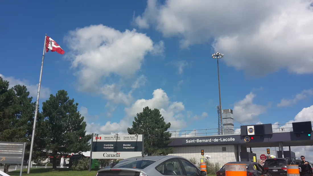
Chateaugay has its own crossing into Quebec. The U.S. port is on County Route 52, about five road miles north of the village and about 27 from the cabins, and the Canadian office across the line is Herdman. Both have kept the same hours since January 6, 2025: 6 a.m. to 6 p.m., seven days a week.
With the Trout River crossing on NY 30 closed to traffic entering the United States since June 1, 2026, CBP named Chateaugay among the alternatives; of those, only Chateaugay and Champlain handle commercial traffic. From Montreal it is the shortest way to the cabins, about 75 road miles, as long as you reach the port before 6 p.m. After that, Fort Covington and Champlain are open around the clock.
Bring a passport or another accepted document for everyone in the car. The border guide covers the documents, the 24-hour ports and the rules for food and dogs, the Trout River post explains the closure, and the Montreal day trip covers the city.
NY 374 to the lakes and Lyon Mountain
NY 374 leaves US 11 in the middle of Chateaugay and runs south as Depot Street and then Lake Street. It climbs as it goes. The village sits at about 940 feet, the lakes at about 1,300 and the hamlet of Lyon Mountain at about 1,750. About six miles out you pass Brainardsville, a hamlet of Bellmont, and then the Lower lake. The state launch on the Narrows is about 12 miles from the village, Merrill comes next, and the hamlet of Lyon Mountain, with its mining museum, is about 17 miles out. Past Lyon Mountain the road runs by Chazy Lake and on through Dannemora to Plattsburgh.
Lyon Mountain itself, the highest summit north of the Saranac River, is the big hike at the end of this road. Its trailhead is off Chazy Lake Road, about six and a half road miles past the hamlet, and the tower on top looks back over the Chateaugay Lakes; see the Lyon Mountain guide and, for the other towers within reach, the Fire Tower Challenge guide.
Food, fuel and cheese
Stewart's, at 195 East Main Street, sells gas, including 91-octane non-ethanol premium, along with coffee, pizza and other quick food, ice cream from the counter, and propane refills. It has restrooms and an ATM.
For something to take home, the Chateaugay Farm and Cheese Store at 36 McCadam Lane sells cheese from the McCadam plant, in seven flavors from Muenster to horseradish cheddar, along with cheese curds and other dairy products. It is open 8 a.m. to 4:30 p.m. on weekdays and 8 a.m. to noon on Saturdays, and closed on Sundays, Thanksgiving, Christmas and New Year's Day; hours can change, so call (518) 497-6341 to check. McCadam has been making cheese since 1876.
The snack bar at High Falls Park sells soft-serve. For groceries, Malone is the place to shop; see groceries and supplies and where to eat.
A loop from the cabins
The easy way to see it all is an out-and-back drive of about 80 road miles, a half day or a little more.
| Time | Stop |
|---|---|
| 9:00 a.m. | Leave the cabins by County Route 25, Malone and US 11 east. |
| 9:40 a.m. | High Falls Park. Walk down to the falls and back, about an hour. |
| 10:50 a.m. | The cheese store on McCadam Lane, then Stewart's for gas. |
| 11:30 a.m. | South on NY 374 past Brainardsville and the Lower lake. |
| 11:55 a.m. | The state launch on the Narrows. Look over the lakes, or put in a boat if you brought one. |
| 12:20 p.m. | The hamlet of Lyon Mountain and its mining museum, if it is a day the museum is open. |
| 1:30 p.m. | Back north on NY 374 to Chateaugay and west on US 11. |
| 2:30 p.m. | Back at the cabins. |
For a full day, swap the museum stop for the climb of Lyon Mountain; the Lyon guide has a plan that ends at the falls. If the day includes Canada, cross at Chateaugay before 6 p.m. or use a 24-hour port.
Good to know
- High Falls Park is private and seasonal. Call (518) 497-3156 before a late-season visit, and bring cash.
- The steps to the base of the falls are steep and many. Hold the railings and keep children close.
- The boat launch on the Narrows closed for road repairs on September 21, 2026, for about three weeks.
- The Chateaugay border crossing closes at 6 p.m. in both directions.
- In winter the Upper lake is open to ice fishing, and the snowmobile guide covers the trails east toward Chateaugay.
- Spring and early summer bring black flies and ticks; the bug guide has the details.
Questions
How tall is High Falls in Chateaugay?
About 120 feet, in three or four steps on the Chateaugay River. The falls are inside High Falls Park Campground, a private park just southwest of the village, which charges walkers a small fee; its posted rate is $5 a person. The walk to the base is short but ends in a flight of more than 200 steps.
Is High Falls Park open in October?
Usually into mid-October. The park's season usually runs from May 1 to October 15, but it does not post its closing date, so call (518) 497-3156 before an October visit. Falls hours are 9 a.m. to 5 p.m. Sunday through Thursday and 9 a.m. to 7 p.m. on Fridays and Saturdays. Bring cash.
Is this the same High Falls as the one near the cabins?
No. The High Falls about five road miles from the cabins is a 30-foot falls on a level walk in the Titusville Mountain State Forest; see the Titusville guide. High Falls in Chateaugay is about 22 road miles away and four times as tall.
Where can you launch a boat on the Chateaugay Lakes?
At DEC's launch on NY 374 in the Narrows between the two lakes, just north of the hamlet of Merrill and about 34 road miles from the cabins. It is the only public launch on the lakes, with a hard-surface ramp, a dock and parking for 25 cars with trailers. DEC closed it on September 21, 2026, for about three weeks of road repairs, so check before you tow a boat over.
What fish are in the Chateaugay Lakes?
The deep Upper lake has lake trout, landlocked Atlantic salmon, rainbow trout, smallmouth bass, northern pike, yellow perch and rainbow smelt, and it is open to ice fishing. The shallow Lower lake has rainbow, brown and brook trout, yellow perch, bullhead and pumpkinseed. Anglers 16 and older need a New York license; see fishing trips.
What are the hours of the Chateaugay border crossing?
6 a.m. to 6 p.m., seven days a week, on both the U.S. side and the Canadian side at Herdman, since January 6, 2025. The port is about 27 road miles from the cabins. For a crossing after 6 p.m., use Fort Covington or Champlain, which are open around the clock; see crossing the border.
Was Orville Gibson from Chateaugay?
Yes. The instrument maker whose name went on Gibson guitars was born on a farm near Chateaugay in 1856. He made his carved mandolins in Kalamazoo, Michigan, where five businessmen formed a company around his patent in 1902, and he is buried in Morningside Cemetery in Malone, about ten road miles from the cabins.
Sources
Facts on this page were checked against these sources in October 2026. Hours, fees and schedules change; confirm before you go.
- highfallsparkcampground.com highfallsparkcampground.com/120-water-falls%2Ffishing
- highfallsparkcampground.com highfallsparkcampground.com/about-the-park
- highfallsparkcampground.com highfallsparkcampground.com/site-fees
- highfallsparkcampground.com highfallsparkcampground.com/map%2Fdirections
- highfallsparkcampground.com highfallsparkcampground.com/event-calendar
- nnywaterfalls.com nnywaterfalls.com/chateaugayriver/highfalls/
- world-of-waterfalls.com world-of-waterfalls.com/waterfalls/eastern-us-high-falls-chateaugay/
- New York State Department of Environmental Conservation dec.ny.gov/places/upper-chateaugay-lake
- New York State Department of Environmental Conservation extapps.dec.ny.gov/docs/fish_marine_pdf/upchatlkmap.pdf
- New York State Department of Environmental Conservation extapps.dec.ny.gov/docs/fish_marine_pdf/lrchatlkmap.pdf
- New York State Department of Environmental Conservation extapps.dec.ny.gov/docs/fish_marine_pdf/nyboatlaunching.pdf
- New York State Department of Environmental Conservation dec.ny.gov/things-to-do/freshwater-fishing/regulations/region-5-specia
- New York State Department of Environmental Conservation dec.ny.gov/things-to-do/freshwater-fishing/hatcheries
- New York State Department of Environmental Conservation dec.ny.gov/places/chazy-highlands-wild-forest
- chateaugaylakefoundation.org chateaugaylakefoundation.org/
- chateaugaylakefoundation.org chateaugaylakefoundation.org/about-us/
- Visit Malone visitmalone.com/page/chateaugay-ny
- newyorkalmanack.com newyorkalmanack.com/2023/11/the-chateaugay-fish-hatchery/
- chateaugayhistory.org chateaugayhistory.org/files/HeritageTrail.pdf
- chateaugayhistory.org chateaugayhistory.org/
- chateaugayhistory.org chateaugayhistory.org/files/HistoryofChateaugay.pdf
- chateaugayhistory.org chateaugayhistory.org/blog/pages/Lakes.html
- townofchateaugayny.gov townofchateaugayny.gov/
- townofchateaugayny.gov townofchateaugayny.gov/events/
- archive.org archive.org/stream/historyofclinton00hurd/historyofclinton00hurd_djvu.
- shatageewoodshistory.wordpress.com shatageewoodshistory.wordpress.com/2006/05/04/chateaugay-lake-and-its-
- adirondacklife.com adirondacklife.com/2012/10/03/frontier-town/
- siminoff.net siminoff.net/orville-gibson
- kalamazoomuseum.org kalamazoomuseum.org/blog/the-mandolin-from-potato-bug-to-local-star
- U.S. Customs and Border Protection cbp.gov/newsroom/national-media-release/cbp-aligns-hours-operations-no
- content.govdelivery.com content.govdelivery.com/accounts/USDHSCBP/bulletins/415e6c6
- locations.stewartsshops.com locations.stewartsshops.com/ny/chateaugay/137
- mccadam.coop mccadam.coop/visit-us/
- Franklin County tourism (Always Franklin) alwaysfranklin.com/listing/agrimark-mccadam
- epqs.nationalmap.gov epqs.nationalmap.gov/v1/json?x=-74.0798&y=44.9266&wkid=4326&units=Feet
- router.project-osrm.org router.project-osrm.org/
- goodsam.com goodsam.com/campgrounds-rv-parks/new-york/chateaugay/high-falls-park/c
- highfallsparkcampground.com highfallsparkcampground.com/
- New York State Department of Environmental Conservation dec.ny.gov/sites/default/files/2025-12/wp404upperchateaugaylakeculvert
- New York State Department of Environmental Conservation dec.ny.gov/sites/default/files/2026-05/cfabmeetingminutesapril2026.pdf
- visitadirondacks.com visitadirondacks.com/attractions/chateaugay-fish-hatchery
- canada.ca canada.ca/en/border-services-agency/news/2024/11/the-cbsa-is-adjusting
- summitpost.org summitpost.org/lyon-mountain/456239
In this guide
Stay nearby
The first of the cabins: a big stone fire pit you see as you walk up, a screened corner of the deck, direct trail access, and a short walk to an observation deck over the pond.
 The Modern Tiny HomeCabin 1 · 2 bd · 1 ba · sleeps 4
More in Lakes & Paddling
Sources
43 references, listed in full at the end of this guide: official park, state, tourism-office and business sources, checked October 2026.
Related guides
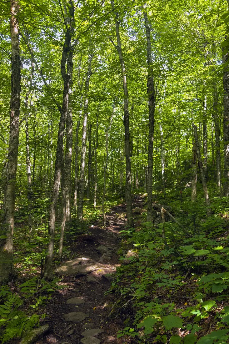
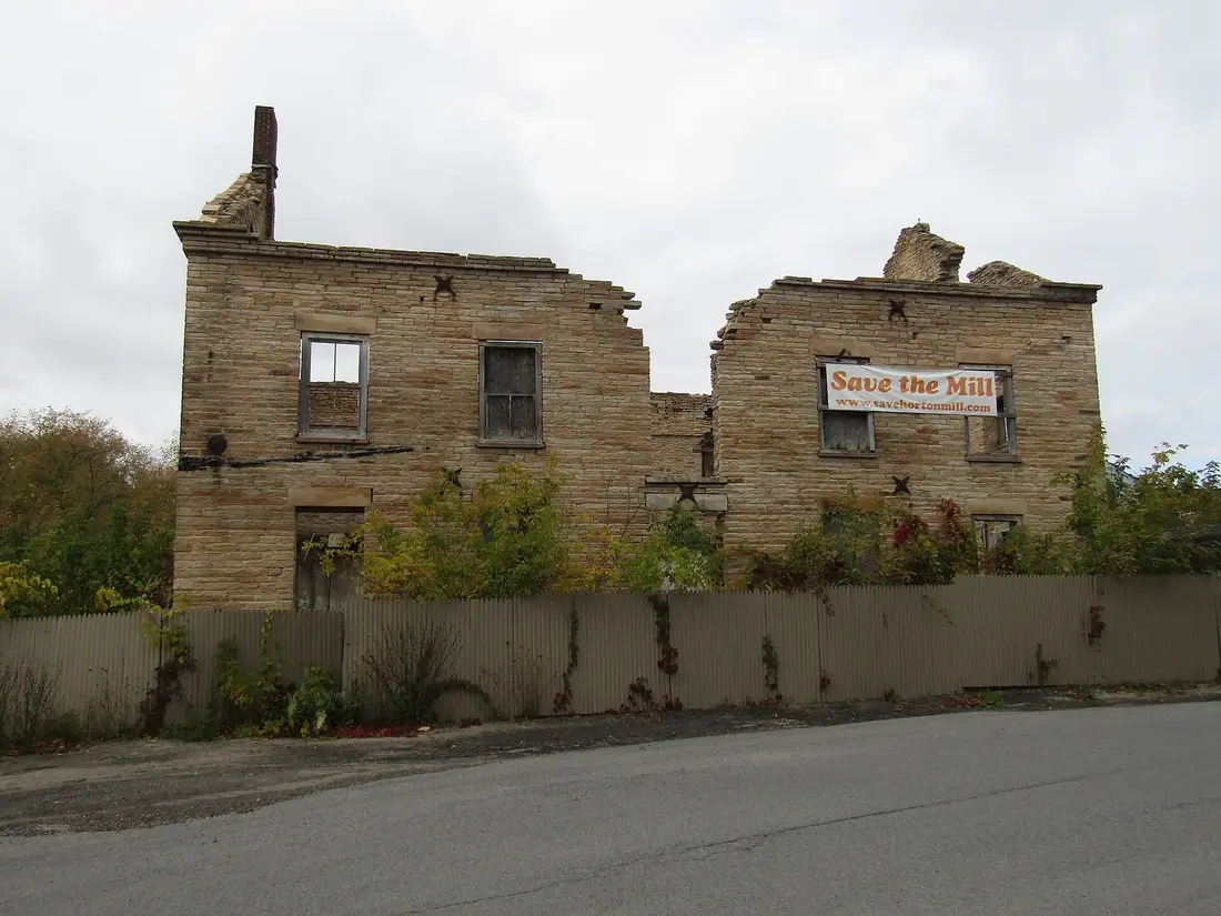


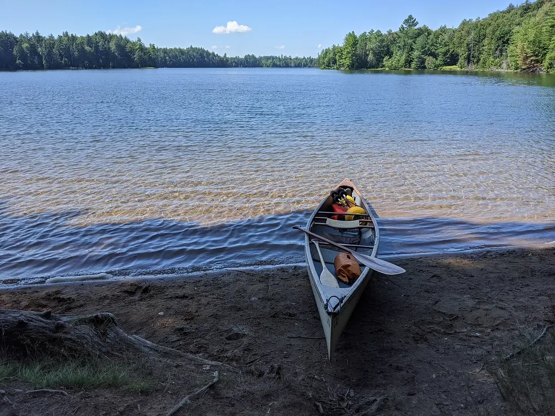
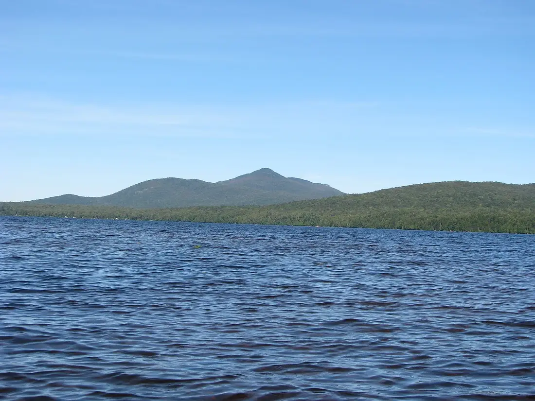
Photos on this page: St Regis Canoe Area by Marty Plante, CC BY-SA 4.0; Meacham Lake Franklin County New York by Mwanner, CC BY-SA 3.0; Hiking trail in sunlit forest, Lyon Mountain, NY by Daniel Case, CC BY-SA 3.0; Ruins of Horton Grist Mill, Malone, NY Front View by OneEagle, CC BY-SA 4.0; 20170809-Saint-Bernard-de-Lacolle US-Canada (NY-Quebec) border crossing by Aude, CC BY-SA 4.0. Resized and cropped for this site. All photo credits