
NY 30 is the slow road to the cabins, and the best one. From the Mohawk Valley at Fonda it runs about 180 road miles north through the middle of the Adirondack Park, past Great Sacandaga Lake, Lake Pleasant, Indian Lake, Blue Mountain Lake, Long Lake, Tupper Lake and Meacham Lake, and leaves you seven miles of county road from the hot tub. This is the plan for driving it in one day, with the stops, the fuel, the daylight and the winter notes.
The Adirondack Trail
Most of this drive has a name. New York's Highway Law designates the Adirondack Trail as the state highway that begins at Malone and runs south on Route 30 through Lake Clear, Tupper Lake, Long Lake and Speculator, then on through Wells and Northville to Riceville, where it follows Route 30A south to Route 5 in Fonda. The Federal Highway Administration's byways listing gives the length as 188 miles and suggests about five hours to drive it, with no fees.
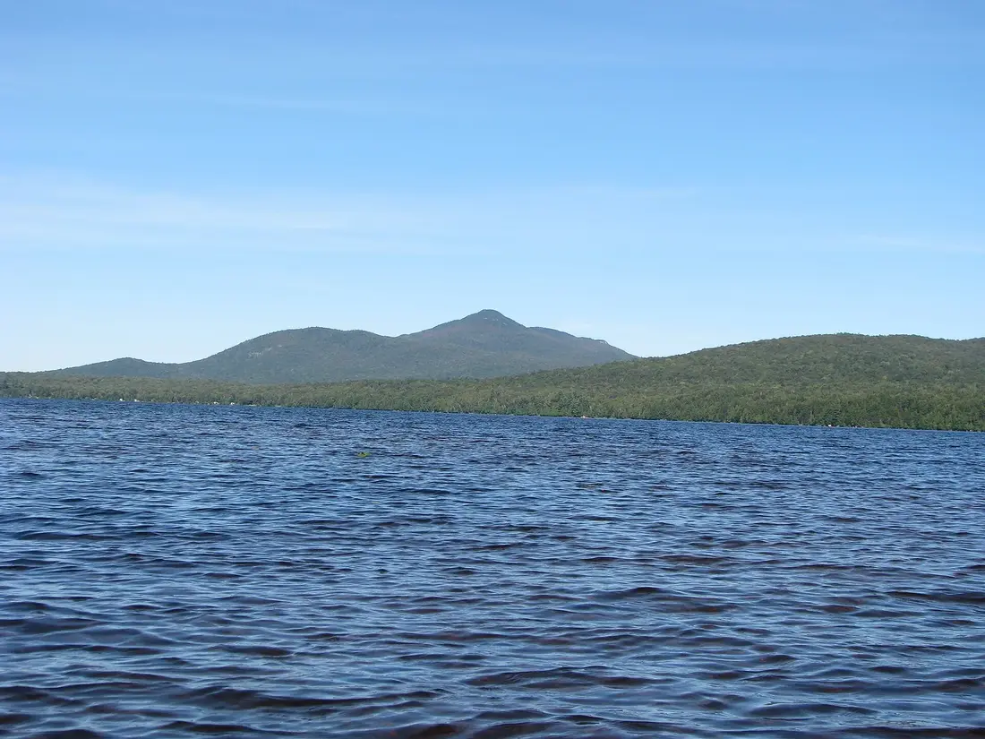
The Adirondack Trail is one of New York's State Scenic Byways. The state legislature created the scenic byways program in 1992, and the Department of Transportation describes the byways as corridors of statewide interest for their scenery, recreation, culture, nature or history. Two sister byways cross the same mountains: the Olympic Trail, 170 miles from Lake Champlain to Lake Ontario through the High Peaks, and the Central Adirondack Trail, 153 miles from Glens Falls to Rome by way of Indian Lake and Blue Mountain Lake. The Adirondack North Country Association is the byway's local contact.
The law reads the trail from north to south. This post drives it the other way, from Fonda toward Malone, because that is the way a guest from Albany, New York City or New Jersey would use it to reach the cabins. The cabins sit near Owls Head in the Town of Bellmont, south of Malone at the northern edge of the Park, so you leave NY 30 about 24 miles north of Paul Smiths and never need to go into Malone itself on arrival day.
Why this is the way to arrive
The fast way up is the Adirondack Northway, I-87, four lanes of interstate up the east side of the Park. It is a good road. NY 30 is a different trip. It is two lanes almost the whole way, it goes through the villages instead of past them, and the lakes come up beside the road one after another. You pass Great Sacandaga Lake at Northville and Lake Pleasant at Speculator, cross the spillway between Lewey Lake and Indian Lake on a bridge, and cross Long Lake on a bridge in the middle of the hamlet. North of Tupper Lake the road passes the ponds around Fish Creek, the college at Paul Smiths and the long woods by Meacham Lake.
The other reason is the arrival itself. On the Northway, the Adirondacks are something you drive toward. On NY 30 you are inside the Park almost from the start, at Mayfield, and you stay in it for most of the drive. By the time you turn off onto the county roads near the cabins, the whole day has been spent in the mountains, and the hot tub is the end of the same day. On a clear fall day with the leaves turning, there is no better way in.
The cost is time. The plan below accounts for it, and the getting to the cabins guide has the faster routes for the days when you need them.
How far and how long
We measured the route on the same road router the rest of this site uses. From Fonda, where you leave the New York State Thruway, to the cabins by way of NY 30 is about 180 road miles. The legs, measured between town centers:
| From | To | Road miles | Road |
|---|---|---|---|
| Fonda | Johnstown | about 5 | NY 30A |
| Johnstown | Northville | about 20 | NY 30A, NY 30 |
| Northville | Wells | about 16 | NY 30 |
| Wells | Speculator | about 14 | NY 30 |
| Speculator | Indian Lake | about 24 | NY 30 (with NY 8 for the first stretch) |
| Indian Lake | Long Lake | about 22 | NY 28 and NY 30 to Blue Mountain Lake, then NY 28N and NY 30 |
| Long Lake | Tupper Lake | about 22 | NY 30 |
| Tupper Lake | Paul Smiths | about 27 | NY 3 and NY 30, then NY 30 |
| Paul Smiths | the cabins | about 31 | NY 30 north for about 24, then county roads for about 7 |
Driving time from Fonda is about four hours with no stops, and the byway listing's five hours is closer to the truth once you add a coffee and a fuel stop. With a swim, a short walk and lunch, plan on seven hours from the Thruway to the cabins.
Against the faster routes, NY 30 adds miles and time. From Midtown Manhattan the NY 30 route is about 365 road miles, against about 337 by the Northway and the High Peaks; from downtown Albany it is about 222, against about 188. In driving time that is roughly an hour more, before any stops. If you are coming from the city, the Thruway carries you about 186 road miles to Fonda first. The drive from New York City and the drive from Albany have the direct routes.
Fonda to Northville
The byway starts on Route 5 in Fonda, in the Mohawk Valley. Route 30A runs north from there into Johnstown, about five miles on, and through Gloversville. The first twenty-odd miles are small cities and farm country, and the mountains come later.
Johnson Hall in Johnstown
Johnson Hall State Historic Site, at 139 Hall Avenue in Johnstown, was built in 1763 as the home of Sir William Johnson, the British Superintendent of Indian Affairs, and Molly Brant of the Mohawk people, with their eight children. New York State Parks set its 2026 season from May 23 to October 11, with guided tours on the hour Wednesday through Saturday from 10 a.m. and Sunday from 1 p.m., the last tour at 3 p.m.; adult tickets were $7 and children 12 and under got in free. The grounds are open from sunrise to sunset. For a spring or summer trip, check the new season's dates before you plan around a tour.
Gloversville
Gloversville was called Stump City for the stumps left from the hemlock harvest, and took its present name in 1828. A 2025 New York State Senate resolution marking the city's 135th year records that from 1890 to 1950, 90 percent of the gloves made in the United States came from Gloversville. The city became a village in 1853 and a city in 1890, and Route 30A takes you right through it.
Mayfield and Great Sacandaga Lake
Route 30A meets NY 30 near Mayfield, and NY 30 heads north close to the western side of Great Sacandaga Lake, with the Adirondack Park boundary just behind you. The lake is a reservoir. The Hudson River-Black River Regulating District completed the Conklingville Dam in 1930, and it holds back a lake of 42 square miles with a 125-mile shoreline, run to hold floodwater and to keep the Hudson flowing in dry spells. Stewart's Shops, the regional convenience store chain, has shops in Mayfield and Northville.
Northville
Northville is the southern end of the Northville-Placid Trail, the 138-mile footpath through the Park to Lake Placid. It was completed in 1924 and turned 100 in 2024, and its start is marked by a wooden arch in the village. A few minutes at the arch is a fine way to start a drive that heads the same way, north into the Park.
Wells and Speculator
North of Northville, NY 30 crosses into Hamilton County. Wells, about 16 road miles on, sits on Lake Algonquin, a 265-acre lake on the Sacandaga River known for its fishing, with a public beach on the shore. It is a quiet place for a first stretch of the legs.
Speculator is about 14 road miles further, on the shore of Lake Pleasant, and it is the only incorporated village in Hamilton County. NY 8 and NY 30 meet at the four corners in the middle of the village. The Speculator Public Beach is half a mile south of the four corners, off Route 30, with a shaded picnic spot on a point beside the sand, public boat docks, and a large parking lot across the road, by the Sacandaga River trails, the ball field and a pavilion. The listed summer hours are 10 a.m. to 5 p.m., Tuesday to Saturday; in the other seasons it is a place to sit by the water for ten minutes.
The village has a handful of places to eat along Route 30 and NY 8. Small Adirondack places change their days with the season, and some change hands, so look up what is open on the day before you count on a meal here. There is no Stewart's in Speculator, Wells or Blue Mountain Lake, so if the tank is under half when you leave Northville, fill it there.
Speculator to Indian Lake
This is the first long, empty stretch: about 24 road miles of forest and water with no village. It is also one of the best stretches of the whole byway.
Lewey Lake
The Lewey Lake campground and day-use area is 12.2 miles north of the Route 8 and 30 intersection in Speculator, on the left. The state Department of Environmental Conservation runs it, with a natural sand beach, a picnic and day-use area, flush toilets and drinking water, and canoe and kayak rentals in season. A day-use fee applies to the launch. Small boats can carry over the spillway under the Route 30 bridge from Lewey Lake into Indian Lake, and from the road that bridge is where the two lakes meet beside you. The campground season runs into mid-October; after that the gate is closed, and the bridge and the view are still there.
Snowy Mountain
The Snowy Mountain trailhead is on Route 30 just over seven miles south of the Route 28 and 30 intersection in Indian Lake, with the trail on one side of the road and the parking on the other. Snowy is 3,899 feet, close to the height of the High Peaks, and the climb is 7.8 miles round trip with 2,180 feet of gain. The first 1.2 miles are gentle, the trail crosses Beaver Brook, and the top is steep and rough. There has been a fire lookout on the summit since 1909, and the steel tower dates from 1917. It is a day of its own, too long to fit into a drive to the cabins. Note it for another trip, and if towers are your thing, the fire tower challenge guide has the ones close to the cabins.
Indian Lake and Blue Mountain Lake
Indian Lake is known as the Whitewater Capital of New York State. Rafting outfitters run guided trips through a 17-mile stretch of the Hudson River Gorge, Class III to V, from April through October. Stewart's opened a rebuilt shop of more than 4,000 square feet in Indian Lake in the fall of 2020, and the hamlet is the natural midday stop, a little short of halfway from Fonda to the cabins. The hamlet's restaurants keep seasonal hours, so check what is open before you plan lunch around one; Stewart's has sandwiches if the dining rooms are closed.
From Indian Lake, NY 30 runs west together with NY 28 for about eleven miles to Blue Mountain Lake. At the hamlet NY 28 splits off west toward Raquette Lake, and NY 30 turns north, sharing the road with NY 28N. The Adirondack Experience, the large museum of Adirondack life, is on NY 30 at Blue Mountain Lake; it fills most of a day, so it is better as its own trip from the cabins than as a stop on arrival day.
Long Lake
Long Lake is about eleven road miles past Blue Mountain Lake. The lake is a widening of the Raquette River, and NY 30 and the hamlet split it into a north and a south section, with the road crossing on a bridge right in town. A seaplane base sits on the water beside the bridge, and the hamlet's beach is along Route 30 just past the bridge. Stewart's has a shop on Newcomb Road in Long Lake.
Buttermilk Falls
The best short walk on the whole route is two miles off it, on the Raquette River near the south end of the lake. Heading north, look for North Point Road on the left at a sharp corner before you reach Long Lake (from the hamlet, it is on the right as you drive back toward Blue Mountain Lake); the parking is on the right after about two miles. The path to the falls is about a tenth of a mile each way with 30 to 40 feet of climb, and you can hear the water from the car. There are picnic spots above and below the falls. Stay off the wet rock at the lip: the tourism office advises against climbing or diving there, and in winter the rocks are icy enough for microspikes. Ten minutes here is the right size of stop for a long driving day.
Long Lake to Tupper Lake
The next 22 road miles are woods, with no village between Long Lake and Tupper Lake. North of the village, NY 30 shares the road with NY 3 for about five miles before it turns north on its own again.
Tupper Lake is the last real town before the cabins and the place to fill the tank: the cabins are about 57 road miles further, and there is no Stewart's on that stretch of NY 30. The village waterfront park, on Raquette Pond along NY 3 (Demars Boulevard), has a waterfront walkway, a pavilion, two covered fishing overlooks, public restrooms, daytime parking and electric vehicle charging, with signs along the walkway on the town's logging and railroad past. It is a good half hour out of the car.
Tupper Lake is also home to The Wild Center, the natural history museum with the Wild Walk in the treetops, about 57 road miles from the cabins. Like the Blue Mountain Lake museum, it deserves its own day; the Wild Center guide has the plan for it.
Fish Creek, Lake Clear and Paul Smiths
North of Tupper Lake, NY 30 leaves NY 3 and heads northeast through the lake country west of Saranac Lake. About eleven road miles from Tupper Lake, the Fish Creek Pond campground sits on the road at 4523 State Route 30, wrapped around Fish Creek Pond and Square Pond, with water connections to Upper Saranac Lake. The DEC campground closes in mid-October; in any season the ponds are right beside the road.
About nine road miles further is Lake Clear, where NY 186 heads east toward Saranac Lake. The Adirondack Regional Airport is at Lake Clear, with Cape Air flights to Boston and New York; the airports guide has the details if someone in your group is flying in.
Paul Smiths is about seven road miles on, where NY 86 comes in from Saranac Lake. Paul Smith's College is right on the road, and its Visitor Interpretive Center, at 8023 NY 30, has trails open from dawn to dusk every day; twenty minutes on them is a good break before the last hour. The Saranac Lake and Paul Smiths guide has the story of Paul Smith's hotel and the trails. From Paul Smiths it is about 31 road miles to the cabins.
Meacham Lake and the last miles
North of Paul Smiths, NY 30 runs through the quietest country of the whole drive. About eleven road miles on is the road into the Meacham Lake state campground; the Meacham Lake guide has the beach, the launches and the routes for a paddling day once you are settled at the cabins, about 20 road miles away. Past Meacham, NY 30 keeps north through the woods of the Town of Duane.
About 24 road miles north of Paul Smiths you leave NY 30 and turn east onto county roads for the last seven miles or so. Those miles are on the host's directions, which you get with the booking; the getting to the cabins guide explains why they beat a phone map. Malone is about ten road miles north of the cabins, with groceries, fuel and dinner a short drive away once you have checked in.
Fuel, food and the empty stretches
The towns on NY 30 are small, and the gaps between them are the reason to plan. Stewart's Shops lists stores in Fonda, Johnstown, Gloversville, Mayfield, Northville, Indian Lake, Long Lake and Tupper Lake on this route, and none in Wells, Speculator, Blue Mountain Lake, Lake Clear or Paul Smiths. Use the chain's store locator to check which shops have pumps and what their hours are on the day you drive.
| Stretch | Road miles | On the way |
|---|---|---|
| Speculator to Indian Lake | about 24 | Lewey Lake (DEC day use in season), Snowy Mountain trailhead; no village |
| Long Lake to Tupper Lake | about 22 | Woods and the Raquette River country; no village |
| Tupper Lake to the cabins | about 57 | Fish Creek, Lake Clear, Paul Smiths, Meacham Lake, Duane; no Stewart's |
The simple rule: fill up in Long Lake, where the Stewart's on Newcomb Road has pumps, and top off again in Tupper Lake. That leaves you with a full tank for the last hour, and for a drive into Malone the next morning.
For groceries, the cabins each have a full kitchen. This route does not pass the Lake Placid and Saranac Lake supermarkets that the High Peaks route does, so either bring the first night's food from home, with a cooler in summer, or plan a run to Malone after you arrive. The groceries and supplies page lists what the kitchens already have, and the Malone town guide has the stores and their hours.
Daylight and arriving before dark
NY 30 is a road for daylight. The views are the point of driving it, and the last miles to the cabins are on county roads in the woods. Sunset at the cabins, from the standard NOAA solar equations:
| Date | Sunset at the cabins | Dark (end of civil twilight) |
|---|---|---|
| Mid-October | about 6:09 p.m. | about 6:38 p.m. |
| Mid-November | about 4:29 p.m. | about 5:01 p.m. |
| Late December | about 4:19 p.m. | about 4:52 p.m. |
| Mid-January | about 4:42 p.m. | about 5:15 p.m. |
| Mid-February | about 5:25 p.m. | about 5:55 p.m. |
| Mid-May | about 8:18 p.m. | about 8:52 p.m. |
| Late June | about 8:46 p.m. | about 9:23 p.m. |
| Mid-September | about 7:08 p.m. | about 7:37 p.m. |
Work backward from those times. With seven hours from Fonda including stops, a summer trip can leave the Thruway as late as noon and still arrive in good light. In mid-October, leave Fonda by 9 a.m. In November and December, the day is too short to do the whole byway with stops: leave Fonda at sunrise, about 6:50 a.m. in mid-November and 7:15 in early December, keep the stops short, and plan to be past Tupper Lake by 2 p.m. If you cannot leave that early, drive the Northway instead and save NY 30 for the trip home, when you can start from the cabins in the morning.
A day on the road in October
This is the plan we would give a guest leaving Albany on a mid-October Saturday, when the color is on the hills and sunset at the cabins comes at about 6:09.
| Time | Plan |
|---|---|
| 8:15 a.m. | Leave Albany on the Thruway west, about 43 road miles to Fonda. |
| 9:00 a.m. | Leave the Thruway at Fonda and head north on Route 30A through Johnstown and Gloversville. |
| 9:45 a.m. | Northville. Fuel if the tank is under half; walk to the trail arch. |
| 10:40 a.m. | Speculator. A few minutes at the beach on Lake Pleasant. |
| 11:25 a.m. | Pull off at the Route 30 bridge between Lewey Lake and Indian Lake. |
| 12:00 p.m. | Lunch in Indian Lake. |
| 1:15 p.m. | Through Blue Mountain Lake; the short walk to Buttermilk Falls, then fuel in Long Lake. |
| 2:25 p.m. | Tupper Lake. Fill the tank and walk the waterfront on Raquette Pond. |
| 3:30 p.m. | Paul Smiths, then north on NY 30 past Meacham Lake. |
| 4:30 p.m. | At the cabins, with an hour and a half of light to unpack, find the fire pit and get the hot tub lid off. |
From New York City, the Thruway adds about 186 road miles before Fonda, so the same plan needs a start before dawn or a night on the way. For the drive home, the Northway through the High Peaks shows you the other side of the Park.
Winter on NY 30
NY 30 is a state highway, a two-lane mountain road with long stretches between towns. In winter, check 511NY before you leave and again at your fuel stops: call 511, use 511NY.org or the free 511NY app for road conditions, closures and the state's live traffic cameras. The state's own winter message is "Don't crowd the plow. When you see ice and snow, take it slow."
- Stay well behind a plow. State officials say the safest place to drive is behind one; plows work at about 35 miles an hour, so slow down and do not pass.
- Turn your headlights on whenever your wipers are on; New York requires it.
- Bridges freeze before the road does, and NY 30 has plenty of them, including the crossings at Lewey Lake and Long Lake.
- Carry the kit the State Police recommend: a shovel, a broom and an ice scraper, sand or kitty litter for traction, jumper cables, a flashlight, flares, blankets and extra warm clothes, and a charged phone, water, food and any medicine you need.
- Keep the tank above half. With 57 road miles between Tupper Lake and the cabins, a full tank is part of the winter kit.
The days are short, so a winter drive up NY 30 is a daylight-only plan, and the timing above matters more than any other tip. January brings dry snow, short days and the hot tub at its best. The winter driving guide has tires and the roads near the cabins, and winter at the cabins has the rest of the season.
Moose and deer on the road
The woods along NY 30 are home to deer and to some of New York's moose. Hamilton County's tourism office lists moose and bald eagles among the wildlife around Indian Lake. The state Department of Environmental Conservation says moose are most active at dawn and dusk, when light is poor, and that early fall is their breeding season in northern New York, when they wander into places they do not usually go. Its advice for September and October is to use extreme caution at dawn and dusk, slow down, watch the roadsides, and, if a moose runs in front of you, brake firmly and do not swerve. Use your flashers to warn the drivers behind you.
A moose standing by the road is a sight guests remember, and the safe way to enjoy it is from a stopped car well off the road, at a distance. The wildlife watching guide has where to look for moose and loons on purpose, and the getting to the cabins guide has the deer numbers and the dusk advice for the last miles.
Which season to drive it
Every season works on NY 30, each with its own plan. Late September and early October bring the color while the state campgrounds and day-use areas are still open, and the fall foliage guide has the timing for the northern Adirondacks. Summer gives you the beaches at Speculator, Wells and Lewey Lake and light until after 8:30 in the evening. Winter is the drive for a confident driver with snow tires and an early start, with snow on the lakes and the woods. Spring is the quietest time, with some campgrounds and seasonal places still closed until May; black flies are out from mid-May to late June, and the bug guide has what works at a beach stop.
Whichever season you pick, book the cabin first. The three cabins each sleep four with a private hot tub, and you can book direct once you know your dates. Then plan the drive backward from the sunset.
Questions
Is NY 30 the fastest way to the cabins from Albany or New York City?
No. It is the scenic way. From downtown Albany, NY 30 is about 222 road miles against about 188 by the Northway, and from Midtown Manhattan about 365 against 337, roughly an hour more of driving before any stops. The getting to the cabins guide has the faster routes.
How long does the drive from Fonda to the cabins take on NY 30?
It is about 180 road miles, about four hours of driving with no stops. With fuel, coffee, a short walk and lunch, plan on about seven hours from the Thruway to the cabins, and start early enough to arrive before sunset.
Where should we buy gas on NY 30?
Stewart's has shops in Northville, Indian Lake, Long Lake and Tupper Lake on this route, and none in Wells, Speculator, Blue Mountain Lake, Lake Clear or Paul Smiths. The Long Lake shop on Newcomb Road has pumps. Fill up in Long Lake and top off in Tupper Lake, about 57 road miles from the cabins, so you arrive with a full tank.
Can we drive NY 30 to the cabins in winter?
Yes, in daylight and with good snow tires. Sunset at the cabins comes at about 4:19 p.m. in late December, so leave Fonda at sunrise and keep stops short. Check 511NY before you leave and at fuel stops, stay well behind plows, and keep the tank above half. The winter driving guide has more.
What is the Adirondack Trail?
It is the state scenic byway that follows NY 30 through the middle of the Adirondack Park, set out in New York's Highway Law from Malone south through Tupper Lake, Long Lake, Speculator, Wells and Northville, then on Route 30A to Fonda. The federal byways listing gives it 188 miles.
Are there moose along NY 30?
There are moose in the woods along the road, and Hamilton County's tourism office lists them around Indian Lake. The state DEC says they are most active at dawn and dusk, especially in September and October. Slow down, watch the roadsides, and if one steps out, brake firmly and do not swerve.
Sources
Facts on this page were checked against these sources in October 2026. Hours, fees and schedules change; confirm before you go.
- nysenate.gov nysenate.gov/legislation/laws/HAY/342-B
- fhwaapps.fhwa.dot.gov fhwaapps.fhwa.dot.gov/bywaysp/byway/2583
- New York State Department of Transportation dot.ny.gov/display/programs/scenic-byways
- fhwaapps.fhwa.dot.gov fhwaapps.fhwa.dot.gov/bywaysp/byway/2224
- fhwaapps.fhwa.dot.gov fhwaapps.fhwa.dot.gov/bywaysp/byway/2225
- adirondackscenicbyways.org adirondackscenicbyways.org/community/mayfield.html
- New York State Parks parks.ny.gov/historic-sites/johnsonhall/details.aspx
- nysenate.gov nysenate.gov/legislation/bills/2025/J55
- hrbrrd.ny.gov hrbrrd.ny.gov/upper-hudson-river-watershed
- experienceouradirondacks.com experienceouradirondacks.com/northvilleplacid-trail
- experienceouradirondacks.com experienceouradirondacks.com/adirondack-towns/wells-hope-and-benson
- New York State Department of Environmental Conservation dec.ny.gov/news/environmental-notice-bulletin/2026-09-16/completed-app
- experienceouradirondacks.com experienceouradirondacks.com/adirondack-towns/speculator
- experienceouradirondacks.com experienceouradirondacks.com/swimming/speculator-public-beach
- experienceouradirondacks.com experienceouradirondacks.com/boating/lewey-lake-beach-launch
- New York State Department of Environmental Conservation dec.ny.gov/places/lewey-lake-campground-and-day-use-area
- experienceouradirondacks.com experienceouradirondacks.com/hiking/snowy-mountain
- experienceouradirondacks.com experienceouradirondacks.com/adirondack-towns/indian-lake
- locations.stewartsshops.com locations.stewartsshops.com/ny
- stewartsshops.com stewartsshops.com/news/stewarts-shops-construction-update-and-grand-op
- locations.stewartsshops.com locations.stewartsshops.com/ll/US/NY/Long-Lake/8589-
- theadkx.org theadkx.org/
- experienceouradirondacks.com experienceouradirondacks.com/paddling/long-lake
- airport-data.com airport-data.com/airport/NY9/
- experienceouradirondacks.com experienceouradirondacks.com/hiking/buttermilk-falls
- tupperlake.com tupperlake.com/attractions/tupper-lake-municipal-park
- New York State Department of Environmental Conservation dec.ny.gov/places/fish-creek-pond-campground-and-day-use-area
- Paul Smith's College paulsmiths.edu/vic
- ny.gov ny.gov/programs/safe-winter-driving
- New York State DMV dmv.ny.gov/news/dmv-gtsc-and-other-state-agencies-offer-drivers-tips-t
- content.govdelivery.com content.govdelivery.com/accounts/NYSDEC/bulletins/d05899
- NOAA gml.noaa.gov/grad/solcalc/
- router.project-osrm.org router.project-osrm.org/
- api.sunrise-sunset.org api.sunrise-sunset.org/json
- New York State Department of Environmental Conservation dec.ny.gov/outdoor/24466.html


