
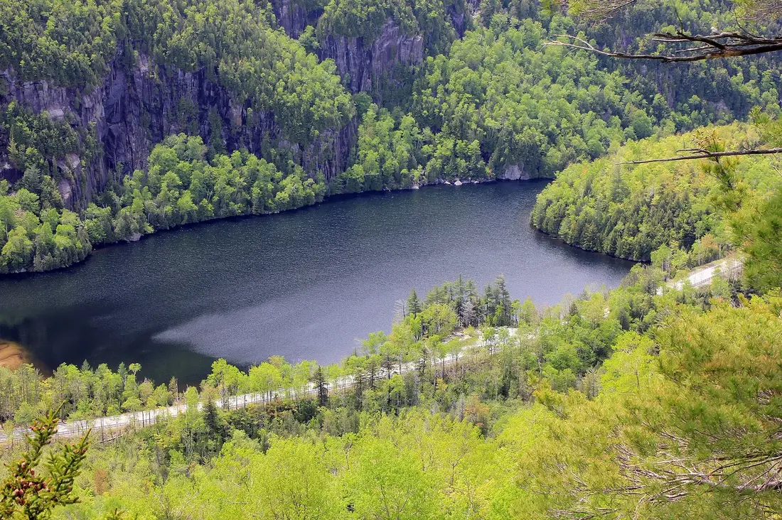
The Adirondack Park is about six million acres of mountains, lakes, forest and small towns in northern New York, and the cabins sit just inside its northern edge, about ten road miles south of Malone. A first trip goes better when you know how the park works: whose land you are standing on, which rules apply where, how far apart things are, and where to find fuel, groceries and a hospital. This is the plan the host would hand a friend coming up for the first time.
The Blue Line
The park's boundary is called the Blue Line. The name goes back to the maps of the early 1890s, when the state's Forest Commission outlined a proposed park in blue ink. Governor Roswell Flower signed the law creating the Adirondack Park on May 20, 1892, and the first park took in about 2.8 million acres. The line was moved outward several times in the twentieth century, and today it is set out word by word in state law, in Section 9-0101 of the Environmental Conservation Law.
Read a few lines of that law and you see how the boundary was drawn: along town lines, old survey lots and rivers. Near the cabins, one stretch reads "southerly along the town of Bellmont boundary to the southwestern corner of lot 80, Township 8 of the Old Military Tract." The Adirondack Park Agency keeps the digital map of the line, traced from county tax maps, and notes that tax maps, the best information available for the whole boundary, are not a land survey.
On the ground, you cross the Blue Line on ordinary roads. It does not fence anything in. Inside it are towns, farms, shops, homes and paved highways, and outside it are more of the same. What changes at the line is the law: inside it, the state's Adirondack land use rules apply to private land, and New York's oldest conservation protections apply to the state's own land.
How big the park is
The Adirondack Park Agency puts the park at approximately six million acres; its own boundary map measures about 5.8 million acres, about 8,600 square miles of it land. The agency calls it the largest publicly protected area in the contiguous United States, bigger than Yellowstone, Everglades, Glacier and Grand Canyon national parks combined, and comparable in size to the whole state of Vermont.
The park holds more than 3,000 lakes and about 30,000 miles of rivers and streams. It is also lived in. About 123,000 people lived inside the Blue Line year-round in 2020, in 101 towns and villages, which works out to about 14 people per square mile. The 2020 census counted 97,707 homes in the park, and 44,152 of them were not occupied as anyone's usual residence, a count that takes in summer camps and second homes. That is why the towns are busier in July than in March.
The agency also notes that the park lies within a day's drive of more than 100 million people in the United States and Canada. Most of them never get as far north as Malone, which is one reason the northern edge of the park stays quiet.
Public land and private land
The single most useful thing to know on a first trip is that the park is a patchwork. By the Adirondack Park Agency's count, 44.6 percent of the land inside the Blue Line belongs to the people of New York as Forest Preserve, 49.4 percent is private, and about 6 percent is water. The state's share comes to roughly 2.6 million acres.
The private half is not empty woods. The agency describes it as homes, commercial centers, farms, working forests and camps, used mostly for forestry, agriculture and open-space recreation. Some of it is open to the public under conservation easements, where the state has bought recreation rights on land that a timber company or other owner still holds. The land around Owls Head, a few miles from the cabins, is one of these: the Owls Head and Sable Highlands guide explains the easement and what you may do there.
For a visitor, the practical rules are simple. Trails, lean-tos and campsites built and marked by the state are on public land or on easements open to the public. Land without trail markers may be private, even deep in the woods, so stay on marked trails and respect posted signs. When you are unsure, the state's maps and the trail signs at each trailhead show whose land you are on.
Wilderness, wild forest and state forest
The state's land in the park is sorted into classes by the State Land Master Plan, signed into law in 1972. The two you will meet most are Wilderness and Wild Forest. Motor vehicles and mountain bikes are not allowed in Wilderness areas; Wild Forest areas permit them on designated roads and trails. Primitive and Canoe areas are managed much like Wilderness. Near the cabins, the Debar Mountain Wild Forest takes in Loon Lake Mountain and Meacham Lake.
State forests are a separate kind of state land. The Department of Environmental Conservation manages them for watershed protection, timber and recreation, so you may see logging on them. The Titusville Mountain State Forest, with Elephant's Head and High Falls a few miles from the cabins, is one, and the Blue Line runs across it.
Forever wild
New York created the Adirondack and Catskill Forest Preserves by law on May 15, 1885, when Governor David B. Hill signed it. Nine years later the state wrote the protection into its constitution. Delegates to the 1894 constitutional convention adopted the new constitution on September 29, 1894, and voters ratified it on November 6. The clause was renumbered in 1938 and is now Article XIV, Section 1.
Its first sentence says the Forest Preserve lands "shall be forever kept as wild forest lands." The next says they may not be leased, sold or exchanged, and that their timber may not be sold, removed or destroyed. Changing either takes a constitutional amendment, passed by two separately elected legislatures and then approved by the voters.
For a visitor, forever wild explains what you see. There is no logging on Forest Preserve land, so the woods along its trails are left to grow old. The land is open to the public, and the rules that come with it, from camping distances to bear canisters, are written to keep it the way the 1894 delegates wanted it.
The Adirondack Park Agency
The state legislature created the Adirondack Park Agency in 1971 to plan for both the public and the private land inside the Blue Line. The agency wrote the State Land Master Plan, signed into law in 1972, and the Adirondack Park Land Use and Development Plan in 1973. It has an 11-member board: eight members appointed by the Governor and confirmed by the Senate, plus the Secretary of State and the commissioners of Environmental Conservation and Empire State Development. Its headquarters is at 1133 State Route 86 in Ray Brook, between Saranac Lake and Lake Placid.
The land use plan sorts every piece of private land into one of six classes: hamlet, moderate intensity use, low intensity use, rural use, resource management and industrial use. Hamlets are the park's growth and service centers, where the agency asks for very few permits. Out in the resource management lands, most building needs a permit, and the plan protects their open-space character.
You will see the agency's work without knowing it. Shops, gas stations and restaurants cluster in the hamlets and villages, and the roads between them run through long stretches of woods. Cell towers are held to a rule of substantial invisibility, so they sit just above the trees, are painted dark gray, or are built as simulated pine trees.
Where the cabins sit
The cabins are near the hamlet of Owls Head in the Town of Bellmont, off County Route 25, about ten road miles south of Malone village. On the Adirondack Park Agency's boundary map they are just inside the park. Here the Blue Line follows the line between the towns of Bellmont and Malone, a little over half a mile west of the cabins, so the cabins are in the park and Malone is not.
That puts the park line between the cabins and much of what you will use. Titus Mountain's ski area, across the town line in Malone, lies just outside the park, and so does the village of Malone with its supermarkets, pharmacies and hospital. Owls Head and Mountain View are inside, and so are Meacham Lake, Paul Smiths and Saranac Lake, the places you pass driving south.
The location gives you both sides. To the north, about twenty minutes away, are a full-size grocery store and a 24-hour emergency room. To the south and east are the Debar Mountain Wild Forest, the Sable Highlands and the lakes. The directions guide covers the roads in and the last miles; the Malone town guide covers the village.
The regions
The tourism offices divide the park into regions, and their names are the ones you will see on signs, maps and websites. The statewide site for the Adirondacks lists ten regions: Lake Placid, Whiteface, the Adirondack Hub, Experience Our Adirondacks (Hamilton County), the Lake Champlain Region, the Adirondack Coast, the Lake George Area, the Adirondack Seaway, the Adirondacks Tug Hill region, and the Always Franklin region around Malone, which it also calls the Adirondack Frontier. These regions are tourism territories, so several reach beyond the Blue Line: Plattsburgh, Potsdam, Watertown and the Tug Hill plateau are all outside the park.
The Regional Office of Sustainable Tourism, which markets Essex and Hamilton counties, Saranac Lake and Tupper Lake, breaks its share into seven zones. They make a good map of the middle of the park:
- Lake Placid and the High Peaks: Lake Placid, North Elba, Keene and Keene Valley. The tallest mountains, the Olympic venues and the busiest trailheads.
- Saranac Lake: Saranac Lake, Bloomingdale, Lake Clear, Paul Smiths and Ray Brook. The nearest village inside the park with a full set of shops, with lakes, paddling and the Saranac Lake 6er peaks.
- Tupper Lake: Tupper Lake and Santa Clara. The Wild Center, dark skies and the Raquette River.
- Whiteface: Wilmington, Jay, Upper Jay and Au Sable Forks. Whiteface Mountain and the Ausable River valley.
- Lake Champlain: Keeseville, Essex, Westport, Port Henry, Crown Point and Ticonderoga. Farms, history and the lake.
- The Adirondack Hub: Schroon Lake, Minerva, Newcomb and North Hudson, in the middle of the park.
- Hamilton County: Blue Mountain Lake, Long Lake, Indian Lake, Inlet, Raquette Lake, Speculator and the other hamlets of Hamilton County.
The cabins' corner of the park, northern Franklin County, sits above all of these. Saranac Lake is the first of them you reach driving south, and the Saranac Lake and Paul Smiths guide is the place to start.
Distances and driving times
The park is big, and its roads are mostly two lanes. Plan around road miles and real driving times, not the straight line on a map. These are road miles from the cabins, with conservative times, and whether each place is inside the Blue Line by the park agency's map:
| Place | Road miles | About | In the park |
|---|---|---|---|
| Titus Mountain ski area | 3.4 | 5 to 10 minutes | No, just outside |
| Malone village | 10 | 20 minutes | No |
| Meacham Lake | 20 | 40 minutes | Yes |
| Saranac Lake | 43 | an hour | Yes |
| Lake Placid | 52 | an hour and a quarter | Yes |
| Tupper Lake and the Wild Center | 57 | an hour and a quarter | Yes |
| Cascade trailhead and Adirondak Loj | 59 to 60 | an hour and a half | Yes |
| Plattsburgh | 61 | an hour and a quarter | No |
| Whiteface Mountain | 62 | an hour and a half | Yes |
| Blue Mountain Lake | 89 | two and a quarter hours | Yes |
| Old Forge | 125 | three hours | Yes |
| Lake George village | 132 | three hours | Yes |
The table shows the shape of a stay. Saranac Lake, Lake Placid, Tupper Lake and the High Peaks trailheads are comfortable day trips. Blue Mountain Lake is a long day. Old Forge and Lake George, at the southern end of the park, are farther from the cabins than Montreal is, and they belong to a different trip. Fill the tank in Malone or Saranac Lake before a long loop, since shops and gas stations cluster in the villages. In winter, read winter driving and add time.
The High Peaks
The High Peaks are the park's best-known mountains: the 46 summits that hikers once believed all reached 4,000 feet. The list comes from Russell Carson's 1927 book on the peaks; later surveys put four of them below 4,000 feet, and the Adirondack Forty-Sixers, the club that recognizes hikers who climb all of them, kept the original list. Mount Marcy, at 5,344 feet, is the highest point in New York, and Lake Tear of the Clouds on its flank is a source of the Hudson River.
The High Peaks start about an hour and a half from the cabins, and on summer and fall weekends their trailheads are the busiest places in the park. Three things to know before you go:
- The Adirondak Loj. The Adirondack Mountain Club, founded in 1922, owns the Loj and the Heart Lake property at the end of Adirondack Loj Road, with the High Peaks Information Center and the trailhead for Marcy and Mount Jo. Parking is by fee: in July 2026 the club charged nonmembers $25 for a day before 1 p.m. and $15 after, and members $10 and $6. In summer the lots often fill before 6 a.m. on weekends and before 9 a.m. on weekdays, and the club does not allow waiting for a spot. Check the current fee before you go.
- The Adirondack Mountain Reserve. Trailheads through the reserve's gate in Keene Valley, and the Noonmark and Round Mountain trailheads, need a free parking reservation from spring through October 31, made at hikeamr.org. Walk-ins are turned away. The system applies only there.
- Cascade. Cascade Mountain, a common choice for a first High Peak, has free state lots on both sides of NY 73 and no reservation. Roadside parking is banned on unsafe stretches, and the ban is enforced, so have a second hike in mind. The Cascade guide has the details.
The High Peaks are not the only mountains. The fire towers and smaller peaks of the northern park, from Loon Lake Mountain to St. Regis, give big views with much less traffic, and several are closer to the cabins. The hiking guide covers them by distance, and the fire tower challenge turns them into a list.
Camping and group rules
Most guests at the cabins sleep in the cabin, not a tent. The camping and group rules still shape how the backcountry works, and day hikers meet them too.
- Where to camp. On state land, camp at least 150 feet from any road, trail, spring, stream, pond or other water, unless you are at a site marked with a "Camp Here" disk.
- How long and how many. A permit from the Forest Ranger for the area is needed for a group of ten or more, or to stay more than three nights in one place.
- The High Peaks Wilderness. Stricter rules apply: day groups are limited to 15 people and overnight groups to 8, and larger groups are not allowed. Between 3,500 and 4,000 feet you may camp only at a designated site, and above 4,000 feet not at all.
- Campfires. No campfires at all in the eastern High Peaks Wilderness. Elsewhere, use the existing fire rings and keep fires small.
- Bear canisters. Overnight campers in the eastern High Peaks must store all food, food containers, garbage and toiletries in a bear-resistant canister from April 1 through November 30. Hanging food in a bag does not count. Day hikers do not need one.
- Dogs. In the eastern High Peaks, dogs must be leashed on trails, at campsites and lean-tos, above 4,000 feet and wherever people gather.
Specific areas can carry their own rules, so read the kiosk at the trailhead. For fires at the cabins, New York's backyard burning rules, the spring burn ban and the firewood rule, see fire pits and firewood.
Leave No Trace and hiking basics
New York's environmental and parks departments ask visitors to state land to follow the seven Leave No Trace principles: plan ahead and prepare, travel and camp on durable surfaces, dispose of waste properly, leave what you find, minimize campfire impacts, respect wildlife, and be considerate of other visitors. In the Adirondacks that comes down to a few habits:
- Stay on the trail and walk through the mud, not around it. On summits, step on bare rock, not the plants that grow between it.
- Carry out everything you carry in, food scraps included.
- Leave trail signs, markers, rocks and plants where they are.
- Keep dogs leashed where the rules say so, and under control everywhere.
The state's Hike Smart NY list names ten essentials to carry, among them food, water, navigation, warm layers, a headlamp, a first-aid kit and an emergency shelter, with traction devices and snowshoes in winter. Leave your trip plan with someone who will call for help if you are late, set a turnaround time, and keep to it.
The Adirondack Mountain Club maintains trails and teaches hikers across the park. Its High Peaks Information Center at Heart Lake is the place to ask about trail conditions before a High Peaks hike. For ticks and black flies, the bug guide has what works.
Fall brings hunting season to much of the public land, from September into December. Wear a bright color on the trail then, and read the hunting section of the hiking guide before an autumn hike.
Boats and invasive species
The park's lakes are protected against invasive plants and animals that ride in on boats and trailers. Since June 2022, anyone launching a motorboat into a new waterbody in the Adirondack Park, or within ten miles of the Blue Line, must carry a certificate that the boat and gear were cleaned, drained and dried. You can get one free from a boat steward, who wears a blue vest and works at the busier launches, after a quick inspection, or fill out the state's self-issued form before you launch. Keep the certificate with the boat.
New York law also requires every boat, canoes and kayaks included, to be cleaned, drained and dried before it goes into a public waterbody anywhere in the state. Rinse off mud and plants, drain the hull and bilge, and let it dry between lakes. The Meacham Lake guide and the St. Regis Canoe Area guide cover the nearest paddling.
Phones and wifi
Expect gaps in cell service. The Adirondack Park Agency names the reasons itself: mountainous terrain, dense foliage, few people, and large areas of state land where towers are not allowed. Plan as if you will lose the signal on trails and back roads, and treat any bar of service as a bonus.
At the cabins, the carriers that work are Verizon and AT&T, and all three cabins have wifi, which makes Wi-Fi calling a good backup. Download offline maps before you leave home, and send the host your arrival time while you still have a signal in Malone or Saranac Lake. Health and safety has the full phone and emergency details.
For a lost or injured hiker or paddler, call 911. The Department of Environmental Conservation's Forest Rangers handle backcountry search and rescue, and their dispatch line is 1-833-NYS-RANGERS (1-833-697-7264). Save both numbers before you go.
Fuel, groceries and hospitals
The park's services are in its villages, and the cabins' nearest full-service town is just outside it. Malone, about ten road miles north, has a Price Chopper supermarket, an ALDI, a Walmart Supercenter, Kinney Drugs, gas stations and the Alice Hyde Medical Center, whose emergency department is open 24 hours. Shop there on the way in. The groceries and supplies page lists the stores, and where to eat covers dinner.
Inside the park, Saranac Lake is the nearest village with a full set of services. Adirondack Health's Adirondack Medical Center, at 2233 State Route 86 in Saranac Lake, runs an emergency department open 24 hours a day.
Between the villages, services thin out. On a day in the middle of the park, leave with a full tank, food and water for the day, and a phone charger in the car, and treat any open gas station as a chance to top off.
A first trip from the cabins
Here is a five-day plan that shows a first-timer the park's range without spending every day in the car. It assumes summer or early fall; the when to come guide covers the other seasons.
Day one, arrive by way of Malone
Stop in Malone for groceries, fuel and anything from the pharmacy, then drive the last ten miles south and cross into the park on the way to the cabin. Unpack, light the fire pit, and spend the evening in the hot tub. If you arrive after dark, the directions guide has what to know.
Day two, the woods next door
Stay close. Walk to Elephant's Head in the Titusville Mountain State Forest, 0.8 mile to the top with about 320 feet of climbing and a view over Lake Titus and Titus Mountain, or take the level walk to High Falls, about five road miles from the cabins. In the afternoon, drive the twenty miles to Meacham Lake for a swim or a paddle, then back to the cabin for dinner. This is the day you learn the cabins' corner of the park.
Day three, Saranac Lake and Paul Smiths
Drive south on NY 30 through Paul Smiths to Saranac Lake, about an hour. Climb one of the shorter Saranac Lake 6er peaks, then walk the village and have lunch on Main Street or Broadway before the drive home. The 6er guide and the Saranac Lake guide have the details.
Day four, the High Peaks and Lake Placid
Leave early. For a first High Peak, climb Cascade, and arrive by dawn on a weekend to find a parking spot. For something shorter, climb Mount Jo from the Heart Lake Program Center at the Adirondak Loj: about two miles round trip with roughly 700 feet of climbing, and from its open summit you look across Heart Lake to Algonquin, Mount Colden and, on a clear day, Mount Marcy. Spend the afternoon in Lake Placid at the Olympic sites and on Main Street, and drive home in daylight if you can.
Day five, Tupper Lake or a quiet day
Spend the morning at The Wild Center in Tupper Lake, whose Wild Walk climbs into the treetops from late May to mid-October, or keep the last day for the cabin, the fire pit and a short walk. Leave the long drives to Blue Mountain Lake and the southern park for a second trip.
Five days covers the north end of the park well. Another week would still leave most of the park to see, and that is a good reason to come back. For a longer stay built around the cabins, read a week at the cabins, and when you are ready, choose a cabin.
Questions
Are the cabins inside the Adirondack Park?
Yes, just inside. On the Adirondack Park Agency's boundary map, the cabins near Owls Head in the Town of Bellmont lie a little over half a mile east of the Blue Line, which here follows the Bellmont and Malone town line. Malone village and the Titus Mountain ski area are just outside the park. See the directions guide for the roads in.
How big is the Adirondack Park?
About six million acres, by the Adirondack Park Agency's count, roughly the size of Vermont and bigger than Yellowstone, Everglades, Glacier and Grand Canyon national parks combined. It holds more than 3,000 lakes, about 30,000 miles of rivers and streams, and 101 towns and villages where about 123,000 people live year-round.
Is all the land in the Adirondack Park public?
No. About 45 percent is state Forest Preserve, open to everyone and protected as forever wild by the state constitution. About 49 percent is private land, from homes and farms to working forests, and about 6 percent is water. Stay on marked trails, and respect posted signs. Some private forest near the cabins is open under conservation easements; see the Owls Head guide.
Do I need a permit to hike in the Adirondacks?
Not for most hikes. You need a free parking reservation from May through October for trailheads on the Adirondack Mountain Reserve in Keene Valley, and the Adirondak Loj charges a parking fee. Cascade's state lots on NY 73 are free. Camping groups of ten or more, or stays over three nights in one place, need a permit from the Forest Ranger.
Is there cell service in the Adirondacks?
Expect gaps. The park's mountains, forests, small population and its state land, where towers are not allowed, leave long stretches without a signal. At the cabins, Verizon and AT&T work and all three have wifi for Wi-Fi calling. Download offline maps before you go; health and safety has the details and emergency numbers.
Where are the nearest hospital and grocery stores to the cabins?
In Malone, about ten road miles north, just outside the park: Alice Hyde Medical Center has a 24-hour emergency department, and Price Chopper, ALDI and Walmart cover groceries. Inside the park, Adirondack Medical Center in Saranac Lake, about 43 road miles south, also runs a 24-hour emergency department. See groceries and supplies.
Do I need a bear canister?
Only if you camp overnight in the eastern High Peaks between April 1 and November 30, when the state requires a bear-resistant canister for all food, garbage and toiletries. Day hikers do not need one. At the cabins, keep trash closed and indoors; wildlife watching covers the animals you may see.
Sources
Facts on this page were checked against these sources in October 2026. Hours, fees and schedules change; confirm before you go.
- apa.ny.gov apa.ny.gov/about/park.html
- apa.ny.gov apa.ny.gov/files/laws/CitizensGuide.pdf
- services2.arcgis.com services2.arcgis.com/8krRUWgifzA4cgL3/ArcGIS/rest/services/BluelinePol
- services2.arcgis.com services2.arcgis.com/8krRUWgifzA4cgL3/ArcGIS/rest/services/AdirondackP
- nysenate.gov nysenate.gov/legislation/laws/CNS/A14S1
- archive.adirondackcouncil.org archive.adirondackcouncil.org/news/one-hundred-and-thirty-years-later-
- New York State Department of Environmental Conservation dec.ny.gov/lands/110552.html
- adirondacklife.com adirondacklife.com/2016/02/25/the-thin-blue-line/
- apa.ny.gov apa.ny.gov/files/laws/APSLMP.pdf
- New York State Department of Environmental Conservation dec.ny.gov/nature/forests-trees/state-forests
- visitadirondacks.com visitadirondacks.com/node/99
- roostadk.com roostadk.com/regions
- adk46er.org adk46er.org/our-background/
- britannica.com britannica.com/place/Mount-Marcy
- Adirondack Mountain Club adk.org/stay/adirondak-loj/
- Adirondack Mountain Club adk.org/hiker-parking-at-heart-lake/
- Adirondack Mountain Club adk.org/hiking-mount-jo-the-perfect-first-adirondack-summit/
- newyorkalmanack.com newyorkalmanack.com/2026/04/adirondack-mountain-reserve-2026/
- New York State Department of Environmental Conservation dec.ny.gov/places/high-peaks-wilderness-complex
- New York State Department of Environmental Conservation dec.ny.gov/things-to-do/camping/state-land-rules
- nps.gov nps.gov/kimo/planyourvisit/leave-no-trace.htm
- New York State Department of Environmental Conservation dec.ny.gov/news/press-releases/2023/2/dec-reminds-visitors-to-state-la
- New York State Department of Environmental Conservation dec.ny.gov/news/press-releases/2024/10/dec-reminds-outdoor-enthusiasts
- New York State Department of Environmental Conservation dec.ny.gov/press/125517.html
- New York State Department of Environmental Conservation extapps.dec.ny.gov/docs/lands_forests_pdf/cddfaq2022b.pdf
- apa.ny.gov apa.ny.gov/_assets/Towers/ParkTowers.html
- New York State Department of Environmental Conservation dec.ny.gov/environmental-protection/public-safety/forest-rangers/searc
- adirondackhealth.org adirondackhealth.org/about/emergency-care
- law.cornell.edu law.cornell.edu/regulations/new-york/6-NYCRR-190.13
- law.cornell.edu law.cornell.edu/regulations/new-york/6-NYCRR-190.3
- law.cornell.edu law.cornell.edu/regulations/new-york/6-NYCRR-190.4
- New York State Department of Environmental Conservation dec.ny.gov/nature/forests-trees/forest-preserve/birth-of-blue-line-in-


