
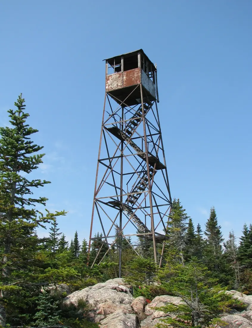
Loon Lake Mountain Fire Tower
Loon Lake Mountain, about 20 road miles from the cabins: a 2.8-mile trail climbs over 1,600 feet to a 3,337-foot summit and a closed 1917 fire tower.
Loon Lake Mountain is the closest fire-tower summit to the cabins: a 2.8-mile trail that climbs about 1,650 feet to open ledges at 3,337 feet and a 35-foot steel tower first put up in 1917. The trailhead on County Route 26 is about 20 road miles from the cabins, roughly 40 minutes, and the climb fills a morning. Go for a wide view over the lakes and mountains of the northern Adirondacks, a quiet trail and a summit that counts toward the Fire Tower Challenge; the tower itself is closed to climbing.
The trail at a glance
| Item | Detail |
|---|---|
| Trailhead | West side of County Route 26 in the Town of Franklin, about 4.7 miles north of the hamlet of Loon Lake |
| From the cabins | About 20 road miles, roughly 40 minutes |
| Distance | 2.8 miles each way; round-trip measurements run from 5.6 to 6.2 miles |
| Climb | About 1,650 feet from a trailhead at about 1,690 feet, some 1,200 of it in the last mile and a half |
| Summit | 3,337 feet by the 2018 USGS lidar survey; older published figures run from 3,279 to 3,355 |
| Markers | Yellow DEC disks |
| Land | Kushaqua Tract conservation easement at the bottom, Forest Preserve for the last 1.1 miles |
| Fire tower | 35-foot Aermotor steel tower, closed to the public, lowest stairs removed |
| Trail opened | October 2013 |
Getting to the trailhead from the cabins
From the cabins, local roads lead about three miles to County Route 27, Pond Road, near Owls Head. Follow it south through Mountain View for about nine miles to County Route 26, the old Port Kent–Hopkinton Turnpike, and turn left. The road to Debar Pond goes off on the right after about 0.2 mile; keep straight for about seven more miles through the woods to the small parking area on the right, the west side of the road. That is about 20 road miles in all, roughly 40 minutes. If you reach the lake and the hamlet of Loon Lake, you have gone 4.7 miles too far.
From other directions: from NY 30 in the town of Duane, County Route 26 runs southeast about 11 miles to the lot, on the right. From Saranac Lake, take NY 3 east through Bloomingdale for about 15.5 miles, turn left onto County Route 26, and the parking area is on the left after about eight miles, past the lake. The lot's position is N44 35.135, W74 07.476. County Route 26 was once state Route 99, a number you may still see on older maps and in directions.
The lot is small, room for about five cars by one July 2026 count, and the trail sees little use. The Town of Franklin agreed in 2013 to plow it in winter. Do not count on a cell signal at the trailhead, and buy food and fuel in Malone before you leave.
The trail from the road to the summit
On the easement land
The trail starts on the Kushaqua Tract, private timberland where a state conservation easement guarantees public access, and it follows yellow DEC markers. For the first 1.4 miles it uses an old logging road, wide and gradual through hardwoods, the easy part of the day. Stay on the marked route: the land is still logged, and about 30 one-acre lots on the tract are leased to hunting camps and closed to the public.
Wooden footbridges and bog bridges carry the trail over the wet spots and three small streams. From one clearing you can see the tower on the summit ahead, a good place to check the time and the weather. Hikers in 2009, before the trail was rebuilt, also noticed old wooden poles that once carried the fire observer's telephone line up the mountain.
Into the Forest Preserve
After the logging road the route narrows to a footpath and starts to climb in earnest. About two miles in, a small cascade comes down beside the trail on the right. The last 1.1 miles are Forest Preserve, part of the Debar Mountain Wild Forest. Of the trail's 1,651 feet of climbing, by one hiker's count, about 1,200 come in the last mile and a half, and grades often pass 30 percent. Conifers close in as you rise.
The final climb
The last push follows a mossy, rocky streambed that is steep and slippery, with water running over the stones after rain and snowmelt. Take it slowly on the way down as well as the way up. Then the grade eases along the summit ridge, the trees thin out, and you come out on open bedrock at the base of the tower. DEC's 2020 draft plan for the area says the upper trail was badly laid out and proposes rerouting it, so the line of the trail may change in coming years.
Time, difficulty and who it suits
Guides rate the hike moderately difficult to difficult. The numbers explain why: a modest distance, but a climb concentrated near the top. At an easy two miles an hour on the flat plus the time the climb takes, most hikers should plan on about four hours for the round trip, including a rest on the summit. The logging road goes quickly; the last mile and a half does not. Wear boots with good grip for the wet rock near the top.
Children who already climb steep trails will manage it, and the logging road and the clearing with the tower in view make an easy turnaround for those who do not. For a first summit with children, Owls Head, on the way, is a much shorter climb to open ledges; see the Owls Head guide. The hiking guide lists the other climbs near the cabins in order of distance.
Dogs are welcome. Outside the Eastern High Peaks, state land has no leash rule, but DEC recommends a leash unless your dog stays under voice control and will not chase wildlife or run up to other hikers. Porcupines live in these woods, and a curious dog can come back with a face full of quills. All three cabins take pets for a fee; see bringing your dog.
The summit and the view
The top is open bedrock around the base of the tower, and even without the cab the view is wide. The broad back of Lyon Mountain rises to the northeast. The point of Whiteface Mountain stands to the southeast, with more of the High Peaks beyond it to the south. Close by to the north are Debar and Baldface mountains with Debar Pond between them, and on a clear day hikers have picked out a ribbon of water far to the north that they took for the St. Lawrence River. Loon Lake and the wetlands of the valleys lie below.
The highest ground, a few steps from the tower, stands 3,337 feet above sea level by the U.S. Geological Survey's lidar survey of 2018, and the trailhead lot sits at about 1,690 feet. You will see other heights for this summit. The state's land master plan and DEC's 2020 draft plan give 3,355 feet, an older USGS figure; DEC's web page for the wild forest gives 3,279; and DEC's 2013 trail announcement said 2,264, a slip, since the parking lot alone sits higher than 1,600 feet. The summit mixes open rock, low blueberry bushes, moss and evergreens, and the tower stands toward the north end of its one clearing, an opening about 35 by 75 feet with a rock face on its west side.
The summit is exposed, and the wind can be far stronger than in the woods. Bring a warm layer and a wind shell even in summer, and leave the top if you hear thunder; a steel tower on bare rock is the wrong place to be in lightning.
Wildflowers and wildlife on the climb
Spring is the season for the woods here. Hikers in mid-May have found trout lilies, violets, spring beauty, wood sorrel and purple and painted trillium along the lower trail, with hobblebush blooming in pale clusters beside the path. Higher up, the hardwoods give way to spruce and fir. DEC's draft plan counts about 778 acres of boreal forest above 2,800 feet in the whole Debar complex, and 475 of them are on Loon Lake Mountain. That high spruce-fir forest is the kind of habitat Bicknell's thrush, a species of special concern in New York, depends on for breeding, so keep to the trail on the upper mountain.
Watch the ground as well as the trees. One party flushed a dark-eyed junco, a dark little bird that flashes two white stripes on its tail as it flies, and found three piles of moose droppings, each pellet about the size of a grape. Moose and black bear both live in the Debar Mountain Wild Forest, so keep food packed away on the summit and give any large animal plenty of room. For more on what lives around the cabins, see wildlife watching.
When to go
Summer and early fall are the easiest seasons on this mountain. Mud season runs anywhere from late March into mid-June, and DEC asks hikers to stay off trails above 2,500 feet until mid-June; this summit is far above that line, and the streambed near the top is at its worst then. Black flies come out in mid-May and are worst in late May and early June, especially on humid or overcast days and near moving water, which this trail crosses again and again. The bug guide has the details.
Fall is also hunting season on the land around the trail. In 2026 the Northern Zone bear seasons run from September 19 and the regular deer season from October 24, both through December 6, and the leased camps on the easement are hunting camps, so wear orange and keep a dog close. From October on, start early and carry a headlamp.
Winter ascents
The trail can be climbed year-round, but snow and ice come early to this mountain and stay late. Expect to need snowshoes or traction spikes from November into May. It is a hard snowshoe, and microspikes grip better than snowshoes on the steepest pitches of the upper streambed. Pack extra layers, a windbreaker, an emergency blanket, a first-aid kit, a headlamp and more food and water than in summer, and set a turnaround time; the days are short and the summit takes the full wind.
The town plows the trailhead lot, but the county roads in from the cabins are slow after a storm, so allow extra time. Sleds have used County Route 26 as a link between snowmobile corridors, so watch for them along the road. For gentler winter walks closer to the door, see the cross-country skiing and snowshoeing guide.
The fire tower's history
Lookouts and observers
The tower is here because of fire. Forest fires burned around Loon Lake, and on the mountain itself, in the summers of 1903, 1905 and 1906, and in 1911 or 1912 the state put a log lookout tower and an observer's cabin on the summit. In 1917 Forest Ranger Albert Tebeau, a native of Owls Head, the hamlet a few miles from the cabins, supervised the building of the 35-foot Aermotor steel tower that stands today. Strong winds blew it over in the winter of 1927–28, and Conservation Department crews set it back up on its footings the next spring.
In 1928 the observer moved into a new cabin about two miles down the slope and walked up to work. The Civilian Conservation Corps finished a foot trail from the observer's parking area to the tower in the summer of 1934. Observers kept watch every fire season until the fall of 1970, when the state closed the tower. The observer's cabin from 1928 still stood on the private land below as of 2020.
The way back to the summit
For most of the years since, the public had no easy way up. The summit is a small parcel of Forest Preserve hemmed in on three sides by private timberland, and the observers' trail crossed that private land. A hiker who first climbed the mountain as a teenager in the 1970s remembers an old woods road that turned into a bushwhack through stiff hobblebush and a scramble up a streambed. Years later an Adirondack Explorer editor and a friend had to bushwhack across state land for hours to reach the top without trespassing.
The 2004 easement on the former International Paper lands changed that by promising public recreation rights after five years. The Kushaqua lands opened in late April 2009, and within weeks hikers were following the logging roads and an overgrown path to the summit, past blowdown near the top. DEC marked the route with yellow disks, built the parking area on County Route 26 and opened the present 2.8-mile trail on October 10, 2013. Along the way the tower went on the State Register of Historic Places in March 2006, the National Register in December 2008 and the National Historic Lookout Register in January 2015.
Why the tower is closed
The tower is not safe to climb, and DEC keeps it closed to the public. The lowest stairs have been taken off so that nobody can reach the cab, and visitors in 2009 already found steps, railings and fencing missing. Do not try to climb it. The Adirondack Mountain Club's challenge list marks the cab as permanently closed, and a hiker who went up in July 2026 found the tower still shut, with part of the staircase gone and rust showing on the steel.
Restoration has been discussed for years. In 2009 the Loon Lake Homeowners Association was raising money to rehabilitate the tower, and DEC's 2020 draft plan for the Debar complex proposes preserving and restoring it and reopening it for education and interpretation, with DEC open to a partnership if a volunteer friends group forms. A friends group, working with DEC, is how Azure Mountain's tower near St. Regis Falls reopened in 2003. As of 2026 no restoration had happened, DEC still listed the tower as not yet restored, and with no adopted plan there is no schedule. Check DEC's fire tower page before you promise anyone the cab.
Fire Tower Challenge credit
Loon Lake Mountain is one of the 27 Adirondack summits on the Adirondack Mountain Club's Fire Tower Challenge. To earn the patch you climb and document, by date, at least 23 fire-tower summits, 18 of the 27 in the Adirondack Park and all five in the Catskills, show some stewardship such as a Leave No Trace course or a volunteer project, and pay a $15 submission fee. Climbing the towers is not required, and the club advises against climbing any that need repair, so reaching this summit counts in full. Take a dated photo by the tower.
The winter version counts ascents between December 21 and March 21, and the club asks winter hikers not to climb any tower in those months because of ice and wind. Of the four challenge summits near the cabins, Loon Lake Mountain is the closest; the challenge guide lays out a week, and St. Regis Mountain and Lyon Mountain have their own guides.
The hamlet of Loon Lake
Below the mountain, County Route 26 follows the old Port Kent–Hopkinton Turnpike, a toll road in its day, along the shore of Loon Lake, about three miles west of NY 3 and 20 miles north of Saranac Lake. Today the hamlet is a quiet summer community of private cottages. It was once one of the most fashionable resorts in the Adirondacks.
Settlement came with the turnpike. John Merrill opened an inn for stagecoach travelers at nearby Merrillsville around 1831. In 1848 the abolitionist Gerrit Smith gave Willis Hodges, a free Black man from Virginia, 200 acres north of the lake as part of his plan to help Black men own enough property to vote. The settlement, called Blackville, lasted about two years, and Hodges Bay on the lake carries his name. In the early 1850s Paul Smith ran lodgings at Loon Lake before he moved on to Lower St. Regis Lake.
The resort years began when Ferdinand and Mary Chase bought ten acres on the lake and built a 31-room, three-story log hotel, the Loon Lake House, which opened in 1879. Within four years it had 100 rooms, and an annex as large went up next door in 1893. The Chases came to own most of the fifty-plus cottages on the lake, built without kitchens on Mary Chase's orders so that every guest ate in the dining rooms. Guests had bowling, billiards, local guides and a nine-hole golf course that opened in 1895 and grew to 18 holes in 1922. Two railroads served the resort, each with its own station, and a staff of close to 500 ran it. Mary Chase hired every one of them herself and decided which guests were invited back.
First Lady Caroline Harrison spent the summer of 1892 convalescing in a cottage now called the President's House, with President Harrison visiting; Grover Cleveland vacationed in the same cottage three years later, and William McKinley summered there from 1897 to 1901. Irving Berlin, George Gershwin and Theodore Dreiser are among the famous guests remembered at the lake, and E. L. Doctorow later used the place in his fiction.
Mary Chase died in 1933, and the hotel limped along under new owners; by the time it burned it belonged to a Florida company, Andron Resorts. The Loon Lake House and its first annex burned in 1956, in a fire so large that legend says it was seen from Montreal. The golf course closed in 2003. The second annex, built around 1905 and now called the Irish House, still stands, as does the 1895 Caddie House with its pagoda roof, along with many of the old cottages. All of them are private property. Drive through slowly and enjoy them from the road; Adirondack Architectural Heritage has offered tours of the old resort, so watch its calendar if you want to see more.
Nearby add-ons
- Debar Pond, on the way: its road leaves County Route 26 just past the Pond Road junction, and a flat 0.3-mile walk ends at a mountain pond with the old Debar Pond Lodge on the shore. The Debar Mountain Wild Forest guide has the details, along with the Debar Mountain trail, the lean-tos and the horse trails.
- Owls Head, off County Route 27 on the way home, for a second short summit.
- Meacham Lake, about 18 road miles from the trailhead by County Route 26 and NY 30, for a summer swim at the state campground beach, unsupervised since 2023, from the designated beach area; see the Meacham Lake guide.
- Saranac Lake, about 24 road miles south by County Route 26 and NY 3, for lunch and the bell of the Saranac Lake 6er; see Saranac Lake and Paul Smiths.
- Lake Kushaqua, about 15 road miles from the trailhead by County Route 26, NY 3 and the Gabriels–Onchiota Road, where the Kushaqua Rail Trail runs 1.3 level miles along the shore from Buck Pond Campground, with Loon Lake Mountain in view; the campground itself is open from mid-May to Labor Day.
A morning on the mountain
Here is a plan for a summer or fall day. Leave the cabins at 8:00 and be at the trailhead by about 8:45. Allow two to two and a half hours up, with breathers at the clearing where the tower comes into view and at the cascade. Eat lunch on the summit ledges, start down by noon and be back at the car by about 1:30.
On the way home, turn in at the Debar Pond road for an hour by the water, then drive Pond Road back through Mountain View and Owls Head. You are at the cabin by mid-afternoon. Each of the cabins has a private hot tub, a fire pit and a washer and dryer for muddy clothes. The Modern Pine and The Aviator also have Jotul gas stoves for a cold evening, and The Modern Tiny Home has the big stone fire pit.
Safety and what to bring
- Water, lunch, a warm layer and rain gear. The summit is exposed.
- A map that works offline. DEC's georeferenced map of the Debar Mountain Wild Forest loads into offline map apps.
- Boots with good grip, and traction spikes from late fall into spring.
- Orange clothing from September into December.
- Head nets or repellent from mid-May into June.
- A plan someone at the cabin knows. In an emergency call 911 or DEC's Forest Ranger dispatch at 1-833-697-7264, and if you are lost or hurt, stay put. Alice Hyde Medical Center in Malone has a 24-hour emergency department; see health and safety.
- The discipline to stay off the tower.
Questions
Can you climb the Loon Lake Mountain fire tower?
No. The 35-foot steel tower is closed to the public and its lowest stairs have been removed. DEC's draft plan calls for restoring and reopening it, but as of 2026 it had not been restored and no plan has been adopted, so there is no schedule. The open bedrock around its base still gives a wide view, and reaching the summit counts for the Fire Tower Challenge.
How high is Loon Lake Mountain?
The highest ground on the summit, beside the fire tower, is 3,337 feet above sea level by the U.S. Geological Survey's 2018 lidar survey, and the trailhead is at about 1,690 feet. Older figures differ: the state's land master plan and DEC's 2020 draft plan give 3,355 feet, DEC's web page 3,279, and DEC's 2013 trail announcement 2,264, a slip. See the Debar Mountain Wild Forest guide for the rest of the unit.
How long does the Loon Lake Mountain hike take?
Plan on about four hours for the round trip, with a rest on top. The trail is 2.8 miles each way and climbs about 1,650 feet, but the first 1.4 miles follow an easy logging road, and about 1,200 feet of the climb comes in the last mile and a half, much of it up a steep, wet streambed.
Where do I park for Loon Lake Mountain?
At the small DEC lot on the west side of County Route 26 in the Town of Franklin, about 4.7 miles north of the hamlet of Loon Lake. From the cabins, take County Route 27 south through Owls Head and Mountain View and turn left onto County Route 26; it is about 20 road miles, roughly 40 minutes. The lot holds only a handful of cars and the town plows it in winter.
Does Loon Lake Mountain count for the Fire Tower Challenge?
Yes. It is one of the 27 Adirondack summits on the Adirondack Mountain Club's list, and climbing the tower is not required, so reaching the summit counts. The winter version counts ascents from December 21 to March 21. See the challenge guide for the other towers near the cabins.
Can I bring my dog up Loon Lake Mountain?
Yes. State land outside the Eastern High Peaks has no leash rule, but DEC recommends a leash unless your dog stays under voice control and will not chase wildlife. The upper trail is a steep, rocky streambed, so make sure your dog is fit for it. All three cabins allow pets for a fee; see bringing your dog.
Can I hike Loon Lake Mountain in winter?
Yes. The trail is open year-round and the town plows the lot. Snow and ice arrive early and linger, so carry snowshoes or traction spikes from November into May; microspikes work best on the steep upper section. Stay off the tower in winter, pack extra layers and a headlamp, and set an early turnaround time on short days.
Is the old Loon Lake House hotel still there?
No. The Loon Lake House, which opened in 1879 and hosted presidents in the 1890s, burned with its first annex in 1956, and the resort's golf course closed in 2003. The second annex, now called the Irish House, and the 1895 Caddie House still stand among the old cottages along County Route 26. All of them are private homes.
Sources
Facts on this page were checked against these sources in October 2026. Hours, fees and schedules change; confirm before you go.
- apa.ny.gov apa.ny.gov/files/laws/APSLMP.pdf
- content.govdelivery.com content.govdelivery.com/accounts/NYSDEC/bulletins/13f3c0a
- content.govdelivery.com content.govdelivery.com/accounts/NYSDEC/bulletins/8f1d39
- New York State Department of Environmental Conservation dec.ny.gov/environmental-protection/public-safety/forest-rangers
- New York State Department of Environmental Conservation dec.ny.gov/places-to-go/maps/debar-mountain-wild-forest-georeferenced-
- New York State Department of Environmental Conservation dec.ny.gov/places/debar-mountain-wild-forest
- New York State Department of Environmental Conservation dec.ny.gov/places/kushaqua-conservation-easement-tract
- New York State Department of Environmental Conservation dec.ny.gov/things-to-do/camping/campground-day-use-schedule
- New York State Department of Environmental Conservation dec.ny.gov/things-to-do/hiking/fire-towers
- New York State Department of Environmental Conservation dec.ny.gov/things-to-do/hunting/deer-bear/seasons
- New York State Department of Environmental Conservation extapps.dec.ny.gov/docs/lands_forests_pdf/debarump.pdf
- New York State Department of Environmental Conservation extapps.dec.ny.gov/docs/permits_ej_operations_pdf/buckpond23.pdf
- nps.gov nps.gov/subjects/nationalregister/upload/weekly-list-2009-national-reg
- nhlr.org nhlr.org/lookouts/us/ny/loon-lake-mountain-fire-tower/
- Adirondack Mountain Club adk.org/adk-fire-tower-challenge/
- Adirondack Mountain Club adk.org/mud-season-quick-facts/
- pureadirondacks.com pureadirondacks.com/blogs/adirondack-hiking/55010177-loon-lake-mountai
- Adirondack Explorer adirondackexplorer.org/communities/history/loon-lakes-lifestyles-of-th
- Adirondack Explorer adirondackexplorer.org/environment/dogs-in-the-adirondacks/
- Adirondack Explorer adirondackexplorer.org/general/loon-lake-mountain/
- Adirondack Explorer adirondackexplorer.org/recreation/hiking/loon-lake-mountain-a-rugged-a
- Adirondack Explorer adirondackexplorer.org/recreation/return-to-loon-lake-mountain/
- OpenStreetMap (road distances) openstreetmap.org/
- protectadks.org protectadks.org/loon-lake-mountain-is-a-rugged-peak-with-a-firetower-t
- Saranac Lake tourism saranaclake.com/hiking/loon-lake-mountain
- streamandsteeple.com streamandsteeple.com/loon-lake-mountain-adk/
- govinfo.gov govinfo.gov/content/pkg/FR-2008-11-10/pdf/E8-26645.pdf
- Adirondack Explorer adirondackexplorer.org/commentary/wild-forest-or-historic-site-decidin
- epqs.nationalmap.gov epqs.nationalmap.gov/v1/json?x=-74.151699&y=44.558178&wkid=4326&units=
- edits.nationalmap.gov edits.nationalmap.gov/apps/gaz-domestic/public/summary/970320
- New York State Department of Environmental Conservation extapps.dec.ny.gov/docs/lands_forests_pdf/ftowerstudy.pdf
- New York State Department of Environmental Conservation dec.ny.gov/sites/default/files/2025-04/summerreccampgroundsummary.pdf
- New York State Department of Environmental Conservation dec.ny.gov/sites/default/files/2024-05/devilstombstonemap.pdf
- content.govdelivery.com content.govdelivery.com/accounts/NYSDEC/bulletins/362b7ec
In this guide
Stay nearby
The first of the cabins: a big stone fire pit you see as you walk up, a screened corner of the deck, direct trail access, and a short walk to an observation deck over the pond.
 The Modern Tiny HomeCabin 1 · 2 bd · 1 ba · sleeps 4
More in Trails & Hiking
Sources
34 references, listed in full at the end of this guide: official park, state, tourism-office and business sources, checked October 2026.
Related guides
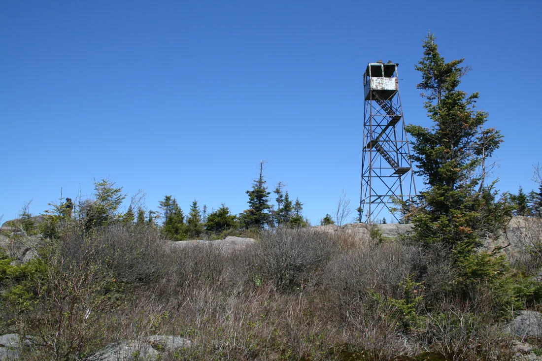
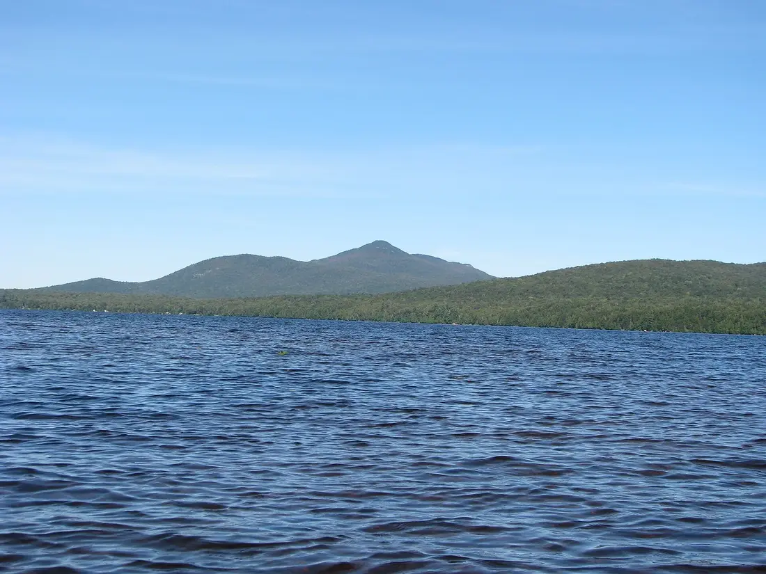
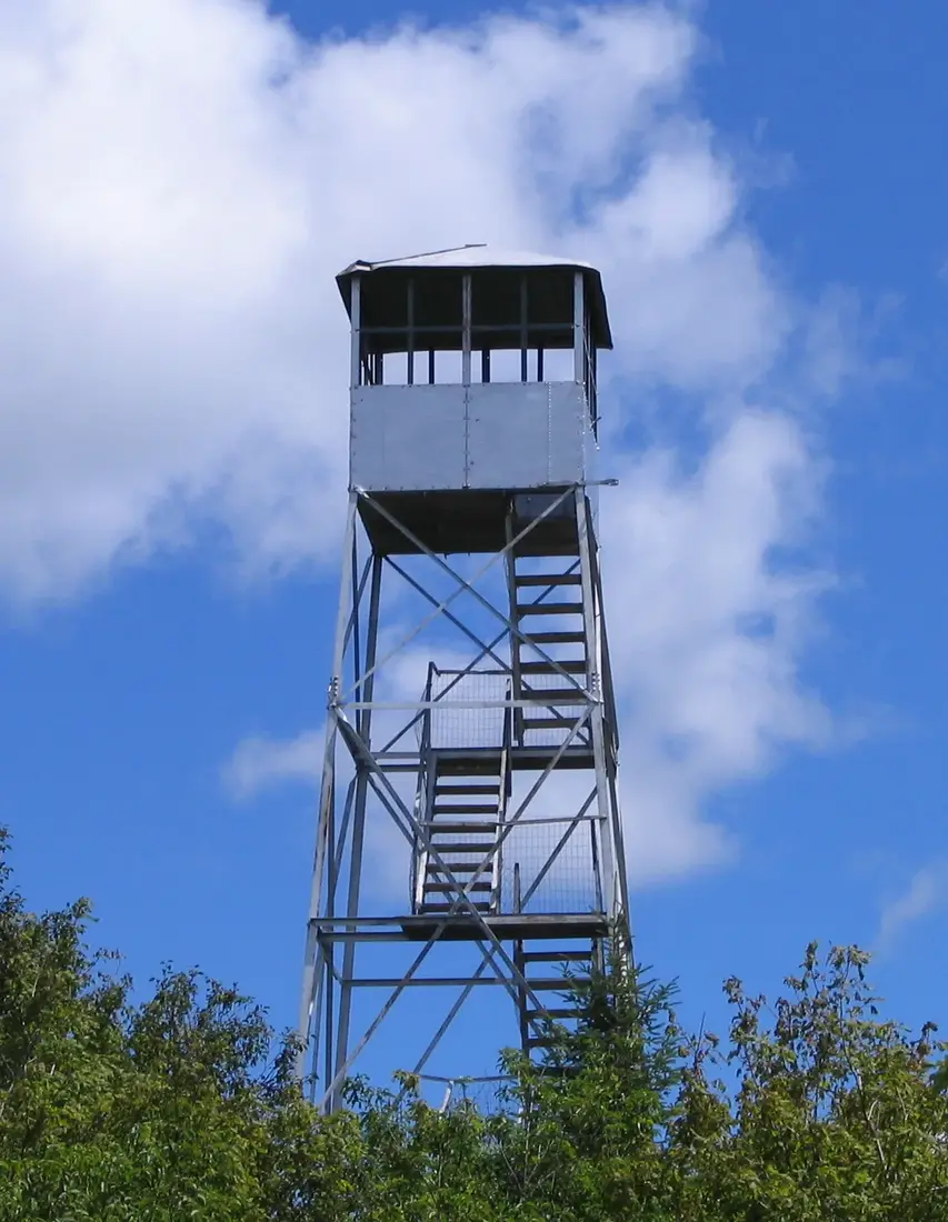


Photos on this page: Fire Observation Tower on the summit of Loon Lake Mountain, Loon Lake, New York, Franklin County by Marc Wanner, CC BY-SA 3.0; Saint Regis Fire Tower 2010 t6 by John Sweeney, CC BY-SA 3.0; Meacham Lake Franklin County New York by Mwanner, CC BY-SA 3.0; Azure Mountain Fire Tower by Mwanner, CC BY-SA 3.0. Resized and cropped for this site. All photo credits