
Lyon Mountain Fire Tower
Lyon Mountain, 45 road miles from the cabins: the 3.4-mile trail to a 1917 fire tower at 3,830 feet, the old trail, the iron-mining hamlet and its museum.
Lyon Mountain stands alone in the northeast corner of the Adirondack Park. At 3,830 feet it is the highest point in Clinton County and the highest summit north of the Saranac River, and a 3.4-mile trail climbs about 1,900 feet to a steel fire tower from 1917 that hikers can still climb. From the cab you look down on Chazy Lake, east to Lake Champlain and Vermont's Green Mountains, south to the High Peaks and, on a clear day, north to the Montreal skyline. The trailhead is about 45 road miles from the cabins, roughly an hour and a quarter by car, so give it a full day.
Trail facts
| Item | Lyon Mountain |
|---|---|
| Summit | 3,830 feet, the highest point in Clinton County |
| Trail | 3.4 miles each way, 6.8 miles round trip |
| Climb | About 1,900 feet from a trailhead at about 1,910 feet |
| Time | Three to five hours round trip, plus time on top |
| Fire tower | 35-foot Aermotor steel tower, built in 1917, repaired in 2005, open to climb |
| Land | Chazy Highlands Wild Forest; the trailhead is on Chazy Highlands State Forest |
| Trailhead | End of a seasonal gravel road off Chazy Lake Road, west of Chazy Lake |
| From the cabins | About 45 road miles, roughly an hour and a quarter |
| Fire Tower Challenge | Yes, one of the 27 Adirondack summits on the list |
The mountain and the land around it
The mountain is named for Nathaniel Lyon, who settled in the Saranac River valley around 1803 and soon moved a few miles northwest to farm near Chazy Lake, at its foot. It became known as Mount Lyon, or Lyon's Mountain. When iron mining began at its western base some sixty years later, the new village there was briefly Lyon Mountainville, before the name Lyon Mountain settled on both the village and the peak.
Lyon is broad as well as high. Its summit is a plateau of spruce and bare rock estimated at about 100 acres, and the very highest ground lies in the woods a short way southwest of the tower. It falls short of the 4,000 feet usually needed for High Peak status, but at 3,830 feet it is ten feet taller than Couchsachraga, the smallest of the traditional 46 High Peaks.
The mountain has been public land only since 2008. In 2004 New York agreed to buy about 20,000 acres from Domtar, Lyon Mountain among them, and the Nature Conservancy owned the land until the state closed on it in October 2008. The same purchase brought a stretch of Chazy Lake shoreline, 1,700 acres on the north side of Ellenburg Mountain and a 920-acre tract around Whistle Pond into public hands. Another 84,000 acres went to a Lyme Timber company, which agreed to sell the state a conservation easement on them. That land is now the Sable Highlands easement tract, and the Owls Head guide follows it.
Today the summit and the tower are in the Chazy Highlands Wild Forest, a set of scattered state parcels around the Chateaugay Lakes and Chazy Lake in the towns of Altona, Beekmantown, Dannemora, Ellenburg and Saranac. The trail starts on the neighboring Chazy Highlands State Forest, about 5,261 acres. Part of that forest came to DEC in 1966 with other land the state prison system had managed, and the other 2,989 acres were bought from the Nature Conservancy in 2008. Partway up, the trail leaves the state forest and enters the wild forest.
Trailhead and parking
The trail starts from a small lot at the end of a gravel road off Chazy Lake Road, on the west side of Chazy Lake. The road was once called Lowenburg Road and has no street sign now. Look for a black and white sign at its start saying it is a seasonal, limited-use highway with no maintenance from November 1 to May 1, and for the DEC sign for the Chazy Highlands. The road runs just under a mile to the lot. In season it is good gravel that any car can handle.
The lot sits at about 1,910 feet, so you climb roughly 1,900 feet to the top. The road is off the main routes, so a GPS helps; the lot is at about 44.7239 north, 73.8417 west. The trail begins opposite the parking area.
The slope beside the road was once a ski area. A Plattsburgh developer planned a resort here in the 1960s called Löwenberg, German for Lyon Mountain, with 30 chairlifts and 50 trails. Money ran short, and it never had more than one T-bar, four trails and 250 vertical feet before it was abandoned in 1969. The bottom of the T-bar still stands just below the lot, on the south side of the road past the privy, and its cable still runs up the slope from tower to tower.
The trail to the summit
The trail is 3.4 miles each way, with about 1,900 feet of climbing. Some guides give a little more, up to 3.6 miles each way and close to 2,000 feet. Plan on three to five hours for the round trip, plus time at the top, and longer with children or in snow.
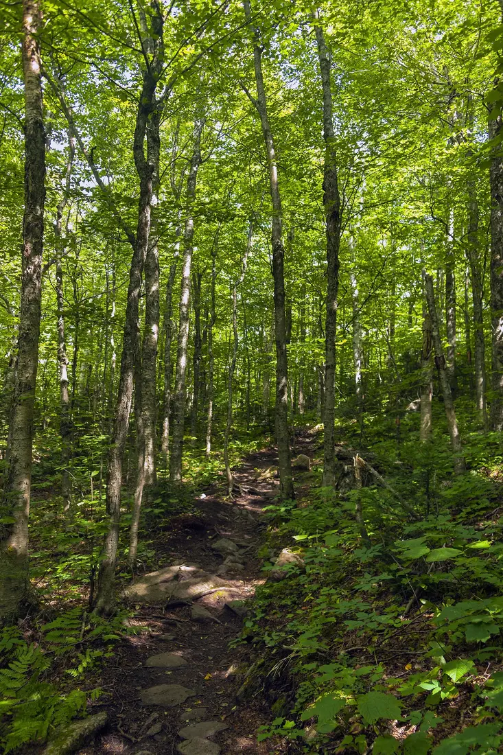
Most of the climbing comes late. The first two miles gain only about 700 feet, on soft, nearly level footing. After that the switchbacks begin, and the grade passes 20 percent only for short stretches.
The lower woods
The first few minutes follow the line of the old trail. In less than ten minutes the new trail turns off to the left, where the crews piled brush across the old route. The lower slopes are young hardwood forest, full of beech, ash and maple, with stands of poplar and birch. The path runs across the hillside so that rain drains off it instead of turning it into a streambed. Low on the mountain it crosses a few streams, one of them on a wooden bridge about 45 minutes up.
The switchbacks
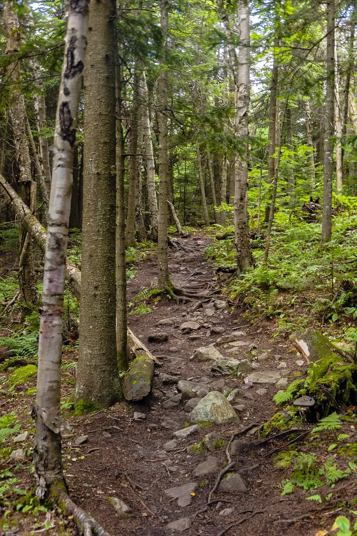
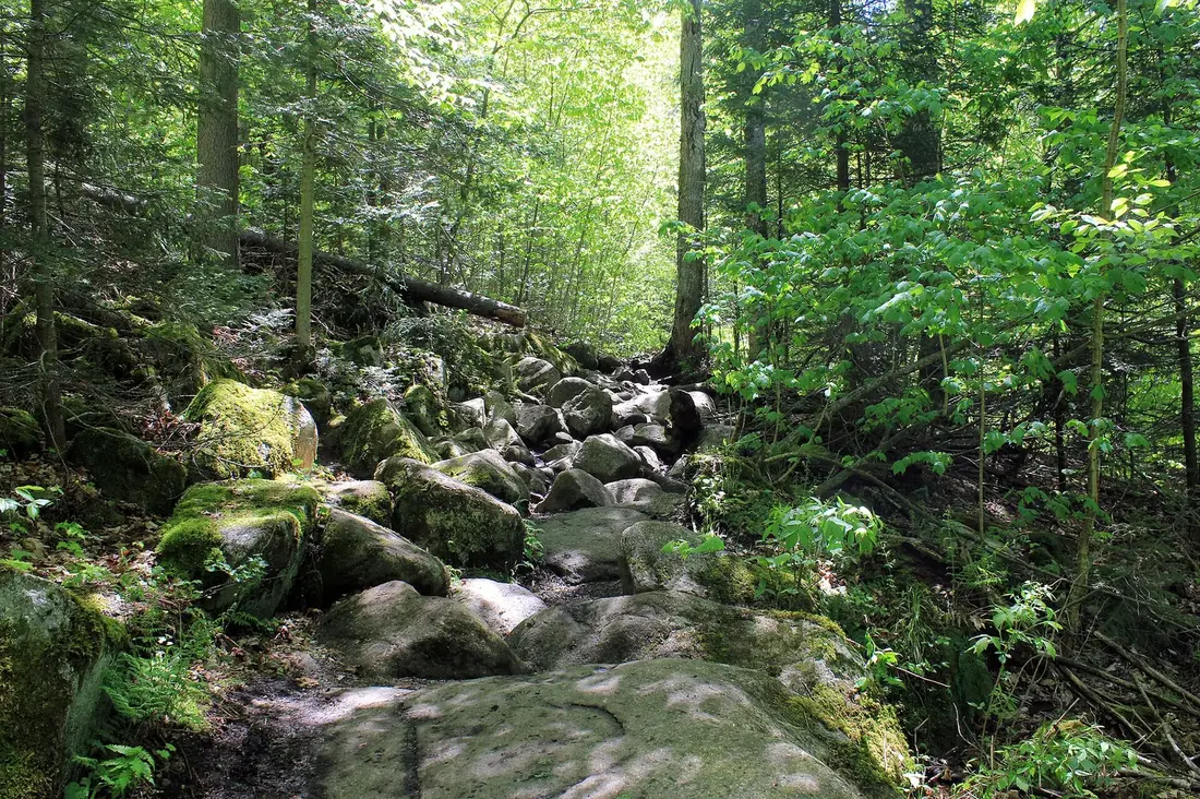
As the slope steepens, the trail climbs it on switchbacks, 11 of them in the design the crew built, and passes a number of open bedrock outcrops. Less than a mile below the summit the hardwoods end and the forest turns to spruce and balsam fir, with moss underfoot.
The last pitch
Near the top a short traverse brings you back onto the old trail for its final steep section, which the new route could not avoid. Then the grade eases across the spruce plateau, and the trail comes out on bare rock at the foot of the tower. Come down the way you went up.
The old trail
The first trail up Lyon Mountain was cut in the spring of 1876 from the Meader brothers' hotel on the southwest shore of Chazy Lake, and that June a newspaper notice for the hotel offered boats, guides and a trail just cut to the summit. On August 11, 1876, Hattie Lyon, a granddaughter of Nathaniel Lyon, climbed it with her brother; she is said to have been the first woman on top. Two summers later the state surveyor Verplanck Colvin used the trail to haul his instruments up for one of his survey stations, and his crew improved it.
That route went more or less straight up: about 2.5 miles, steep, and worn after more than a century into stretches of grass, rock, boulders and slick mud. In 2006 the Adirondack Mountain Club laid out a replacement with money from its Algonquin Chapter, and in the summer of 2008 the club's professional trail crew, five people on average, spent ten weeks building it under a contract with DEC. It was the longest trail that crew had built since it was formed in 1979. After 132 years the old trail was retired. It is no longer maintained, though some hikers still use it.
Take the new trail. The old one is about a mile shorter each way, roughly 5 miles round trip, but it is hard on knees and on the mountain, and its top section is the same steep pitch you finish on anyway. Partway up the old route are the remains of the fire observer's cabin, which may date from around 1916; vandals burned it more than sixty years later.
The fire tower
Some kind of lookout has stood on the summit almost since the first trail. The men who cut it in 1876 built a platform in the tops of four trees, reached by a ladder, for a clear view in every direction. Colvin's crew left a log cabin and a lookout tower in 1878, on the spot where the fire tower stands now. In 1910, after a fire burned from Loon Lake to Dannemora Mountain, the state made Lyon a fire observation station and put an observer on top, with a log tower.
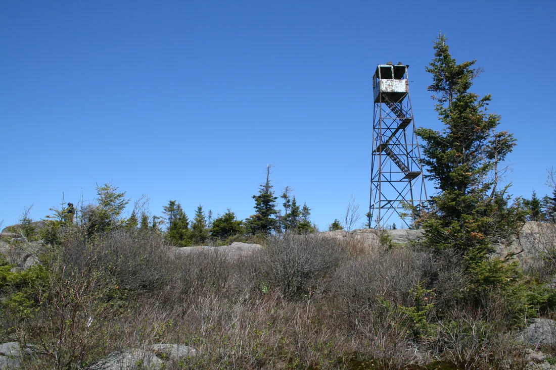
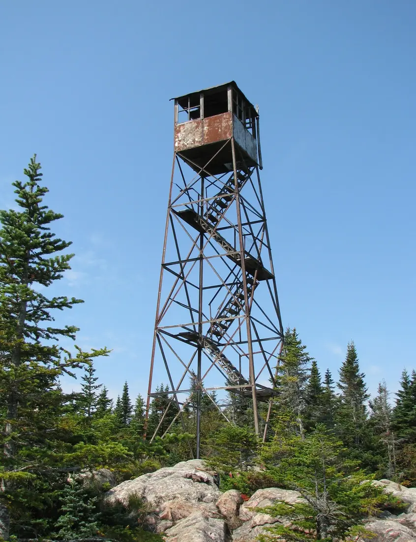
The steel tower went up in 1917. It is a 35-foot Aermotor LS-40, one of 12 steel towers the state put up that year with stairs instead of ladders. Observers watched for smoke from its cab every season through 1988, and the tower closed officially in 1989.
By 2005 a few steps were missing. That year DEC and the Student Conservation Corps put in new footings, landing boards, stairs, a cab floor and safety netting, with the materials flown up by a State Police helicopter. In the fall of 2016 the New York chapter of the Forest Fire Lookout Association agreed to help maintain the trail and the tower, and in 2017 the inside of the cab was repainted to cover graffiti. The tower joined the National Historic Lookout Register in January 2017. It also carries a radio repeater, with solar panels and an equipment box in the cab. In past summers the Town of Saranac and DEC have hired a summit steward to greet hikers and talk about the tower and the view, but do not count on finding one.
The tower is open to climb. Go up in calm, dry weather, hold the railings and keep children close, and come down at the first sign of a thunderstorm; a steel tower on a bare summit is the wrong place to be in lightning. The Adirondack Mountain Club asks hikers to stay off all fire towers between December 21 and March 21, when high wind and ice make the stairs dangerous and crampon points damage them.
What you can see from the top
From the cab the near view is Chazy Lake, below you to the northeast. Beyond it lie Lake Champlain and the Champlain Valley, with Vermont's Green Mountains on the eastern skyline. Due south, Whiteface stands out among the High Peaks. To the north the land falls away toward wind farms, and far past them, on a clear day, the Montreal skyline shows as a small gray outline. The tower also looks over the summit spruce to the Chateaugay Lakes and the St. Lawrence River.
The summit plateau is wide, and its spruce hide much of the view from the ground. A north-facing overlook on the summit gives a good share of the view without climbing the tower, and rock ledges look east and south as well.
Birders know the summit for its spruce-forest species. Boreal chickadee, blackpoll warbler and Bicknell's thrush all turn up here, and birders hoping for the thrush start early.
The Fire Tower Challenge
Lyon Mountain is one of the 27 Adirondack summits on the Adirondack Mountain Club's Fire Tower Challenge list. To finish, you climb at least 23 fire-tower summits, 18 in the Adirondack Park and all five in the Catskills, and send proof of some stewardship of public land with your completion form. A winter version counts hikes between December 21 and March 21. Lyon has the most climbing of the four challenge towers near the cabins; Loon Lake Mountain, St. Regis Mountain and Azure Mountain are the others, and the challenge guide fits all four into a week.
Iron mining in Lyon Mountain
The hamlet at the mountain's western foot grew up around a mine known for some of the purest iron ore in the world. Lloyd Rogers acquired the tract holding the Chateaugay ore bed in 1822, and local legend credits a trapper named George Collins with finding the ore the next year. In 1873 Andrew Williams, who owned a forge in Saranac, and the lawyer Smith Weed founded the Chateaugay Ore and Iron Company, opened pits along the vein and built a 13-mile plank road to carry ore to Williams's forge.
The narrow-gauge Chateaugay Railroad reached the mines in 1879, running 17 miles to Dannemora, and the first trainload of Lyon Mountain ore arrived in Plattsburgh on December 18 that year. By 1880 about 700 people lived in the settlement, in log cabins owned by the company, which also owned the hotel and the store. By 1883 there were about 3,000. Workers came from Sweden, Ireland, Italy, Mexico and Eastern Europe; the Swedes were once so numerous that First Street is still known as Sweden. Until 1904 the company paid wages in vouchers good only at its own store.
The Delaware and Hudson took over in 1903 and widened the railroad to standard gauge. In 1906, the deadliest year, 12 men died in the mines, and a strike of 350 men for higher pay failed. By 1907 the mines turned out 400,000 tons of ore a year, 30 percent of New York's production, and by 1919 the main shaft reached 1,685 feet. Republic Steel leased the mines in 1937 and bought the company in 1939. During World War II the mines ran three shifts, seven days a week, and raised about a million tons a year.
Lyon Mountain ore went into the cables of the Brooklyn, George Washington and Golden Gate bridges, and into tanks, ships, motors and missiles. It came at a cost: 165 men died in the mines over nearly a century. The miners unionized after the war, and a six-month strike in 1946 ended with Republic Steel settling. The mines closed for good in 1967, after more than 30 million tons of ore, with the workings more than 2,000 feet deep. The closing sent families looking for work; some found it at the state prison in Dannemora.
The Lyon Mountain Mining and Railroad Museum
The mining story is told in the hamlet's old railroad station, which the Delaware and Hudson built in 1903. A local museum group formed in 1999, bought the station in August 2000, restored it and opened it as a museum in 2006, and the building is on the state and national historic registers. It is at 2914 Standish Road, about six and a half road miles back toward Chateaugay from the trailhead.
Inside are drills, helmets, dynamite crates and the lunch pails miners carried underground, a diorama built in 2010 that shows how the mine worked above and below ground, and videos of miners talking about the work and the accidents. There is a 36-inch model of the Standish blast furnace, the 1890 bell from St. Michael's Church, photographs from 1881 on, and pictures of the mine jobs with what each paid in 1957. The museum also has Iron Shoes, the 1936 bobsled designed and built at the Lyon Mountain and Standish mining works; the all-metal sled won the Olympic tryouts in 1939, though the war canceled the 1940 Games. There are exhibits on Chazy Lake and the Chateaugay Lakes, model trains and hands-on tables for children, and a memorial to the men killed in the mines at Lyon Mountain and Standish.
Admission has long been free, with a box for donations. Volunteers run the museum, and its days change from year to year. Its usual season is Wednesdays and Saturdays from 10 a.m. to 2 p.m., from the first Saturday in June to the Saturday before Columbus Day, and visits at other times can be arranged by appointment. The latest published schedule is the 2025 one: Wednesdays and Saturdays from May 24 through August, then Saturdays only through October 11. Check the museum's Facebook page or call (518) 565-6278 for this year's days before you plan around them. The building is wheelchair accessible, and pets are not allowed inside.
Chazy Lake
Chazy Lake lies along the mountain's eastern foot. It is the lake you see below the tower, and the trailhead road leaves Chazy Lake Road on its western side. The lake covers 1,606 acres in the town of Dannemora, with a mean depth of 33 feet. DEC's boat launch is on NY 374 about five miles west of the village of Dannemora, with a hard-surface ramp and parking for 20 cars and trailers.
The lake holds lake trout, landlocked Atlantic salmon, rainbow trout, smallmouth bass, yellow perch, brown bullhead and pumpkinseed, with a few lake whitefish and brook trout, and DEC stocks it with lake trout, rainbow trout and landlocked salmon. Trout and salmon fishing is concentrated over the deep water in the middle of the lake. Special rules have applied to its lake trout, with fishing all year, a 21-inch minimum and three fish a day; check the current regulations before you go.
The lake had hotels for visitors before the mines boomed. In 1876 the Meader brothers' hotel offered boats, guides and good fishing as well as the new trail, and Ed Davis ran another hotel on the shore.
Driving from the cabins
The trailhead is about 45 road miles from the cabins, roughly an hour and a quarter, and the quickest way runs through Malone and Chateaugay. Take County Route 25 north into Malone and pick up US 11 east. About 12 miles of US 11 bring you to Chateaugay village, about 22 road miles from the cabins. In the middle of the village turn right onto NY 374 and follow it south for about 20 miles, past the Chateaugay Lakes and through the hamlet of Lyon Mountain. About four miles past the hamlet, turn right onto Chazy Lake Road, go about 1.8 miles south, and turn right onto the gravel road; the lot is just under a mile in.
Chateaugay is a good place to fuel up. Stewart's, at 195 East Main Street, sells gas, coffee, pizza and other quick food and has restrooms and an ATM. Past the mountain, NY 374 continues about nine miles east of Chazy Lake Road to Dannemora, which has gas, food and supplies, and on to Plattsburgh. Guests coming down from Quebec can drive straight to the mountain through the Chateaugay crossing, about five road miles north of the village, which is open from 6 a.m. to 6 p.m.; the border guide has the hours and the documents. The Chateaugay Lakes guide covers the village, the falls and the lakes on the way, and winter driving covers the roads in snow.
Winter on Lyon Mountain
Lyon is a popular winter summit, and backcountry skiers use it too. The trail is too steep and narrow for cross-country skis, but it makes a good snowshoe climb. The gravel road to the lot is not maintained from November 1 to May 1, so in winter you may have to start at Chazy Lake Road, which adds about a mile each way and 340 feet of climbing. The road itself is skiable.
Expect ice where the trail follows the old route, near the bottom and on the last pitch, because the cobbled surface there freezes hard; carry microspikes from late fall into spring. The summit catches the wind. Stay off the tower in winter, carry a headlamp for the short days, and set a turnaround time before you start. The snowshoeing guide has easier winter walks near the cabins.
When to go
Summer and early fall are the easy seasons for Lyon. In spring, DEC asks hikers to stay off trails above 2,500 feet until mid-June; mud season can run from late March into mid-June depending on the year, and Lyon's upper trail and summit are well above that line. Black flies are thickest from mid-May into June; the bug guide has the details.
In fall the hardwoods on the lower slopes turn color, and the foliage guide has the timing. Fall is also hunting season on the state land around the mountain. The regular deer season in the Northern Zone runs from October 24 to December 6 in 2026, so wear blaze orange and put something bright on your dog.
Safety, dogs and camping
Treat Lyon as a full-day climb. Carry plenty of water and food, a warm layer and a rain shell, a map and a headlamp; the hiking guide has DEC's full list of essentials. In an emergency call 911, or DEC's Forest Ranger dispatch at 833-NYS-RANGERS (833-697-7264).
Dogs are welcome on the trail. Leashes are not required on the Forest Preserve outside the Eastern High Peaks, but DEC recommends one unless your dog will come when called and leave wildlife and other hikers alone. All three cabins take pets for a fee; see bringing your dog.
Stay on the trail and carry out what you carry in; foot traffic has already worn the rock bare around the tower. Primitive camping is allowed on Chazy Highlands State Forest, and DEC has designated campsites on the southeastern side of Chazy Lake. A permit from a forest ranger is needed to stay more than three nights or to camp in a group of ten or more.
A day on Lyon Mountain and the Chateaugay Lakes
A climb of Lyon fits well with the lakes and the falls on the way home. This plan assumes a summer or early-fall day and an average pace.
| Time | Plan |
|---|---|
| 7:15 a.m. | Leave the cabins. Coffee and gas at Stewart's in Chateaugay. |
| 8:45 a.m. | Start up the trail from the lot off Chazy Lake Road. |
| 11:00 a.m. | Summit and tower. Lunch on the rock by the tower. |
| 1:30 p.m. | Back at the car. Head west on NY 374 through the hamlet of Lyon Mountain. |
| 2:00 p.m. | Stop at the state boat launch on the Narrows to look over the Chateaugay Lakes. |
| 2:45 p.m. | High Falls Park, just southwest of Chateaugay village, for the 120-foot falls. In recent seasons the park has let walkers in until 5 p.m. Sunday to Thursday and 7 p.m. on Fridays and Saturdays, from May into mid-October. |
| 4:00 p.m. | Ice cream at Stewart's, then home by about 4:45. |
To see the mining museum as well, go on a day it is open and stop there first, at 10 a.m., then start the hike by about 11; in recent seasons it has closed at 2 p.m. In October 2026 the boat launch may still be closed for road repairs, and the falls park usually closes for the season in mid-October; the Chateaugay guide has the details for both.
Then the hot tub. One guest wrote: "It was so nice to plan for an exhausting day of hiking, knowing that comfort and luxury were there for us in the evening." Every cabin has a private hot tub and a fire pit, and The Modern Pine and The Aviator both have Jøtul gas stoves; see the cabins.
Questions
How long is the Lyon Mountain hike?
The trail is 3.4 miles each way, 6.8 miles round trip, with about 1,900 feet of climbing; some guides list a little more. Most hikers need three to five hours for the round trip, plus time at the tower. In winter, if the gravel road to the lot is not passable, add about a mile each way from Chazy Lake Road.
Can you climb the Lyon Mountain fire tower?
Yes. The 35-foot steel tower from 1917 was repaired in 2005 with new footings, stairs, landings and a cab floor, and it is open to hikers. Climb it in calm, dry weather and come down if a storm builds. The Adirondack Mountain Club asks hikers not to climb any fire tower between December 21 and March 21, when ice and wind make the stairs dangerous.
Where do you park for Lyon Mountain?
At a small lot at the end of a gravel road, once called Lowenburg Road, that leaves Chazy Lake Road about 1.8 miles south of NY 374, on the west side of Chazy Lake. The road is not maintained from November 1 to May 1, so in winter you may have to start from Chazy Lake Road and walk about a mile to the lot.
How far is Lyon Mountain from the cabins?
About 45 road miles to the trailhead, roughly an hour and a quarter: County Route 25 into Malone, US 11 east to Chateaugay, NY 374 south past the Chateaugay Lakes and through the hamlet of Lyon Mountain, then Chazy Lake Road and the gravel road to the lot. The Chateaugay guide covers the stops along the way.
Should I take the old trail or the new one?
Take the new trail. The old route, cut in 1876, runs about 2.5 miles nearly straight up, is badly eroded and is no longer maintained. The new trail, built by the Adirondack Mountain Club's crew in 2008, is about a mile longer but climbs on switchbacks and is easier on knees and on the mountain. Both share the steep last pitch to the summit.
Is the Lyon Mountain mining museum open?
It is a volunteer-run seasonal museum in the old railroad station at 2914 Standish Road, with free admission and a donation box. Its usual season is Wednesdays and Saturdays, 10 a.m. to 2 p.m., from the first Saturday in June to the Saturday before Columbus Day. The latest published schedule is the 2025 one, so check its Facebook page or call (518) 565-6278 for this year's days.
Can I bring my dog up Lyon Mountain?
Yes. A leash is not required on this part of the Forest Preserve, but DEC recommends one unless your dog will come when called and leave wildlife and other hikers alone. It is a long day, so carry water for your dog too. The cabins allow pets for a fee; see bringing your dog.
Sources
Facts on this page were checked against these sources in October 2026. Hours, fees and schedules change; confirm before you go.
- New York State Department of Environmental Conservation dec.ny.gov/places/chazy-highlands-wild-forest
- New York State Department of Environmental Conservation dec.ny.gov/places/chazy-highlands-state-forest
- New York State Department of Environmental Conservation dec.ny.gov/places/chazy-lake
- New York State Department of Environmental Conservation dec.ny.gov/things-to-do/hunting/deer-bear/seasons
- New York State Department of Environmental Conservation dec.ny.gov/things-to-do/freshwater-fishing/regulations/region-5-specia
- New York State Department of Environmental Conservation extapps.dec.ny.gov/docs/fish_marine_pdf/nyboatlaunching.pdf
- New York State Department of Environmental Conservation extapps.dec.ny.gov/docs/fish_marine_pdf/chzylkmap.pdf
- Adirondack Mountain Club adk.org/adk-fire-tower-challenge/
- Adirondack Mountain Club adk.org/mud-season-quick-facts/
- nhlr.org nhlr.org/lookouts/us/ny/lyon-mountain-fire-tower/
- Adirondack Explorer adirondackexplorer.org/communities/history/the-historic-old-trail-on-l
- Adirondack Explorer adirondackexplorer.org/adirondacks-almanack/new-trail-cut-on-lyon-moun
- Adirondack Explorer adirondackexplorer.org/general/a-lyon-in-winter/
- Adirondack Explorer adirondackexplorer.org/recreation/lyon-mountain/
- Adirondack Explorer adirondackexplorer.org/communities/history/the-lyon-mountain-mining-an
- Adirondack Explorer adirondackexplorer.org/environment/dogs-in-the-adirondacks/
- newyorkalmanack.com newyorkalmanack.com/2022/08/recreation-highlight-lyon-mountain-fire-to
- adirondacklife.com adirondacklife.com/2012/10/03/frontier-town/
- protectadks.org protectadks.org/hike-lyon-mountain/
- protectadks.org protectadks.org/wp-content/uploads/2020/08/Lyon-Mountain-Trail-web-1.p
- Saranac Lake tourism saranaclake.com/hiking/lyon-mountain
- pureadirondacks.com pureadirondacks.com/blogs/adirondack-hiking/lyon-mountain
- cnyhiking.com cnyhiking.com/LyonMountain.htm
- stavislost.com stavislost.com/hikes/trail/lyon-mountain/
- facebook.com facebook.com/p/Lyon-Mountain-Mining-Railroad-Museum-100085332153965/
- lyonmountain.bloatedtoe.com lyonmountain.bloatedtoe.com/museum.php
- passageport.org passageport.org/places-to-go/friends-of-lyon-mountain-mining-and-railr
- adkcoastcultural.org adkcoastcultural.org/museum-days.html
- locations.stewartsshops.com locations.stewartsshops.com/ny/chateaugay/137
- U.S. Customs and Border Protection cbp.gov/newsroom/national-media-release/cbp-aligns-hours-operations-no
- content.govdelivery.com content.govdelivery.com/accounts/USDHSCBP/bulletins/415e6c6
- epqs.nationalmap.gov epqs.nationalmap.gov/v1/json?x=-73.8645&y=44.7032&wkid=4326&units=Feet
- router.project-osrm.org router.project-osrm.org/
- Adirondack Explorer adirondackexplorer.org/recreation/hiking/lift-line-to-lyon-mountain/
- newyorkalmanack.com newyorkalmanack.com/2022/11/the-old-trail-a-lyon-mountain-history/
- Visit Malone visitmalone.com/attractions/lyon-mountain-hiking-and-mining-museum
- Visit Malone visitmalone.com/hiking/lyon-mountain
- summitpost.org summitpost.org/lyon-mountain/456239
- New York State Department of Environmental Conservation dec.ny.gov/places/sable-highlands-conservation-easement-tract
In this guide
Stay nearby
The first of the cabins: a big stone fire pit you see as you walk up, a screened corner of the deck, direct trail access, and a short walk to an observation deck over the pond.
 The Modern Tiny HomeCabin 1 · 2 bd · 1 ba · sleeps 4
More in Trails & Hiking
Sources
39 references, listed in full at the end of this guide: official park, state, tourism-office and business sources, checked October 2026.
Related guides


Photos on this page: Hiking trail in sunlit forest, Lyon Mountain, NY by Daniel Case, CC BY-SA 3.0; Lyon Mountain hiking trail at forest transition by Daniel Case, CC BY-SA 3.0; Saint Regis Fire Tower 2010 t6 by John Sweeney, CC BY-SA 3.0; Fire Observation Tower on the summit of Loon Lake Mountain, Loon Lake, New York, Franklin County by Marc Wanner, CC BY-SA 3.0. Resized and cropped for this site. All photo credits