
Poke-O-Moonshine Fire Tower
Poke-O-Moonshine's two trails, the restored 1917 fire tower, the cliffs and falcon closures, and the drive from the cabins, about 80 road miles.
Poke-O-Moonshine is a granite mountain of about 2,180 feet in the Town of Chesterfield, with cliffs that rise straight above the Northway south of Keeseville and a restored 1917 fire tower on its open summit. The trailheads are on US 9, about 80 road miles from the cabins, a little over an hour and a half by Malone, Plattsburgh and I-87. Two trails climb 1,280 to about 1,450 feet to a view that runs across Lake Champlain to Vermont, and the hike fits in a morning.
Trail facts
| Ranger Trail | Observer's Trail | |
|---|---|---|
| Trailhead | Poke-O-Moonshine Day Use Area on US 9 | Observer's Trail lot on US 9, about a mile farther south |
| One way | About 1.5 to 1.8 miles | About 2.3 to 2.4 miles |
| Climb | About 1,280 feet | About 1,450 feet |
| Character | Steep, rebuilt with stone staircases, close views of the cliffs | The fire observers' old road, gradual, past beaver ponds |
| Where they meet | About 1.4 miles up, at the lean-to | About 2.1 miles up, at the lean-to |
- Summit: about 2,180 feet, open ledges facing east, a 35-foot steel fire tower built in 1917.
- Tower cab: open when the summit steward is on duty, typically Thursday through Monday in summer and on some fall weekends; the days can change from year to year.
- Fees and permits: none. The land is state Forest Preserve, open all year.
- From the cabins: about 80 road miles to the Day Use Area and 81 to the Observer's Trail lot.
- Fire Tower Challenge: Poke-O-Moonshine counts.
The mountain and its name
Poke-O-Moonshine stands in the Taylor Pond Wild Forest, part of the state Forest Preserve, in the Town of Chesterfield in Essex County. Its east face is a wall of granite that overlooks the Northway between Exits 32 and 33, so anyone who has driven I-87 between Plattsburgh and the High Peaks has seen it. Below the cliffs, along US 9, is the old state campground, now a day use area, where the steep trail and the climbers' approach both begin.
The name is said to come from two Algonquin words, pohqui and moosie, meaning "broken" and "smooth." The Adirondack Mountain Club's guidebook reads "smooth" as the rock on the summit or a big slab on the southeast side, and "broken" as the cliffs on the east face. Most people call it Poke-O.
People have been writing about the mountain for a long time. In 1843 the abolitionist Abel Brown described "Poc O moonshine" as a mass of rock about 800 feet high, 500 feet of it solid ledge, and called the view from the top beautiful. The Friends of Poke-O-Moonshine trace the line of the Ranger Trail back to Brown, who used the route in the 1840s.
The summit height depends on the map. Published figures run from about 2,160 to 2,180 feet, and most guides use 2,180. That makes Poke-O a small mountain by Adirondack standards, and a quick climb for the size of its view.
The drive from the cabins
The Day Use Area is about 80 road miles from the cabins, and the drive takes about an hour and a half. Most of it is two-lane road across northern Franklin and Clinton counties, then a short run on the interstate.
- County Route 25 to Malone. Head north on County Route 25, the Duane Road, through Chasm Falls and into Malone.
- US 11 east. Follow US 11 east through Chateaugay to Ellenburg, about 25 miles.
- NY 190, the Military Turnpike. At the flashing light in Ellenburg, turn onto NY 190 and follow it about 23 miles east into Plattsburgh. Soldiers began the original Military Turnpike from Plattsburgh toward Malone and Hopkinton in 1817, and it was finished in 1826.
- NY 3 to the Northway. A mile on NY 3 brings you to I-87. Plattsburgh is the last city on the drive, about 61 road miles from the cabins, so fill the tank and pick up lunch here.
- I-87 south to Exit 33. About 17 miles.
- US 9 south. Leave at Exit 33, go east briefly and turn right onto US 9. The Day Use Area is on the right in about three to four miles, and the Observer's Trail lot is about a mile farther south.
Coming from Keeseville instead, the Day Use Area is 7.5 miles south of the US 9 and NY 9N intersection. In winter the winter driving guide has the tires and timing, and getting to the cabins covers the last miles home in the dark.
Parking and the day use area
There are two lots, both on US 9 and both free.
- Poke-O-Moonshine Day Use Area. This was the state campground at the foot of the cliffs. Camping there has ended, and overnight stays are not allowed, but the grounds stay open for day use, with picnic tables, fireplaces, grills and a privy. The Ranger Trail starts here, and so does the climbers' path along the base of the cliffs.
- Observer's Trail lot. About a mile south on US 9, listed by the state as the Fire Tower and Observer's Trailhead. The Friends start their winter tracking walks here.
The Friends count more than 7,500 hikers a year on the mountain, so on a warm weekend an early start gets you a parking spot and a quieter summit. The picnic tables at the Day Use Area make a good lunch stop after the hike, with the cliffs right above you.
The Ranger Trail
The Ranger Trail is the old route, the path the fire wardens walked to the tower, and it is the shorter and steeper of the two. For most of its history it went straight up a drainage between the cliffs, and it eroded so badly that the state's 2011 management plan for the Taylor Pond Wild Forest proposed closing it if its condition did not improve within the life of the plan.
The Friends of Poke-O-Moonshine set out to save it. They had patched the trail every year since the 1998 ice storm; in 2013 volunteers began shoring it up in earnest, and the work soon called for professional trail builders: crews from the Adirondack Mountain Club, the Student Conservation Corps and Tahawus Trails. By 2017 they had built more than 180 rock steps, water bars, a bridge and two major reroutes. In September 2022 the club's professional crew finished another month of work, paid for by the Friends through a New York State Park and Trail Partnership Grant. All told, the Friends have raised more than $300,000 for the project through grants and donations.
By late 2023 the rebuilt route was in use from bottom to top, and it is the one to walk; check the kiosk at the trailhead for any trail-work notices. It starts through a boulder field of blocks that fell from the cliffs, then climbs a series of stone staircases tucked neatly into the ledges and slabs. A couple of overlooks in this first stretch look straight down on the Northway and across to the cliff face. Wooden stairs lead to a long section over lichen-covered slabs, where you get your first looks at the tower, and then to the lean-to and the old cabin site, about 1.4 miles up. The last pitch, once an eroded rock scramble, now has steps and a new section that swings west before rejoining the old line near the tower.
The reroutes added about half a mile to the old route. Measured lengths now run from about 1.5 to 1.8 miles each way, with about 1,280 feet of climbing. A tip for the way down: follow the steps and the markers. Bits of the old trail still show through the leaves, including a narrow chimney from the summit down to the cabin site that stays slick with mud and wet leaves.
The Observer's Trail and the loop
The Observer's Trail is the newer route. It follows the old woods road that the fire observers used to reach their cabin below the summit, up the mountain's southern shoulder. It crosses a 200-acre tract that the Adirondack Land Trust bought in 2006 and handed to the state for the Forest Preserve, and when it opened it was too new to appear in the guidebooks.
It is about 2.3 to 2.4 miles each way with about 1,450 feet of climbing, spread over the whole distance along a ridge. The trail is marked in blue and lined with rocky water bars. About three-quarters of a mile in, it turns right at a junction, crosses a small bridge and climbs a steep, straight stretch. It passes two open wetlands. Around the 1.5-mile mark comes the hardest footing on the route, loose rock and slabs of bedrock that are slippery when wet. On the left, a beaver pond sits at the foot of a rock cliff; it is the headwaters of Cold Brook, with green frogs and dragonflies in summer. At about 2.1 miles the trail meets the Ranger Trail at the lean-to.
A good plan is to go up the Ranger Trail for the cliffs and come down the Observer's Trail for the easier footing. The two trailheads are about a mile apart on US 9. Either leave a second car at the Observer's lot before you start, or plan on walking the highway shoulder back to the Day Use Area. The Friends hope to build a connector trail through the woods between the two starts one day.
The Observer's Trail is also the one for snowshoes. Its old road climbs gently, it makes a fairly easy snowshoe, and the Friends lead winter tracking walks from its lot.
The lean-to and the observer's cabin
The two trails meet in a wide clearing below the summit with a lean-to, an outhouse and a fire pit. It is the place to camp on the mountain, since overnight stays are not allowed at the Day Use Area, and it is close enough to the top to walk up for sunrise or sunset. For a day hike it is the obvious rest stop before the last climb.
A short side path leads to a big stone chimney. It is all that is left of the cabin where the fire observer lived from 1936 until the tower closed in 1988. The cabin burned in the early 1990s, leaving the chimney and the foundation. The National Register listing for the station counts both 1917, the year of the tower, and 1936, the year of the cabin, as its key dates.
The observers knew this ground better than anyone. John Mussen, who watched for fires from Poke-O in the late 1950s and early 1960s, estimated he climbed the mountain about 700 times and said he could reach the top in about 20 minutes. He climbed it again in 2017, on his 91st birthday, with three of his children; that time it took a little over two hours.
Above the clearing, a pair of stone and wooden staircases climb to a long rock outcrop with a view south, a preview of the summit. Whiteface stands to the west and the bulk of Giant Mountain to the south.
The fire tower
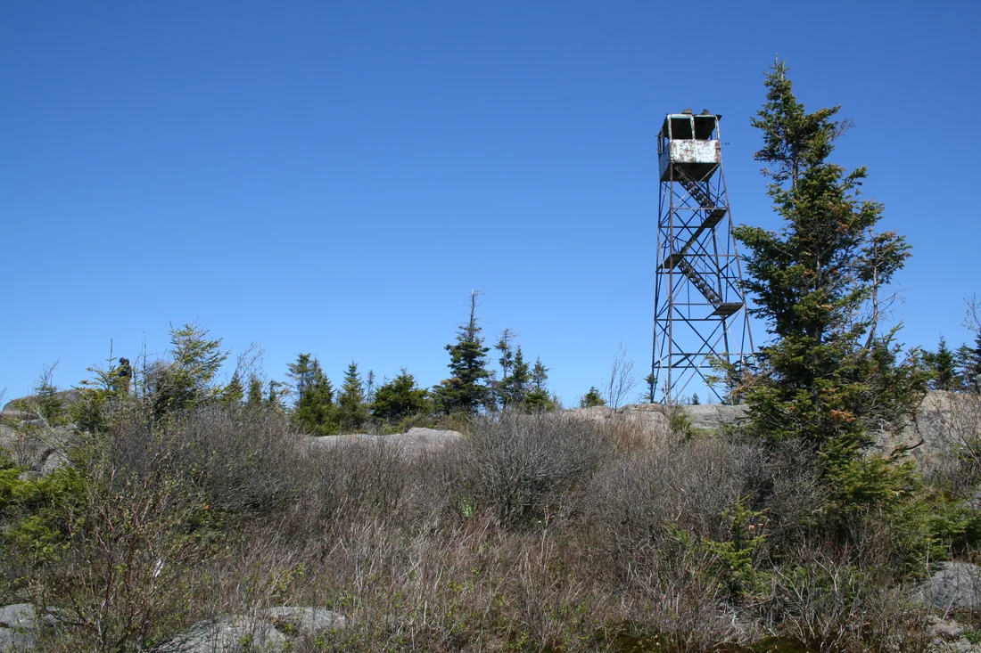
New York started building fire observation stations after the forest fires of 1903 and 1908 burned nearly a million acres, and Poke-O got its first station in 1912. Five years later the state replaced it with a standard steel tower, built by the Aermotor company, a windmill maker the state hired for its towers. It is 35 feet tall, with five flights of stairs inside a metal cage and a cab about 7 feet square at the top, reached through a hatch.
The observers lived in cabins near the summits and staffed the towers from late spring through the fall. When one spotted smoke, it called the bearing down the mountain by a phone line strung up the slope, later by radio, and readings from three or more towers fixed the fire on the map.
By the 1980s the state was moving to spotting fires from the air. The state closed the Poke-O tower in 1988 and flagged it for removal in the early 1990s, since the State Land Master Plan treats such towers as structures that do not belong on Forest Preserve land. The usual first step was to take out the lowest flight of stairs. Gary Friedrich, the forest ranger who arrived in December 1994, kept putting that job off, and the stairs at Poke-O were never removed.
Friedrich went looking for a way to save the tower and found Adirondack Architectural Heritage, which led to the Friends group in 1997. Testing the tower meant carrying a 30-ton jack and 80-pound bags of concrete up the mountain. Years of exposure on the summit had twisted the frame, and the original maker could no longer supply parts, so the state paid to fabricate new steel diagonals. A State Police helicopter flew the steel up and dropped one load into a beaver swamp at the south end of Auger Pond; Friedrich found it by a strap hanging from a tree and dug the steel out of three feet of mud.
The restoration began in 1997. Money raised by volunteers replaced the wooden steps and the steel crosspieces and paid for new windows, safety fencing, a map table and a brass alidade, with interpretive panels on the cab walls. The station was listed on the National Register of Historic Places in 2001, the first summit steward went to work in 2002, and the fully restored tower was rededicated in June 2005. In 2017 more than 100 people hiked up to mark its 100th year.
The tower still needs looking after. In April 2023 someone broke the lock off the cab door and carried off the replica Osborne Fire Finder, the round table map about 30 inches across that observers used to take bearings. The Friends asked hikers to keep an eye out along the trails and set to work to find or replace it.
The Friends and the summit stewards
The Friends of Poke-O-Moonshine have looked after the mountain since 1997. The group is a partnership of the state Department of Environmental Conservation, Adirondack Architectural Heritage in Keeseville, the Town of Chesterfield, several Adirondack Mountain Club chapters and a membership of about 400. It works under the wing of Adirondack Architectural Heritage, the park's historic preservation group, at 1745 Main Street in Keeseville, and gifts to it are tax-deductible.
Since 2002 the Friends have hired a summit steward each summer. The job runs about ten weeks and usually goes to an environmental studies student; the recent stewards have been SUNY Plattsburgh students, and earlier ones came from SUNY Potsdam. The steward opens the cab, tells hikers about the tower and the park, teaches low-impact use of the summit, and keeps up the trails, the summit and the tower. The steward's days have typically been Thursday through Monday, so a midweek hiker in July may find the cab locked; the view from the open ledges is the same.
The stewards have also been restoring the thin summit plants that boots wore away. Stay on the rock and the marked paths at the top, and the plants have a chance.
The Friends lead outings through the year: snowshoe walks to read animal tracks, ski trips, wildflower walks and trail work days. They have set eleven numbered interpretive stops along the Ranger Trail, keyed to a flier on the mountain's plants, rocks, weather, wildlife and tower history; look for it at the trailhead kiosk. In September 2026 the Adirondack Land Trust ran a free guided hike up the Observer's Trail with David Thomas-Train, the Friends' longtime coordinator; both groups list their outings on their event pages.
The view from the top
The summit is open to the east, with a dozen big rock ledges and cliff tops facing Lake Champlain. From the ledges you look across the Champlain Valley and the lake to Burlington and the Green Mountains of Vermont, with the Northway running along the foot of the cliffs.
The tower adds the rest of the circle. West is Whiteface. South are Giant and the High Peaks. North, you can pick out Plattsburgh, and on a clear day Montreal. The full 360 degrees is the reason to time a summer or fall hike for a day the steward is in the cab.
The summit is much more exposed than the trailhead, so bring a warm layer and a windbreaker even in July. The fire tower challenge guide covers lightning and the tower stairs; the same rules apply here.
The cliffs and the peregrine falcons
For climbers, Poke-O is one of the great cliffs of the Northeast. The Main Face is about 400 feet of granite with long, exposed pitches, and the mountain holds more than 250 routes, most of them moderate to hard, and the other faces, among them the Slab, the Headwall and the Second Tier, have shorter routes. The Great Dihedral and Catharsis are two of the classics. In a good winter the same cliffs carry some of the best and easiest-to-reach ice climbing in the Adirondacks. Climbers park at the Day Use Area and follow the path along the base of the cliffs.
The cliffs are also home to peregrine falcons. Peregrines vanished from New York in the 1960s, poisoned by DDT, and although they have come back they are still listed as endangered in the state. They nest on cliff ledges and dive at up to 180 miles an hour after prey.
To give them a quiet season, the state closes climbing routes on parts of the Main Face from April 1 into midsummer. Which routes close depends on how close and how visible each one is to that year's nest, and they reopen once the young fledge, sooner when a pair nests early. In 2026 a June update kept most of the Main Face closed, with a list of routes left open, and as of August 1 every route on Poke-O was open again. The closed routes are posted at the trailhead kiosk and on the state's Adirondack route closures page. The closures are enforced: in April 2020 two climbers were ticketed, with fines of up to $250 each. Climbers help too: volunteers monitor the nests with the state, and the Adirondack Climbers' Coalition backs the program.
Hikers get the best of it without a rope. The openings on the Ranger Trail that look up at the cliffs are good places to watch peregrines launch and land. Look for migrating hawks and flocks of ravens too. The wildlife guide has more places for birds closer to the cabins.
The Fire Tower Challenge
Poke-O-Moonshine is one of the 27 Adirondack Park towers on the Adirondack Mountain Club's Fire Tower Challenge list. The patch takes 18 of those 27 plus all five Catskill towers, with proof of a stewardship project. The fire tower challenge guide has the rules, the full list and a four-day plan from the cabins. For a two-tower day on this side of the park, pair it with Hurricane Mountain near Keene, about 21 road miles away through Elizabethtown. Lyon Mountain, the highest point in Clinton County, is a bigger climb and much closer to the cabins.
The challenge also has a winter rocker for hikes done between December 21 and March 21. The club asks winter hikers to stay off the towers themselves in those months, since ice and snow make the stairs unsafe. On Poke-O in winter, the ledges below the tower give you the lake view anyway.
Seasons and winter
- Summer. The steward season, roughly mid-June to early September, is when the cab is open. Hot, humid afternoons make the Ranger Trail a sweaty climb, so start early and carry more water than a short hike seems to need.
- Late spring. Black flies are out from mid-May into June; the bug guide has what works. Climbing closures for the falcons start April 1.
- Fall. In recent years the tower has opened on selected fall weekends, and the Champlain Valley color from the summit is worth the drive; the foliage guide covers timing. The Taylor Pond Wild Forest lies in hunting units 5C, 5F and 5G, so wear blaze orange in deer season.
- Winter. The trailhead is plowed in winter, and the Friends' snowshoe walks have met at the Observer's Trail lot. The Observer's Trail is the gentle snowshoe route; the Ranger Trail's steps and ledges make it the more technical climb. Skis are not a good idea on either trail. Bring microspikes, because the last climb to the summit is often icy, and plan for full winter conditions on the top.
Coming back to the cabins after a cold winter climb, the hot tub is waiting, and the Pine and the Aviator have the Jotul gas stove to warm up by.
Dogs on the mountain
Dogs are welcome on the Forest Preserve trails. The state asks that they be leashed at trailheads and campsites, leashed whenever they meet another group, and under complete control at all times. On Poke-O that means a leash in the Day Use Area, at the lean-to clearing and anywhere near the summit cliffs, which drop away on the east side.
The Observer's Trail's old road is the easier climb for most dogs. Keep dogs off the tower stairs; one person can wait with the dog on the ledges while the others go up. Carry water for the dog as well as for yourself.
All three cabins allow pets, with a pet fee. Bringing your dog covers the house rules, the leash laws near the cabins and the vets, and the pet-friendly cabins page compares the yards.
Ausable Chasm and Plattsburgh
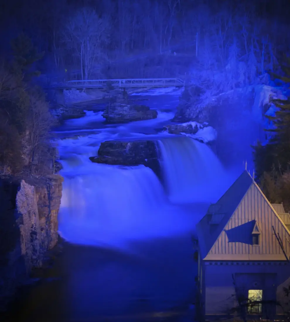
Poke-O pairs well with the places you pass on the way. Ausable Chasm is about 9 road miles north of the Day Use Area, past Keeseville, and its trails and Rainbow Falls fill an afternoon after a morning hike. Keeseville, about 7.5 miles north, is the nearest village.
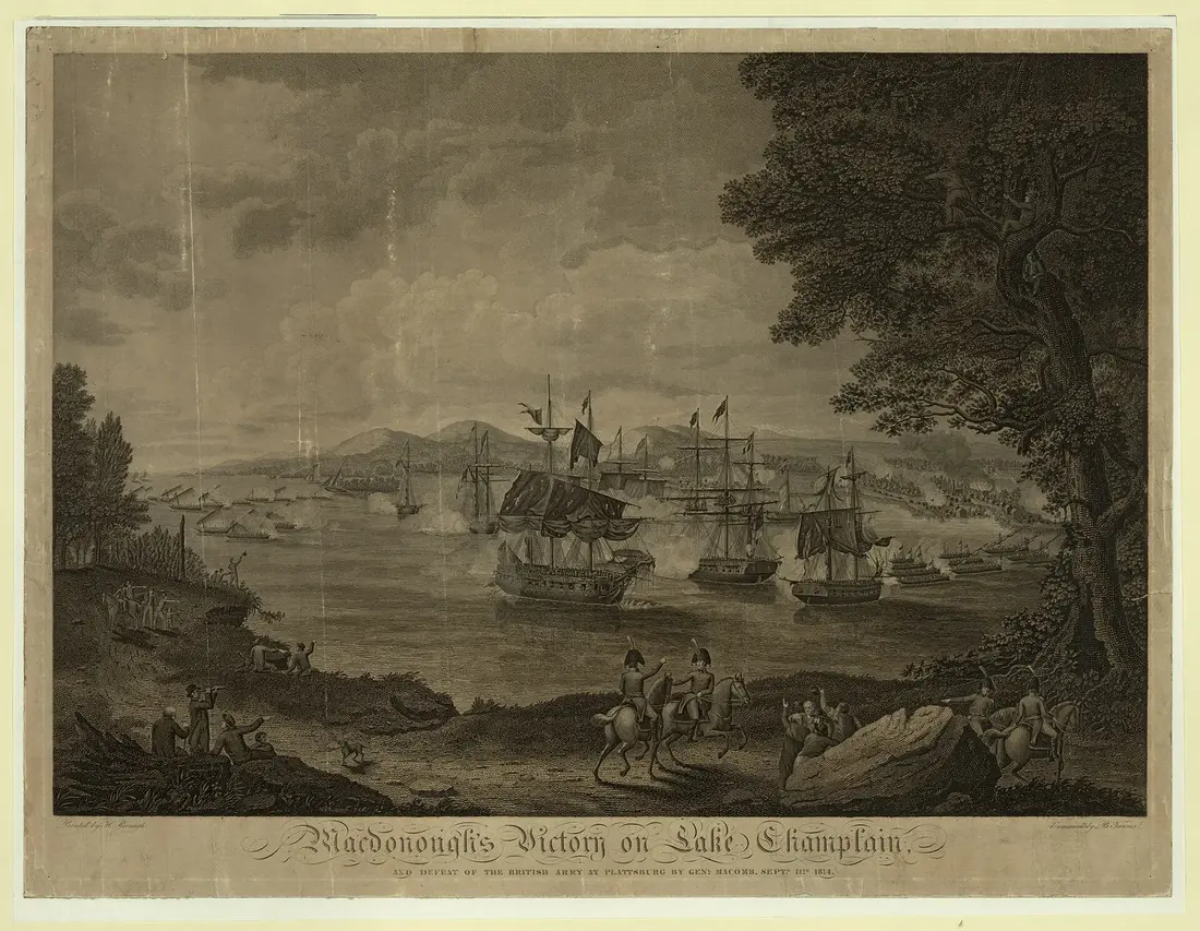
Plattsburgh is about 23 road miles north on the Northway and right on the road home, with the lake shore, the War of 1812 Museum in season and dinner before the last 61 miles back to the cabins.
A day from the cabins
| Time | Plan |
|---|---|
| 7:30 a.m. | Leave the cabins; Malone, US 11, the Military Turnpike and Plattsburgh, about 80 miles. |
| 9:15 a.m. | Drop a second car at the Observer's Trail lot if you have one, then start up the Ranger Trail at the Day Use Area. |
| 10:30 a.m. | Lean-to, the old cabin chimney, then the summit ledges and the tower if the steward is on duty. |
| 11:30 a.m. | Down the Observer's Trail past the beaver ponds. |
| 1:00 p.m. | Lunch at the Day Use Area picnic tables or in Keeseville. |
| 2:00 p.m. | Ausable Chasm, about 9 miles north. |
| 5:00 p.m. | Dinner in Plattsburgh, then about 61 miles home to the hot tub. |
For a shorter day, go up and down the Observer's Trail, skip the car shuffle and head straight home through Plattsburgh. For a longer one, the hiking guide lists the trails much closer to the cabins for the next morning, and the cabins page has the three places to come back to.
Questions
How long is the hike up Poke-O-Moonshine?
The Ranger Trail is about 1.5 to 1.8 miles each way with about 1,280 feet of climbing, the steepest and shortest route. The Observer's Trail is about 2.3 to 2.4 miles each way with about 1,450 feet, on the fire observers' old road. A loop up one and down the other needs a second car or a mile on US 9.
Is the Ranger Trail open?
It was in use from bottom to top by late 2023. The state once proposed closing the eroded old trail, and the Friends of Poke-O-Moonshine raised more than $300,000 to rebuild it instead, with stone staircases, a bridge and reroutes, including a new upper section that loops west. It starts at the Day Use Area on US 9; read the trailhead kiosk for any work closures.
Is the fire tower open to climb?
The 1917 tower was restored and rededicated in 2005. Its cab is unlocked when the Friends' summit steward is on duty, typically Thursday through Monday in summer, plus some fall weekends; the days can change from year to year. The Adirondack Mountain Club asks winter hikers to stay off fire towers from December 21 to March 21.
How far is Poke-O-Moonshine from the cabins?
About 80 road miles to the Day Use Area, an hour and a half by Malone, US 11, NY 190 and Plattsburgh, then I-87 south to Exit 33 and US 9 south. Ausable Chasm is about 9 miles north of the trailhead and makes a good second stop; see the Ausable Chasm guide.
Can I bring my dog up Poke-O-Moonshine?
Yes. Dogs are allowed on the Forest Preserve trails; the state asks for a leash at trailheads and campsites and whenever you meet another group. Keep dogs off the tower stairs and leashed near the cliffs. The cabins allow pets for a fee; see bringing your dog.
When are the climbing routes closed for the peregrine falcons?
The state closes routes on parts of the Main Face from April 1 until the young falcons fledge, usually into midsummer. In 2026 every route on Poke-O was open again by August 1. The current list is posted at the trailhead kiosk and on the state's Adirondack route closures page.
Can I hike Poke-O-Moonshine in winter?
Yes. The trailhead is plowed, and the Observer's Trail makes a fairly easy snowshoe. Carry microspikes, since the last climb to the summit is often icy, and dress for a cold, windy top. Skis are not a good idea on either trail.
Sources
Facts on this page were checked against these sources in October 2026. Hours, fees and schedules change; confirm before you go.
- New York State Department of Environmental Conservation dec.ny.gov/places/taylor-pond-wild-forest
- New York State Department of Environmental Conservation dec.ny.gov/things-to-do/hiking/adirondack-day-hikes
- New York State Department of Environmental Conservation dec.ny.gov/things-to-do/rock-and-ice-climbing/adirondack-route-closure
- New York State Department of Environmental Conservation dec.ny.gov/things-to-do/hiking/trail-etiquette
- lakechamplainregion.com lakechamplainregion.com/hiking/poke-o-moonshine
- lakechamplainregion.com lakechamplainregion.com/birding/poke-o-moonshine-day-use-area
- pokeomoonshine.org pokeomoonshine.org/about
- pokeomoonshine.org pokeomoonshine.org/news/towering-legacy-friends-group-honors-poke-o-mo
- pokeomoonshine.org pokeomoonshine.org/news/poke-o-moonshine-friends-rejoice-in-saved-trai
- pokeomoonshine.org pokeomoonshine.org/news/poke-o-moonshine-fire-tower-vandalized
- pokeomoonshine.org pokeomoonshine.org/stewards
- Adirondack Explorer adirondackexplorer.org/recreation/hiking/a-hike-through-history-on-pok
- Adirondack Explorer adirondackexplorer.org/general/poke-os-gentle-side/
- Adirondack Explorer adirondackexplorer.org/environment/climbers-ticketed-for-ignoring-falc
- sevendaysvt.com sevendaysvt.com/arts-culture/from-the-top-2140969/
- npgallery.nps.gov npgallery.nps.gov/AssetDetail/NRIS/01001034
- Adirondack Mountain Club adk.org/?p=5048
- Adirondack Mountain Club adk.org/?p=146019
- adirondacklandtrust.org adirondacklandtrust.org/event/poke-o-moonshine-hike/
- protectadks.org protectadks.org/hike-poke-o-moonshine-mountain/
- ausableriver.org ausableriver.org/explore/hiking/poke-o-moonshine
- mountainproject.com mountainproject.com/area/106050968/poke-o-moonshine
- plattsburgh.edu plattsburgh.edu/about/directions/
- hmdb.org hmdb.org/m.asp?m=249001
- mydigitalpublication.com mydigitalpublication.com/article/Save+That+Trail/1750727/215765/articl
- firelookout.org firelookout.org/wp-content/uploads/2024/11/cr-ny-2003.pdf
- pokeomoonshine.org pokeomoonshine.org/events
In this guide
Stay nearby
The first of the cabins: a big stone fire pit you see as you walk up, a screened corner of the deck, direct trail access, and a short walk to an observation deck over the pond.
 The Modern Tiny HomeCabin 1 · 2 bd · 1 ba · sleeps 4
More in Trails & Hiking
Sources
27 references, listed in full at the end of this guide: official park, state, tourism-office and business sources, checked October 2026.
Related guides


Photos on this page: Saint Regis Fire Tower 2010 t6 by John Sweeney, CC BY-SA 3.0. Resized and cropped for this site. All photo credits