
The Raquette River from Tupper Lake
Paddling the Raquette River near Tupper Lake: Axton Landing, the Crusher, the Raquette Falls carry, lean-tos, water levels and shuttles.
Above Tupper Lake the Raquette River runs slow and flat for miles, winding between silver maples from Raquette Falls down to the village's lakes. The two main launches, Axton Landing and the state launch locals call the Crusher, are about 54 to 57 road miles from the cabins, roughly an hour and a half by car. The current is gentle enough to paddle upstream in the morning and ride it back in the afternoon, with lean-tos, a sandy beach and a waterfall at the top end.
The river above Tupper Lake
The Raquette is New York's third-longest river, about 146 miles from Raquette Lake to the St. Lawrence. Above Tupper Lake it passes through Forked Lake and Long Lake, drops over Raquette Falls, then winds north past Axton Landing and the Crusher to Simon Pond and Tupper Lake. On U.S. Geological Survey maps the whole of Tupper Lake's water carries the name Raquette Pond. Below the village the river goes on past Setting Pole Dam toward Piercefield.
The stretch from the falls down to the Crusher is the one paddlers come for, and the water around Axton Landing is classified by state law as a Scenic River. The east bank forms part of the western boundary of the High Peaks Wilderness; the river itself is outside the wilderness, and motorboats are allowed on it. They are seldom seen, and the many blind curves are reason enough to keep to one side of the channel.
The west bank changed in 2024. The Nature Conservancy bought the Follensby Pond property in 2008, and in 2024 New York State completed a conservation easement on 5,985 acres beside the river, including the lower Moose Creek watershed, which opened public access along about ten miles of the Raquette. The easement allows non-motorized recreation such as camping, picnicking, hiking, hunting and fishing. Follensby Pond itself stays a research preserve.
This water is also a link in the 740-mile Northern Forest Canoe Trail, which comes down the Raquette from Long Lake and turns off at Stony Creek toward the Saranac lakes. The Adirondack Canoe Classic, the 90-mile race from Old Forge to Saranac Lake, spends its second day on Long Lake and this river.
Getting there from the cabins
From the cabins, local roads and County Route 25 lead about seven miles to NY 30. Turn south and stay on NY 30 for about 45 miles, past Meacham Lake and Paul Smiths, to its junction with NY 3 east of Tupper Lake at Wawbeek Corners, the fork the visitor maps call the Y.
- The Crusher: turn right at the Y onto NY 3 and NY 30 toward Tupper Lake. The launch is on the left about a mile and a half along, about 54 road miles from the cabins and a little under an hour and a half.
- Axton Landing and Stony Creek: turn left at the Y onto NY 3 toward Saranac Lake. Coreys Road is on the right after about two and a half miles. Axton Landing is about 57 road miles from the cabins, about an hour and a half.
- The Tupper Lake boat launch at Moody: go through the village and follow NY 30 south toward Long Lake; the launch is about 60 road miles from the cabins.
Coreys Road starts out residential and turns to gravel through state land. At 1.9 miles a narrow dirt road on the right, marked with an Axton Landing sign, leads 0.2 mile to the parking area and launch. The hikers' trailhead for Raquette Falls is on the right at 2.7 miles, just past the Stony Creek bridge. Pack lunch and fill the tank before you leave; groceries and fuel are a short drive from the cabins in Malone.
Put-ins and take-outs
| Launch | Where | Launch type | Best for |
|---|---|---|---|
| Axton Landing | Coreys Road, 1.9 miles from NY 3, then 0.2 mile on a dirt road | Soft cartop launch on a small cove | Upstream to Raquette Falls, downstream to the Crusher |
| Stony Creek Ponds | Off Coreys Road, a small launch area at the ponds | Hand launch | Stony Creek down to Axton Landing |
| The Crusher | NY 3 and NY 30, a few miles east of the village | DEC hard-surface ramp, parking for about 20 cars and trailers | Upstream toward Axton, downstream to Tupper Lake |
| Tupper Lake boat launch | NY 30, a quarter mile past Moody Bridge heading toward Long Lake | Hard launch | The take-out for a run down from the Crusher |
| Waterfront Park | Tupper Lake Waterfront Park, in the village | Hard launch or riverbank | Raquette Pond to Setting Pole Dam |
| Long Lake | State boat launch in the hamlet of Long Lake | State boat launch | Multi-day trips down to Axton or the Crusher |
The Crusher has a big lot and a hard ramp, and Axton Landing puts you closest to the falls. The main trips run upstream from either launch and back, or one way downstream with a car spotted at the take-out. An outfitter's shuttle saves the second car.
Axton Landing to Raquette Falls
This is the classic day on the river. The Northern Forest Canoe Trail lists it as a 13-mile out-and-back that takes about four to six hours depending on skill: about six miles upstream to a sandy beach landing roughly a third of a mile northeast of Raquette Falls, then back down to Axton with the current. Tupper Lake's visitor site suggests planning a half day, and St. Regis Canoe Outfitters puts the round trip at 12 to 14 miles. The hard paddling comes first, which makes the ride home easy.
Leave the cove at Axton and turn upstream; bearing right out of the cove takes you downstream toward Tupper Lake instead. The river winds between low banks lined mostly with silver maples. About half a mile up, past the mouth of Stony Creek, the east shore becomes High Peaks Wilderness. The current is light. Beyond about six miles from Axton the water turns shallow and rocky, a sign the falls are close.
At the sandy beach you can pull up, eat lunch, swim, fish and walk to the falls along the carry trail. Day paddlers never need to portage on this trip, since the river below the falls is open all the way to Axton.
How long it takes
Going up takes longer than coming back. When the river runs high in spring the upstream leg is slower, and in a dry summer it is easier. Plan to leave Axton by mid-morning so you are back at the car with daylight to spare, and add the hour and a half drive at each end.
Raquette Falls and the carry
Raquette Falls is a series of three drops. The Lower Falls drop about a dozen feet and make the best picture, most impressive when the water is high; the upper falls are about 0.7 mile beyond the lower falls. The river is mostly wide and calm between Long Lake and Tupper Lake except for this mile-long stretch that ends at the Lower Falls, and none of it is navigable. Always carry. Coming down from Long Lake, the carry landing sits above the falls; one family, in high water, heard the roar half a mile before they reached it. Keep near the shore once you hear it and watch for the landing.
The carry trail runs about a mile and a quarter around the falls; published figures range from one mile to a mile and a half. It climbs to a rise above the falls and drops back to the river, and the Northern Forest Canoe Trail improved it in the summer of 2019. The DEC keeps an interior ranger station and caretaker's cabin near the downstream end of the carry; it is staffed only part of the year and is busy in summer. From the station a side trail of 0.2 mile leads to the Lower Falls, and a footpath on the east bank of the river reaches the middle and upper falls.
Hikers reach the same spot on foot. The trail from Coreys Road follows an old road, later a horse trail, for about 4.3 miles to the ranger station, so on a summer weekend you will share the falls with walkers as well as paddlers. Carrying all the way through, from Long Lake or back up to it, takes planning: one family with heavy Royalex canoes needed three trips over the carry, one with the boats and two with gear. Portage packs and portage wheels can be rented in Tupper Lake.
Stony Creek and the Stony Creek Ponds
Stony Creek drains the Stony Creek Ponds and joins the Raquette a short way above Axton Landing. Tupper Lake's visitor site calls the paddle from the ponds to Axton easy and a good one for beginners: 3.25 miles one way from a hand launch at the ponds, down the winding creek to the Raquette and a short way downstream to Axton Landing, with no portages. It lists good swimming and picnic spots and a fair chance of songbirds, herons, common loons and a bald eagle overhead. Both ends are off Coreys Road, which keeps the car shuttle short.
From the last pond the creek winds more than a mile and a half to the river, passing under the Coreys Road bridge about a quarter mile above its mouth. The view east from the ponds takes in Stony Creek Mountain, with the Seward Range to the southeast. The confluence is where the Northern Forest Canoe Trail leaves the Raquette for the Saranac chain.
In mid-April, snowmelt and spring rain usually flood the silver-maple floodplains along the outlet and the river, and the bridges over the ponds and the creek can be too low to pass under. In one spring flood an Adirondack Explorer writer paddled right over Coreys Road. The current runs faster then and the water is ice-cold, so this is a summer trip for most paddlers; until May 1 the law requires a life jacket on anyway.
Axton Landing to the Crusher
Paddled one way downstream, Axton to the Crusher is an easy day with the current behind you, and the river between the falls and the Crusher is close to wild. Published distances run from under eight miles to about eleven. St. Regis Canoe Outfitters lists it at nine miles, an easy full day with no portages, and puts the Crusher about three to four hours of paddling below Axton. One paddler's breakdown: the outlet of Follensby Pond comes in about 3.5 miles below Axton, Trombley Landing is about three miles past that, and the Crusher is about a mile and a half past Trombley.
Campsites line the banks, usually within half a mile of one another, and there is a lean-to in a backwater at Trombley Landing, with a grove of tall hemlocks nearby for a walk. The Follensby outlet is narrow and runs through a grassy marsh; posted signs mark where to stop, and maps show more open water there than exists. Follensby Pond, 958 acres and 102 feet deep, sits inside an 8,660-acre research preserve with no general public access. In 1858 it was the site of the Philosophers' Camp, where Ralph Waldo Emerson came with other writers, artists and scientists.
From 1933 to 1936 a Civilian Conservation Corps camp at Cross Clearing, a mile east of the Crusher, housed more than 200 workers. They replanted the forest, built 35 bridges and cleared eight miles of river channel from Moody up to Raquette Falls.
The Crusher to Tupper Lake
Most paddlers who sign the register at the Crusher head upriver. The trip the other way, downstream to the Tupper Lake boat launch at Moody, is 7.75 miles by the Tupper Lake visitor site's count and closer to ten miles for paddlers who skip both shortcuts described below; one Adirondack Explorer writer took nearly three hours on an October trip. Leave a car at the Moody launch first.
Below the launch the river runs more than 50 yards wide in places and turns 180 degrees twice before a half-mile straightaway near the highway. Past the edge of the Saranac Lakes Wild Forest, camps, homes and docks line the north shore along River Road, and small red and green buoys mark a channel past rocks and shoals. Near The Wild Center a one-mile cutoff channel marked by green buoys skips the Oxbow; staying on the main river adds about a mile and takes you around the Oxbow itself, a crescent-shaped loop with views of the Seward Range. The guidebook author Paul Jamieson wrote that early boaters in fog sometimes got turned around in these loops and headed back toward Axton.
Below the Oxbow comes a 1.5-mile straightaway with the old ski slopes of Big Tupper and Sugar Loaf to the south. Just before a sharp bend, a 200-yard channel called the Cut leads straight into Simon Pond; it was dug in the 1800s so log drives could skip a two-mile loop of river. Simon Pond covers about 640 acres, and a strong west wind makes its open water hard work. Boat traffic picks up from Simon Pond to the take-out, where boats should be at no-wake speed. Either way, the route ends under Moody Bridge and through a channel to the launch.
Between The Wild Center and Simon Pond the river also passes under a private bridge on the access road to Follensby Pond. Canoes and kayaks go under it, and the gap shrinks as the river rises, so look at the gauge before a spring trip. The Northern Forest Canoe Trail suggests a shorter outing on this stretch that needs no shuttle: an 8-mile loop from the Raquette River Outfitters launch on Simon Pond, upstream past The Wild Center, around the Oxbow and back.
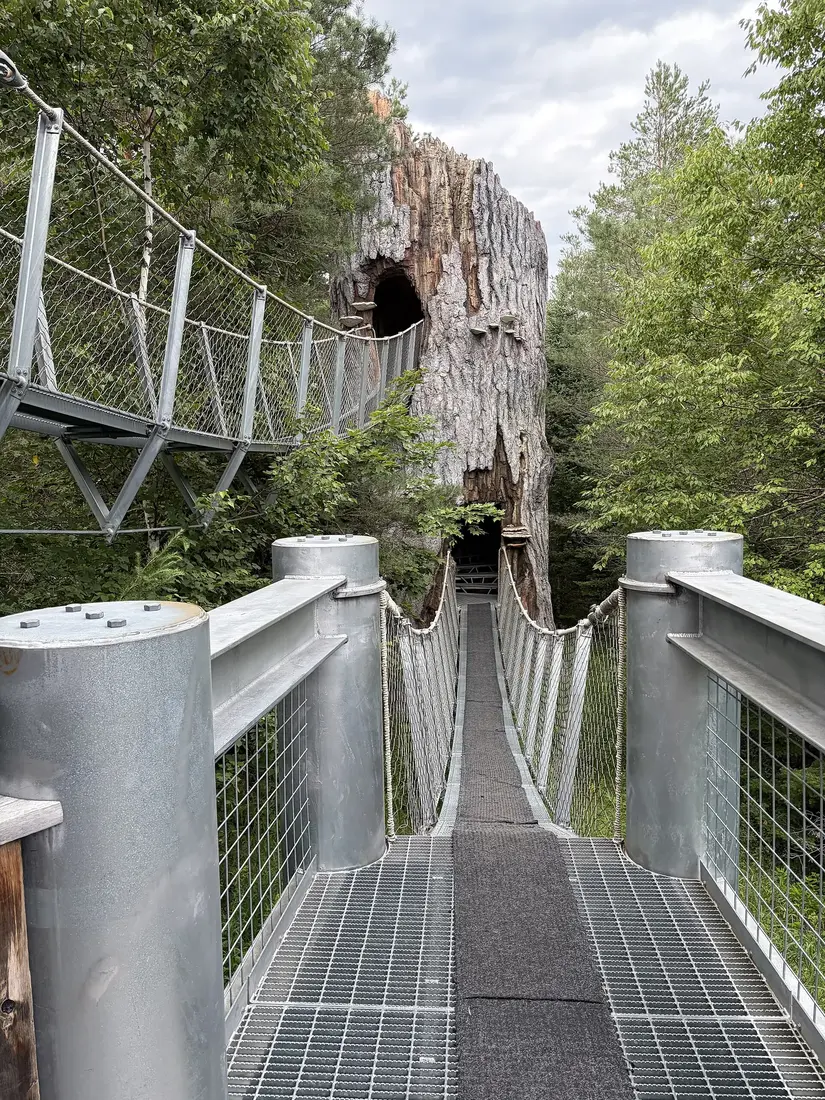
The Wild Center's dock sits on the Oxbow, about three and a half road miles from the Crusher, and the museum runs guided canoe and kayak trips there in summer; those are covered in the Wild Center guide.
Why it is called the Crusher
The name has nothing to do with the paddling. A gravel-crushing operation stood here in the 1930s while Route 3 and 30 was being built. The parking lot sits on an old logging railbed that fed the Brooklyn Cooperage Company's mill at Faust, now part of Tupper Lake, which made barrel staves and headings from 1900 to 1921.
The Tupper Lake Paddling Triad
Tupper Lake runs a paddling patch alongside its hiking one. The three paddles are the Crusher to the Tupper Lake boat launch (7.75 miles), Raquette Pond to Setting Pole Dam (3.25 miles, one to two hours) and the Stony Creek Ponds to Axton Landing (3.25 miles), all one way, by canoe or kayak, over as many days or years as you like. Registration has been a one-time $10 fee that covers the patch and postage; check the visitor site for the current fee. The Raquette Pond paddle starts at Waterfront Park in the village and ends at Setting Pole Dam, where you stay to the side, well clear of the dam.
Long Lake to Tupper Lake
The river from Long Lake makes a good first canoe-camping trip. The Northern Forest Canoe Trail lists Long Lake to Axton Landing as 22 miles over one to four days with one portage, the carry at Raquette Falls, and most paddlers spend the first night on Long Lake and reach the river on day two. St. Regis Canoe Outfitters rates its guided version for novices: nine miles down Long Lake the first day, five miles of river plus the 1.3-mile carry the second, and 6.5 miles of river to Axton the third. Going on to the Crusher makes about 30 miles from the Long Lake launch.
Long Lake can get choppy, especially at its north end near the river, so cross the open water early while it is calm. The 2026 Canoe Classic ran September 11 to 13, and listings show the 2027 race on September 10 to 12; if you paddle that weekend, expect racers on the river.
Lean-tos and camping rules
Between Axton Landing and the falls there are five lean-tos: Stony Creek, Hemlock Hill, Palmer Brook, Raquette Falls No. 2 and Raquette Falls No. 1. Four stand on the riverbank and are easy to reach by boat; Raquette Falls No. 1, beyond the ranger station, sits beside the trail away from the water and is the only one a boat cannot reach. From the water you may see only two of them. None looks out on the falls, though the last two are a short walk away, with several designated campsites between them. Palmer Brook, about a mile below the falls on a curve of the river, has room for tents and a big fire pit. One Explorer writer counted at least six lean-tos and more than a dozen tent sites between the falls and the Crusher.
The rules
- Lean-tos and designated tent sites are free and first come, first served. They cannot be reserved, and a lean-to is shared with later arrivals until it is full, normally eight people.
- Tents do not go inside lean-tos. Use a designated site wherever you can; where at-large camping is allowed, camp at least 150 feet from any water, road or trail.
- Staying more than three nights in one place, or camping with ten or more people, takes a free permit from a Forest Ranger.
- On the east bank, inside the High Peaks Wilderness, overnight groups are limited to eight people.
- The easement land on the west bank is open year-round with no fee, reached only by water, and has no designated campsites. Five one-acre leased camp sites are off limits, and Follensby Pond is closed to general public use.
Bear canisters are required overnight only in the Eastern High Peaks, from April 1 to November 30, and DEC recommends one for any backcountry camping in bear country; Raquette River Outfitters rents them, along with dry barrels. Burn only dead and down wood in the existing fire rings, keep soap out of the river and treat drinking water, since Giardia is present. On busy weekends backpackers on the trail and paddlers on the river want the same riverside lean-tos, so plan to arrive early or carry a tent for a designated site.
Current, water levels and the gauge
The current on this stretch is slow. From the Crusher you can paddle easily in either direction, and from Axton the upstream push is light. What changes the trip is the water level. After snowmelt and heavy rain the river spreads into the maples and the current quickens; one family who came through after a month of rain found the river 18 inches above normal. When the river is low, the last stretch below the falls is shallow and rocky, and motorboats have to pick their way.
The U.S. Geological Survey's gauge here is Raquette River at Piercefield, station 04266500, west of Tupper Lake below the village's lakes. It measures the flow off 721 square miles of watershed, so it reflects what the whole upper river is doing. Its daily record goes back to 1908, and the highest peak on file came on May 1, 2011, at 10,400 cubic feet per second and a gauge height of 13.4 feet. Before you go, open the station's page, look at the recent graph and compare today's flow with the usual flow for the date. A reading well above normal, or one rising after rain, means a slower trip upstream and higher water under the bridges; a reading near normal in summer is the easy river most trip reports describe. Raquette River Outfitters helps plan routes, so ask about the water when you call.
Wind, life jackets and boating rules
The river itself is sheltered. The open water at either end is where the wind matters: Long Lake on the way in from the south, and Simon Pond and Big Tupper Lake on the way out, where a west wind can make the last stretch to Moody slow going. Paddle the open water early and keep to the shore.
- Life jackets: from November 1 to May 1, New York law requires everyone in a boat under 21 feet, canoes and kayaks included, to wear one. State Parks recommends wearing one any time the water is below 70 degrees.
- Clean, drain, dry: New York law requires every boat, canoes and kayaks included, to be cleaned, drained and dried, or treated, before it goes into public water. Motorboats also carry a clean, drain, dry certificate; paddlecraft are exempt from that paperwork. The Adirondack Watershed Institute at Paul Smith's College planned boat stewards at more than 60 launches and decontamination sites in the Park for a 2026 season running May 22 through Labor Day.
- Hunting season: the easement land is open to hunting. In the Northern Zone the 2026 regular deer season runs October 24 to December 6, so a bright jacket or hat makes sense on a late-fall paddle.
- Bugs: black flies are out from mid-May to late June and like moving water; the bug guide has what works.
- Emergencies: call 911 or the DEC Forest Ranger line at 1-833-NYS-RANGERS.
Once the black flies ease, the water warms for a swim at the beach below the falls, and the maples along the banks color up in fall. The foliage guide has the usual timing, and when to come and what to pack covers the weather month by month.
Wildlife on the river
The marsh edges and slow water draw birds. Trip writers on this stretch list teal, black ducks, wood ducks, mergansers, ravens, great blue herons and bald eagles, and one watched a coyote swim across the river; deer and otter turn up too. Common loons and songbirds are around the Stony Creek Ponds. Below Long Lake, one family counted a black duck with her brood, a dozen Canada geese in a bay and several beaver lodges along the banks. Near the Cut, a fall paddler flushed several blue herons and a pair of mallards from the tall grass, and one outfitter customer who paddled a few hours from the Tupper Lake shop came back with deer, hawks, a vulture and a muskrat on the list. For more places to look, see the wildlife guide.
Fishing
The river between Simon Pond and Raquette Falls is flatwater and marsh, and it holds walleye, northern pike, largemouth and smallmouth bass, yellow perch, pumpkinseed, brown bullhead and brown trout. The beach below the falls is a handy place to cast. Simon Pond is about 640 acres and 42 feet at its deepest, and a DEC survey there in 2021 turned up walleye of about 23 to 26 inches. The easement's Moose Creek and Beaver Brook are known for brook trout.
Walleye and northern pike follow the statewide rules here: open May 1 to March 15, with a 15-inch minimum for walleye, 18 inches for pike and five a day. Bass are different. Axton, the Crusher and Tupper Lake are in Franklin County, where bass season runs June 15 to November 30, 12 inches and five a day, and there is no catch-and-release bass fishing in the closed season, though most of the state allows it with artificial lures. Anglers 16 and over need a New York license; check DEC's current regulations guide before you go. The fishing trips page covers licenses and the waters closer to the cabins, including the Salmon River in Malone.
Outfitters, rentals and shuttles
The listings include no boats, so most guests rent. Two long-running outfitters work this river; call ahead for the current season, rates and shuttle prices.
- Raquette River Outfitters, 1754 State Route 30, Tupper Lake, with its own launch on Simon Pond, (518) 359-3228. In business since 1983 and marking 43 years in 2026, it lists hours of 9 to 5 every day. It rents lightweight Kevlar and Royalex canoes, solo pack canoes, touring and sit-on-top kayaks, paddleboards and a Kevlar guideboat, priced per calendar day with paddles, life jackets and car-top gear included. It delivers boats to the put-in and will either move your car to the take-out or arrange a shuttle, priced on request. It also rents bear canisters, portage packs, portage wheels, tents and stoves, and the staff help plan routes. Reservations are by phone.
- St. Regis Canoe Outfitters, 73 Dorsey Street, Saranac Lake, (518) 891-1838, open daily from 9 to 5 and in business since 1984. It rents canoes, kayaks and camping gear, offers boat transportation and shuttles with its outfitting packages, and runs guided trips on this river: Long Lake to Axton Landing over two nights, and Axton to Raquette Falls and on to Tupper Lake over two nights. The dates posted with those trips are from earlier seasons, so ask about the coming one.
The Wild Center's guided trips on the Oxbow are the easiest way onto the water without a boat or a shuttle; in 2026 they ran from July into October and needed a museum ticket too. Outfitters around Saranac Lake also rent canoes and kayaks, and the St. Regis Canoe Area guide lists the shops closest to its ponds.
A day from the cabins
Leave the cabins at about 8 with lunch packed and you can be on the water at Axton Landing by about 9:30. Paddle up to the beach below Raquette Falls by early afternoon, eat, walk the carry trail to the Lower Falls and swim, then ride the current back to Axton by late afternoon. You will be home in time for a soak in the hot tub; every cabin has its own, and the washer and dryer take care of wet gear.
For a shorter day, paddle the Stony Creek Ponds to Axton in the morning and spend the afternoon at The Wild Center, about ten road miles from Axton on the road into the village; its Wild Walk and exhibits are in the Wild Center guide. Hikers can trade the river for a summit on the Tupper Lake Triad, the town's three-mountain hiking patch. For paddling closer to home, Meacham Lake is about 20 road miles from the cabins on the same NY 30 drive, and the ponds of the St. Regis Canoe Area and the Saranac lakes are a short way off it. Pick your cabin on the cabins page.
Questions
How long is the paddle from Axton Landing to Raquette Falls?
About six miles upstream to a sandy beach a third of a mile from the falls, and six back. The Northern Forest Canoe Trail lists the 13-mile round trip at about four to six hours. The current is light, so the upstream half is the slower one, and day paddlers never need to carry around the falls.
Do you have to carry around Raquette Falls?
Yes, for anyone going past them. The last mile of river ending at the Lower Falls cannot be paddled, so always use the carry trail, about a mile and a quarter long. Coming down from Long Lake, watch for the carry landing above the falls. A day trip up from Axton Landing turns around at the beach below the falls and needs no carry.
Can you reserve the lean-tos on the Raquette River?
No. Lean-tos and designated tent sites are free, first come, first served, and a lean-to is shared with later arrivals until it is full. Stays of more than three nights in one place, or groups of ten or more, need a free Forest Ranger permit, and on the High Peaks Wilderness side overnight groups are limited to eight.
How far is the Raquette River from the cabins?
The Crusher launch is about 54 road miles from the cabins and Axton Landing about 57, roughly an hour and a half each way by County Route 25 and NY 30. The getting there guide covers the roads near the cabins.
Can I get a shuttle for a one-way trip?
Yes. Raquette River Outfitters in Tupper Lake delivers rental boats to the put-in and will move your car to the take-out or arrange a shuttle, priced on request, and St. Regis Canoe Outfitters in Saranac Lake offers transportation with its outfitting packages. Call ahead for the current season and rates.
Is the Raquette near Tupper Lake good for beginners?
Yes. The current is slow, and the Stony Creek Ponds to Axton Landing paddle is 3.25 miles with no portages. The Crusher to the Tupper Lake boat launch is 7.75 miles downstream. Wind on Simon Pond and Long Lake is the main thing to watch, so cross open water early.
How do I check the water level before I go?
Look up the USGS gauge Raquette River at Piercefield, station 04266500, and compare today's flow with the usual flow for the date. High or rising water after rain means a slower trip upstream and low clearance under bridges.
Sources
Facts on this page were checked against these sources in October 2026. Hours, fees and schedules change; confirm before you go.
- northernforestcanoetrail.org northernforestcanoetrail.org/suggested-trips/raquette-river-axton-land
- plan.northernforestcanoetrail.org plan.northernforestcanoetrail.org/itinerary/long-lake-to-axton-landing
- tupperlake.com tupperlake.com/paddling/the-crusher-on-the-raquette-river
- tupperlake.com tupperlake.com/paddling/axton-landing-to-raquette-falls
- tupperlake.com tupperlake.com/paddling/axton-landing-to-the-crusher
- tupperlake.com tupperlake.com/paddling/the-crusher-to-tupper-lake-boat-launch
- tupperlake.com tupperlake.com/paddling/stony-creek-ponds-to-axton-landing
- tupperlake.com tupperlake.com/tupper-lake-paddling-triad
- tupperlake.com tupperlake.com/paddling/raquette-pond-to-setting-pole-dam
- tupperlake.com tupperlake.com/fishing/raquette-river
- adksports.com adksports.com/2021-07-paddling
- adksports.com adksports.com/2024-04-hiking-paddling-camping
- Adirondack Explorer adirondackexplorer.org/recreation/paddling/downriver-on-the-raquette/
- Adirondack Explorer adirondackexplorer.org/general/raquette-river-2/
- Adirondack Explorer adirondackexplorer.org/recreation/raquette-river/
- governor.ny.gov governor.ny.gov/news/governor-hochul-announces-permanent-protection-14
- New York State Department of Environmental Conservation dec.ny.gov/places/raquette-river-recreational-access-conservation-ease
- New York State Department of Environmental Conservation dec.ny.gov/news/press-releases/2024/7/dec-and-the-nature-conservancy-a
- New York State Department of Environmental Conservation dec.ny.gov/places/high-peaks-wilderness-complex
- New York State Department of Environmental Conservation dec.ny.gov/things-to-do/camping-primitive
- New York State Department of Environmental Conservation dec.ny.gov/things-to-do/boating/launch-sites/franklin-county
- New York State Department of Environmental Conservation dec.ny.gov/things-to-do/freshwater-fishing/regulations/statewide-seaso
- New York State Department of Environmental Conservation dec.ny.gov/docs/fish_marine_pdf/tb5simon.pdf
- New York State Department of Environmental Conservation dec.ny.gov/news/press-releases/2026/10/dec-announces-2026-big-game-hun
- New York State Department of Environmental Conservation dec.ny.gov/news/press-releases/2026/5/dec-reminds-water-recreationists
- adkwatershed.org adkwatershed.org/newsroom/2026-boat-stewardship-launch
- waterdata.usgs.gov waterdata.usgs.gov/monitoring-location/04266500/
- nwis.waterdata.usgs.gov nwis.waterdata.usgs.gov/nwis/peak?site_no=04266500&agency_cd=USGS&form
- raquetteriveroutfitters.com raquetteriveroutfitters.com/
- raquetteriveroutfitters.com raquetteriveroutfitters.com/rentals
- canoeoutfitters.com canoeoutfitters.com/
- canoeoutfitters.com canoeoutfitters.com/guided-trips/long-lake-axton-raquette-river
- canoeoutfitters.com canoeoutfitters.com/guided-trips/axton-raquette-falls-tupper-lake
- canoeoutfitters.com canoeoutfitters.com/trip-planning/routes/raquette-river-falls-and-retu
- experienceouradirondacks.com experienceouradirondacks.com/events/adirondack-canoe-classic-the-90-mi
- canoeoutfitters.com canoeoutfitters.com/trip-planning/routes/axton-crusher-raquette-river
- plan.northernforestcanoetrail.org plan.northernforestcanoetrail.org/itinerary/raquette-river-oxbow/
- northernforestcanoetrail.org northernforestcanoetrail.org/winding-through-the-raquette-river-oxbow/
- The Wild Center wildcenter.org/events/paddle-the-raquette/
- New York State Department of Environmental Conservation dec.ny.gov/places/raquette-river-conservation-easement-tract
- New York State Department of Environmental Conservation dec.ny.gov/things-to-do/camping/primitive
- New York State Department of Environmental Conservation dec.ny.gov/things-to-do/freshwater-fishing/places-to-fish/adirondack-l
- New York State Department of Environmental Conservation dec.ny.gov/things-to-do/freshwater-fishing/regulations/region-5-specia
- New York State Department of Environmental Conservation dec.ny.gov/regulatory/permits-licenses/sporting-and-use/sporting/fishi
- New York State Department of Environmental Conservation extapps.dec.ny.gov/docs/lands_forests_pdf/cddfaq2022b.pdf
- New York State Parks parks.ny.gov/newsroom/press-releases/release.aspx?r=760
- nystateparks.blog nystateparks.blog/tag/life-jacket/
In this guide
Stay nearby
The aviation cabin: flight-themed décor, a Jøtul gas stove, a large open deck with its own hot tub, and a smokeless fire pit on the lawn.
 The AviatorCabin 3 · 2 bd · 1 ba · sleeps 4
More in Lakes & Paddling
Sources
47 references, listed in full at the end of this guide: official park, state, tourism-office and business sources, checked October 2026.
Related guides


Photos on this page: Wild Center 01 by Dclemens1971, CC BY 4.0; St Regis Canoe Area by Marty Plante, CC BY-SA 4.0. Resized and cropped for this site. All photo credits