
Winter Hiking near the Cabins
Snowshoe hikes from the cabins to Owls Head, High Falls, Elephant's Head and Loon Lake Mountain, with traction, daylight, layers, parking and ranger help.
Snow turns the short climbs around the cabins into snowshoe hikes. Owls Head is about four road miles from the cabins, High Falls about five, the winter start for Elephant's Head about nine and Loon Lake Mountain about twenty, and four bigger summits lie within about an hour and a quarter's drive. This guide covers which hikes work in snow, what goes on your boots, the High Peaks snowshoe rule in the state's own words, daylight by month, layers, winter parking, how to reach a Forest Ranger and a winter day planned from the cabin door.
The winter hikes at a glance
These are the hikes that work in snow, in order of distance from the cabins. Road miles are measured from the cabins; round trips and climbs come from the land managers and trail guides for each mountain.
| Hike | Road miles | Round trip | Climb | Winter start | On your boots |
|---|---|---|---|---|---|
| Owls Head | About 4 | 2.7 miles | About 750 feet | Station Road in the hamlet; no official lot | Snowshoes after a storm, microspikes for the steep pitch and the summit rock |
| High Falls | About 5 | About 1.5 miles, plus about 1.4 if you walk Barnesville Road | Nearly level | Barnesville Road, a gravel road the snowmobile route also follows | Snowshoes or boots, microspikes for the stairs at the falls |
| Elephant's Head | About 9 to the gate | About 4.2 miles from the gate | About 580 feet | The gate off NY 30, closed in winter | Skis or snowshoes on the road, snowshoes for the last stretch |
| Loon Lake Mountain | About 20 | 5.6 miles | About 1,600 feet | Small lot on County Route 26 | Snowshoes low down, microspikes for the steep last mile |
| St. Regis Mountain | About 33 | 6.8 miles | More than 1,200 feet | Keese Mills Road, west of Paul Smiths | Snowshoes, microspikes for the steep top |
| Azure Mountain | About 42 | About 2 miles | About 940 feet | Blue Mountain Road, by way of NY 458 | Snowshoes, microspikes for the steep upper half |
| Baker Mountain | About 43 to Saranac Lake | 1.6 miles | 884 feet | Forest Hill Avenue in Saranac Lake; park downtown | Snowshoes, microspikes for the steep finish |
| Lyon Mountain | About 45 | 6.8 miles, about 9 from Chazy Lake Road | About 1,900 feet | A seasonal gravel road off Chazy Lake Road | Snowshoes, microspikes for the icy cobbles |
Owls Head, High Falls and Elephant's Head each fit in a morning, with lunch and the hot tub after. Loon Lake Mountain, St. Regis and Lyon take most of a short winter day. Azure Mountain and Baker are short and steep, each a half day plus the drive. The hiking guide covers every trail near the cabins in the warm months.
Owls Head and High Falls in snow
Owls Head
Owls Head is the nearest summit hike to the cabins and a good first winter climb: 2.7 miles round trip and about 750 feet up to open ledges near the 2,250-foot top. The path is rocky, with roots and small streams across it. The one steep stretch begins at the old mine shaft, a little past the first mile. Put microspikes on there and leave them on for the open rock at the top and the whole way down.
The trailhead has no sign and no official lot, only an unmarked pull-off under the power line off Station Road, a dead-end lane. After a storm, park only where the plow has left room, and keep the lane and every driveway clear. The climb takes about two hours without snow. On snowshoes allow three, and more if you are the first one out after fresh snow. The Owls Head guide has the turn-by-turn directions.
High Falls
High Falls is the gentle one: about three-quarters of a mile each way beside the Salmon River to a 30-foot curtain slide. The trailhead is a small parking spot 0.7 mile down Barnesville Road, a gravel road off County Route 27, and the snowmobile route on the state's map of the Titusville Mountain State Forest follows the same road. If the plow has not gone that far, leave the car well clear of the plowed road and walk in along the edge, about 1.4 miles more for the round trip. Walk single file on the shoulder so sleds can pass; on designated snowmobile trails, DEC asks skiers and snowshoers to keep to the side.
At the falls, a short wooden staircase leads down to the rock at the base. Spray keeps it wet, so expect ice on it in winter: wear microspikes on the steps or watch from the top, and keep off snow-covered rock at the water's edge, where you cannot see what lies underneath.
Elephant's Head and Loon Lake Mountain
Elephant's Head is the winter walk with a summit view over Lake Titus. In winter the gate on the 1.5-mile access road is closed, so you park beside it off NY 30, where the state's map shows parking, and walk the road: about 4.2 miles round trip with about 580 feet of gain. Skis suit the gentle road, and snowshoes the narrower trail at the top. The Titusville Mountain State Forest guide covers the road, the trail and the view.
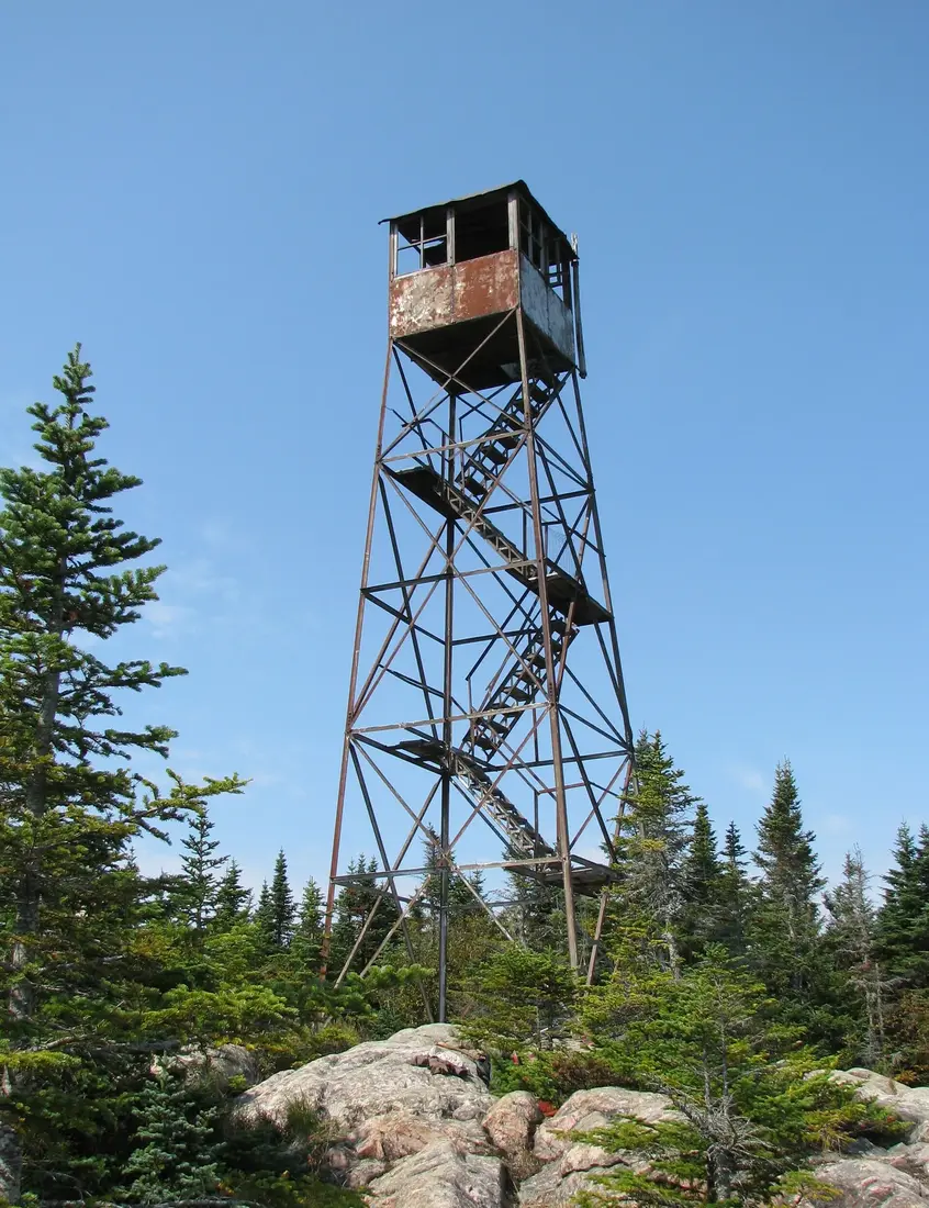
Loon Lake Mountain is the bigger climb close to home, a fire-tower summit 2.8 miles each way and about 1,600 feet up on DEC's trail map. The first 1.4 miles follow an old logging road that snowshoes handle well. The last mile is steeper and narrower, through conifers, and that is where microspikes earn their weight. When the trail opened in 2013, the Town of Franklin agreed to plow the small lot on County Route 26 for winter visitors. The tower itself is closed to the public. The Loon Lake Mountain guide covers the drive and the climb.
Bigger winter summits
Four bigger summits lie within about an hour and a quarter's drive, all of them good snowshoe climbs.
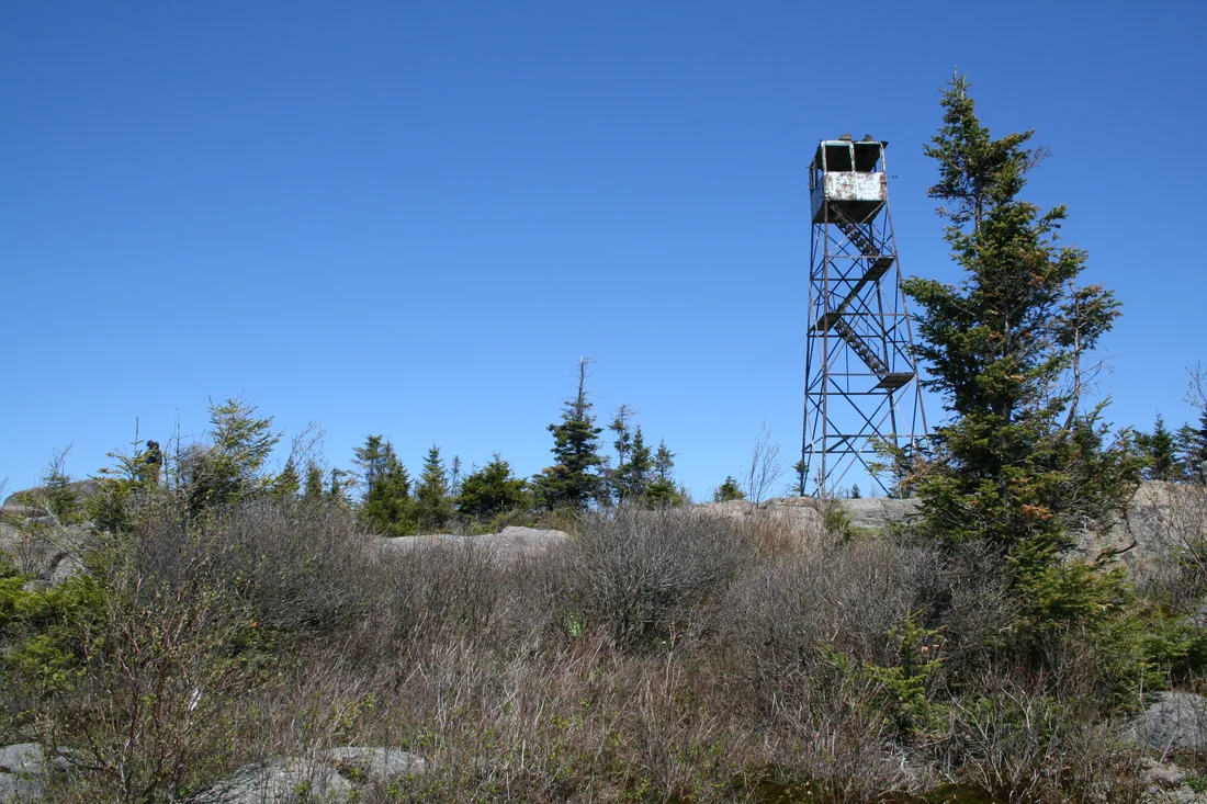
- St. Regis Mountain, about 33 road miles: 6.8 miles round trip and more than 1,200 feet of climbing to a 2,874-foot summit. It makes an excellent snowshoe climb, and the steeper upper footpath can be icy enough to call for microspikes. When the lake ice is right, skiers cross Upper St. Regis Lake from the boat launch to Spring Bay, switch to snowshoes at the dock and climb an esker trail of about a mile to the main trail. See St. Regis Mountain.
- Azure Mountain, about 42 road miles: about 2 miles round trip and 940 feet to a 2,518-foot summit, a short but challenging snowshoe. Come in by NY 458 and Blue Mountain Road, and start early anyway. See Azure Mountain.
- Baker Mountain, in Saranac Lake about 43 road miles away: 1.6 miles round trip and 884 feet, a good beginner snowshoe with a steep finish below the 2,452-foot top.
- Lyon Mountain, about 45 road miles: 3.4 miles each way and about 1,900 feet of climbing to a 3,830-foot summit. The gravel road to the lot is signed as a seasonal road with no maintenance from November 1 to May 1, so a winter climb may start at Chazy Lake Road, about a mile more each way and 340 feet more climbing. The trail is too steep and narrow for skis and makes a good snowshoe; where it follows the old cobbled route near the bottom and the top, expect ice. See Lyon Mountain.
Hikes to the listed fire-tower summits between December 21 and March 21 count toward the Adirondack Mountain Club's winter Fire Tower Challenge, and the club asks winter hikers to leave the towers themselves alone: the steps are often covered in ice and snow, high winds add risk, and crampon points damage the wooden treads. The Fire Tower Challenge guide has the rules. Baker and St. Regis also count toward the winter patch of the Saranac Lake 6er.
Snowshoes, microspikes and crampons
Three kinds of traction cover a winter here, and each has its own job.
Snowshoes
Snowshoes spread your weight so you stay near the surface instead of sinking to the knee with every step. That sinking is called post-holing. Each plunge leaves a knee-deep hole in the trail, rough going for the next hiker and a hazard for skiers on the same trail. DEC's advice is to use snowshoes or skis in deep snow to reduce injuries and ease travel.
The Adirondack Mountain Club's winter gear list describes a good snowshoe: sized to carry you, with crampon teeth under the binding and along the frame, a heel riser for steep climbs, and a binding that is secure and easy to adjust. Size them for your weight with your pack on, and go bigger for deep, dry powder than for heavy or packed snow. Check that the bindings fit your winter boots before the trip.
Microspikes
Microspikes, which one Adirondack writer called crampons-lite, stretch over most boots and grip better than snowshoes on ice. They are the tool for steep, icy pitches and for trails that many feet have packed hard, which is how trails here often look even after a thaw. DEC's winter packing list includes micro-spikes or crampons for icy conditions. Carry them on every winter hike, and try them on your own boots at home first.
Crampons
Crampons have longer points, 10 or 12 on most models, on a frame that is most often semi-rigid, and they are built for steep snow and ice, often with an ice axe in hand. DEC's winter advisories call for crampons or other traction on icy summits and other exposed areas, and add that an ice axe may be needed above tree line in the High Peaks. The trail guides for the hikes in the table ask for snowshoes and microspikes.
Poles and gaiters
Trekking poles with snow baskets help with balance on snowshoes and with getting back up after a fall, and the baskets keep the poles from sinking. Gaiters keep snow out of the tops of your boots in deep powder.
The cabins do not supply snowshoes or traction devices. The cross-country skiing and snowshoeing guide lists where to rent them at Paul Smiths, Saranac Lake and Lake Placid.
The snowshoe rule in the High Peaks
One part of the Adirondacks makes snowshoes the law. DEC's winter hiking safety page states the rule in one sentence: "The use of snowshoes or skis is required in the High Peaks Wilderness when snow depths exceed 8 inches."
The regulation behind it, in the state's rules for wilderness areas in the Adirondack Park, says that in the High Peaks Wilderness Area no person shall "fail to possess and use skis or snowshoes when the terrain is snow-covered with eight or more inches of snow." Two words do the work there: possess and use. Snowshoes strapped to a pack meet the first and not the second; once the snow is that deep, they go on your feet. The two wordings differ only at exactly eight inches, so at eight inches, wear them.
The High Peaks Wilderness Complex covers 275,460 acres and is best known for Mount Marcy, the highest peak in the state. None of the hikes near the cabins lies inside it: Owls Head is on the Sable Highlands conservation easement, Elephant's Head and High Falls are in a state forest, and Loon Lake Mountain is on easement land and the Debar Mountain Wild Forest. The reason for the rule applies everywhere, so wear snowshoes wherever you would sink in. Cascade, on NY 73 near Lake Placid, is a serious winter climb for hikers with winter experience, and snowshoes are required even on its packed trail; see Cascade Mountain.
Daylight by month
The short days set the plan for every winter hike. These are the times at the cabins, with last light meaning the end of civil twilight. Under the trees you will want the headlamp out before then.
| Date | Sunrise | Sunset | Daylight | Last light |
|---|---|---|---|---|
| November 1 | 6:35 a.m. | 4:45 p.m. | 10 h 10 min | 5:16 p.m. |
| November 15 | 6:54 a.m. | 4:28 p.m. | 9 h 34 min | 5:00 p.m. |
| December 1 | 7:14 a.m. | 4:17 p.m. | 9 h 3 min | 4:50 p.m. |
| December 15 | 7:27 a.m. | 4:17 p.m. | 8 h 49 min | 4:50 p.m. |
| December 21 | 7:31 a.m. | 4:19 p.m. | 8 h 48 min | 4:52 p.m. |
| January 1 | 7:34 a.m. | 4:27 p.m. | 8 h 52 min | 5:00 p.m. |
| January 15 | 7:31 a.m. | 4:42 p.m. | 9 h 11 min | 5:15 p.m. |
| February 1 | 7:16 a.m. | 5:05 p.m. | 9 h 49 min | 5:36 p.m. |
| February 15 | 6:57 a.m. | 5:25 p.m. | 10 h 27 min | 5:55 p.m. |
| March 1 | 6:35 a.m. | 5:44 p.m. | 11 h 10 min | 6:14 p.m. |
| March 15 | 7:09 a.m. | 7:03 p.m. | 11 h 53 min | 7:32 p.m. |
| April 1 | 6:38 a.m. | 7:24 p.m. | 12 h 46 min | 7:54 p.m. |
The clocks fall back at 2 a.m. on November 1, 2026, and spring forward on the second Sunday of March, March 14 in 2027, which is why sunset jumps by an hour in mid-March. The earliest sunsets come in the first half of December, a little before the solstice, and the latest sunrises come around New Year's.
Plan backward from sunset. DEC's rule of thumb is that the walk back takes as long as the walk out, so on a December day, with sunset between about 4:15 and 4:20, take the time halfway between your start and 4 p.m. as your turnaround: start at 8:30 and turn back by 12:15, whether or not you have reached the top. Pick the turnaround time at the cabin and keep it on the mountain, and carry a headlamp on every winter hike, even a short one.
Winter layers
Dress to stay dry from the inside. DEC's winter list starts with a base layer of moisture-wicking fabric, insulating layers of wool or fleece over it, and a waterproof or water-resistant shell, and it rules out cotton, which holds moisture. The Adirondack Mountain Club's education staff put a number on that: cotton absorbs and holds seven times its weight in water and draws heat from the body, so the club does not allow it on its guided trips. Wool and fleece keep their warmth when wet.
The layers
The club's winter day list makes a good model for a guest's pack:
- A base layer top and bottom, with a spare set in the pack.
- Two midweight fleece or wool tops, one worn and one carried, and insulated pants.
- Quick-drying hiking pants.
- A waterproof shell jacket with a hood and shell pants, both big enough to go over everything else.
- An insulated jacket for stops and summits, with synthetic fill preferred, since down loses its warmth when wet.
Take a layer off before you start to sweat on a climb, and put one on before you get cold at the top. DEC's reason is that overheating and sweating can lead to chilling and hypothermia. It is easier to stay warm than to warm up again.
Hands, head and feet
Bring two warm hats, a balaclava or neck gaiter for the face, thin liner gloves, and two pairs of insulated mittens; the club's method is fleece or wool mittens under waterproof over-mitts. Boots should be insulated and waterproof, with a lugged sole and support above the ankle, and summer boots will not do. Wear one pair of thick wool or synthetic socks, with a thin liner if you like, and pack a spare pair; two thick pairs at once squeeze the foot and leave it colder. Sunglasses or goggles help on bright snow and in blowing snow, and DEC adds sunscreen, since sunburn happens all year.
Wind, frostbite and hypothermia
January in Malone averages a high of 23°F and a low of 4°F, and an open summit adds wind. At 0°F with a 15 mph wind the wind chill is minus 19°F, cold enough to freeze exposed skin in about 30 minutes. Frostbite first shows as redness or pain; then the skin turns white or grayish-yellow and feels firm, waxy or numb. Cover it, get out of the wind, warm hands in your armpits, and never rub it. Hypothermia means a body temperature below 95°F, and feeling cold and sluggish or having trouble thinking clearly are the signs. Get the person into dry layers and out of the wind, warm the center of the body first, and get medical help.
Food, water and batteries
Carry 2 to 3 liters of water in insulated bottles; hydration bladders and their hoses freeze. A spare wool sock makes a bottle cover, and a bottle carried upside down keeps its lid from freezing shut. Pack food you can eat half frozen, and snack often, since eating keeps you warm. Cold drains batteries fast, so carry a headlamp with spare batteries, lithium if you can, and keep the phone in an inside pocket. iPhones are designed for temperatures between 32°F and 95°F; in deep cold the battery runs down sooner and the phone may shut off until it warms up.
Checking conditions before you go
The weather at the cabin is a poor guide to the mountain. Plan for winter conditions whatever the thermometer by the door says: trails are often packed and icy even after a thaw, and summits run colder and windier than the trailheads. Malone averages about 95 inches of snow a year, most of it from December through March: about 21 inches in December, 22 in January, 18 in February and 15 in March.
DEC's Backcountry Information page for the Adirondack Park lists trail closures, washouts and seasonal road notices region by region, with the newest notices at the top. Its Northern section covers Loon Lake Mountain and the Debar Mountain Wild Forest, and its Northeastern section the Sable Highlands. Check it and the forecast on the cabin wifi before you leave, and if the forecast is too harsh, DEC's advice is to postpone; the hot tub will still be there. If a snow squall closes in on the trail, stop where you are, since squalls tend to be brief.
Early-season hikers share the woods with hunters. The regular deer and bear season in the Northern Zone runs to December 6 in 2026, and a late bow and muzzleloader week follows to December 13 in a few units, so wear blaze orange or pink on November and December hikes. The Titusville Mountain State Forest guide lists every 2026 season date for the woods around the cabins.
Trailhead parking and plowing
Winter parking decides many hike plans here. What each trailhead offers in snow:
- Owls Head. No official lot and no sign, only the pull-off along the power line off Station Road. Leave the lane passable for the plow and the neighbors.
- High Falls. The small spot 0.7 mile down Barnesville Road, if the road is plowed that far. If it is not, find a spot clear of the plowed road and walk in.
- Elephant's Head. The gate off NY 30, where the 1.5-mile access road begins. The gate is closed in winter, so park beside it, fully off the highway, and walk the road.
- Loon Lake Mountain. A small lot on the west side of County Route 26, which the Town of Franklin agreed to plow when the trail opened in 2013.
- St. Regis Mountain. The DEC lot on Keese Mills Road, about 2.6 miles west of NY 30, on the left. Have a second hike in mind in case the lot has not been plowed.
- Azure Mountain. Come in from NY 458 and follow Blue Mountain Road 7 miles to the DEC sign for the parking area. That end of the road starts paved and turns to dirt for the last four miles or so. The shorter way in, from Keese Mills Road near Paul Smiths, follows the narrow, winding dirt part of Blue Mountain Road for most of its length, and travel on it can be tricky in winter, so come and go by NY 458. Turn back if the road or the lot has not been plowed.
- Baker Mountain. Parking on Forest Hill Avenue is extremely limited and sits beside a quiet neighborhood, and cars outside the designated spots get ticketed. Park downtown in Saranac Lake and walk the mile.
- Lyon Mountain. The gravel road to the lot gets no maintenance from November 1 to May 1, so a winter hike may start at Chazy Lake Road. Park well off the road there.
Arrive early on weekends and pick a second destination before you leave, so a full lot never means parking on the road shoulder. Keep a shovel and a brush in the car, and read winter driving for the county roads and what to carry.
Snowmobiles, dogs and frozen water
Sharing the trail with sleds
Snowmobiles are part of winter around the cabins, and the C7 corridor passes close by. Where a walk shares a road or trail with sleds, as on Barnesville Road, keep to the side; DEC asks snowmobilers in turn to slow down when they pass skiers and snowshoers. Wear something bright, keep dogs close, and step well off the track when you hear engines. The snowmobiling guide covers the trail network.
Dogs on winter trails
Dogs are welcome at the cabins for a pet fee. In snow, DEC asks hikers to keep dogs to the side of the trail so their paws do not post-hole the packed track. A bright vest helps sled riders and hunters see the dog. See bringing your dog for winter with a dog, leash rules and vets.
Ice on ponds and rivers
Snow on a pond hides what the ice is doing underneath. DEC's tips: ice that holds snow may not hold the weight of a person, check the thickness before you cross, and avoid ice over running water and near inlets, outlets, boathouses and docks. Keep to the bank at High Falls and at stream crossings, and save the ski route across Upper St. Regis Lake for days when the ice is known to be sound.
Forest Rangers and calling for help
New York's Forest Rangers run search and rescue on state land. Each ranger covers a territory, and each year more than 300 people are lost or hurt on state land and need an emergency response. A rescue on an icy trail takes a crew: on a Friday evening in November 2025, nine rangers used a sled to bring a hiker with an ankle injury down from the summit of Ampersand Mountain near Saranac Lake, after a fall on an icy section of trail without traction devices. The hiking guide has the rangers' year-round advice; this is the winter version.
Before you leave the cabin
- Save the Forest Ranger dispatch number, 1-833-NYS-RANGERS (1-833-697-7264), in every phone in the group, and do not count on a signal to use it.
- Leave your route and your return time with someone at home.
- Sign the trail register where there is one; it helps searchers.
- On an iPhone, set up Medical ID and emergency contacts, and try the satellite demo.
If something goes wrong
- Call 911 or the dispatch number. The dispatcher will ask questions to pin down where you are, so know the trail, the last landmark you passed and the time you left the car.
- With no signal, move a short way to a spot where searchers on the ground or in the air can see you, and wear or spread out something bright. An iPhone 14 or later can reach emergency services by satellite with no cell or wifi signal, if you are outside with a clear view of the sky and the horizon.
- If you are lost, stop and stay calm. Look for landmarks and listen for traffic on nearby roads. Walk out only if you are sure of the way with map and compass; otherwise stay where you are.
- Three blasts on a whistle is the call for help. Carry a plastic whistle, since metal can freeze.
- Save the phone for calls: switch it to airplane mode between checks and use your headlamp for light.
- If someone is hurt and there is no signal, at least one person stays with them while another goes for help.
- While you wait, add your spare layers and sit on a foam pad rather than the snow. If a night out looks likely, clear snow for a fire, which also helps searchers find you, and build a shelter from snow or what is in your packs, lined with conifer boughs and leaf litter.
The nearest hospital is the Alice Hyde Medical Center in Malone, with a 24-hour emergency department, about 10.5 road miles from the cabins; see health and safety.
A winter day from the cabins
The night before
Check the forecast and DEC's backcountry page on the cabin wifi, choose a first and a second hike, and lay out the layers. Charge phones and headlamps, fill the gas tank, and pick up lunch and snacks in Malone, about ten road miles north; the groceries guide lists the stores. Every cabin has a full kitchen, so sandwiches and a hot drink for your thermos are easy in the morning.
A short-hike day
On a late-December day, have breakfast at sunrise, about 7:30. Leave around 9 for Owls Head, about ten minutes away, and plan on three hours for the climb on snowshoes, back at the car around noon. After lunch at the cabin there is time for a second, easy outing: High Falls is about 15 minutes away and an hour or two on foot. Be back by about 3:30, as the light starts to go, for the hot tub at sunset, about 4:20.
A big-summit day
For Loon Lake Mountain, leave the cabin at first light. The trailhead is about 20 road miles away, roughly 40 minutes in good conditions; allow an hour after a snowfall. Be on the trail by about 8:30 and turn back by 12:15 wherever you are, and DEC's rule of thumb has you at the car by about 4, before last light. St. Regis is about an hour away and Lyon about an hour and a quarter, so on those days leave before sunrise to keep the same start and turnaround.
Back at the cabin
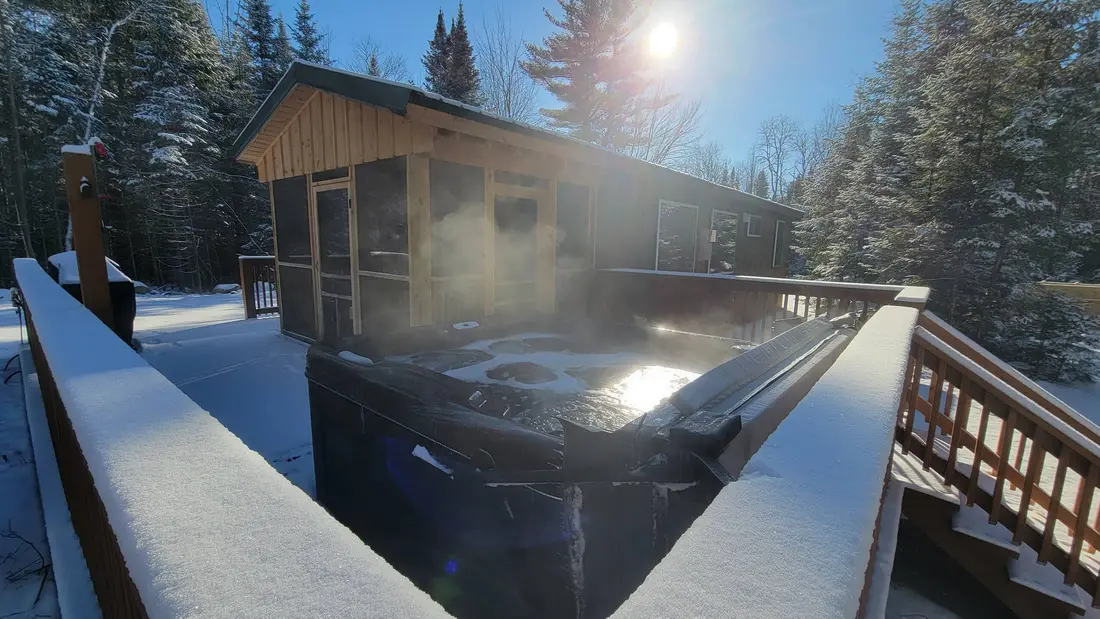
Each cabin has its own private hot tub, and The Modern Pine's is open around the clock. The Modern Pine and The Aviator each have a Jotul gas stove to warm up beside, and every cabin has a washer and dryer for wet layers and a fire pit for the evening. The cabin comparison sets the three side by side.
Questions
Do I need snowshoes to hike near the cabins in winter?
After a storm, yes. DEC's advice is to use snowshoes or skis in deep snow to reduce injuries and ease travel, and post-holing leaves knee-deep holes in the trail. In the High Peaks Wilderness the rule requires them once the snow is eight inches deep or more. Carry microspikes too for packed and icy pitches. The cabins do not supply either; the cross-country skiing and snowshoeing guide lists rentals.
What is the easiest winter hike near the cabins?
High Falls, about five road miles away: roughly 1.5 miles round trip over nearly level ground beside the Salmon River to a 30-foot curtain slide. If Barnesville Road is not plowed to the trailhead, walking it adds about 1.4 miles. For a first summit, Owls Head is about four road miles away, 2.7 miles round trip with about 750 feet of climbing.
What is the snowshoe rule in the High Peaks?
DEC's wording: "The use of snowshoes or skis is required in the High Peaks Wilderness when snow depths exceed 8 inches." The regulation itself says eight or more inches and requires you to possess and use them, so they go on your feet. None of the hikes close to the cabins is in the High Peaks Wilderness. On Cascade, snowshoes are required even on the packed trail.
How early does it get dark at the cabins in winter?
From early December into early January the sun sets between about 4:16 and 4:30 p.m., and the last usable light ends around 4:50 to 5:00. By mid-February sunset is near 5:25. Set your turnaround halfway between your start time and about 4 p.m., and carry a headlamp on every winter hike.
Who do I call if someone gets hurt on a winter hike?
Call 911 or DEC's Forest Ranger dispatch, 1-833-NYS-RANGERS (1-833-697-7264), and save the number before you go, since many trailheads have no signal. An iPhone 14 or later can reach emergency services by satellite if you are outside with a clear view of the sky. The nearest hospital is Alice Hyde in Malone, with a 24-hour emergency department; see health and safety.
Can I climb the fire towers in winter?
The Adirondack Mountain Club asks winter hikers not to climb the towers between December 21 and March 21: the stairs are often covered in ice and snow, the wind is strong, and crampon points damage the wooden steps. The hike to the summit still counts for the club's winter Fire Tower Challenge. The Loon Lake Mountain tower is closed all year.
Can I bring my dog on winter hikes from the cabins?
Yes. Dogs are welcome at the cabins for a pet fee, and DEC asks hikers to keep dogs to the side of a snowy trail so their paws do not post-hole it. Put a bright vest on the dog near snowmobile routes and during the regular deer and bear season, which ends December 6 in 2026. The dog guide covers winter with a dog.
Sources
Facts on this page were checked against these sources in October 2026. Hours, fees and schedules change; confirm before you go.
- New York State Department of Environmental Conservation dec.ny.gov/things-to-do/hiking/winter-safety
- law.cornell.edu law.cornell.edu/regulations/new-york/6-NYCRR-190.13
- New York State Department of Environmental Conservation dec.ny.gov/environmental-protection/public-safety/forest-rangers/searc
- New York State Department of Environmental Conservation dec.ny.gov/things-to-do/hiking/adirondack-backcountry/backcountry-info
- New York State Department of Environmental Conservation dec.ny.gov/sites/default/files/maptitusvillemtn.pdf
- New York State Department of Environmental Conservation extapps.dec.ny.gov/docs/lands_forests_pdf/loonlakemtnhikingmap.pdf
- adirondackbasecamp.com adirondackbasecamp.com/2013/10/opens-trail-loon-lake/
- Adirondack Mountain Club adk.org/wp-content/uploads/2026/07/Winter-Day-Hike-Gear-List-ADK-EDU-G
- Adirondack Mountain Club adk.org/adk-fire-tower-challenge/
- Adirondack Explorer adirondackexplorer.org/recreation/owls-head-malone/
- Adirondack Explorer adirondackexplorer.org/recreation/owls-head-a-popular-hike-in-the-othe
- Adirondack Explorer adirondackexplorer.org/recreation/titusville-triad-three-hiking-opport
- Visit Malone visitmalone.com/hiking/high-falls-titusville-mountain
- Visit Malone visitmalone.com/hiking/elephant-head
- pureadirondacks.com pureadirondacks.com/blogs/adirondack-hiking/elephants-head-trail
- Adirondack Mountain Club shatageeadk.org/tag/snowshoeing/
- pureadirondacks.com pureadirondacks.com/blogs/adirondack-hiking/55010177-loon-lake-mountai
- Saranac Lake tourism saranaclake.com/hiking/st-regis-mountain
- Saranac Lake tourism saranaclake.com/hiking/azure-mountain
- Saranac Lake tourism saranaclake.com/hiking/baker-mountain
- Saranac Lake tourism saranaclake.com/story/2019/01/how-become-saranac-lake-winter-6er
- Saranac Lake tourism saranaclake.com/saranac-lake-6er
- Saranac Lake tourism saranaclake.com/story/2020/preparedness-is-no-accident
- Visit Malone visitmalone.com/hiking/lyon-mountain
- Adirondack Explorer adirondackexplorer.org/recreation/lyon-mountain/
- Adirondack Explorer adirondackexplorer.org/recreation/a-lyon-in-winter-2/
- Lake Placid tourism (ROOST) lakeplacid.com/hiking/high-peaks-wilderness-area
- Lake Placid tourism (ROOST) lakeplacid.com/hiking/cascade-mountain
- atlassnowshoe.com atlassnowshoe.com/en-us/support/snowshoe-selection
- atlassnowshoe.com atlassnowshoe.com/en-us/support/using-your-snowshoes
- rei.com rei.com/learn/expert-advice/crampons-snow-ice-climbing.html
- National Weather Service weather.gov/safety/cold-wind-chill-chart
- National Weather Service weather.gov/safety/cold-during
- support.apple.com support.apple.com/en-us/118431
- support.apple.com support.apple.com/en-us/101573
- nist.gov nist.gov/pml/time-and-frequency-division/popular-links/daylight-saving
- northeastexplorer.com northeastexplorer.com/new-york-ampersand-mountain-rescue/
- New York State Department of Environmental Conservation dec.ny.gov/news/press-releases/2024/1/dec-advises-backcountry-visitors
- New York State Department of Environmental Conservation dec.ny.gov/sites/default/files/2024-07/htgsummarypullout.pdf
- New York State Department of Environmental Conservation dec.ny.gov/news/press-releases/2026/10/dec-announces-2026-big-game-hun
- New York State Department of Environmental Conservation dec.ny.gov/news/press-releases/2024/10/dec-reminds-outdoor-enthusiasts
- New York State Department of Environmental Conservation dec.ny.gov/places/saint-regis-canoe-area
- New York State Department of Environmental Conservation dec.ny.gov/places/chazy-highlands-wild-forest
- cnyhiking.com cnyhiking.com/LyonMountain.htm
- Saranac Lake tourism saranaclake.com/cycling/blue-mountain-road
- Saranac Lake tourism saranaclake.com/story/2019/09/azure-mountain-adventure
- OpenStreetMap (road distances) openstreetmap.org/way/1192493080
- OpenStreetMap (road distances) openstreetmap.org/way/20086530
- api.met.no api.met.no/weatherapi/sunrise/3.0/sun?lat=44.769&lon=-74.192&date=2026
In this guide
Stay nearby
The aviation cabin: flight-themed décor, a Jøtul gas stove, a large open deck with its own hot tub, and a smokeless fire pit on the lawn.
 The AviatorCabin 3 · 2 bd · 1 ba · sleeps 4
More in Skiing & Winter
Sources
49 references, listed in full at the end of this guide: official park, state, tourism-office and business sources, checked October 2026.
Related guides


Photos on this page: Fire Observation Tower on the summit of Loon Lake Mountain, Loon Lake, New York, Franklin County by Marc Wanner, CC BY-SA 3.0; Saint Regis Fire Tower 2010 t6 by John Sweeney, CC BY-SA 3.0. Resized and cropped for this site. All photo credits